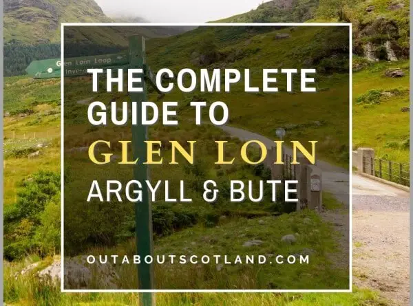
This scenic walking route runs through the dramatic mountain peaks and glens of the Arrochar Alps near the Trossachs National Park to Glen Loin & Coiregrograin. At around 11 miles, the route offers an enjoyable walk on paths that vary between tarmac, gravel, and mud on a circuit that’s mostly level with a few minor climbs.
Along the way, walkers will see many of the Munros and Corbetts of the Arrochar Alps as well as the pretty village of Arrochar and the tranquil waters of Loch Long. Discover this stunning part of Argyll & Bute with this complete visitor guide.
| Address: | Arrochar, G83 7AN |
| Opening Hours: | Arrochar and the Glen Loin Loop are accessible 24/7, 365 days a year. |
| Admission Price: | N/A |
| Parking: | There are two paid car parks in Arrochar - Succoth and Loch Long car parks. Both car parks are open from 9 am to 6 pm and have numberplate recognition cameras. Both car parks have public toilets. |
| Contact: | N/A |
| Facilities: | There are no facilities on the Glen Loin loop. Arrochar has public toilets, cafes and restaurants, pubs, hotels, a post office and convenience stores. |
| Photos: | Virtual Tour |
Overview
While the Scottish Highlands tend to get all the fanfare when it comes to breathtaking scenery, the south of the country comes a close second thanks to the dense forests of the Borders and the gorgeous open countryside and rolling hills of the central belt.
Heading slightly further north past Glasgow takes visitors into The Trossachs National Park, an area that’s famous for its lochs (Loch Katrine and Lomond need no introduction) as well as the mountain peaks of Ben Lomond and Ben Ledi.
One of the most popular areas of this region is the Arrochar Alps, a group of mountains located immediately north of the villages of Arrochar and Lochgoilhead and lochs Goil and Long.
These mountains are frequently visited by residents of Glasgow as getting there takes just one hour by car, after which hill climbers can enjoy peaks such as Ben Vorlich, Ben Vane, and Ben Arthur (also known as The Cobbler) as well as walk through picturesque glens that include Glen Core, Glenbranter, and Glen Loin.
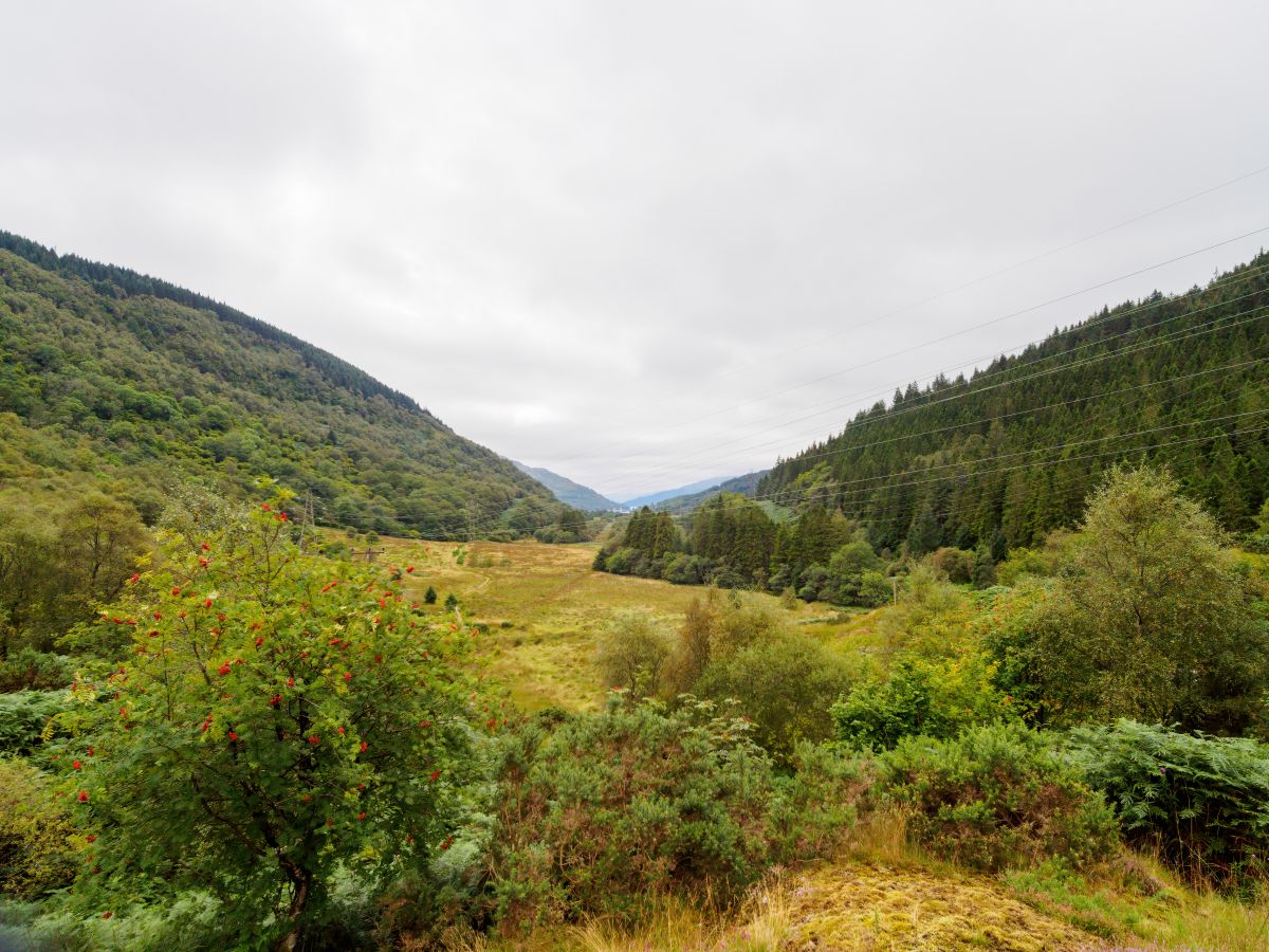
One of the best walks in the area follows a winding path through Glen Loin in a circular route that heads towards Loch Sloy and presents magnificent views of the surrounding countryside. This 11-mile path offers a long and mildly challenging walk, but it makes up for it with stunning views of the Arrochar Alps on (mostly) well-maintained paths.
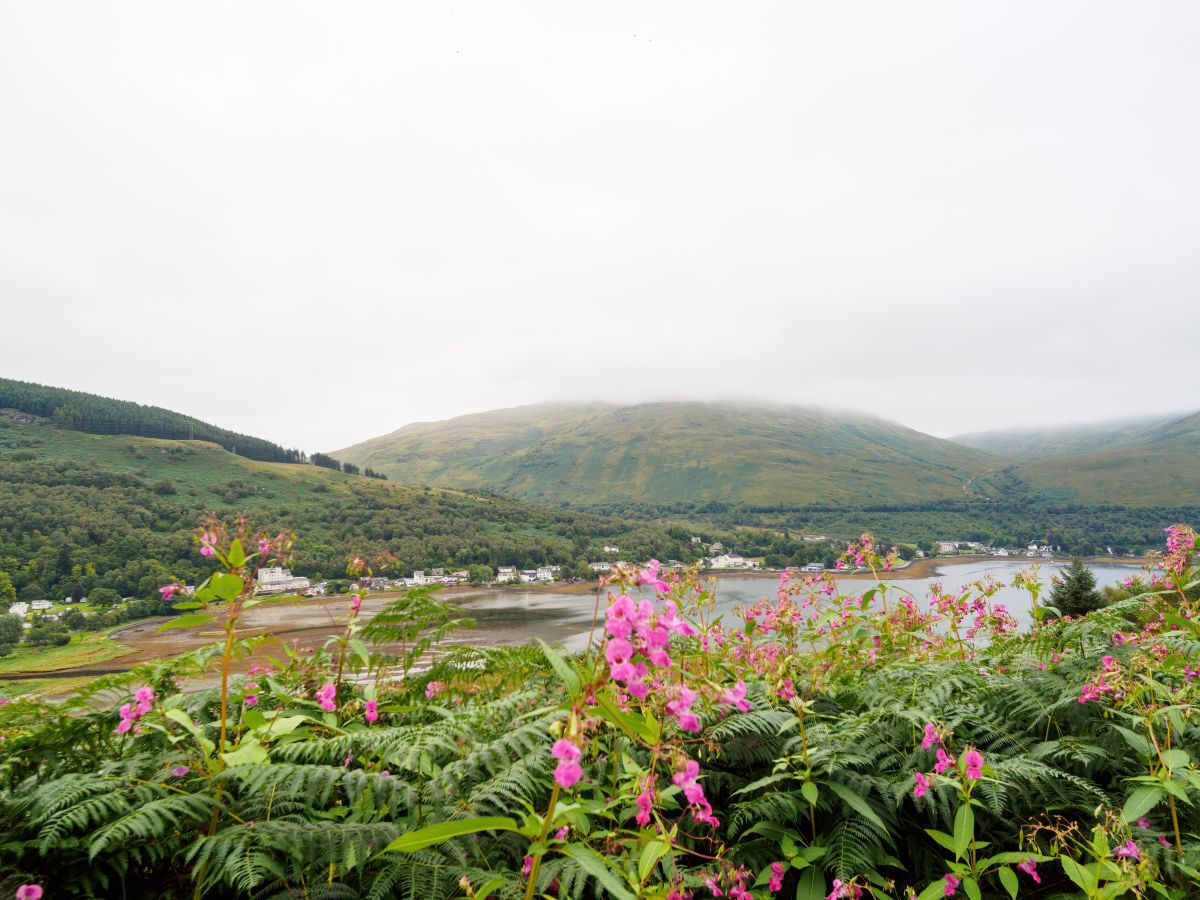
The route starts and ends in the attractive lochside village of Arrochar, which has two car parks and plenty of facilities, including a petrol forecourt, cafes, and convenience stores. There are two entrances to the route at the head of Loch Long, both of which can be accessed from the Succoth car park (west side) and the Loch Long car park (east side).
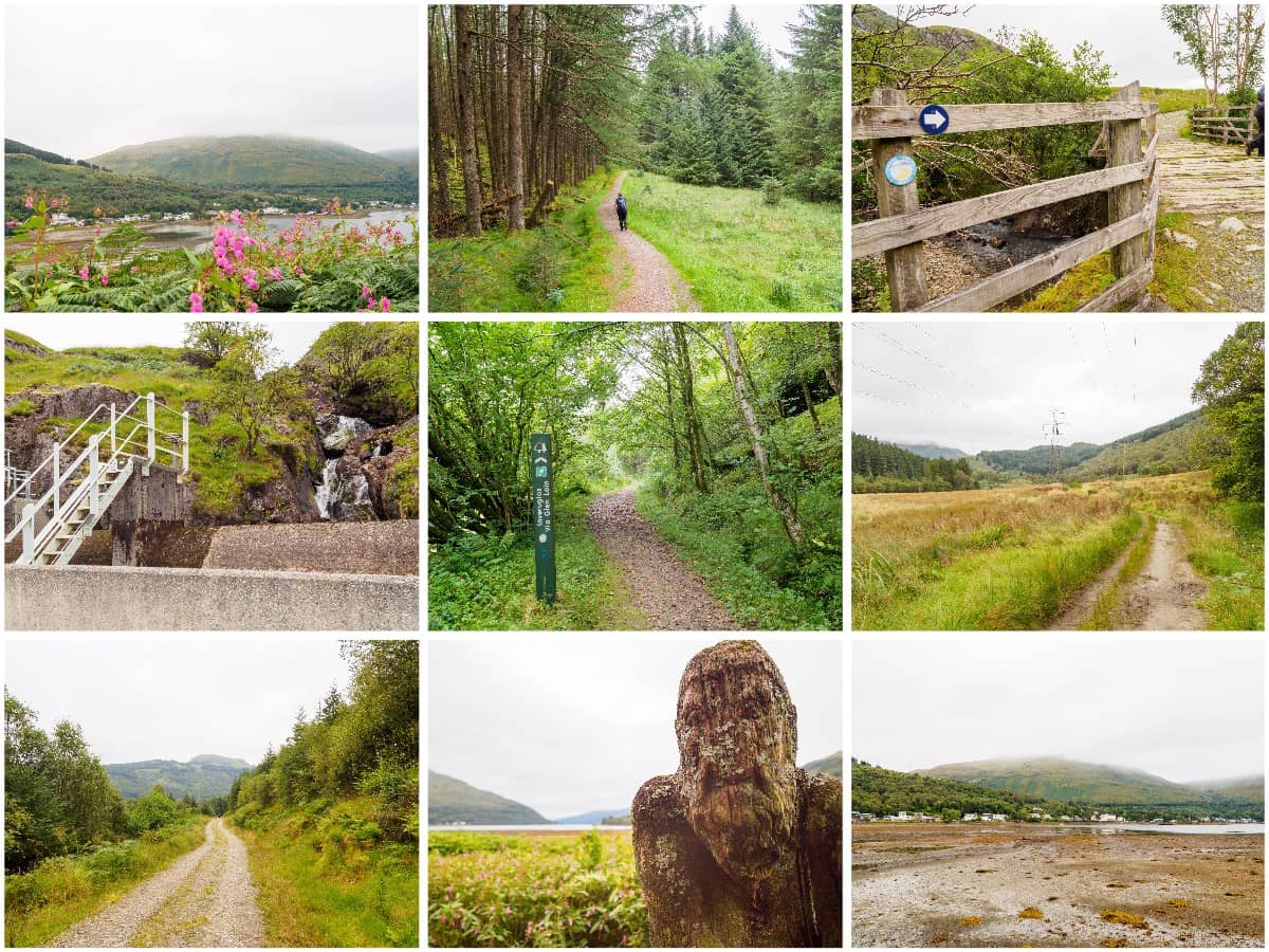
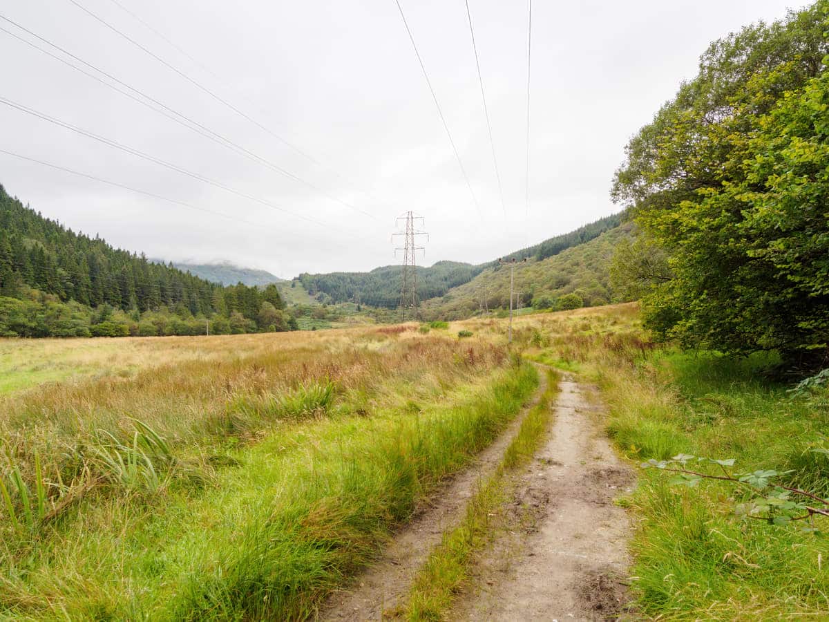
The trail is circular as you can see from the map below, but the western side is the most used as the trail on that side provides access to the peaks of Beinn Narnain and The Cobbler and has a wide and level gravel surface that’s ideal for cycling. The eastern trail, meanwhile, runs along the length of Glen Loin on a path that’s much narrower and is comprised of muddy paths that will be very challenging to all but the most hardened mountain bikers.
The northern end of the trail is marked by the Allt Coiregrogain and Inveruglas Water burns, the latter of which leads to Loch Sloy and its impressive dam – an addition that adds another 2 miles to the route but is definitely worth making time for.
The Highlights
1: The Arrochar Alps is a popular hiking area due to its proximity to Glasgow, but exploring the monumental peaks and hidden-away glens usually requires a trek into the back of beyond. This route from Arrochar is easily accessible by road and is a great way to experience the beauty of the region without having to make any significant climbs. In addition, Arrochar has lots of facilities for visitors, including car parks, public toilets, shops, and cafes.
2: The views on the Glen Loin loop are stunning and visitors can enjoy the soaring peaks of Beinn Narnain, A’Chrois, Ben Vorlich, Ben Vane, and Ben Lomond as well as the picturesque Glen Loin and the surrounding forests.
Visiting Tips
1: The Glen Loin loop can be started from the Loch Long and Succoth car parks in Arrochar, both of which have entrances to the Glen Loin path almost directly opposite. Note that both car parks have number plate recognition systems and non-payment risks fines of £100.
2: The trail around Glen Loin is accessible on foot but there are a few fairly steep sections in places as well as several boggy patches that are occasionally cut off due to waterlogged ground. This means the entire loop is unsuitable to complete on a bike.
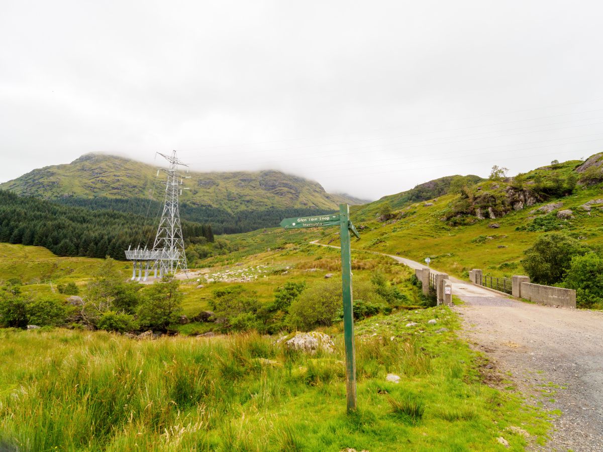
However, the majority of the worst terrain is located on the east side of the glen, so visitors on bikes might prefer to keep to the western side and double back once they reach the farm track near Inveruglas Water. A small bridge with a gated entrance that crosses a burn marks this location. There is a farm to the northwest, and the Sloy switching station lies to the southeast.
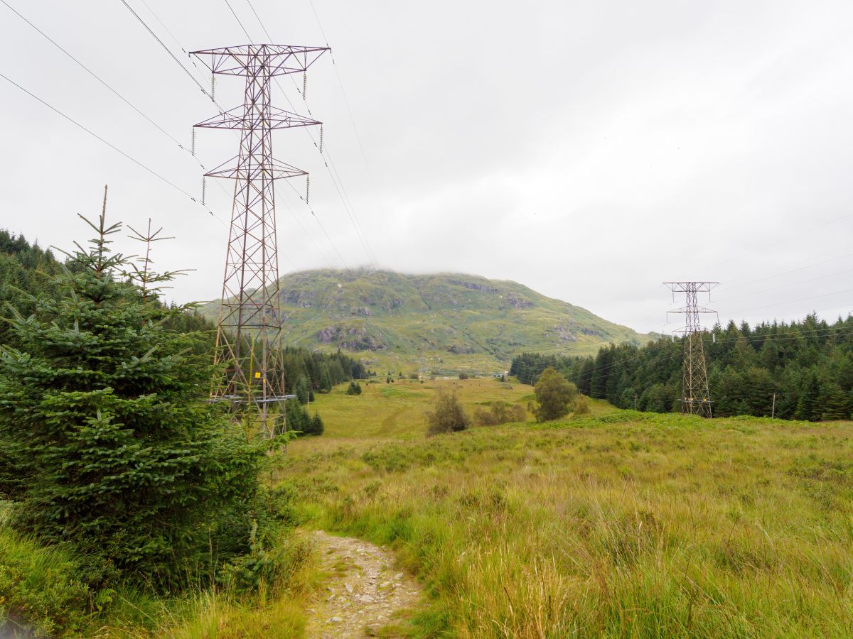
3: An interesting diversion on the route is the Loch Sloy dam which lies 1.5 miles north of the bridge on Inveruglas Water. The dam and its electrical station are the reason why there are so many electricity pylons in Glen Loin. It’s quite a feat of engineering and is certainly worth a look if you have the time.
Walking Route
To start the Gloin Loin and Coiregrograin route, park in the Loch Long car park and follow the pavement along the main road heading left. Just before the Loin Water bridge, cross over the road onto a farm track marked with a sign for the Cowal Way. Continue along the path and turn right across a field, which is marked as the Cowal Way. This track joins a rough footpath that heads north into the glen.
Follow the footpath into Glen Loin where you will see Beinn Narnain and A’Chrois mountains on the left-hand side. Ahead, the path crosses a small bridge before reaching a steep rocky section where it narrows.
Electricity pylons loom overhead and end at the Loch Sloy switching station. The glen opens up a little further onwards, and there is dense forestry on either side. Take caution in the area where forestry borders the path on the immediate left because the ground is very boggy.
Continue on the path as it veers west into the forest until you reach a gate and a bridge that cross the Inveruglas Water Burn. A farm can be seen to the north across fields. The path now joins a tarmac road. To the east is the switching station, and one mile after that is the shore of Loch Lomond. To the north is Loch Sloy and its dam.
Head north for 1/3 mile then take the turning west over another bridge. The path now follows the bottom of Ben Vane with the Allt Coiregrograin burn on the left-hand side. On the right side, a quarry is located one mile from the bridge, then a lengthy, steep section follows. A sluice gate marks the summit of the climb, after which the path turns south and travels through a forest.
Take a minor path over a burn in front of a small reservoir. From this point, you will be returning to Arrochar via the north side of A’ Chrois mountain on a path that is gravelled and fairly level. Glen Loin lies to the east, and there are superb views of Ben Lomond along this section. Follow the track for 3.5 miles and take note of a path heading north to Beinn Narnain.
1/3 mile past the Beinn Narnain path there is a twisting path that winds down a steep incline to the A83. The track then exits opposite the Succoth car park which has a footpath leading around the head of Loch Long to the starting point of the route.
Things to Do
Hiking and Exploring: Glen Loin is renowned for its beautiful hiking trails that allow visitors to explore the peaks of the Arrochar Alps as well as the tranquil waters of Loch Long. The Arrochar Alps provide a challenging hike even for seasoned hill walkers while the lower areas of Glen Loin are more suitable for leisurely walks.
Camping: Immerse yourself in nature by camping in Glen Loin. There are several spots that are perfect for setting up a tent (link to tent reviews) where you’ll get to experience the Scottish wilderness up close, gaze at the starry sky at night, and wake up to panoramic views of the mountains.
Photography: This picturesque area is a paradise for photographers. From the majestic mountains to the serene lochs, there are endless opportunities to capture some truly unique shots. If you’re camping overnight, try to get up early to capture Glen Loin during the magical golden hour.
Cycling: If you’re an avid cyclist, Glen Loin is the place for you. The winding trails offer a challenging ride, but the breathtaking views are well worth the effort. The forest tracks are best suited to a mountain bike, but there’s a compacted dirt track on the western side of the glen that is suitable for the majority of bikes when the ground is dry.
Bird Watching: Glen Loin is home to many bird species. Take a leisurely stroll through the area with your binoculars (link to binocular reviews) as there’s a good chance of spotting birds of prey, and if you keep quiet you might see a red squirrel darting through the trees as well.
Things to Do Nearby
Loch Lomond. Address: Tarbet, Arrochar, G83 7DE. Distance: 1.5 miles from Arrochar.
Loch Lomond needs no introduction. This vast expanse of freshwater is the largest loch in Scotland by surface area and is one of the country’s most popular outdoor destinations. There are hundreds of good locations to explore Loch Lomond, but Tarbet is one of the best villages due to the cruise boats that sail in and out of Tarbet Pier.
Ben Vorlich. Address: Arrochar, G83 7DT. Distance: 5 miles from Arrochar.
Ben Vorlich is the most northerly of the Arrochar Alps and is a popular mountain to climb as it’s located on the northern end of Loch Lomond. There are a number of trails that lead to the summit, but the most popular starts on the Loch Sloy Dam road from Inveruglas. The start of the trail begins 0.6 miles south of the Loch Sloy dam.
Inveruglas Pier. Address: Arrochar, G83 7DP. Distance: 3.6 miles from Arrochar.
Due to the frequent ferry services that travel the entire length and breadth of the loch from Balloch to Ardleish, Inveruglas Pier is well-used by tourists. Since the area is home to some of the best walking trails in the nation, such as the John Muir Way, the Rob Roy Way, and the West Highland Way, cyclists and walkers use the waterbus all year long.
Arrochar. Address: Arrochar, G83 7AJ.
The village of Arrochar sits on the northern end of Loch Long on the Cowal Peninsula. Though small, it sees tens of thousands of tourists year-round who use it as a base for hikes around Loch Lomond and the Arrochar Alps.
Beinn Narnain. Address: Arrochar, G83 7AR. Distance: 2.1 miles from Arrochar.
Beinn Narnain is well known for its rugged mountain slopes that offer a challenge to all but the most experienced Munro-baggers. A climb to the summit of this mountain is often completed along with Ben Arthur (AKA The Cobbler), a mountain made famous by the sheer-sided rock outcrop that marks its highest point.
Frequently Asked Questions
Is Arrochar worth visiting?
Arrochar is well worth visiting for tourists looking to enjoy a Highland experience without having to travel far from Glasgow. This small village at the northern end of Loch Long offers countless walking trails into the surrounding Arrochar Alps (a mountain range with many challenging peaks) as well as easier trails into the Trossachs National Park.
Does Arrochar have a beach?
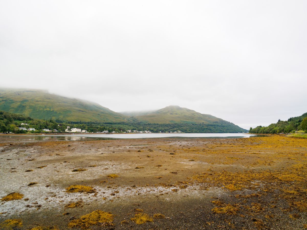
Arrochar does not have a beach. The village is located on the northern end of the saltwater Loch Long, which has an area of mudflats at its northernmost point where it meets the Loin Water. Further mudflats stretch along the edge of the loch on both sides, but these are only visible when the tide is out.
Can you wild camp in Arrochar?
It is permitted to wild camp anywhere in Scotland as long as campers abide by the Scottish Outdoor Access Code. The main points to follow are to avoid overcrowding an area, do not set open fires, leave no litter behind, and ask permission from the landowner if there is private housing nearby.
Where are the Arrochar Alps?
The Arrochar Alps are a group of mountains located west of the Trossachs National Park. The mountains are easily accessed from the villages of Arrochar and Lochgoilhead.
Munros (over 3,000 feet or 910 metres) in the Arrochar Alps are:
Beinn Ìme, 1011 m
Beinn Bhuidhe, 948 m
Ben Vorlich, 943 m
Beinn Narnain, 926 m
Ben Vane, 915 m
Corbetts (2,500 to 3,000 feet, or 762 to 910 metres) in the Arrochar Alps are:
Beinn an Lochain, 901 m
The Cobbler (Ben Arthur) 884 m
Beinn Luibhean, 857 m
Ben Donich, 847 m
Binnein an Fhidhleir, 817 m
The Brack, 787 m
Beinn Bheula, 779 m
Cnoc Coinnich, 763 m