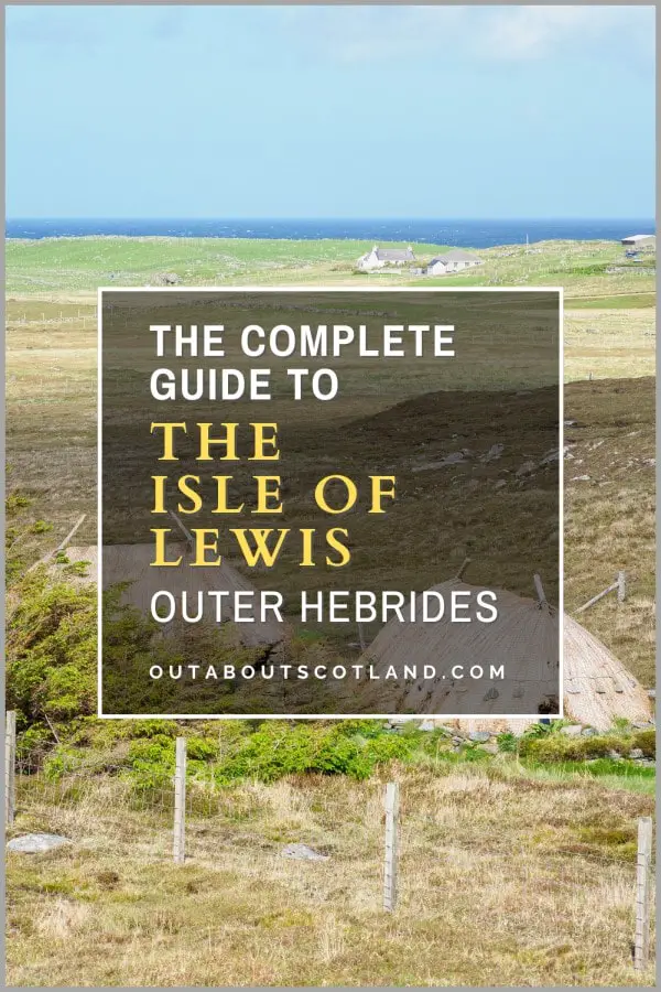
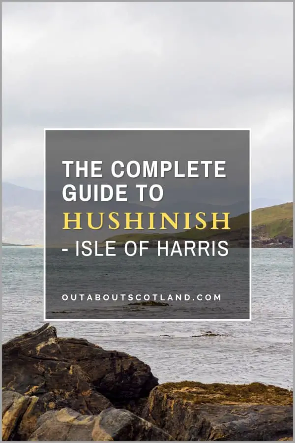
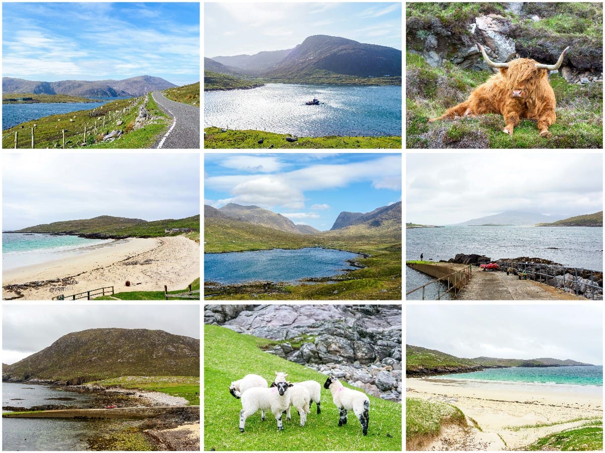
Hushinish Beach, Harris
Hushinish is a remote region on the Isle of Harris in the Outer Hebrides of Scotland. It is accessed via a twisting 12-mile single-track road on the southwest side of the island, which presents stunning views of South Harris and the island of Taransay.
Visitors can kayak to the nearby island of Scarp from Hushinish, where there is a white-sand beach and a rugged coastline to explore. Discover this stunning part of Harris and Lewis with this complete visitor guide.
🠇 Head to the bottom of the page for essential details on each attraction featured here, including addresses, opening hours, and entry prices 🠇
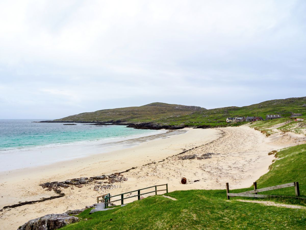
Hushinish Beach
The island of Harris and Lewis is one of the most visited of the Outer Hebrides. While Lewis is flat and almost completely covered in open moorland, Harris is much hillier, especially in the area north of Tarbert. This part of the island is wild and remote and offers walkers a variety of excursions into the great outdoors, from the scenic Isle of Scalpay to the mountainous peaks of Clisham.
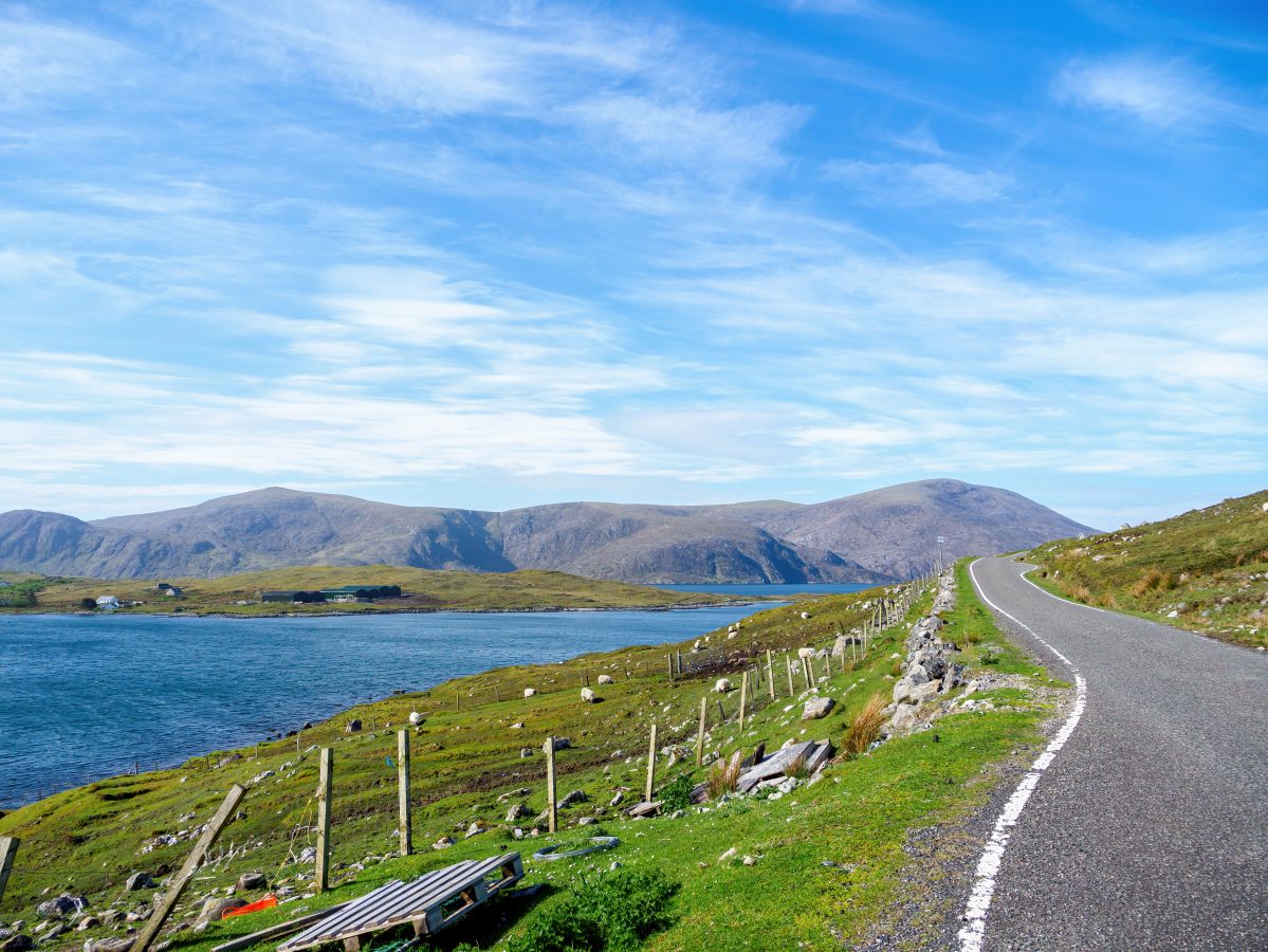
Heading to the western side of the island is rather tricky as the roads are few and far between, but there’s one road in particular that has become something of a must-do for tourists.
This road – the B887 – starts 3 miles west of Tarbert at the foot of the mountain range that divides Harris from Lewis. At 12 miles it’s not exactly long, but it’s narrow and has multiple switchbacks which make the journey slow, with the complete route taking 30 to 45 minutes by car.
The B887 finishes at the most westerly point of Harris at a tiny crofting settlement called Hushinish (Huisinis in Gaelic). Hushinish is a small promontory that curves south around a shallow bay with a beach on one side, while the other is comprised of bare rock and shallow cliffs that face the island of Scarp.
It’s an extraordinarily pretty area and it’s one that has become synonymous with two activities in particular – snorkelling and kayaking. In addition, Hushinish is a popular spot for campervans thanks to a recently opened parking area, and it’s also one of the best places in the Outer Hebrides for wildlife watching.
Parking up and scanning the sky with a pair of binoculars opens up opportunities to see golden eagles soaring overhead, while the shoreline is a favourite spot for otters on the prowl for their next meal.
There’s also a good chance of seeing red deer in the hills that surround Hushinish (especially in autumn during the rutting season), and the sea is a favoured place for seals, dolphins, and minke whales.
The Highlights
1: North Harris is full of wild places, but many of them can only be accessed via a long hike across hills and moorland. On the other hand, Hushinish is conveniently located at the end of a tarmac road, making it accessible to both cars and bikes.
2: The beach at Huisinis is small but sheltered, so it’s a great spot for a beach day. By following the track that runs along the base of the hills to the Sound of Scarp at Crabhadail, you can find a much larger deserted beach. Although the Sound of Scarp is only 1/4 mile wide at the beach, it is not advisable to swim across to Scarp as the currents can be treacherous.
3: If you like snorkelling, you’ll love the waters around Huisinis beach. The amount of marine life is incredibly diverse and you’ll see a rich marine environment under the waves as you swim around including a variety of sponges and starfish, dogfish, wrasse, crabs and jellyfish.
Visiting Tips
1: Many people visit Huisinis to enjoy snorkelling in the clear waters that surround the reefs to the west of the bay. However, be mindful of a few key points before setting off into the water.
- Never snorkel alone.
- Be mindful that the currents on the north side of Huisinis are strong.
- There are Lion’s Mane jellyfish in the area which have a painful sting.
- The marine environment at Huisinis is very fragile so avoid disturbing the marine animals and do not take anything away with you.
2: The campervan site is a great spot for pitching, but it’s rather small, with space for only 4 campervans. There is no booking, so availability is on a first-come, first-served basis. Payment can be made by an on-site honesty box as well as by text (details are posted at the site).
3. If the car park is full, kindly avoid parking on the machair (wild grassland), as cars are causing damage to it. Note that all land past the cattle grid on the B887 (the single-track road) is part of the crofting community on the west side of the beach.
Tourist Information
The road to Hushinish is one of the most enjoyable drives in the Outer Hebrides, so it’s just as well there are plenty of off-road spaces to stop and soak up the views of Taransay and South Harris. As nice as the coastline is, though, the highlight of driving the B887 has to be the North Harris Eagle Observatory, which is widely regarded as one of the best locations in Scotland for watching golden eagles.
From Loch Mhiabhaig, you can park at the observatory car park and walk north along a gravel track for 1.5 miles to a bird hide situated in the middle of a glen that’s home to a breeding pair of golden eagles. These magnificent birds can usually be seen soaring overhead, so there’s a very good chance you’ll see them when you visit, though they’re most active during bright and breezy weather.
The drive from the observatory car park to Hushinish is around 8 miles and isn’t really suitable for large motorhomes in my opinion, but even so, there’s a designated camping area near Hushinish which has electric hook-up points.
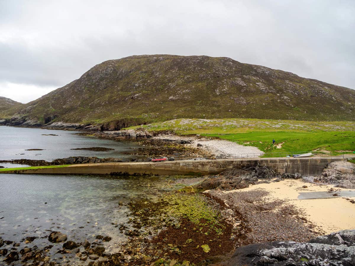
There’s also a small car park behind Hushinish Beach which has a visitor cabin complete with toilets, picnic benches, and showers, but there are no shops in the area so you will need to take supplies with you.
The beach is small and clean, and the bay is shallow, so it’s a great place for a family day out, especially if you enjoy snorkelling.
The western end of the bay has reefs that are home to shoals of fish as well as jellyfish and starfish, and as the water is so clear you can see them all in dazzling detail. Be aware though, that the water is cold throughout the year – even in the height of summer – so a wetsuit is highly recommended as it will keep you toasty while providing protection from some of the jellyfish which have a rather painful sting.
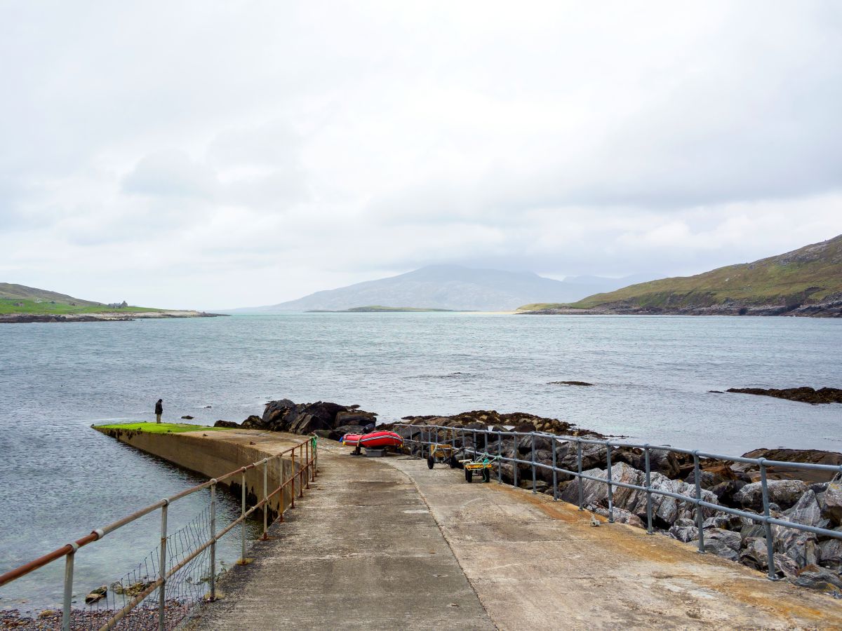
The opposite side of the Hushinish promontory faces the Isle of Scarp which is a fairly short paddle away if you have a kayak, and launching is made easy thanks to a jetty situated next to a small shingle cove.
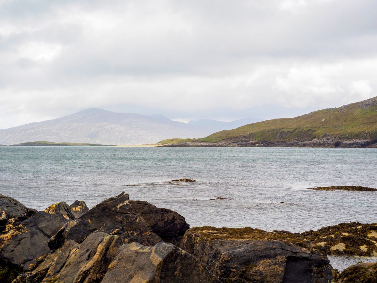
A kayak really opens up this part of Harris as the coastline is incredibly scenic once you round the headland and veer north towards Loch Crabhadail. This small sea loch has a nice wee beach, behind which is another loch (Loch a’ Ghlinne), which offers a good 2.5-mile walk around it, though there are no footpaths and the terrain is rather boggy.
If you’d prefer to kayak to Scarp, the best crossing point is at Traigh Mheilein Beach, opposite the Kyle of Scarp, which is less than a 1/4 mile across. Once on the island, you’ll find a number of ruined houses left behind by the last crofters who departed in the 1970s, while the rest of the island is barren and rocky, but no less attractive for it.
During my visit, I wandered around the area behind the old crofter’s houses and climbed to the top of Sron Romul Hill, which was probably the high point (no pun intended) of my entire visit to Hushinish.
The second highlight was walking from the Hushinish car park to Traigh Mheilein Beach, which is a half-mile stretch of golden sand that was blissfully deserted. The sea is shallow and therefore has that gorgeous turquoise colour that the Outer Hebrides is famous for, but sadly, the currents are fierce, so swimming is best avoided.
Things to Do
Hiking to Hushinish: Begin your adventure on Harris with a picturesque hike to Hushinish. This trail offers panoramic views of the surrounding islands and the opportunity to spot wildlife like harbour porpoises and dolphins. The serene ambience and breathtaking scenery make it a must-do for all hiking enthusiasts.
Wildlife Watching: The area around Hushinish is rich in wildlife. You can spot seals sunbathing on the rocks, otters playing in the water, and various birds flying overhead, including golden eagles. Don’t forget your binoculars (link to binocular reviews) to fully appreciate these animals in their natural habitat.
Fishing at Loch Crabhadail: If you’re an angling enthusiast, head to Loch Crabhadail. This small sea loch offers a tranquil setting for a peaceful day of fishing, though it involves a 2-mile walk around the coastline to get there.
Picnicking on the Beach: The white sandy beach at Hushinish is perfect for a family picnic. With the turquoise sea as your backdrop and occasional visits from friendly sheep, this is an ideal spot to relax. The new Huisinis Gateway building provides amenities like toilets, drinking water, and indoor picnic benches.
Photography: The dramatic landscapes of Hushinish provide abundant opportunities for photography. Capture the stunning sunsets, the idyllic beach, and the rugged hills. Whether you’re a professional photographer or an amateur, the beauty of Hushinish is guaranteed to amaze you.
Things to Do Nearby
North Harris Eagle Observatory. Address: Isle of Harris, HS3 3AW. Distance: 9 miles.
This nature reserve is set in a stunning location within a mountain range in North Harris. A gravel path leads into the mountains from a roadside car park to an observatory that offers views of a breeding pair of golden eagles.
Isle of Harris Distillery. Address: Tarbert, Isle of Harris, HS3 3DJ. Distance: 16.5 miles from Scalpay Bridge.
This is a lochside gin and whisky distillery situated near the ferry terminal in Tarbert on the Isle of Harris. The distillery features a cafe, gift shop and guided tours that explain the process of gin and whisky production.
Harris Tweed Shop. Address: Caberfeidh, Tarbert, Isle of Harris HS3 3DJ. Distance: 16.6 miles from Scalpay Bridge.
The Harris Tweed shop in Tarbert is the main retail outlet for authentic Harris Tweed on the island. Inside, visitors will find a range of pre-made gifts and clothes made from genuine Harris Tweed as well as lengths of cloth that can be purchased in bulk.
Clisham. Address: Isle of Harris HS3 3AP. Distance: 15 miles.
Clisham is the highest mountain (designated as a Corbett) in the Outer Hebrides, with a total height of 2,621 feet. There are several paths that lead to the summit but the most popular starts at a car park on the A859 and heads northwest on a straight line for 3.25 miles. Once at the top, climbers can enjoy a beautiful panorama across Harris and Lewis.
Scarp. Distance: 1 mile from the Huisinis causeway.
Scarp is a wild and remote, uninhabited island situated north of Huisinis in North Harris. From the Huisinis jetty, you can kayak to the island. The remains of buildings owned by the last inhabitants (who departed in 1971) can be seen on the island, and the largest hill (Sron Romul, 1,000 feet) offers incredible views from the top.
Frequently Asked Questions
What is the Isle of Harris famous for?
Harris is best known as a tourist destination due to its beaches (Luskentyre is the highlight), mountains, dramatic coastline, and scenic villages.
The island is also known as the birthplace of Harris Tweed – the durable patterned fabric made from locally sourced wool.
Can you stay on the Isle of Harris?
The are many places to stay on the Isle of Harris, from hotels to guesthouses and Airbnb holiday rentals to campsites. A good resource to find accommodation is the Explore Harris website.
How do you get to the Isle of Harris?
The Isle of Harris can be accessed via Calmac ferry services that operate from Ullapool on the mainland to Stornoway, and Uig on Skye to Tarbert.
See the Calmac website for further details.
Is the Isle of Harris the same as the Isle of Lewis?
The Isle of Harris and Lewis is one landmass, but it is designated as two separate islands. This is because the mountain range on North Harris meant that in the past it was difficult to travel between the north and south regions of the island, so residents classified themselves as either being from Lewis (northern half) or Harris (southern half).
Harris is further subdivided into North Harris and South Harris, with both regions divided by an isthmus near the village of Tarbert.