Faraid Head, Sutherland
Faraid Head is located on a peninsula on the north coast of Scotland, 3 miles north of Durness in Sutherland. The peninsula is a popular tourist destination thanks to the wide expanse of golden sand at Balnakeil Beach. The area behind the beach is covered in dunes and grasses which are a favourite nesting site for a variety of seabirds.
🠇 Head to the bottom of the page for essential details on each attraction featured here, including addresses, opening hours, and entry prices 🠇
Faraid Head
There are lots of secluded bays along the northwest tip of Scotland, but one of my favourites sits on a rocky headland three miles north of Durness. The village can be easily found if you follow the A838 as far north as you can go, with the southern route following the Kyle of Durness and the eastern approach circling Loch Eriboll, two stretches of water that offer some of the best wildlife-watching experiences in Scotland.
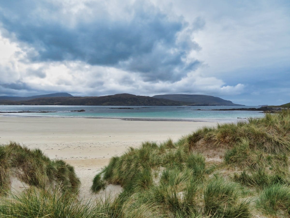
From Durness, you’ll see signs pointing to the village of Balnakeil, from which point you’ll be able to park up to explore the wild, open expanse of Faraid Head. This promontory reaches out into the Pentland Firth for over two miles, and in my opinion, it’s a must-do for all visitors to the area, especially if you’re looking for somewhere to take a quiet walk.
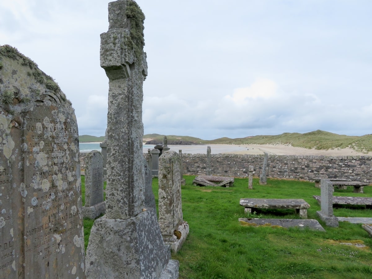
Balnakeil village is home to the 1700s Balnakeil House, which was at one time used as the summer palace of the Bishops of Caithness. Balnakeil Church is opposite, which is even older than the house, having been built all the way back in 1619. While it’s completely in ruin, it’s quite interesting to walk around the old graveyard and look at the headstones. It’s also where you’ll first catch sight of the magnificent Balnakeil Bay.
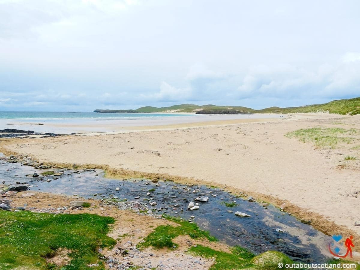
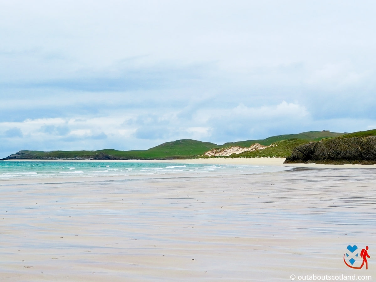
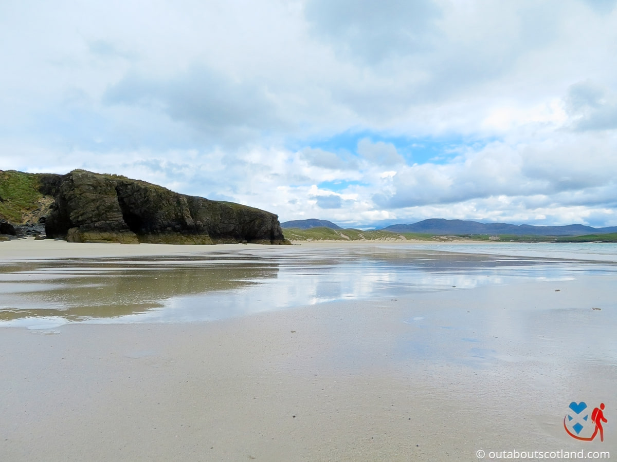
The bay is wide and sweeping, with a vast expanse of white sand fringing beautifully clear turquoise waters. Thanks to the fact that it’s protected by the coastline to the west and high dunes to the east, it’s also sheltered from the biting winds that roar in from the North Sea.
Faraid Head, with its unique combination of natural beauty, wildlife and history, is a highlight for those exploring the far north of Scotland. There are great hiking opportunities in the area, and a walk around the headland offers stunning views and the chance to enjoy peace and quiet with a sense of being at one with nature.
The Highlights
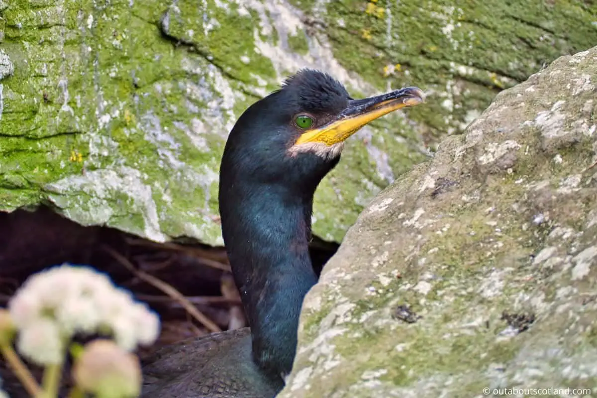
1: Faraid Head is an excellent place for wildlife enthusiasts. The area is renowned for its seabird colonies, including puffins, guillemots, razorbills, and kittiwakes, that nest on the cliffs during the breeding season (usually from April to July). Seals are often seen lounging on the sands or swimming in the waters around the headland, and if you’re fortunate, you might spot dolphins, porpoises, or even whales offshore.
2: One of the main attractions of Faraid Head is Balnakeil Beach, a beautiful and expansive stretch of white sand backed by large dunes. The beach is popular for walking, picnicking, and surfing, given the right conditions.
3: With its breathtaking landscapes and abundant wildlife, Faraid Head is a fantastic location for photography. Whether capturing the dynamic coastline, the wildlife, or the ever-changing beach, it’s a wonderful spot for shutterbugs.
Visiting Tips
1: There are no facilities in the bay, so take a packed lunch with you. If you want hot food, I recommend heading to Balnakeil Craft Village which has a good café.
2: Sango Bay is another nice part of the coastline which lies a few miles east. It’s a bit rockier than Faraid Head but it’s very picturesque.
3: When visiting Faraid Head, it’s important to be mindful of the weather, as conditions can change rapidly in this part of Scotland. Also, there are very limited facilities in the immediate area, so visitors should only go there if they take essentials like snacks, water, and wet weather clothing.
Tourist Information
Although the peninsula is privately owned and used for grazing sheep, the furthest point is easily accessible thanks to a narrow road that cuts through the dunes to a Ministry of Defence training facility. What you’ll see on the highest point of the dunes is a 1950s radar station, and this small collection of lookout towers and military buildings is the reason why a tarmacked road runs through the otherwise inaccessible grasslands.
Although the road makes progress easy for most of a walk around Faraid Head, the ferocious winds blowing in from the north cover the majority of the road’s surface with sand, so it gets a bit tricky to follow at times. If you were hoping the road would offer access for wheelchairs and pushchairs, I’m afraid you’re going to be out of luck.
As with the majority of Scotland’s wilderness areas, you’ll want to take a pair of binoculars (see my recommended optics) and a camera with you for this walk, as there’s a surprising amount of wildlife to see. The area is a prime spot for watching puffins, so if you have any interest in Scotland’s cutest seabird, you might like to set up camp near the dunes and look towards the sea. You’ll find more information about these wee birds here: Puffins in Scotland.
Imagine the scenery of The Lord of the Rings, and you’ll have a good idea of what it’s like to explore this remote corner of Scotland, which is why there’s a local legend that says the area inspired Tolkein to write his fantasy books.
A criss-cross network of paths runs through the dunes, and it’s enjoyable to just wander off in random directions to see where they take you. That being said, you could potentially get lost if you’re not careful, which is why I recommend purchasing an Ordnance Survey map before leaving home.
One final point to note is that because this part of Sutherland is so remote, there’s hardly any light pollution, and if you stay there after dark (from October through April), you’ll be able to witness the magnificent spectacle of the Aurora Borealis. For more information about this natural phenomenon, read Places to See the Northern Lights in Scotland.
Things to Do
Faraid Head Walk: Enjoy a walk at Faraid Head, a scenic promontory that has stunning views of the sea and the surrounding landscape. It’s a great way to admire the wildlife of the area and there’s a good chance you’ll catch sight of seals and dolphins as you make your way around the headland.
Birdwatching: Faraid Head is a dream come true for birdwatchers. Its cliffs serve as nesting grounds for various seabirds including guillemots, puffins, and razorbills. Make sure to take your binoculars (link to binocular reviews) for a closer look.
Durness Beach: Just a short distance from Faraid Head, you’ll find Durness Beach, known for its white sands and turquoise waters. It’s the perfect place for a relaxing day of picnicking, sunbathing, or even a swim if you’re brave enough to face the cold water. The nearby campsite is a fantastic location for exploring the surrounding area – click here to see recommended tents.
Balnakeil Craft Village: For those who love arts and crafts, a visit to Balnakeil Craft Village is a must-do. In the village, you can browse a variety of local artisan shops that showcase the best of Scottish arts and crafts.
Photography: With its rugged landscape, dramatic cliffs, and stunning sea views, Faraid Head is a wonderful location for setting up a camera. Whether you’re a professional or a hobbyist, you’ll find plenty of opportunities to photograph the raw beauty of Scotland’s far northern coastline.
Things to Do Nearby
Smoo Cave. Lairg IV27 4QA. 8-minute drive. One of the largest sea caves in Scotland.
A guided tour allows visitors to travel deep inside the cave and view an underground waterfall via a dinghy boat ride.
Balnakeil Craft Village. 21E Craft Village, Balnakeil, Durness, Lairg IV27 4PT. 4-minute drive.
An independent craft village located near the village of Durness. Local artists sell a variety of artworks including pottery, paintings and woodwork. There is a café on site.
Sango Bay. 2010 A838, Lairg IV27 4QA. 6-minute drive.
Scenic beach with sea stacks. The beach is renowned for the crystal clear sea in the bay which is ideal for swimming and snorkelling. There are clifftop walks along the coastline and there are several campsites nearby.
Balnakeil Beach. Lairg IV27 4PX. 2-minute walk.
A wide, sweeping stretch of golden dunes overlooking the Kyle of Durness and the Achiemore peninsula. Parking is available near the ruins of the historic Balnakeil Church.
Durness. A838, Durness, Lairg IV27 4PN. 5-minute drive.
A small country village that is lightly populated but frequently visited thanks to its central location that offers access to the coastline. There is a store (one of the few in the area) in the village centre.
Frequently Asked Questions
How do I get to Faraid Head?
By travelling past Balnakeil craft village and the Balnakeil car park, one can reach Faraid Head from Durness. Follow the single-track road alongside Balnakeil Beach, which runs to the tip of the promontory.
Address: Balnakeil Bay, Durness, Sutherland, IV27 4.
Where do you park at Faraid Head?
There are free car parking areas near the kirkyard that faces Balnakeil Bay.
Where is Balnakeil?
Balnakeil is located at Faraid Head on the southern edge of Balnakeil Beach. Balnakeil is part of the parish of Durness, Sutherland, in the northern Scottish Highlands.
What towns are near Durness?
Near Durness, you can visit the following settlements:
Thurso: This is the most northerly town in mainland Scotland. It offers beautiful coastlines and holds a lot of historical significance.
Wick: Known for its harbour, this town is also in the north of Scotland. It’s famous for its whisky distillery and fascinating history.
Tongue: This village in northwest Highland offers stunning landscapes and historic sites like Castle Varrich.