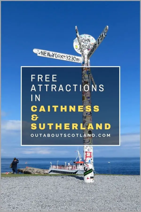
The Best Free Things to Do in Caithness & Sutherland
The North Highlands cover some of the wildest, most remote, and most scenic landscapes anywhere in Europe. From John O’Groats to Ullapool, you’re guaranteed to become smitten with the beauty of this extraordinary region of Scotland. Discover the best free things to do in Caithness & Sutherland with this article, which features an overview of the top attractions and useful tourist information.
🠇 Head to the bottom of the page for essential details on each attraction featured here, including addresses, opening hours, and entry prices 🠇
Free Things to Do in Caithness & Sutherland
The far north of Scotland was, until recently, one of the least visited regions of the country by tourists. It’s a fact that’s understandable when you look at a map, as there’s a lot of travel involved in getting to this wild and remote area, and it was sadly under-sold as a holiday destination against Skye, Edinburgh, and the rest of the Highlands.
That all changed with the introduction of the North Coast 500 in 2015, and now hundreds of thousands of holidaymakers come to the North Highlands to explore the 516-mile scenic route that winds its way through some of Scotland’s most scenic landscapes. The Highland council area where the NC500 is staged comprises everything north of Inverness, which includes the counties of Ross and Cromarty, Caithness and Sutherland, each of which offers a different experience.
Ross and Cromarty is best known for its windswept coastline that faces the ever-popular Isle of Skye, and it’s highly rated for its mountain scenery that includes the Torridon Hills and the stunning Bealach na Ba pass. Sutherland is the next county north, and it’s a favourite area for hill walkers thanks to rugged mountains like Ben Hope and Suilven, but it’s also a firm visitor favourite due to its rugged coastline, especially on its western fringes where mountains meet the sea.
Caithness is the most northerly point on the British mainland and though it’s a small county at just 618 square miles it has a healthy tourism industry thanks to attractions like John O’ Groats, plus it’s the main departure point for ferries to the islands of Orkney.
There are hundreds more attractions to explore in the region, but it would be impossible to include them all in a single article. Instead, I’ll list a carefully chosen selection of the best places to visit in the North Highlands that will give you a good idea of what to expect when you visit.
Ben Hope
Out About Scotland Complete Guide to Ben Hope
One of Scotland’s most popular outdoor activities is Munro bagging, where hill walkers across the country attempt to climb as many of Scotland’s 3,000+ foot mountains as possible.
Becoming a Munroist – someone that has completed all 282 Munros – is a lifelong ambition for many people and this mountain in Sutherland tends to be one of the first they tick off their lists. Ben More has the accolade of being the most northerly peak in mainland Britain, and it’s set in a stunning landscape that’s remote enough to give visitors a feeling of being completely off-grid.
The mountain lies deep in the heart of Scotland’s Flow Country – a large area of peatland that’s designated as a national nature reserve – and other than the single-track road that leads to the car park the area surrounding Ben Hope is completely unspoilt.
There are very few people living in the 21,000 hectares of the reserve meaning it’s possible to go on an all-day hike and not see another person all day, which makes a great antidote to the crowds of tourists you have to fight your way through elsewhere in Scotland.
At 3,170 feet, Ben More cannot be viewed lightly, especially as the lower half is such a hard slog, but it should be possible for the majority of people to at least make it halfway, where they’ll be rewarded by gob-smacking views in all directions. One of the best outdoor experiences in the area is the climb to the summit of this mountain, which has thickets of gorse bushes that fill the summer air with a delicious vanilla scent.
Duncansby Head
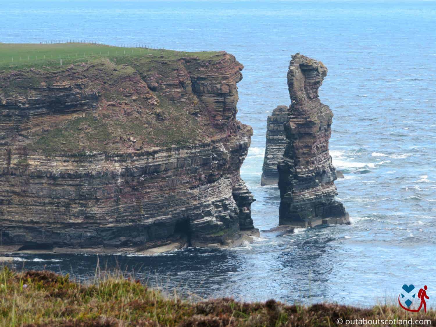
Out About Scotland Complete Guide to Duncansby Head
Duncansby Head is a favourite site for bird watchers who travel in their droves to view the Duncansby Stacks and their swirling flocks of seabirds. The three ‘stacks’ are actually the remnants of cliffs that remain standing against the pounding waves of the North Sea due to their rock composition, which is harder than the crumbling stone that surrounded them.
They’re quite a sight when viewed from the path that runs along the cliff edge, not only due to their immense size but also because they offer protection for seabirds who build their nests on every ledge and crevice, transforming the sky above into a squawking, swirling mass of feathers.
Getting to Duncansby Head is easy and you have two main options, one of which is to drive to the car park at the historic Duncansby Lighthouse and walk twenty minutes, and the other is to set off from the John O’ Groats signpost and follow the five-mile coastal route.
If you’re visiting the iconic signpost then the latter option is by far the best as the scenery really is very pretty at every step of the way, where you’ll cross wild pastures and walk alongside golden beaches before reaching the dramatic cliffs that Duncansby Head is famous for.
Even stopping for photos, the return walk shouldn’t take more than three hours to complete, so viewing the monumental rock formations is a bit of a must-do if you’re visiting John O’ Groats, and you’ll more than likely have time left over to visit other attractions in the area, like the historic Castle of Mey.
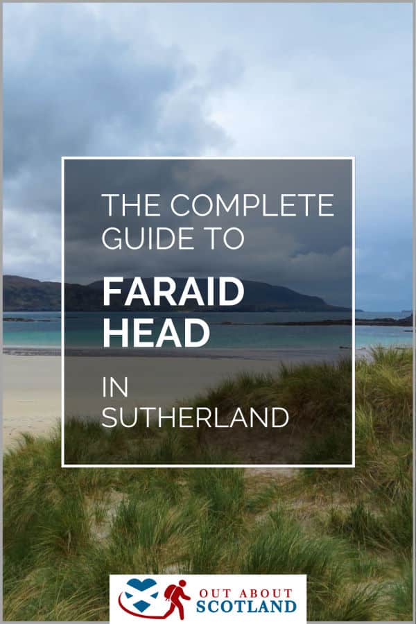
Faraid Head
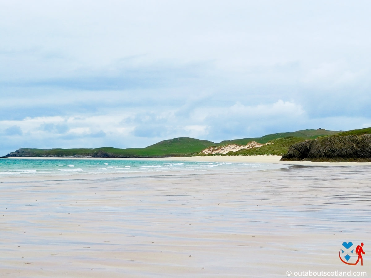
Out About Scotland Complete Guide to Faraid Head
The coastline of the North Highlands is well known for its rugged cliffs and vast golden beaches and there’s perhaps no finer example of them than Faraid Head. This peninsula is located three miles north of Durness on the furthest north-west section of the NC500, so it’s a popular point to take a break from the route. To get there from Durness, head to the village of Balnakeil and follow the road that leads north to a small car park at Balnakeil Beach.
The beach is spectacular – there’s no other word for it – as it arcs its way around a wide, shallow bay that has perfect turquoise waters.
There’s a minor road that runs through the middle of Faraid Head towards a disused radar station, but my advice is to first walk the two-mile length of the beach and then head inland into the sand dunes at the far end before doubling back along the sand-covered road.
Keep an eye on the sea as you make your way around as it’s a favourite spot for resting seals and there’s every chance you’ll spot dolphins on the hunt for their next meal. It’s also a prime spot for nesting puffins so a decent pair of binoculars will come into their own during your visit.
Another great beach lies at the eastern foot of Faraid Head at Sango Bay which is a little busier than Balnakeil beach as it’s closer to Durness, but at least there’s a campsite on top of the cliffs which has one of the few restaurants in the area.
After you’ve walked around the peninsula, I recommend driving a mile to Balnakeil craft village, which is home to a collection of artist workshops that sell a variety of one-of-a-kind pieces, and there’s a nice wee café at the entrance where you’ll be able to refuel hungry bellies with coffee and delicious home-made baked goodies.
John O’ Groats
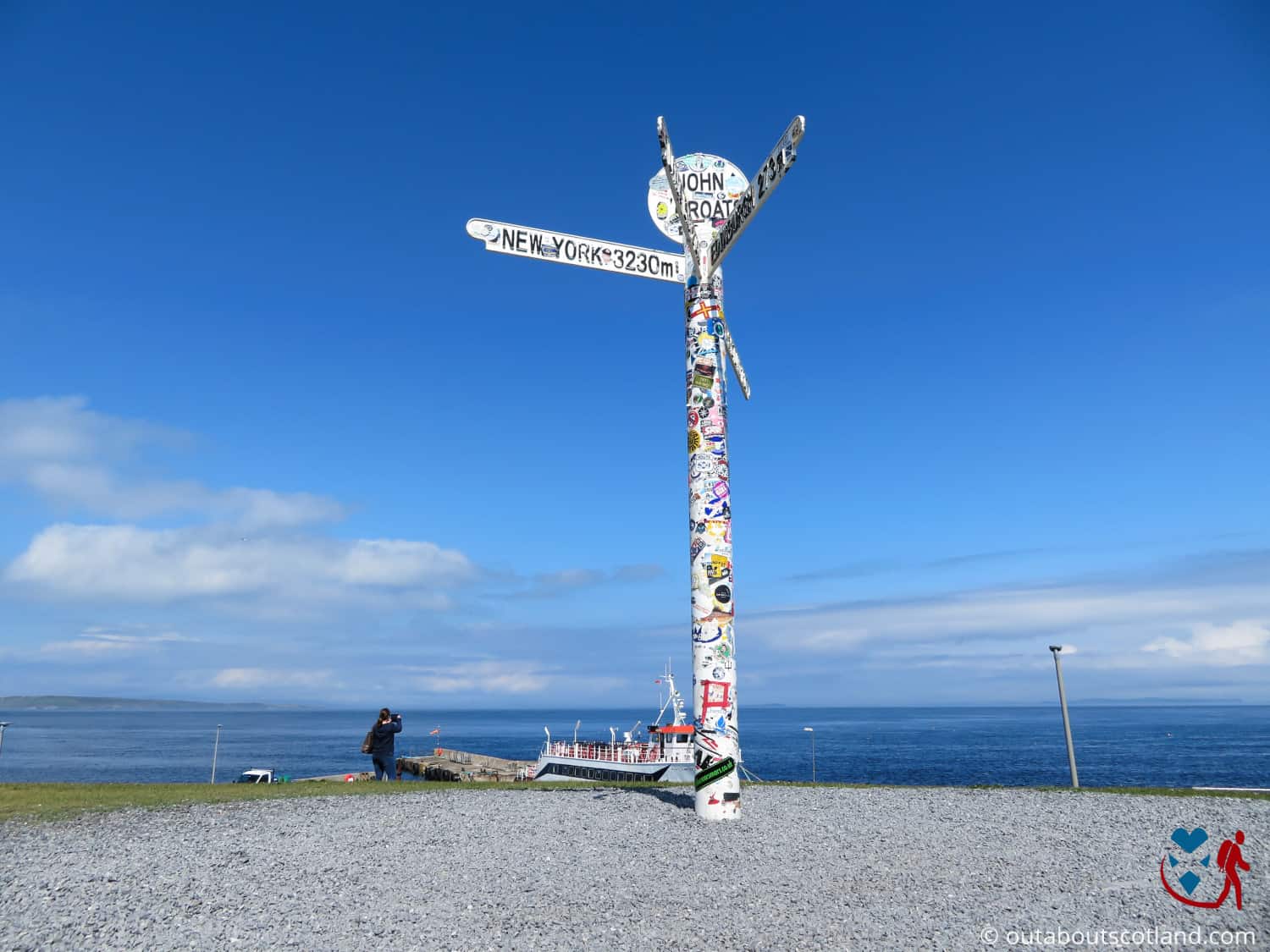
Out About Scotland Complete Guide to John O’ Groats
John O’ Groats bills itself as the most northerly point on Britain’s mainland, and a sizeable tourist attraction has been built around the famous signpost that features on countless postcards. The signpost is certainly worth visiting, especially if you’re setting off from there to see Duncansby Head, but the truth is that the most northerly point on Britain’s mainland actually lies 15 miles west on the peninsula of Dunnet Head.
If you can forgive it that slight bending of the truth you’ll have a nice time at John O’ Groats – if you arrive when there aren’t too many tourists.
Unfortunately, due to its ‘most northerly point’ legend, John O’Groats is one of those must-visit destinations that everyone on the NC500 makes a point of stopping at, and in the summer it gets incredibly busy.
If you can, try to visit midweek outside the school holidays when you’ll be able to take selfies in front of the signpost without crowds of tourists getting in the way, after which you can explore the rest of the site before following either of the coastal paths that lead east and west.
The John O’ Groats visitor centre includes a hotel, holiday lodges, a restaurant, and a number of cafés and gift shops as well as a tourist information centre where you can find out about other attractions in the North Highlands. There’s also a ferry service that takes tourists to Orkney, a camping site, and even a brewery, so all in all, there’s quite a lot going on at this attraction.
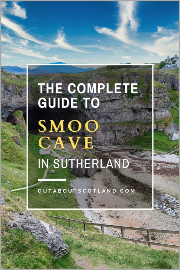
Smoo Cave
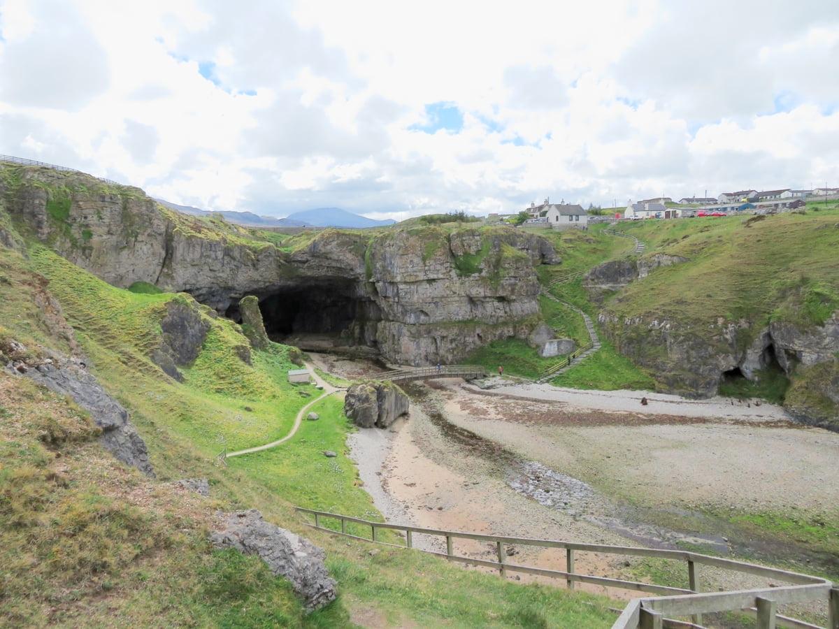
Out About Scotland Complete Guide to Smoo Cave
Smoo Cave is one of the largest sea caves in Britain with a central cavern that’s over fifty feet high. It’s a genuinely amazing place and stepping inside it is one of those ‘wow’ moments you’ll never forget. Entry is free, and because it lies just a couple of miles west of Faraid Head, visiting it is kind of a no-brainer if you’re in the area.
The cave is signposted along the A838 so you’ll have no problems finding it and there’s a good-sized car park, a toilet block and a café just down the road so it makes yet another great place to take a break from the NC500. Plus, the lovely beach of Sango Dunes is a mere ten-minute walk away if you fancy dipping your toes into the sea.
The main highlight, of course, is the cave, which you enter via a sloping path that runs down to a sea inlet from the cliffs that tower overhead. The path leads into the central chamber, but if you’d like to explore more of the cave, you can join a guided tour that goes deeper underground.
The tour is worth joining as you get to sail across a large underground seawater pool with a cascading freshwater waterfall that’s lit with natural light from holes in the cavern ceiling. This combination of erosion from both sea and rainwater is the reason why the cave looks the way it does, and in fact, it’s the only cave in Britain that has been formed this way.
The guides that take you on the short journey underground are experts in geology and they’ll tell you all about the formation of the caves as well as the stories associated with them, including Smoo Cave’s use as a smuggler’s den in days past.
When you’ve finished the tour, I recommend heading a couple of miles east to the lovely Ceannabeinne Beach and trying the exciting zip line that hurtles across it, but before you do, I suggest heading up the path onto the small headland opposite Smoo Cave, which has a very scenic path around it.
Talmine Bay
Out About Scotland Complete Guide to Talmine Bay
There aren’t many villages in Scotland more remote than Talmine, and there are fewer still that have such attractive coastlines. Talmine is located northwest of the Kyle of Tongue, where it overlooks Talmine Bay and the small island of Eilean nan Ron.
If you’re exploring this part of the county you’ll no doubt find yourself on the Kyle of Tongue causeway as it’s listed in virtually every tourist attraction guidebook due to the superb views you’ll get from the middle of the bridge.
The road leading to Talmine spurs off a short distance from the western side of the causeway with the village located three miles to the north. When you get there you’ll find a small grass area where you can park up and a beach that leads to the coastal footpath.
The sea in Talmine Bay is incredibly clear and on a summer day it’s very inviting, so if you have a canoe or a paddle board you might consider bringing them with you. There’s a jetty at the far end of the beach, which allows easy access to the bay, and the nearby islands are great places to paddle around.
Eilean nan Ron in particular is worth a look as it’s a favourite sunbathing spot for grey seals, but please avoid it if you’re visiting in autumn as the seals use the island for birthing their pups.
If you’re not interested in water activities, I guarantee you’ll enjoy walking along the coastline and just taking in the view, with the path offering a lovely, easy-going hike where you can cut inland to the other side of the peninsula to soak up the sun on the secluded Achininiver Beach.
Castle Varrich
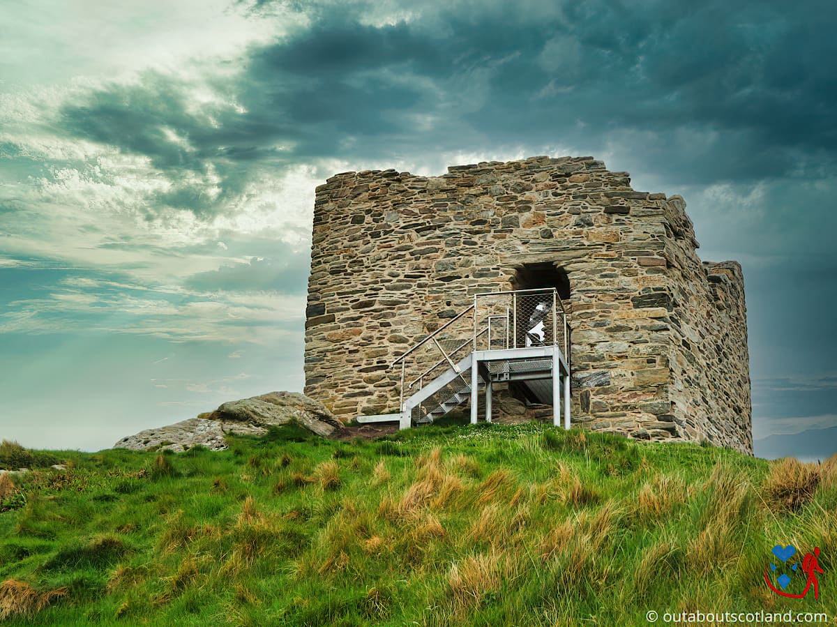
Out About Scotland Complete Guide to Castle Varrich
This is one of the smallest historic attractions I’ve covered to date on Out About Scotland, but I included it because I really enjoyed the short walk to it and the views from the top of the castle are astonishing. When I say castle, don’t go thinking you’re going to find a multi-turreted fort with a gift shop and a restaurant. Castle Varrich is really just a lookout tower, and it was historically used for the defence of the Kyle of Tongue, which allowed ships a safe place to dock in the ferocious North Sea.
The fortification was the seat of power for Clan Mackay for hundreds of years and it sits on top of ruins that are believed to be up to a thousand years old. Today, it’s a shadow of its former glory and is mostly in ruin, but Historic Environment Scotland has installed a modern viewing platform so you can climb to the top and look across the Kyle of Tongue just as the earliest Scottish tribespeople did.
To get to Castle Varrich, head to the Kyle of Tongue Causeway and take the turning south towards Tongue. This is a small village with a couple of nice hotels, and having stopped at the Ben Loyal Hotel for a coffee before setting off on the castle footpath, I have to give it a big thumbs up as the staff are such a friendly bunch.
The footpath starts a hundred yards or so from the hotel where it slopes down to an estuary before weaving its way through woodland and the hill on which Castle Varrich sits. Although it’s a short route that will take around 40 minutes, it’s a great way to take in the countryside of Sutherland, and as it’s so close to Talmine Bay, it’s easy to combine visits to both in one afternoon.
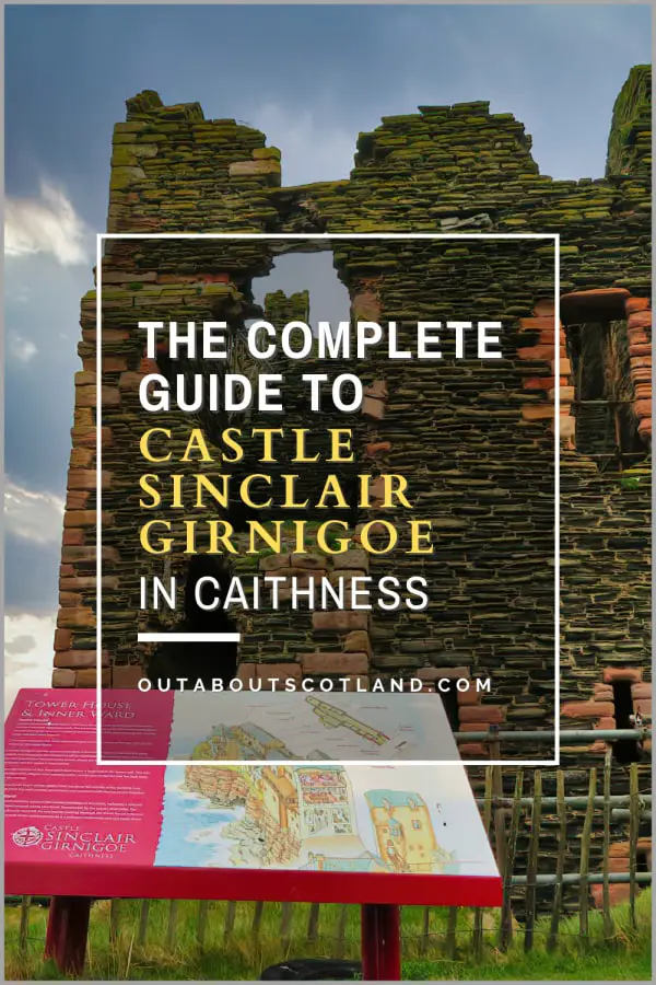
Castle Sinclair Girnigoe
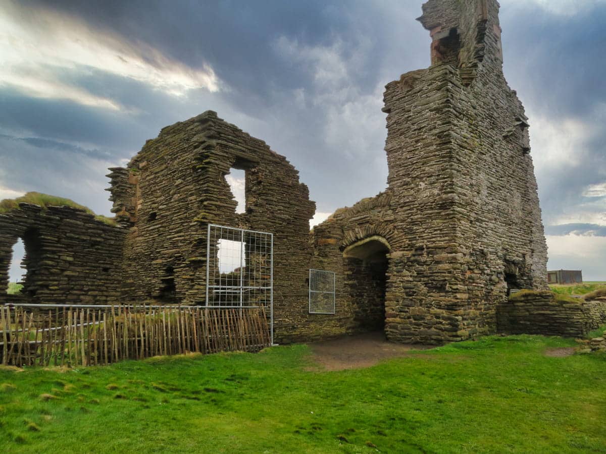
Out About Scotland Complete Guide to Castle Sinclair Girnigoe
Although the Queen Mother’s former residence at Castle Mey gets the most interest, this much smaller fort in Caithness is just as impressive, but for different reasons. While Castle Mey offers tourists the chance to see royal luxury, Castle Sinclair Girnigoe is all about history and dramatic clifftop views.
It lies entirely in ruin but it’s certainly worth adding to your Caithness sightseeing itinerary, mainly because it’s close to the historic fishing town of Wick so you can visit the castle and the town within a few hours.
The castle comprises two main buildings, both of which were built for the Earls of Caithness. The first was built in the 15th century and is the more dilapidated of the two, with not much more than a few low walls to walk around. The second is a newer tower house built in the 17th century that’s more intact but is sadly off-limits to the public.
Access is via a narrow road near Wick airfield, the end of which has a small car park and a narrow footpath that leads to the castle. At the time of writing entry is free but as it’s managed by a private charity this may change in the future.
I wouldn’t plan much more than an hour for a visit as there’s not much to do other than explore the ruins but there’s a footpath heading further west along the coast that offers a good dose of fresh sea air. If you follow the coastline a couple of miles further, you’ll eventually reach the beautiful azure waters and white sands of Reiss Beach, which is guaranteed to take your breath away on a sunny day.
More Attractions in the North Highlands
| Faraid Head | Duncansby Head | Torridon Hills |
| Castle Sinclair Girnigoe | Dunrobin Castle | Rogie Falls |
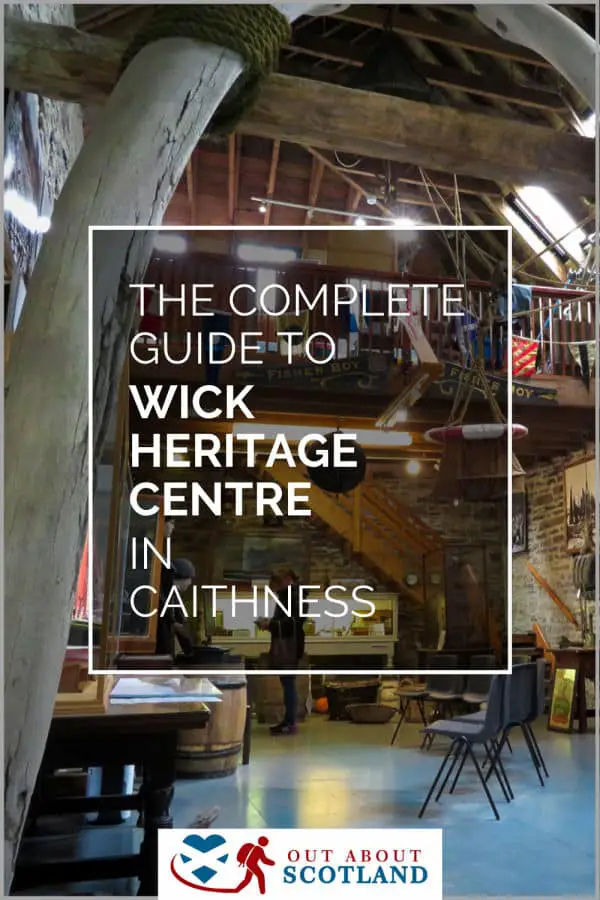
| Wick Heritage Centre | Ullapool | Inverewe Garden |
| Smoo Cave | Talmine Bay | Bealach Na Ba |
| Castle Varrich | North Coast 500 | Applecross |
| Ben Hope | Durness | Eilean Donan Castle |
| John O’ Groats | Ardvreck Castle | Durness Beach |
Frequently Asked Questions
Where are the North Highlands?
The North Highlands of Scotland stretches from Inverness all the way to the far northern tip of Scotland’s mainland at John O’ Groats, across to Cape Wrath on the west coast and down to the Isle of Skye at Kyle of Lochalsh.
The touring route North Coast 500 circles the region on a coastal route that is 516 miles in length.
What are the Highlands?
The Scottish Highlands are a region of Scotland to the west and north of the Highland Boundary Fault. This fault line separates Scotland between the Highlands and the Lowlands, with the latter being flat and mostly used for farming and the former being mountainous and containing the majority of Scotland’s lochs.
When is the best time to visit the Highlands?
The best time to visit the Scottish Highlands is between May and September, when the days are long and the temperature is moderate. During these months, the daily average temperatures sit in the range of 15 °C (59 °F) to 17 °C (63 °F). Outside these months, the weather is more likely to be wet, and the temperatures plummet towards 0 °C, depending on the elevation.
How can I travel around the Highlands?
Travel around the Highlands is best done by car as there are infrequent bus services and train lines only connect the larger towns. Travel to the islands is usually by ferry but it is also possible to travel by aircraft to the larger islands.