Lammermuir Hills
The Lammermuir’s are a range of hills in the south of Scotland that form a natural boundary between East Lothian and the Scottish Borders. Visitors can explore the ancient hill forts at White Castle and Addinston, go for woodland walks at Pressmennan Wood and Yester Estate, and climb the highest point of the hill range at Meikle Says Law (1,755 feet/535 metres).
🠇 Head to the bottom of the page for essential details on each attraction featured here, including addresses, opening hours, and entry prices 🠇
Lammermuir Hills

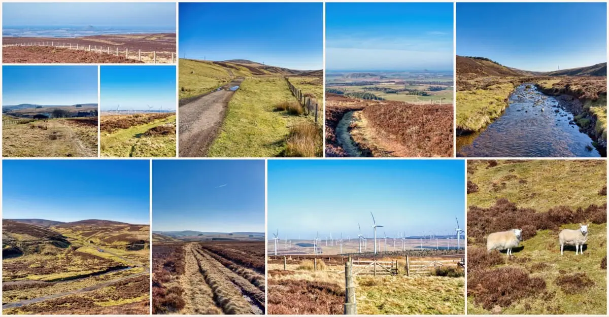
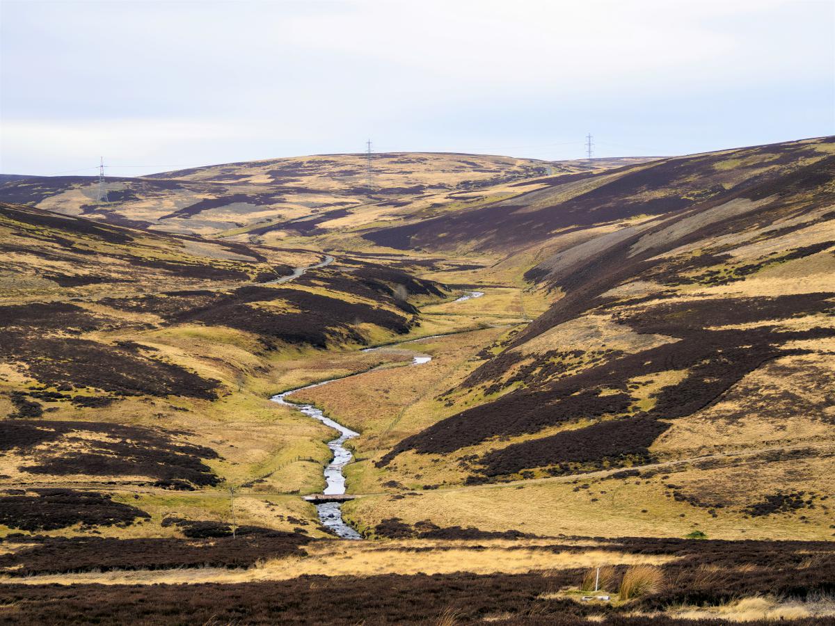
The Lammermuir Hills in southeast Scotland are an enchanting range of rolling hills known for their serene beauty. The landscape, mostly comprised of heather moorland scattered with freshwater reservoirs, offers a multitude of tranquil walking routes as well as plentiful fishing opportunities.
While the south of Scotland isn’t exactly known for its mountains, it does have several hill ranges that offer superb walks into the great outdoors within an hour or so of the country’s capital city. The Pentland Hills are perhaps the best-known hill range purely because of their proximity to Edinburgh, but there’s another range that’s accessible in less than an hour that is more remote and arguably even more scenic.
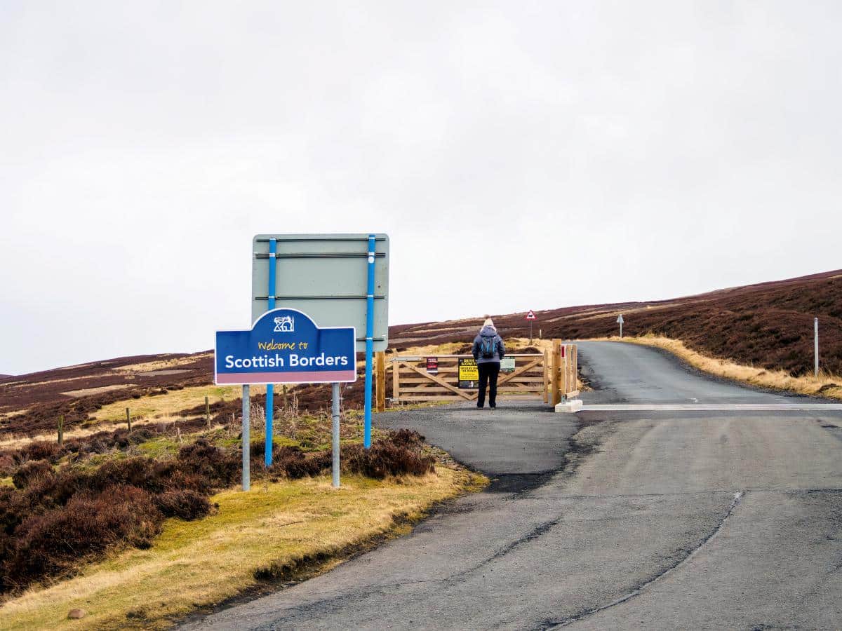
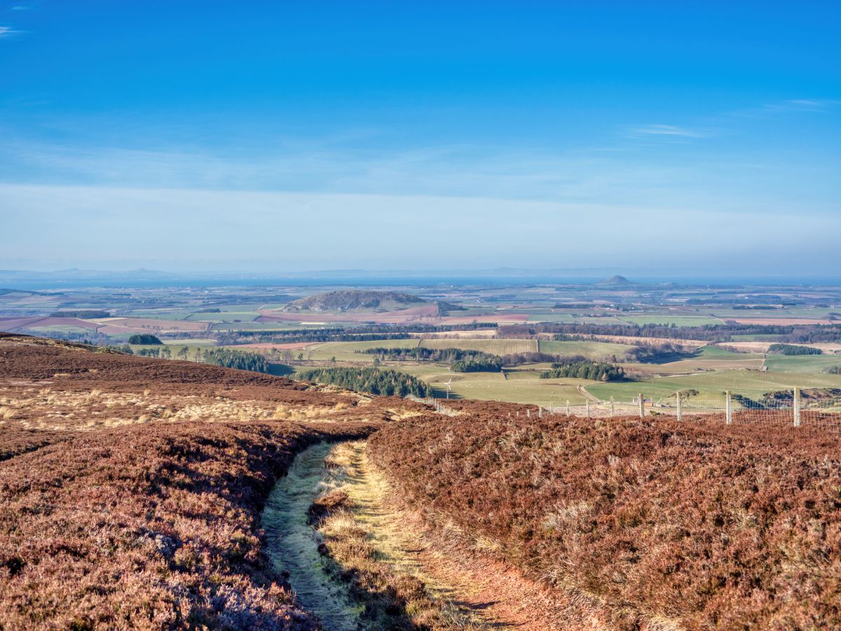
The Lammermuir Hills lie to the south of East Lothian where they form a natural boundary with the Scottish Borders. The hills aren’t particularly high but they offer stunning views from each summit, especially at the highest point of Meikle Says Law which stands tall at 1,755 feet. From up there, you can see across the sweeping fields of East Lothian all the way to the Firth of Forth and the Fife coastline, while the opposite direction presents fine views of the Lowlands as far as the English border.
Getting to the Lammermuir’s can be a wee bit tricky for newcomers to the area (perhaps the reason why these hills are so much quieter than the Pentlands), so a sat nav is a necessity. That being said, it’s possible to end up on the western edge of the hills by simply following the A68 from the Edinburgh bypass for 30 minutes, though car parking spaces are rather sparse once you get there.
A far better option is to follow the B6355 from Gifford which is a much slower road but one that ends up right in the heart of the Lammermuir’s where it’s then possible to head off onto one of the myriad walking trails that thread their way across the moorland.
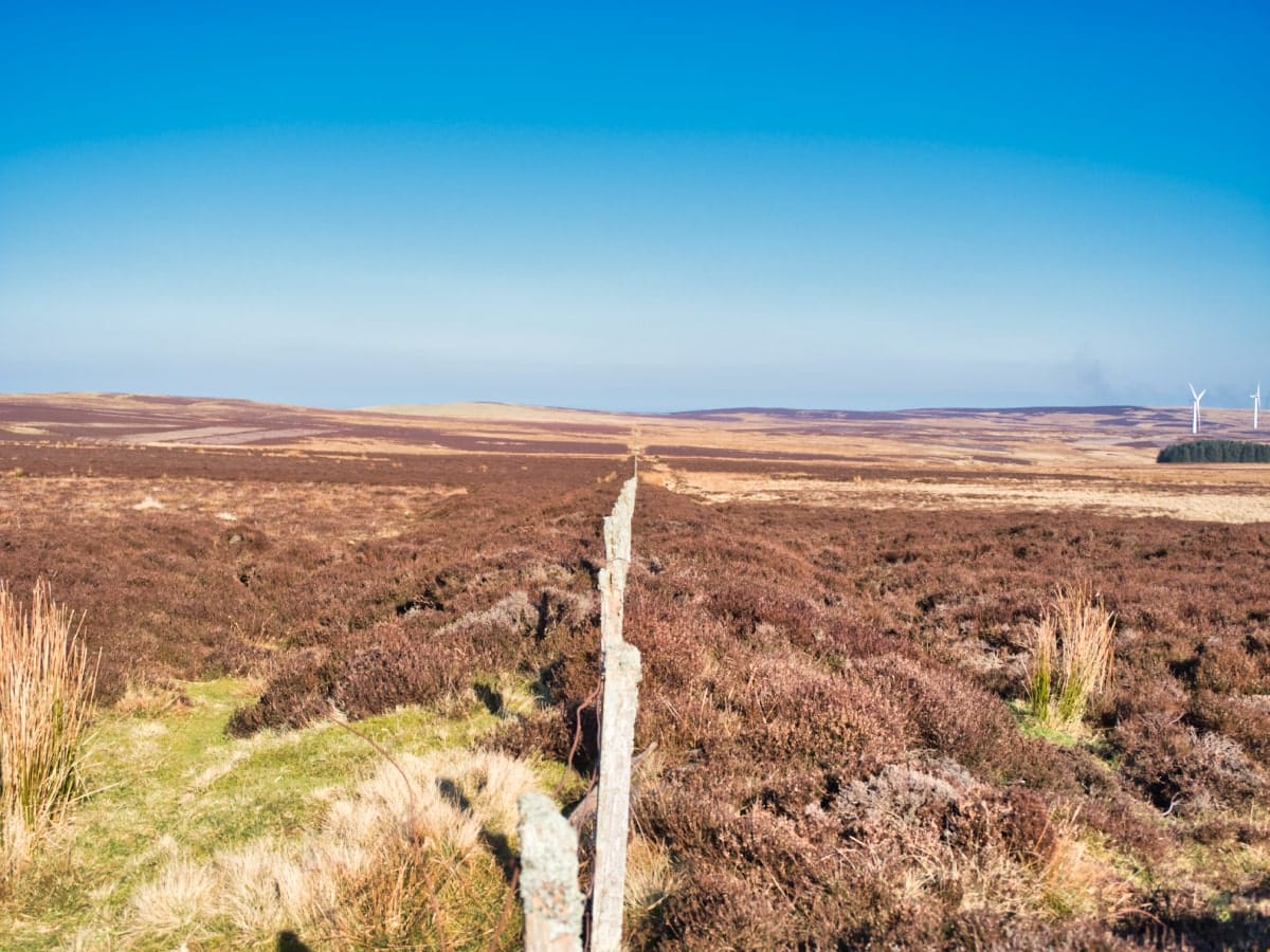
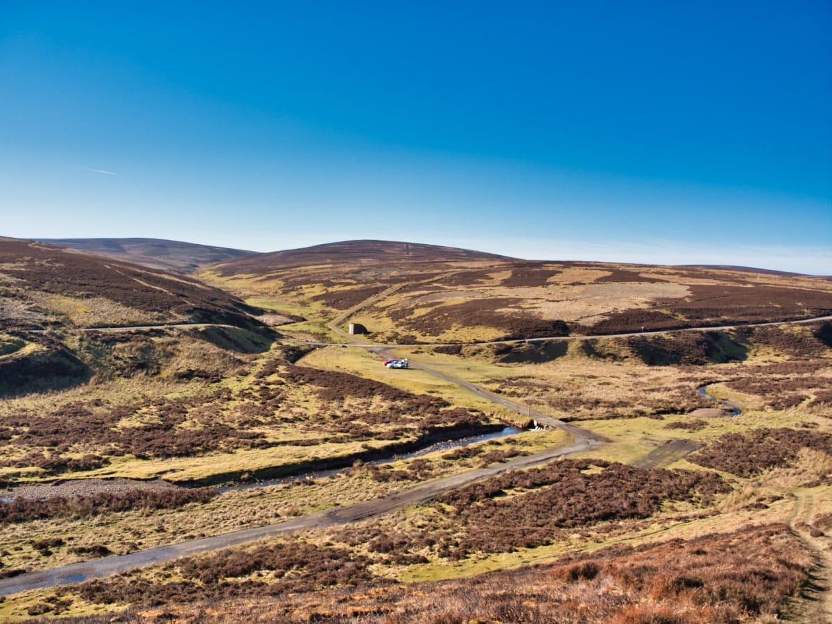
As far as the terrain goes, the Lammermuir Hills are almost entirely used for sheep grazing so there are plenty of farm roads that offer a good mix of tarmac and gravel paths, interspersed by rough grass tracks.
The Scottish Rights of Way Society (Scotways), which has created a number of walking trails that take in the best viewpoints this vast hill range has to offer, has designated many of these paths for public use. While an OS map is by far the best way to find footpaths, Scotways has a decent map of its own, which is free to download from the East Lothian Council website. Just type in ‘Lammermuir Hills’ and it’ll appear as one of the first search results.
One surprising feature of the hills is the number of ancient forts that can still be seen throughout the area. Many of these are from the time of the Votadini (one of the most powerful tribes in Britain during the Roman occupation), and though the remains are basically just earthen mounds, they’re fascinating places to explore.
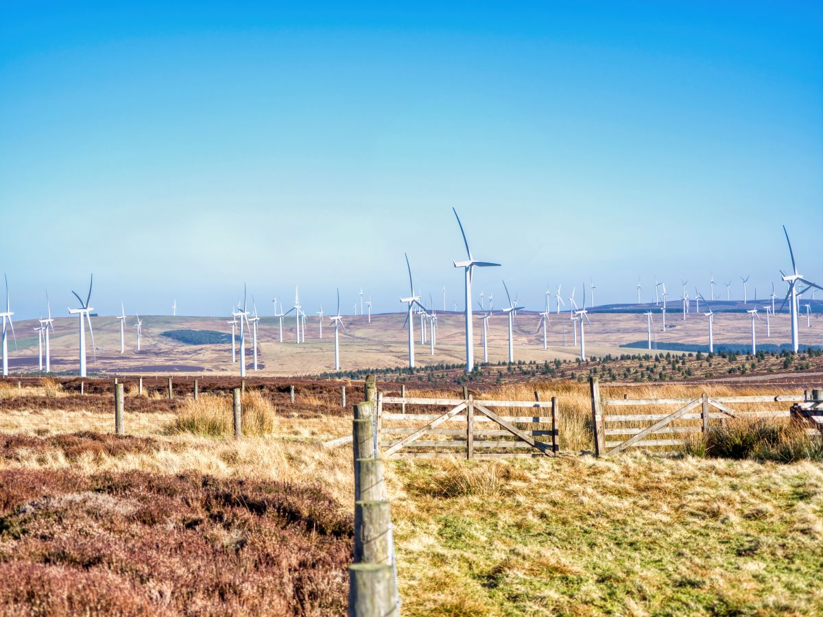
Aside from the hill forts, another feature of the Lammermuir Hills is the two enormous wind farms that stretch across a large portion of the central region and the area on the northeastern edge. More-or-less in the middle between the wind farms is a large freshwater reservoir that’s home to many species of waterfowl, and there’s a water sports centre next to it that offers lessons for everything from sailing to swimming.
Meanwhile, if hill-bagging is your preferred sport you may be interested to know that the Lammermuir’s are home to three Marilyn’s (Meikle Says Law, Spartleton, and Dirrington Great Law), along with 25 trig points. There are also lots of geocaches to find, so if you’re looking for a fun Lammermuir Hills walk, you might consider checking geocaching.com before leaving home to load their locations into the Geocache app.
Note that mobile signals in the Lammermuir Hills are very patchy so it’s best to download everything before you get there.
The Highlights
1: The Lammermuir Hills are, without a doubt, the best place to go near Edinburgh to get away from it all. Unlike the Pentland Hills, the Lammermuir’s see few people even at the weekend, so it’s possible to go for a long walk and not see another person. Bliss!
2: Whiteadder Reservoir is a real highlight of the Lammermuir’s and it’s a superb place to take a pair of binoculars if you enjoy birdwatching (see my recommended binoculars). The reservoir has a water sports centre facing the B6355 which offers supervised swimming sessions, paddleboarding and kayak tuition, and private sailing tuition.
3: Meikle Says Law is the highest point in East Lothian and offers stunning views from its summit where visitors can look across the rolling hills to the Scottish Borders. Another hill worth climbing is Lammer Law, which lies to the west of Meikle Says Law. This hill is right on the edge of the hill range and can be combined with a walk around Hopes Reservoir and Longyester Estate.
Visiting Tips
1: There are several hill forts in this part of East Lothian but two are within walking distance of Whiteadder Reservoir. Gamelshiel Castle and Kilmade Hillfort are interesting glimpses into Scotland’s ancient history, though they’re a wee bit tricky to find. Your best option to find them is to follow Google Maps from the reservoir.
2: The Lammermuir’s are surprisingly big so it can be slightly confusing to work out where the best paths are. This is one instance where you really need an OS map to make the most of a visit. #345 Explorer is the best map for the hill range. See the link below to order a copy.
3: Be aware that grouse shooting takes place in the hills between August 12 and December 10. Additionally, there is a live firing range in the western Lammermuir’s, which has signage around its perimeter. Red warning flags will be flown when shooting is taking place.
Tourist Information
If you enjoy setting off onto the open road on two wheels you’ll be pleased to know there are lots of great bike rides in the area. To find the best Lammermuir Hills cycling routes I personally use Komoot, but to be honest, you won’t go far wrong whichever road you take.
Options for walking through the hill range, meanwhile, are limitless, but if you’re a first-timer you might like to follow the Priestlaw Hill circular route from Whiteadder Reservoir.
The old Herring Road, which fishwives once used to travel from Dunbar to the market town of Lauder, is a fairly simple ramble across the northeastern hills. The entire route is around 7 miles on gravel and grass tracks with just a few moderately steep inclines, so it should be possible to complete for anyone with average fitness levels.
Be aware that Lammermuir Hills parking can be rather hit-or-miss as suitable places are few and far between, so you may have to drive around till you find somewhere.
Walking Route
1: To begin, head to Whiteadder Reservoir and park on the roadside near the cattle grid where a lane branches off to Priestlaw Farm. Head along the lane and then turn right onto a track signposted as The Herring Road.
2: This rough track heads towards farm buildings where there’s a gated footpath that leads up an incline through the empty countryside. Continue for 1.5 miles to a small bridge, beyond which is a minor road that climbs to the left.
3: Follow the tarmac single-lane road for just over one mile till you reach a sign pointing in the direction of Priestlaw Hill that’s signed for Garvald and Whiteadder Reservoir.
4: The track heads out onto open moorland with lovely views in all directions, but for a really scenic viewpoint you might like to take a small detour up the obvious path that leads to the summit of the hill. This is also a pretty good location for a spot of Lammermuir Hills wild camping.
5: After soaking up the view, return to the main track and continue onwards to Whiteadder Reservoir. The reservoir can be seen ahead and the track is obvious so directions aren’t really needed from this point on.
6: Once you reach Priestlaw Farm, rejoin the lane that leads to the parking area next to the cattle grid.
Things to Do
Hiking: The Lammermuir Hills offer a wide range of trails for hikers of all abilities. The paths weave through beautiful moorland and rolling hills, making the area the perfect place to enjoy nature while getting some exercise.
Bird Watching: The hills are home to a variety of bird species and wildlife lovers can spend hours spotting beautiful birds such as the curlew and skylark. Don’t forget your binoculars (link to binocular reviews).
Photography: The wild landscapes of the Lammermuir Hills are great for photography. Capture the changing seasons of the hills and vast moorlands for some fantastic shots.
Cycling: With its varied terrain, the Lammermuir Hills are a great place for cycling. Whether you’re a seasoned mountain biker or an amateur road cyclist, you’ll find routes to suit your ability wherever you go in this underappreciated part of Scotland.
Picnicking: Find a quiet spot amongst the heather and enjoy a picnic with a view. The peaceful scenery of the Lammermuir Hills is the perfect place to relax and unwind whether hiking to the top of Priestlaw Hill or taking a slow ramble around Fallago wind farm.
Things to Do Nearby
From Whiteadder Reservoir:
Traprain Law. Haddington EH41 4PY. Distance: 15 miles.
A conical hill similar to (but smaller than) North Berwick Law which is a well-known landmark on the coast of East Lothian. A 1-mile path from a small car park to the summit offers panoramic views of the area.
Athelstaneford National Flag Centre. North Berwick EH39 5BE. Distance: 16 miles.
Athelstaneford is a small parish village in East Lothian that legend says is the place where a Scottish King founded the Saltire national flag after seeing it appear in the clouds. There is a small museum dedicated to the Saltire behind the church (located inside a doocot).
Woodhall Dean Wildlife Reserve. Dunbar EH42 1SJ. Distance: 10 miles.
Nature reserve on the edge of the Lammermuir Hills. This reserve is home to sessile oak trees (a once-abundant tree that is now dwindling in numbers) and it is highly regarded for the carpets of woodland wildflowers that bloom in spring.
Marchmont House. Address: Marchmont, Greenlaw, Berwickshire, TD10 6YL. Distance: 18 miles.
The 3rd Earl of Marchmont built Marchmont House in 1750, which is a Grade A mansion. The mansion house is open for overnight accommodations as well as guided tours, and there are exhibitions staged both inside the house and in the extensive gardens throughout the year.
Frequently Asked Questions
How high are the Lammermuir Hills?
The Lammermuir Hills have an elevation of 1,388 feet. The highest point of the hill range is Meikle Says Law which is 1,755 feet (535 metres) high.
Can you walk around Whiteadder Reservoir?
Visitors can walk around Whiteadder Reservoir via the B6355 minor road to the north and a farm track to the south. The entire walk takes around 1.5 hours. Interesting points to note are the ancient remains of Kilmade Fort to the east of the reservoir, and Priestlaw Hill which borders the south of the reservoir.
Where do you park at Whiteadder Reservoir?
There is a parking area at the fishery car park at the East of Scotland Water building on the northeast end of Whiteadder Reservoir. There is also space on the side of the B6355 road opposite the turning to Priestlaw Farm on the northwest end of the reservoir.
Where are the Lammermuir Hills in Scotland?
The Lammermuir Hills span the counties of Selkirk, East Lothian, and Berwick in the southeast of Scotland. The hills lie to the southeast of Edinburgh and to the north of the Scottish Borders.
Where is Lammer Law?
Lammer Law is a hill located in the Lammermuir Hills in East Lothian, Scotland. The postcode is TD2 6RE. It is part of a range of hills that runs from near the border with England to just east of Haddington in East Lothian.
Lammer Law is the highest point in the Lammermuir Hills, standing at 473 meters (1,552 feet) above sea level.