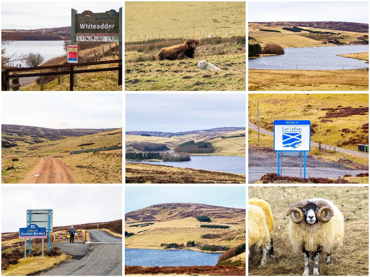
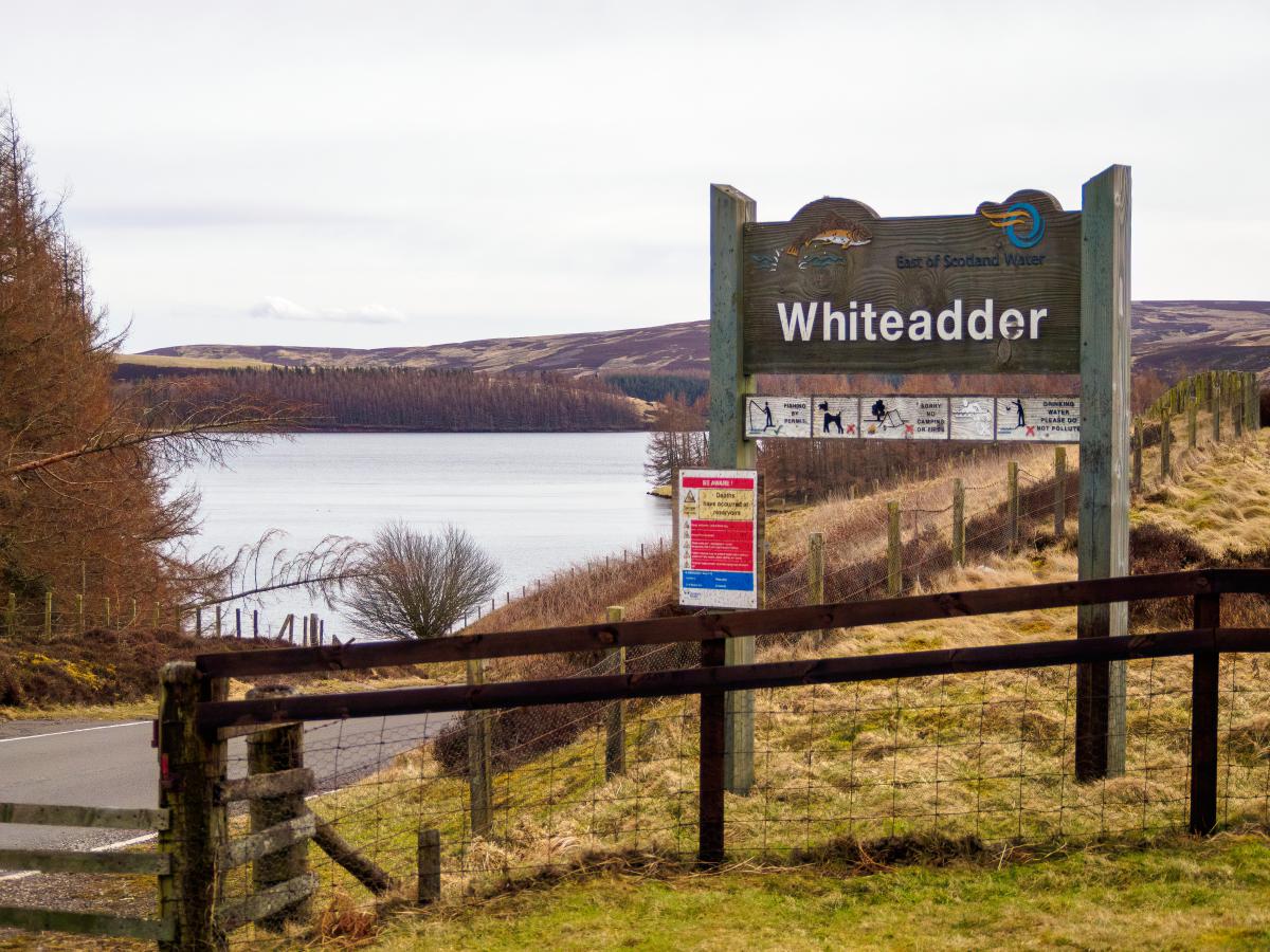
Whiteadder Reservoir
Whiteadder Reservoir & Priestlaw Hill are situated deep within the heart of the Lammermuir Hills in East Lothian. The reservoir was intended to be an additional source of drinking water for the county, but after work was completed in 1968, it became a haven for wildlife as well as a popular location for fishing and water sports.
A popular walking trail takes walkers around the reservoir to the heather-covered summit of Priestlaw Hill which has stunning views of the countryside in both East Lothian and the Scottish Borders.
🠇 Head to the bottom of the page for essential details on each attraction featured here, including addresses, opening hours, and entry prices 🠇
Whiteadder Reservoir
East Lothian is a county with a surprisingly diverse landscape, from the sublime golden sand beaches of Yellowcraig and Seacliff to the pretty country villages of Athelstaneford and Preston. The county is also home to one of the wildest hill ranges in the south of Scotland, thanks to the vast Lammermuir Hills, which span the southernmost region and beyond to Selkirk and Berwick in the Scottish Borders.
Although these hills equal Edinburgh’s Pentland Hills for size they see far fewer visitors, perhaps because the crowds of the capital prefer the shorter journey to places like Flotterstone and Swanston which lie just a few minute’s drive south of the city bypass.
That means East Lothian’s hill range is much quieter and it’s entirely possible to set off on a midweek walk and not see another person for hours on end – something that’s nigh-on impossible as you near the city.
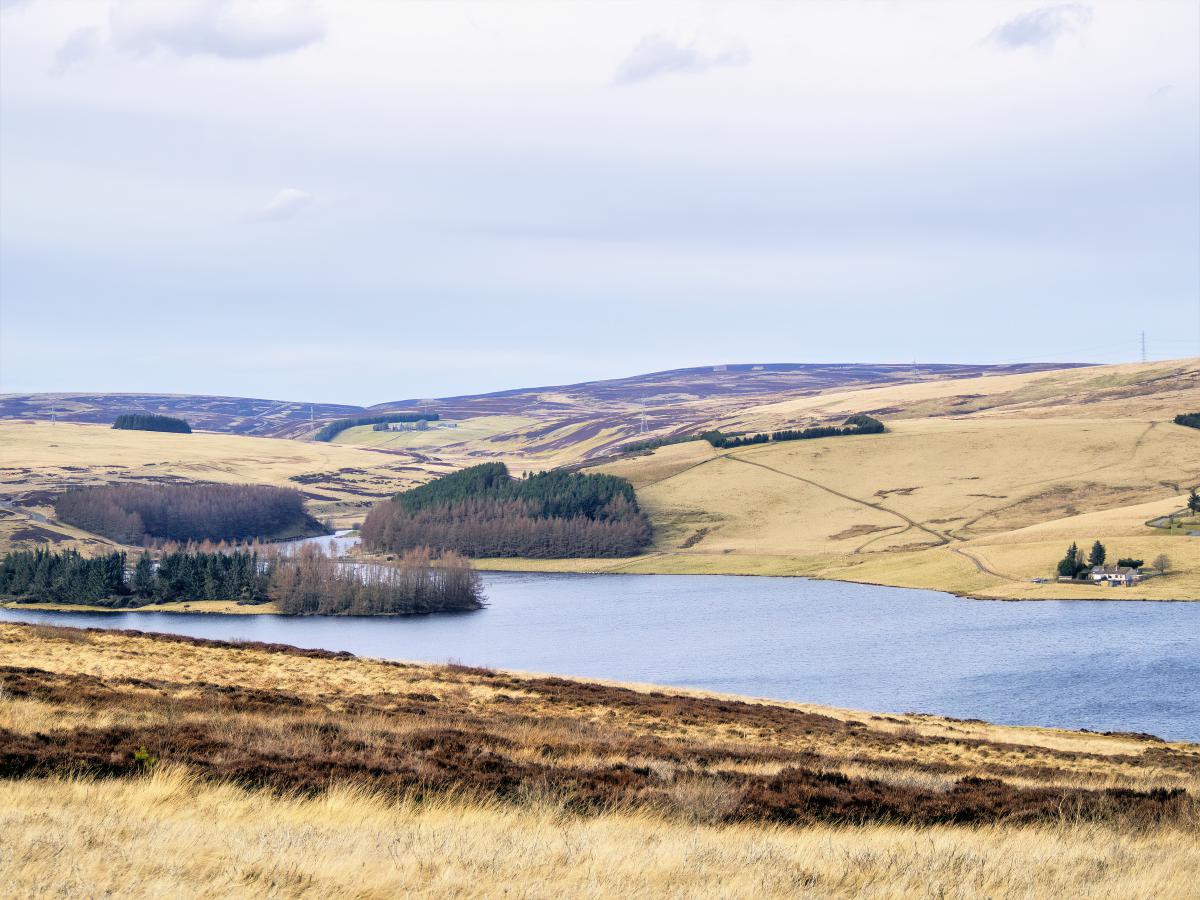
There are multiple walking routes through the Lammermuir’s but one of the nicest (in my opinion) is the circular trail south of Whiteadder Reservoir and around Priestlaw Hill. The reservoir is a relatively recent addition to the area, having been constructed in the 1960s as an additional drinking water supply for East Lothian, but it now also serves as an important habitat for a variety of birdlife that thrives in the surrounding moorland.
In addition to the wildlife-spotting opportunities, Whiteadder Reservoir is also a popular place for summertime watersports, hence the reason a watersports centre was built on the northern shore which is one of the premier places in southeast Scotland to learn how to safely use a sailing boat, kayak, canoe or paddleboard.
Those visitors who prefer a rather less active pastime will no doubt enjoy a spot of Whiteadder Reservoir fishing as it’s possible to fly fish from either the bank or from a boat as long as a fishing fee has been paid.
It’s also possible to brave the cold and go swimming at the watersports centre which has changing facilities, though pre-booking is necessary which you can do via their website or by contacting them on their Facebook page.
Heading south of the reservoir takes visitors deeper into the wilderness of the Lammermuir Hills to Priestlaw Hill which has an elevation of 1,250 feet. Walkers looking for great views will undoubtedly enjoy climbing this hill, as the summit offers beautiful views of East Lothian and the Borders.
On a clear day it’s possible to see as far as Fife looking north and the Cheviot Hills looking south as well as two enormous wind farms in the near distance, so a camera with a decent zoom (Amazon link to the camera I use) is well worth packing in your backpack when you visit.
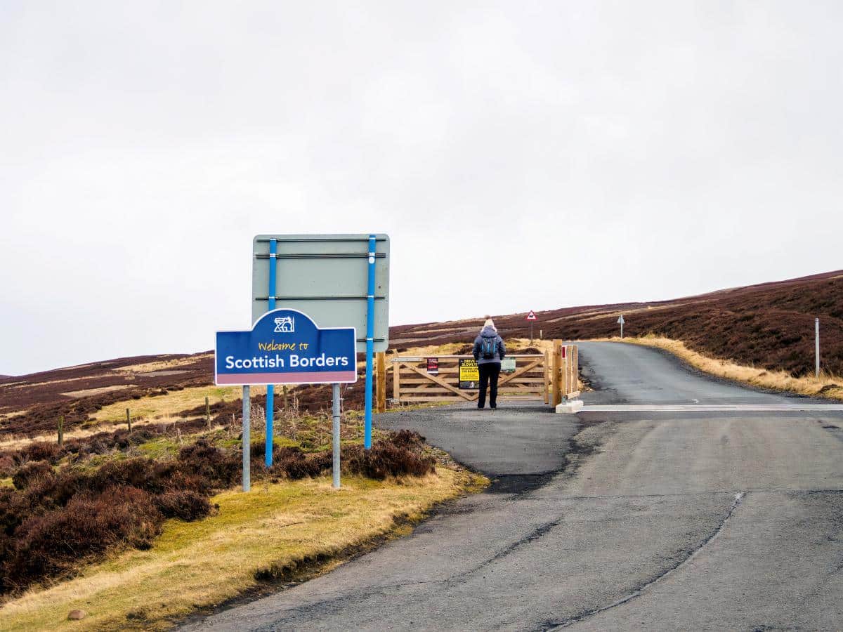
It’s interesting to note that this walking trail follows the historic Herring Road, which Dunbar fishwives used in the 18th and 19th centuries. Back then, Dunbar was a major fishing port, and women would carry enormous creels of fish over 28 miles from Dunbar Harbour to the market town of Lauder before returning on the same route, laden down with salted fish.
Today, much of the route is used by farm vehicles, so it has been widened and the surface has been reinforced, but you will at least get an idea of what it would have been like to walk through the landscape, which is virtually unchanged from those bygone days.
The Highlights
1: The Lammermuir Hills are an off-grid gem that offers a touch of Highland-esque scenery just a short drive from Edinburgh. This walking trail around Whiteadder Reservoir and Priestlaw Hill is a great way to experience the landscape of the hill range.
2: Anyone looking to try watersports – whether sailing, kayaking, or paddleboarding – can learn safely at the Whiteadder Watersports Centre. The centre offers expert tuition with trained instructors and equipment rentals that include sailing boats, sit-on kayaks, and paddleboards.
3: Whiteadder Reservoir is a good place for birdwatching throughout the year so taking a pair of binoculars (link to recommended optics) is highly recommended. Keen-eyed twitchers will see flocks of barnacle and pink-footed geese in winter, while other months welcome pochard, shelduck, mute swans, oystercatchers, herons, and great crested grebes, amongst other species.
Visiting Tips
1: The track on the western side of Priestlaw Hill is partially gravelled and relatively firm underfoot so it shouldn’t be too muddy even in the depths of winter. Sadly, the same can’t be said for the trail on the east side, which sees lots of rainwater running off the hillside. Waterproof walking boots (link to recommended pairs) are highly recommended.
2: Those visitors coming from the direction of Edinburgh will likely pass through the village of Gifford, which has a co-op and a couple of cafes. There are no other places to purchase food after Gifford, so it’s a good place to stock up on snacks before heading into the hills.
Walking Route
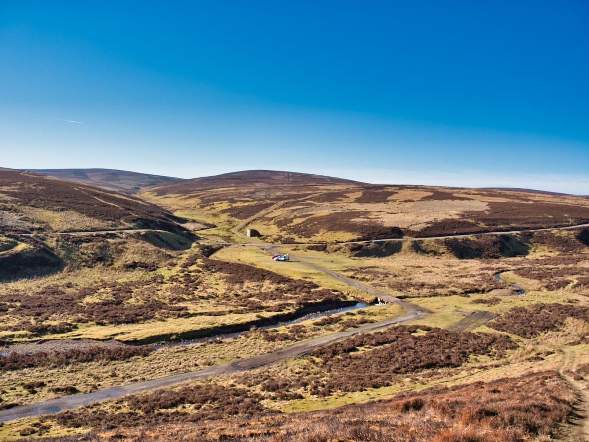
1: To begin the trail, park off the road near the cattle grid opposite the turning to Priestlaw Farm. There’s only room for around 5 cars but as it’s a rather quiet location you shouldn’t have any problem finding a space.
2: A signpost points towards the public path leading to the farm. Follow the lane till it descends slightly. At this point, you will see another sign pointing towards Ing Road. Follow the track towards Penshiel Farm and turn right through a gate, then follow the farm track, which passes along a hillside.
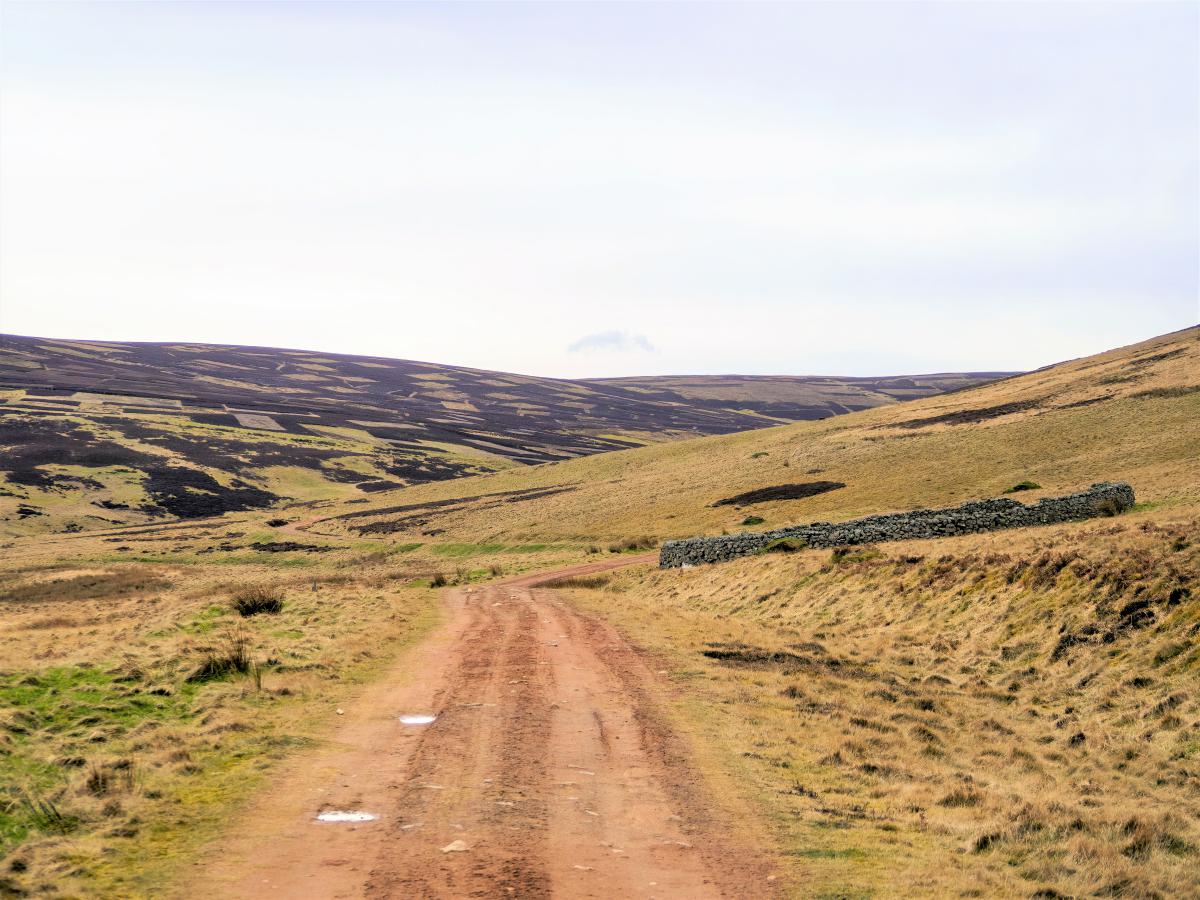
3: Along the track you will see the remains of a monastic grange and an old stone wall sheep pen as well as a couple of standing stones. After 1.5 miles the track crosses a bridge over the Faseny Water.
4: Shortly after the bridge you’ll find yourself on a single-track tarmac road. Turn left and follow the road as it crosses over the border of East Lothian into the Scottish Borders. The road climbs a steady incline for 1.2 miles until it reaches a point directly south of Priestlaw Hill.
5: The track to the hill is signposted and there’s a gate in front of it so it’s pretty much impossible to miss. Follow the track north which heads in one direction back to Whiteadder Reservoir.
6: (Optional). This part of the walk crosses open moorland so it can be rather wet and muddy, making the side path leading up to the hill summit difficult to find. Fortunately, it’s not a big ascent and you can simply point yourself in the direction of the cairn on the hilltop.
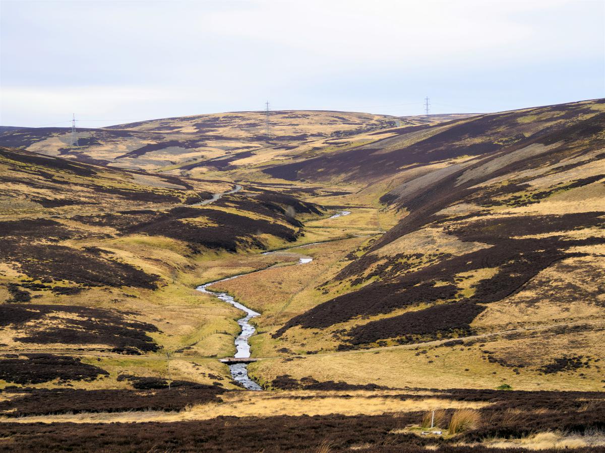
7: Continue along the farm track towards the reservoir. The path eventually swings west down to Priestlaw Farm. This section of the farm track is muddy but presents elevated views of the reservoir and is the best place for birdwatching with binoculars.
8: Keep walking past the farm and you’ll eventually find yourself back on the tarmac road that leads to the Whiteadder Reservoir parking area. The total distance of the route is approximately 7 miles, which should take anyone with average fitness levels 3–4 hours to complete.
Things to Do
Whiteadder Reservoir Water Activities: Try a new water sport at the Whiteadder Watersports Centre. Whether it’s sailing, kayaking or paddleboarding, the instructors at the reservoir will ensure you learn new skills while enjoying a great day out.
Bird Watching: The area around the reservoir is a haven for birdwatchers. Keep an eye out for various species of ducks, swans, and other water birds. The surrounding moorland is also home to birds such as grouse and curlews.
Hiking in Lammermuir Hills: The rolling hills provide numerous walking and hiking trails, especially on Priestlaw Hill, the highest point of the Lammermuir’s. The area is known for its wild beauty and panoramic views across the landscape of East Lothian and the Scottish Borders.
Gamelshiel Castle: Though small and totally in ruin, this historic landmark is a point of interest for walks around nearby Spartleton Hill.
Cycling: The quiet, scenic roads of the Lammermuir Hills are ideal for cycling. There are routes to suit all levels, from gentle country lanes to more challenging hill climbs, all in a peaceful rural setting. The B6355 that runs past Whiteadder Reservoir is particularly good for cycling as the road is quiet, well-maintained, and presents lovely views of the surrounding hills.
Things to Do Nearby
Woodhall Dean Wildlife Reserve. Dunbar EH42 1SJ. Distance: 10 miles.
Woodhall Dean is a nature reserve on the edge of the Lammermuir Hills. The reserve is home to sessile oak trees (a once-abundant tree that is now dwindling in numbers) and is highly regarded for the carpets of wildflowers that bloom in spring. A rough trail runs through the reserve, allowing able-bodied visitors to enjoy the picturesque setting.
Traprain Law. Haddington EH41 4PY. Distance: 15 miles.
A steep hill in the middle of East Lothian that has the remains of a hill fort dating back to 1,000 BC. A 1-mile path leading to the summit from a small car park offers panoramic views across the surrounding countryside. Traprain Law is also known for the semi-wild herd of Exmoor ponies that live on it.
Athelstaneford National Flag Centre. North Berwick EH39 5BE. Distance: 16 miles.
Athelstaneford is a small parish village in East Lothian that legend says is the place where a Scottish King founded the Saltire national flag after seeing a cross appear in the sky before a battle. There is a small museum dedicated to the Saltire behind the church, which is located inside a doocot (a historic pigeon coop).
Marchmont House. Address: Marchmont, Greenlaw, Berwickshire, TD10 6YL. Distance: 18 miles.
The 3rd Earl of Marchmont constructed Marchmont House in 1750, which is a Grade A-listed mansion. The house is open for overnight accommodation as well as guided tours, and there are exhibitions staged both inside the house and in the extensive gardens throughout the year.
Frequently Asked Questions
How high are the Lammermuir Hills?
The Lammermuir Hills have an average elevation of 1,388 feet. The highest point of the hill range is Meikle Says Law which is 1,755 feet (535 metres) high.
Can you walk around Whiteadder Reservoir?
Visitors can walk around Whiteadder Reservoir on the Priestlaw Hill circular from Whiteadder which starts on the B6355 road to the north and follows a farm track to the south. The entire walk takes around 1.5 hours.
Interesting points to note are the ancient remains of Kilmade Fort to the east of the reservoir and Priestlaw Hill to the south.
Where do you park at Whiteadder Reservoir?
There is a parking area at the fishery car park at the East of Scotland Water building on the northeast end of Whiteadder Reservoir.
There is also space on the side of the B6355 road opposite the turning to Priestlaw Farm on the northwest end of the reservoir.
Where are the Lammermuir Hills in Scotland?
The Lammermuir Hills span the counties of Selkirk, East Lothian, and Berwick in the southeast of Scotland. The hills lie to the southeast of Edinburgh and to the north of the Scottish Borders.