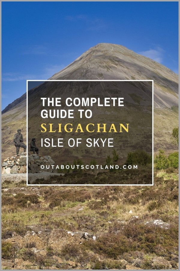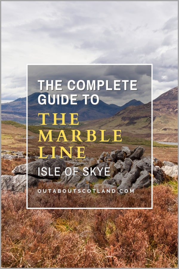
The Marble Line, Skye
The Marble Line is located a mile south of the village of Broadford in the southern half of the Isle of Skye. This long-abandoned railway line was used to transport marble from a quarry 2 miles further south, but it has now been converted into a footpath that allows visitors to explore the clearance villages of Boreraig and Suisnish as well as the Strath Suardal valley.
🠇 Head to the bottom of the page for essential details on each attraction featured here, including addresses, opening hours, and entry prices 🠇
The Marble Line
The southern region of Skye between the Cuillin mountains and the Sleat Peninsula is one of the less-visited parts of the island, primarily due to the fact that all the ‘big’ attractions are located to the north. While coachloads of tourists pack places like Portree, Quiraing, and the Fairy Pools, those in the know can head to the area south of the village of Broadford to enjoy a landscape that’s captivatingly scenic yet is free from the maddening crowds found elsewhere on Skye.
Broadford itself is a small village overlooking the Inner Sound and Broadford Bay which makes an ideal base for excursions deep into the Cuillin mountains, thanks to a large car park, supermarket, and petrol station in the village’s centre.
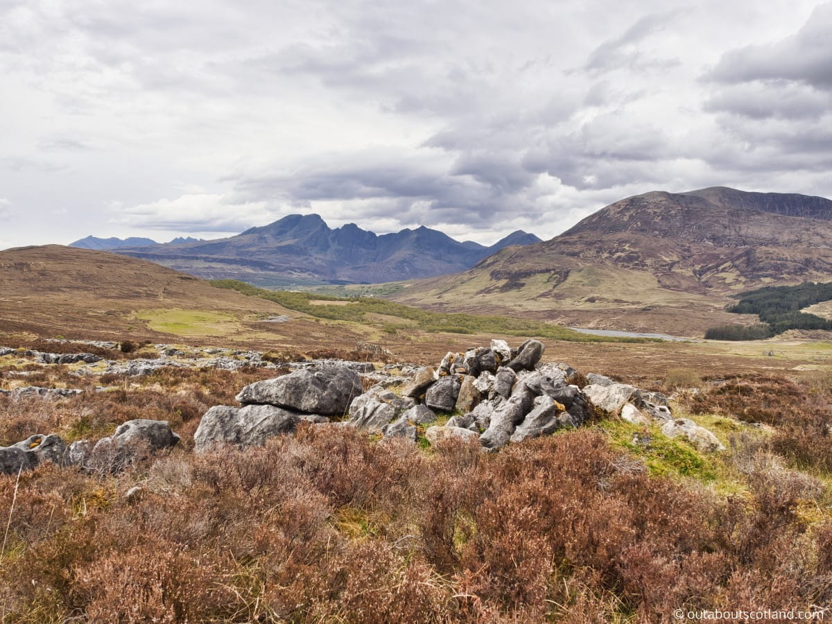
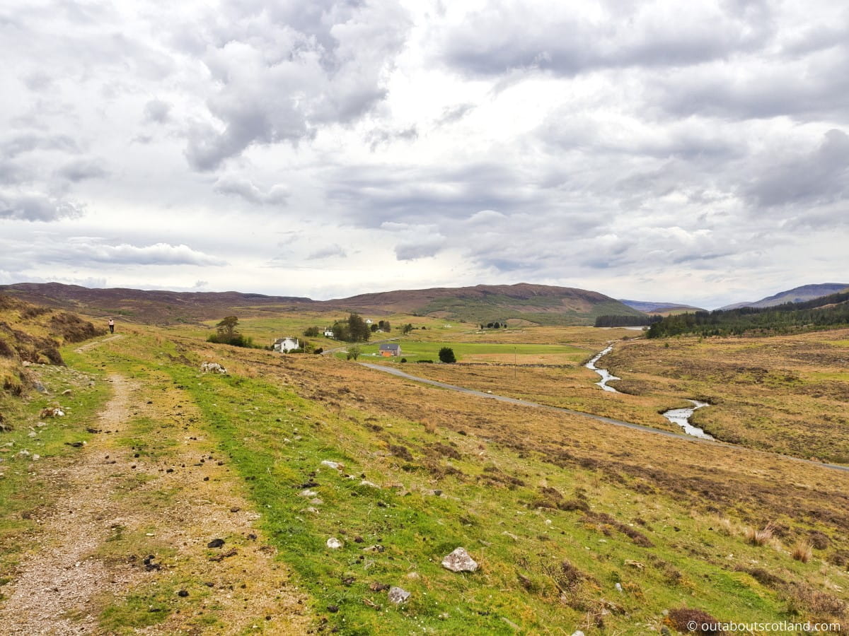
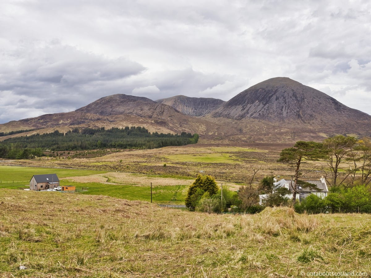
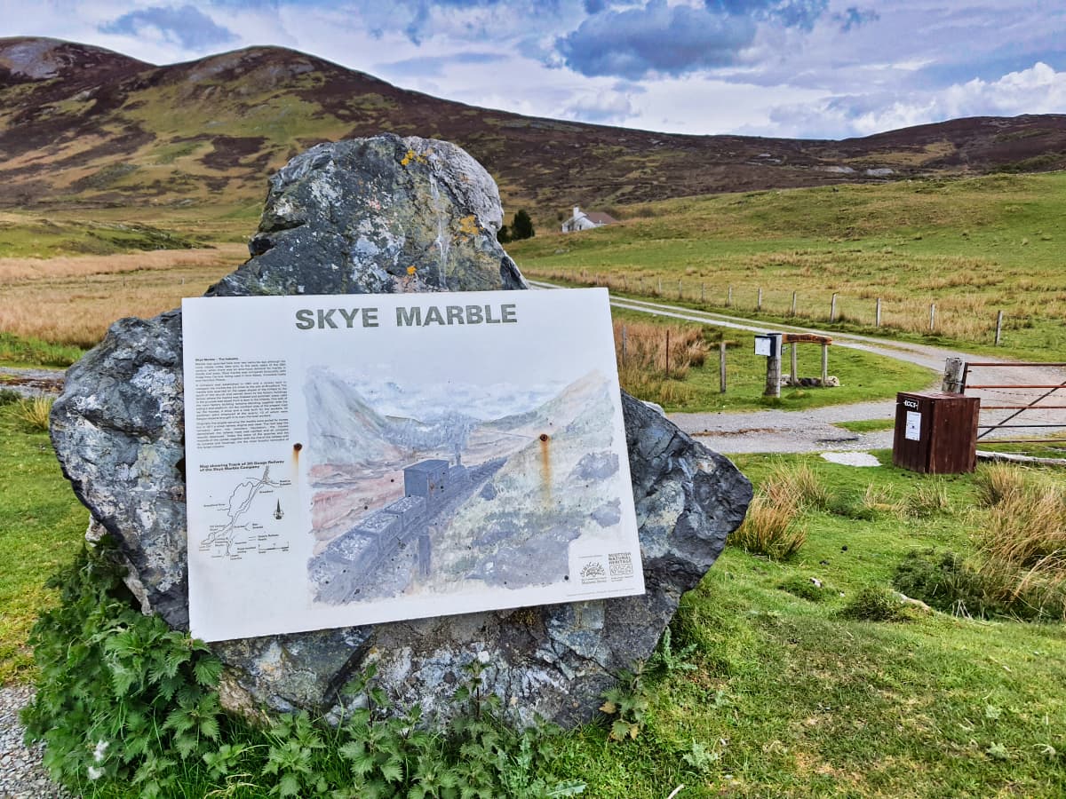
There are a number of options for walks from the village, but one highly recommended option is following the Marble Line, which starts half a mile south on the B8083. As its name suggests, the Marble Line is a converted railway that had a former life transporting valuable Skye marble from a quarry 2 miles south of Broadford. This marble was formed 500 million years ago in the shadow of the Red Cuillins and is, in fact, the only seam of true marble in Britain.
The marble saw use in many grand buildings in Scotland including Iona Abbey and Armadale Castle and was even used in the Vatican, and while it’s no longer mined today its rarity means genuine pieces are now used in jewellery rather than building materials.
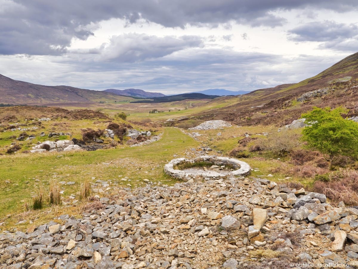
Skye marble was extracted from Strath Suardal in Torrin for many centuries, first by hand and later by machine, to the point where a railway was constructed in 1907 to cope with the ever-increasing quantities. This 3.5-mile railway transported marble from the quarry at Suardale to Broadford pier, where it was then shipped to British manufacturing plants, but rising costs saw the venture fail within a few years, and it was liquidated in 1913.
The track was abandoned until the early 2000s when a local community project saw it transformed into a safe walking route between Broadford and Kilchrist, with the track-bed of the railway used as the basis for a level, gravelled path.
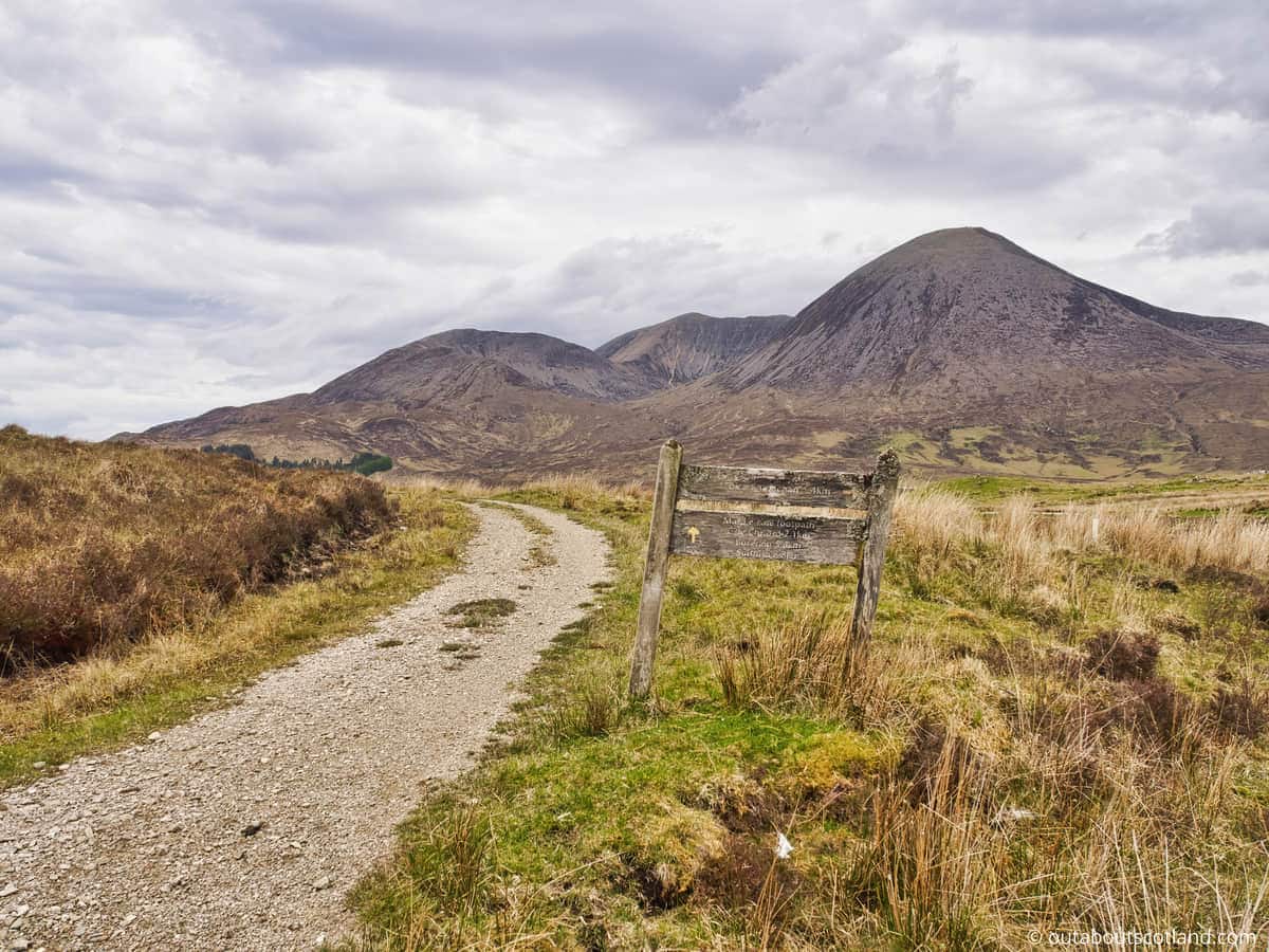
Access to the Marble Line is possible from 2 locations on the B8083, the first of which is a gated fence half a mile from Broadford, and the second a rough track close to Kilchrist Church. From Broadford, the route to the quarry and back is approximately 5 miles, which should take around 3 hours to complete on a return walk. However, it’s possible to extend it by continuing past the quarry to the remains of the clearance village at Boreraig (see my complete guide to Boreraig for more information).
The quarry has several remnants of the old railway, including a winding wheel and a dilapidated station, but the highlight of getting to this point is the view, which is nothing short of spectacular. The Red Cuillins stand majestic against the low-lying surrounding landscape, and they’re especially attractive in the morning and evening sun when the granite of the mountains takes on its famous reddish hue.
The Highlights
1: Walking the Marble Line is a great way to see an often-missed part of the Isle of Skye. Admittedly it’s not up to the standards of scenery you’ll see at The Quiraing, but it’s very pretty nonetheless thanks to the dramatic Red Cuillin mountains to the north.
2: The Marble Line offers a glimpse into a long-lost industry that was integral to Skye’s economy. Visiting the remains of the railway is a wonderful way to experience a historic site on the island that makes a nice change from the usual tourist hotspots.
3: Perhaps the best feature of the Marble Line is the fact it joins the footpath that winds its way to the Highland Clearance village of Boreraig, meaning visitors get to experience two historic sites on one walking trail.
Visiting Tips
1: If you’re just visiting the Marble Line, you have the option of either walking or cycling it. The route is predominantly a firm, level gravel surface that can easily be cycled in an hour. If you intend to continue on to Boreraig, it’s best to walk, as there are a couple of fences with stiles along the way that block cycle access.
2: The Red Cuillin mountains are located to the north of the abandoned railway and are a haven for wildlife, so keep your eyes open for eagles on the hunt for their next meal as well as herds of red deer. Don’t have binoculars yet? Check out my recommended budget birdwatching binoculars.
3: It would be very difficult to get lost on the Marble Line route, but it’s advisable to take a map and compass if walking the route in winter as snowfall can obscure the path very quickly. In addition, Skye is renowned for its changeable weather (there’s a reason it’s called ‘the misty isle’) so pack additional warm waterproof clothing.
Tourist Information
The best place to start the Marble Line walk is from Broadford Village, where there’s ample car parking. Follow the A87 towards Portree and take the left turn down the B8083 next to the Broadford Hotel. Continue along the footpath out of Broadford, where it rises uphill close to a conifer plantation. At this point, look for a signed path with a gated fence on the left-hand side. Go through the gate and follow the path, which shortly joins the Marble Line.
From here onwards the path is level and does not deviate, so simply keep to it and enjoy the scenery while keeping an eye on the skyline for buzzards and eagles.
The quarry is located 2.5 miles out of Broadford, and you’ll immediately know when you’re nearing it as the final section rises up a moderately steep grass incline. Just before this point, there’s an unmarked track that heads north towards the Church of Kilchrist, which adds a 1-mile detour to the walk, but it’s well worth seeing the ruined church and its amazing views over Loch Cill Chriosd.
The quarry marks the end of the Marble Line, but there’s the option to extend it by another 2.5 miles to explore the Highland Clearance village of Boreraig. The path to the village is unmarked from the quarry, but it’s the only one that continues south. Alternatively, return to Broadford on the same route for a total 3-hour walk.
Things to Do
Exploring the Marble Quarry: Start your journey by visiting the historic Marble Quarry. It’s a fascinating site where you can see some of the beautiful natural marble that Skye is famous for.
Hiking and Wildlife Watching: The area offers numerous hiking trails with varying levels of difficulty. Along the way, you’ll get to see the island’s diverse wildlife which includes sea eagles and red deer.
Photography: The Marble Line offers panoramic views of the Red Cuillin mountains, making it a paradise for photographers. At sunset, the mountains take on a beautiful deep red colour which contrasts against the moorland below.
Picnicking: Pack a picnic basket and enjoy your lunch in one of Skye’s less-visited areas. There are no bins, so remember to take your rubbish home to preserve the beauty of the area.
Cycling: For adventure seekers, cycling along the Marble Line is a great experience. The route provides a unique opportunity to explore the southern part of the island, but note that the path becomes unsuitable for bikes beyond the quarry.
Things to Do Nearby
Isle of Scalpay. Isle of Skye, IV49 9BS. Scalpay is situated offshore of the mainland, north of Broadford. It is simple to access by kayak because it is only 1,000 feet across Loch na Cairidh at its closest point.
James Ross Park. Broadford, Isle of Skye, IV49 9AB. Small park near Broadford car park which overlooks Broadford Bay. A footpath runs from the park along the shoreline of the bay heading north to Corry.
Irishman’s Point. Corry, Isle of Skye. A 30-minute walk from Broadford. This small vantage point on the northwest side of Broadford Bay is a popular area for walking. There are rough footpaths along the shoreline heading west which offer superb views of the Isle of Scalpay.
Ashaig Beach. A87, Isle of Skye, IV42 8PZ. 8-minute drive. A small beach that backs an aerodrome. The shallow water of the inlets surrounding the beach is a popular spot for kayaking.
Beinn na Caillich. Isle of Skye, IV49 9AL. This mountain is one of the Red Cuillins. It has an elevation of 2,402 feet and is designated as a Graham. The horseshoe-shaped walk to the summit is superb, though some scrambling is required towards the top.
Frequently Asked Questions
How do you get to the Isle of Skye?
The Isle of Skye is a large island situated on the west coast of Scotland. Access is possible at two entry points on the southern half of the island.
The first is the ferry from Mallaig on the North Morar Peninsula on the mainland to Armadale on the Sleat Peninsula on Skye. Calmac operates the ferry, which takes about 45 minutes. See the Calmac website for details.
The second access point is the Skye Bridge, which provides road access via the A87 from Kyle of Lochalsh on the mainland to Kyleakin on Skye.
Is the Isle of Skye touristy?
The Isle of Skye is very touristy, both in the sense that it is a great place to visit for tourists, and there are large numbers of tourists that visit the island throughout the year.
A recent study found that approximately 650,000 tourists visit Skye annually, giving the island’s economy a £211 million boost.
The most popular tourist destinations are the Fairy Pools, Portree, The Storr, and The Quiraing.
Do you need a car on the Isle of Skye?
A car is not necessary on Skye, but it is the best option for tourists to visit the main attractions.
Skye has a bus service (www.stagecoachbus.com) that travels village to village, but the buses are infrequent. There is no train service on Skye.
Cycling is possible on some of the side roads, but it is not advisable to do so on the main A87 road because it is very congested and frequently used by tour buses.
One viable option for visitors without a car is to explore the island with an organised tour. One of the best operators is Rabbie’s, which specialises in informal small-group tours. Explore small group tours of Scotland with Rabbie’s
Is the Isle of Skye a must-visit?
The Isle of Skye is a must-do for any tourist that is visiting Scotland. The island features many of the most scenic landscapes in Scotland, it has a dramatic coastline, attractive villages, lots of superb walking trails, and it is easy to get to thanks to the Skye Bridge.