Solway Firth
The Solway Firth is a scenic estuary located on the west coast of Scotland, marking the boundary between Scotland and England. Renowned for its rich biodiversity, it hosts a plethora of bird species, making it a paradise for bird watchers.
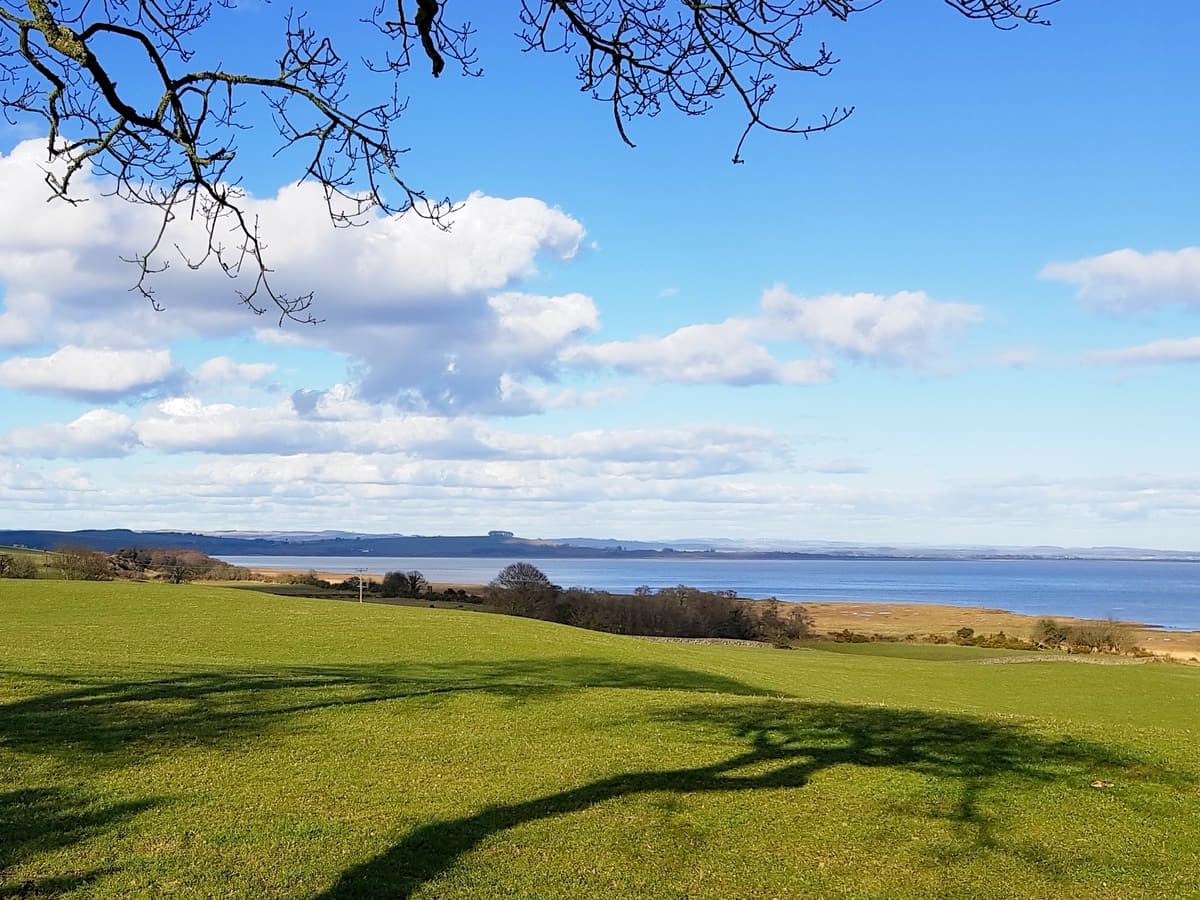
The surrounding landscapes of Dumfries and Galloway feature sandy beaches, rolling hills, and quaint villages, all of which offer visitors a tranquil retreat coupled with unparalleled sightseeing opportunities.
🠇 Head to the bottom of the page for essential details on each attraction featured here, including addresses, opening hours, and entry prices 🠇
Solway Firth
Stretching out across both England and Scotland, the Solway Firth borders the stunning coastlines of Cumbria and Dumfries and Galloway, and extends into the Irish Sea to almost touch the Isle of Man.
Most hikers on the English side who are walking the Hadrian’s Wall path tend to ignore the Solway Firth as it’s flat and virtually featureless, while swimmers are urged to stay out of the water due to the fierce tides that tear up and down the estuary. In a way, that’s a good thing because it means there are fewer people to disturb the sand dunes, salt marshes, and peat bogs that are teeming with insects and birdlife.
Moving slightly inland, visitors can enjoy a remarkably diverse landscape that encompasses grasslands and rolling fields, and it’s here that two of the most important wildlife areas in Britain can be found: Caerlaverock National Nature Reserve and the RSPB Mersehead Reserve.
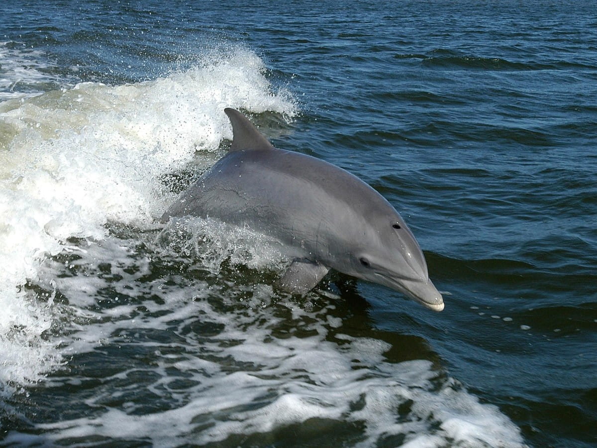
One of the best places for spotting harbour porpoises, basking sharks, and bottlenose dolphins is the old Victorian resort town of Silloth on the southern side of the estuary. It’s a bit of a chore to get to as you have to drive inland some distance to cross the River Esk Bridge on the M6, but the drive back along the coast is more than worth the effort as you’ll get to see the Solway Coast Nature Reserve, the South Solway Mosses Nature Reserve, and the Drumburgh Moss Nature Reserve along the way.
But it’s not just picture-postcard coastal scenes that you’ll find in this part of Scotland because there are lots of pretty villages to explore as well. These include Kippford, Kirkcudbright, Gatehouse of Fleet, Wigtown, and Whithorn, while the towns of Dumfries, Annan, and Gretna are within easy driving distance if you’d rather visit a historic attraction.
The Highlights
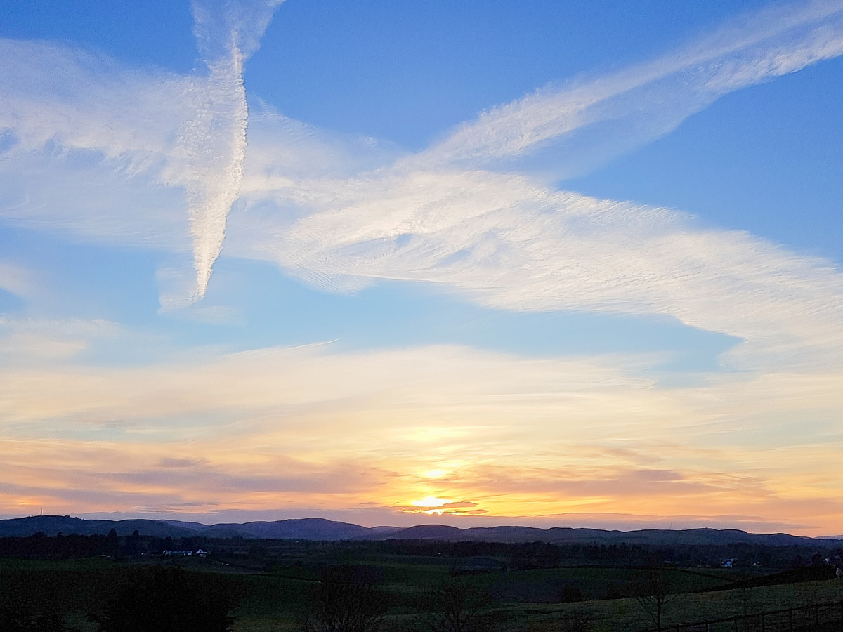
1: The Solway Firth is an amazing place for birdwatchers and photographers. When the sun is low the view across the estuary is stunning.
2: The Solway Firth has a range of superb walks, especially in the nature reserves. Caerlaverock Nature Reserve is highly recommended due to the amount of wildlife within it.
3: While the Scottish side is, in my opinion, the most scenic part of the Solway Firth, the English side has its fair share of attractions too. Two nature reserves in particular – Solway Coast and Glasson Moss – are definitely worth a visit.
Visiting Tips
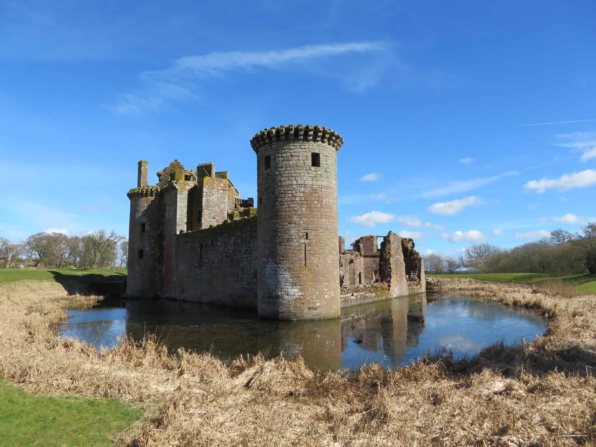
1: If you’d like to discover the history of the area, visit Caerlaverock Castle which is an unusual triangular-shaped fortress close to Caerlaverock Nature Reserve, or visit New Abbey Corn Mill which is one of the few water-powered grain mills that’s still operational in Scotland.
2: Take binoculars with you (link to recommended pairs on Amazon). The Solway Firth is full of wildlife, and it’s a haven for seabirds.
3: Drive the A710 and A711 as they hug the coastline along several sections where you can detour onto quiet roads to less-visited areas of the Solway Firth.
Tourist Information
There are over 110 square miles of Sites of Special Scientific Interest in the Solway Firth, meaning it’s one of the best locations in Scotland for nature enthusiasts. There are many options to explore the region, but one of the most popular walking trails is the 55-mile Annandale Way which runs between the towns of Annan and Moffat. This trail offers spectacular views of the woodlands at Hoddam Estate as well as the largest body of freshwater in Dumfriesshire, Castle Loch.
If you’d like to follow the route, I recommend taking a look at the official website. Across endless cattle farms, sand dunes, salt marshes, peat bogs, and raised mires, you’ll find a diverse range of wildlife. The number of different species you’ll see depends upon the time of year you visit, but in summer, the area comes alive and visitors will see everything from buzzing dragonflies in the fields to bottle-nose dolphins looking for their next meal out at sea.
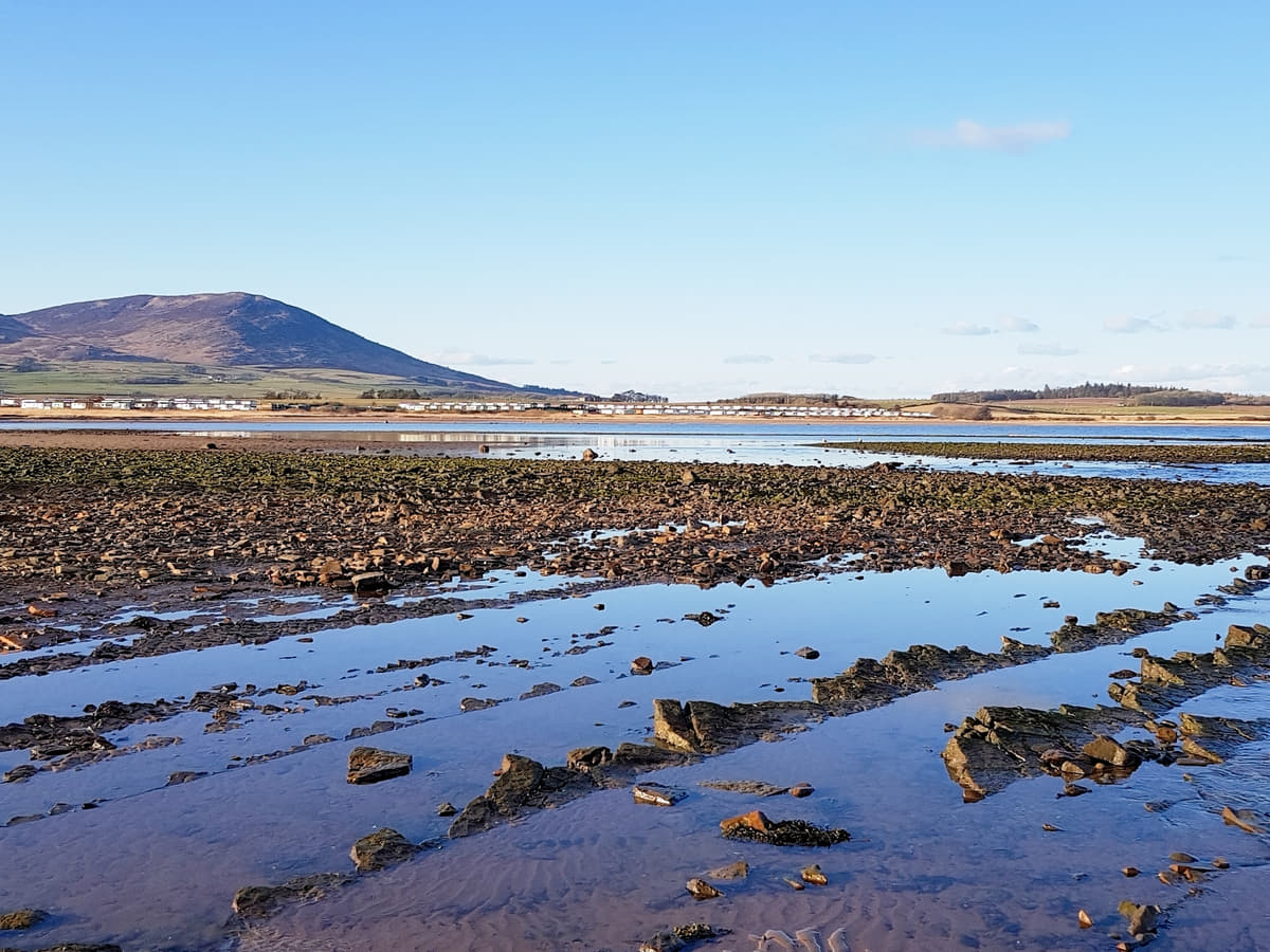
Tourists visiting the Solway Firth won’t be disappointed with the quality of beaches on offer, with the ever-popular Rockcliffe, Southerness, and Sandyhills beaches all within close distance of each other and many other coves and bays waiting to be discovered around each corner.
The marine environment, with its plentiful food supplies, has led to the Solway Firth becoming a haven for seabirds, especially barnacle and pink-footed geese which make the area their home from autumn through spring. At other times you can see finches, yellow-hammers, reed buntings, lapwings, and skylarks, so it’s understandable why so many parts of the region have been categorised as nature reserves.
Moving slightly inland, you’ll find a variety of historic buildings and castles (Caerlaverock Castle with its unique triangular shape is a highlight), while tourist attractions like Gretna Green Blacksmiths Shop and the market town of Dumfries are a short drive away.
If you want to investigate the English side, you’ll find the Hadrian’s Wall World Heritage Site, which has several fascinating Roman ruins, and the Senhouse Roman Museum at Maryport, both of which are must-visit tourist destinations.
Things to Do
Birdwatching at RSPB Mersehead: Located on the shores of the Solway Firth, RSPB Mersehead is a haven for birdwatchers. The reserve is home to numerous bird species including pintails, lapwings, and reed warblers. In autumn, witness the spectacular sight of thousands of barnacle geese descending from the Arctic for winter.
Exploring Caerlaverock Castle: This 13th-century triangular castle offers a real step back in time for families. Visit the castle’s siege warfare exhibition, walk the nature trail that leads to the ruins of another castle, and enjoy exploring the nooks and crannies of one of Scotland’s most unusual fortresses.
Hiking on the Solway Coast: The Solway Coast Area of Outstanding Natural Beauty is the perfect destination for walkers. Whether you prefer a gentle stroll or a challenging hike, the coastline offers breathtaking views from start to finish.
Fishing on the Solway Firth: The Solway Firth is a popular destination for anglers. With an abundance of salmon, sea trout, and flounder, it’s a fantastic spot for recreational sea anglers to set up a rod.
Visit Southerness Beach: There are several beaches on the Solway Firth but Southerness Beach is one of the best. At 3 miles in length and 3/4 mile in width when the tide’s out, it’s a great place to go for a bracing walk, especially if you have your canine companion with you.
Things to Do Nearby
Caerlaverock Castle. Castle Road End, Dumfries DG1 4RU.
A medieval castle with an unusual triangular shape. It is one of the few remaining castles in Scotland that still has a moat surrounding it. The castle has a small museum, a play park and a picnic area at the entrance and there is a path that leads behind it to the Solway Firth wetlands.
Caerlaverock Wetland Centre. Eastpark Farm, Caerlaverock DG1 4RS.
This nature reserve is within walking distance of Caerlaverock Castle. It is famed for its diverse wildlife habitats that are a haven for barnacle geese, ospreys, swans and other waterfowl.
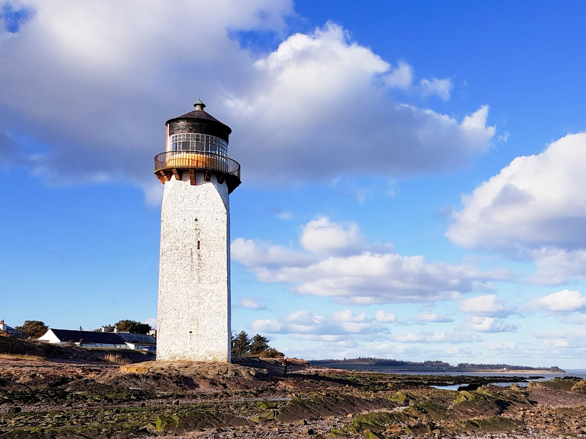
Southerness Point. Southerness, Dumfries DG2 8AZ.
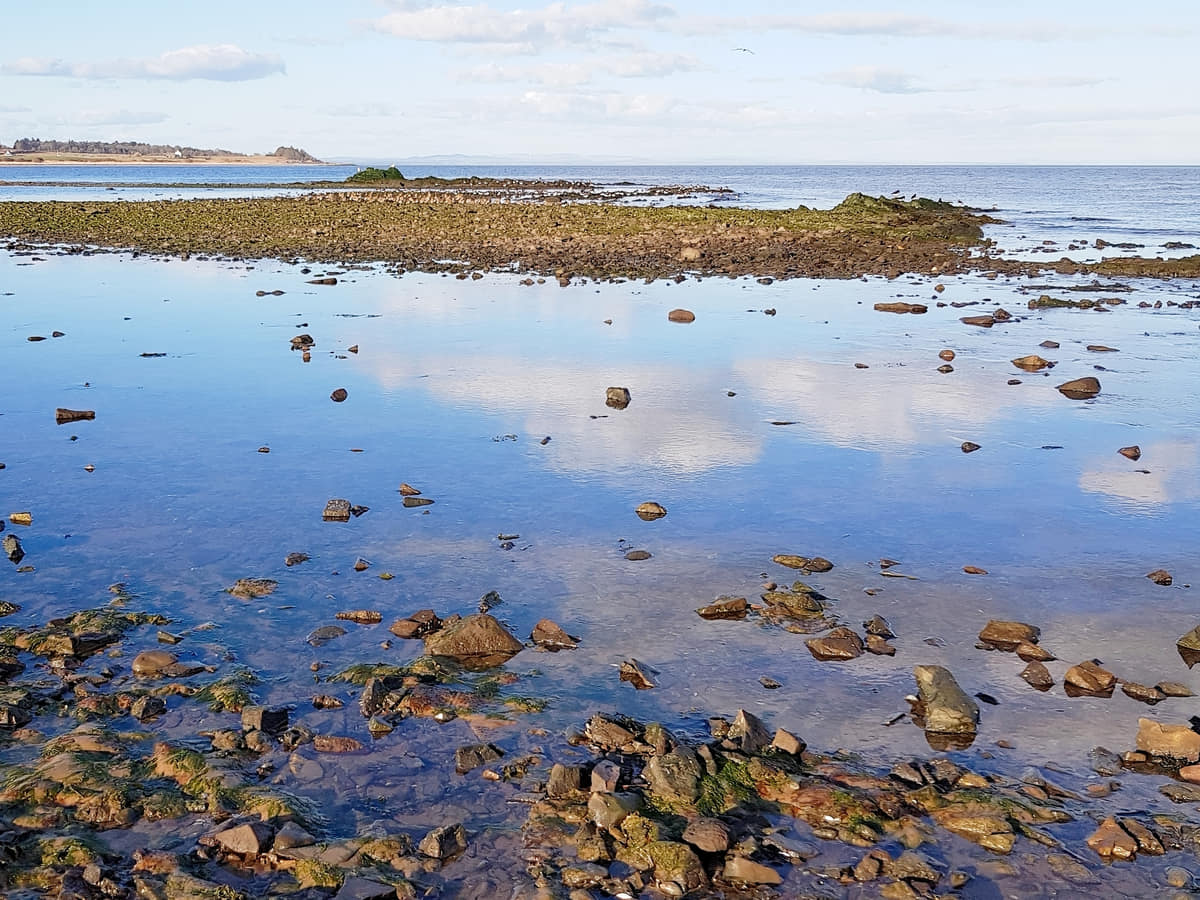
A very popular stretch of coastline on the Solway Firth. The section at Southerness is largely bedrock that is an ideal place to explore rock pools left behind by the retreating tide. The beach at Southerness has a historic lighthouse, although it is not open to the public. Paths lead in either direction for superb coastal walks.
Broughton House and Garden. 12 High St, Kirkcudbright DG6 4JX.
An Edwardian country manor set amongst manicured Japanese-inspired gardens. The house is open to the public for self-guided tours that allow visitors to see a number of exhibitions including a rare collection of books by Robert Burns.
Bainloch Deer Park. Laggan Woodlands, Sandyhills, Dalbeattie DG5 4NZ.
A deer park overlooking the Solway Firth that offers visitors guided tours by experienced guides to see the animals up close.
Frequently Asked Questions
Can you walk across the Solway Firth?
It is not possible to walk across the Solway Firth when the tide is in. When the tide is out it is theoretically possible, but it would be dangerous to walk across as there are areas of sinking sand.
Why is the Solway Firth called that?
‘Solway’ is derived from a Scandinavian word that refers to a ford across mud flats. ‘Firth’ is a Scots word that denotes coastal water.
Is the Solway Firth in Scotland or England?
The Solway Firth is a border between Scotland and England. The north side is Scottish, while the south side is English. The Solway Firth extends inland for 38 miles.
What river flows into the Solway Firth?
The Solway Firth is an estuary where the River Eden and the River Esk meet.