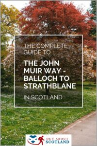
Balloch, John Muir Way
This walk through Strathclyde on the John Muir Way takes visitors on a journey past Balloch Castle Country Park, the shores of Loch Lomond, and over the Kilpatrick Hills to Strathblane. Along the way, you’ll get to experience the stunning countryside that this part of Scotland is famous for. Discover this beautiful region of Scotland with this complete visitor guide.
🠇 Head to the bottom of the page for essential details on each attraction featured here, including addresses, opening hours, and entry prices 🠇
Balloch
The John Muir Way is a long-distance walking and cycling route that stretches 134 miles from Helensburgh in the west through to Dunbar on the east coast. Named after the naturalist and conservationist John Muir who was born in Dunbar and is famous for founding America’s national parks, the route was officially opened in 2014 in his honour.
The trail offers a diverse range of landscapes and terrains. It includes stunning coastal views, rolling hills, dense woodlands, and it also passes through historic towns and villages. Along the way, you’ll encounter a variety of points of interest including castles, wildlife reserves, lochs and forests. The route is well-signposted and can be traversed on foot or by bike, making it a popular choice for outdoor enthusiasts of all fitness levels.
The John Muir Way can be completed in sections or as a continuous journey. It typically takes about 9-11 days to walk the entire route and around 4-5 days to cycle it. Whether you’re a seasoned hiker or a casual mountain biker, the John Muir Way offers an unforgettable journey through the heart of Scotland.
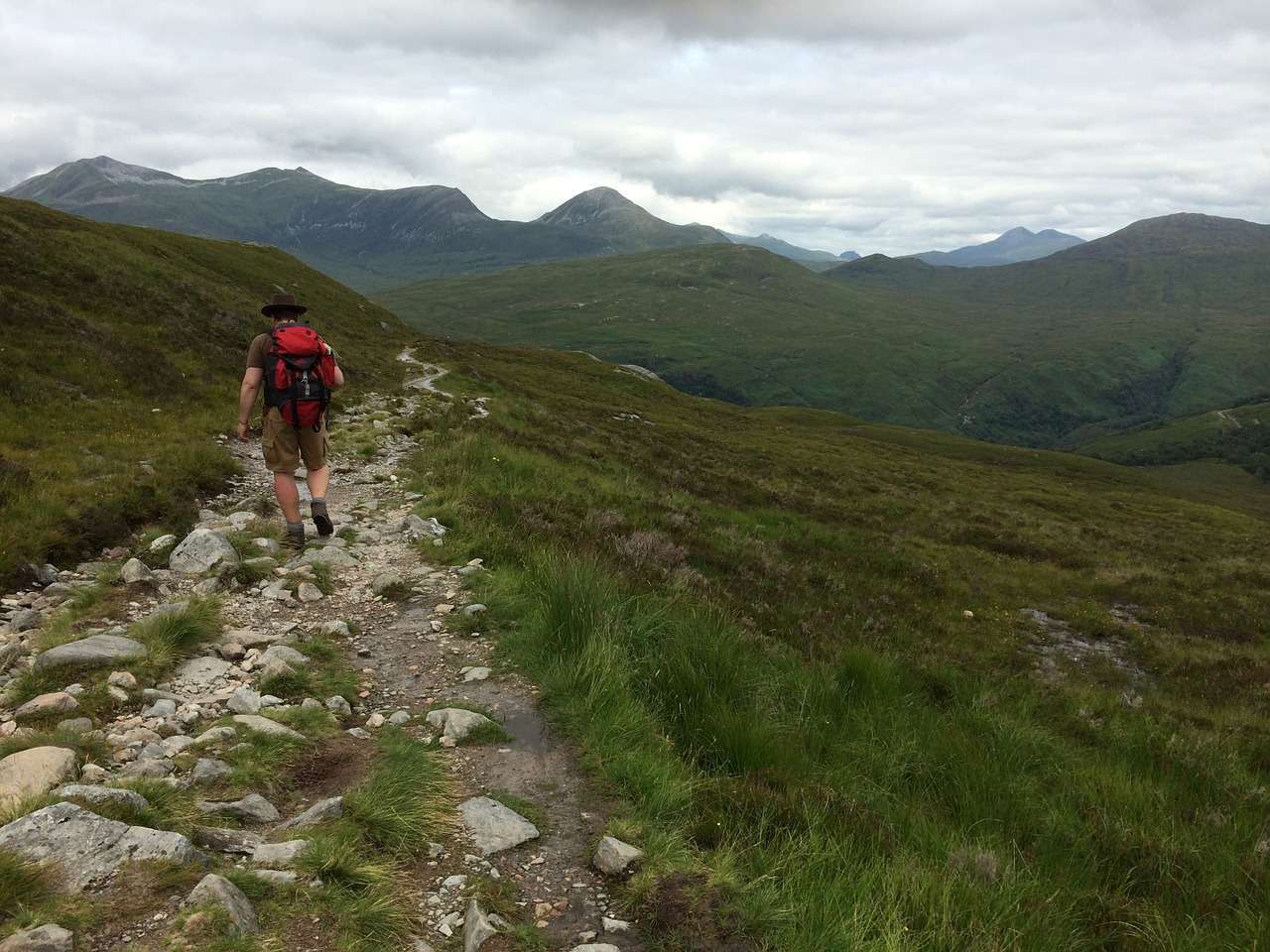
The Highlights
1: This is a lovely walking trail, especially in summer. In fact, the John Muir Way is, in my opinion, one of the nicest long-distance trails in Scotland.
2: The views are stunning once you get into the countryside considering you’re not that far from Glasgow. It’s off the beaten track, but not too far off the beaten track.
3: Balloch is a nice place to spend time in. The aquarium is excellent and the Loch Lomond Shores shopping centre is a great place for hot food and drinks. Balloch Castle Country Park is well worth exploring too.
Visiting Tips
1: Load the area onto your mobile phone via the Ordnance Survey app or buy a paper map (my preferred option) to ensure you don’t get lost.
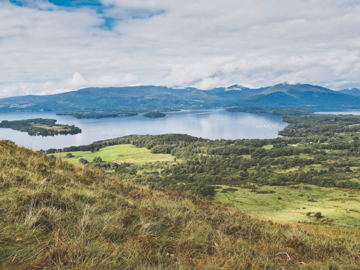
2: Balloch is located at the southernmost tip of Loch Lomond so before setting off I recommend spending time at Loch Lomond Shores. A highlight of the shopping centre is the boat hire shop which has kayaks and canoes for hire by the hour.
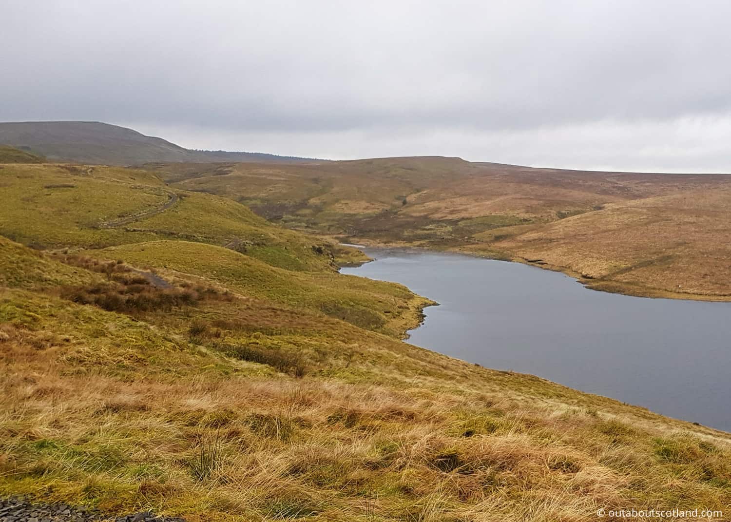
3: Part of the John Muir Way runs past Burncrooks Reservoir which is worth visiting as it offers lovely views across Glasgow. If you’d like a bite to eat nearby you’ll find a very good farm shop at postcode G63 9AX.
Tourist Information
There are several points of interest along this route, but the best locations are the start and midpoints. You’ll initially pass through Balloch Country Park which covers more than 200 acres and offers lovely views of Loch Lomond, before entering the Dunbartonshire countryside and the Kilpatrick Hills.
This hill range is probably the highlight of the walk as it offers amazing panoramic views of the Trossachs even though it’s only 10 miles outside of Glasgow. The Trossachs is a stunning area comprising a captivating blend of rolling hills, glittering lochs, dense woodlands, and extraordinary wildlife, and it’s a must-visit region for any hiker.
The end destination of the trail is the village of Strathblane which will allow you to have a rest and some refreshments before either heading back to Balloch or continuing with the next section of the John Muir Way.
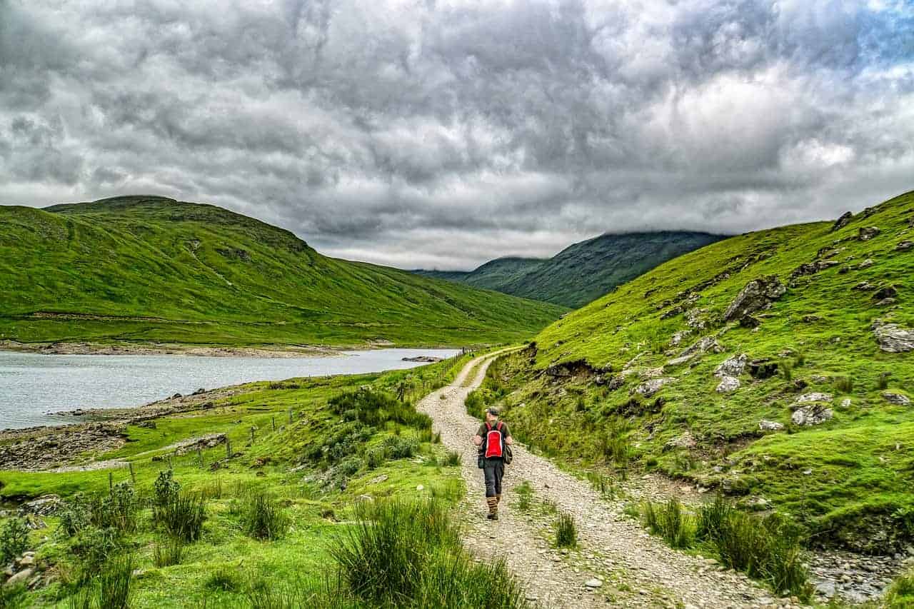
Walking Route
Time
The walk from Balloch to Strathblane is around 18 miles and will take walkers of average fitness levels around 6 to 7 hours to complete.
Difficulty
Easy-medium difficulty. There’s a mixture of forest tracks, public roads and gravel paths on this route, with some steep sections in places, especially as you get into the hills. Note that in winter the pathways that run through the Kilpatrick Hills can get very muddy.
Route
From the centre of Balloch, follow the path into the country park and around the castle until you reach signs pointing towards Mollanbowie Road.
Follow the public footpath east towards Stirling Road, and once at the junction head north until you see signs for Auchincarroch Road. The footpath here will take you towards the Kilpatrick Hills and there are signposts along the way to keep you on track.
You’ll eventually reach Burncrooks Reservoir which you can walk around until you get on the minor road heading towards the village of Carbeth. Continue heading east along the various man-made tracks and natural paths until you reach Carbeth, and then head north along the A809 until you reach the next section of the (signposted) off-road path.
This path will eventually take you past Carbeth Loch. Join the West Highland Way as it continues north before finally walking the last section of the trail which takes you to Strathblane.
Things to Do in Balloch
From the Lomond Shores car park:
Loch Lomond Shores. Ben Lomond Way, Balloch G83 8QL. 2-minute walk.
A chic and modern lochside shopping mall with a variety of upper-market shops, delicatessens and cafés. There is a large car park to the rear.
Balloch Castle and Country Park. Loch Lomond, The Highlands, Drymen Rd, Balloch G83 8LX. 9-minute drive.
This 19th-century castle is set in 200 acres of mixed gardens and woodland. There are walking trails around Loch Lomond, formal ornamental gardens, open parkland, wildflower meadows and children’s play parks.
Loch Lomond Bird of Prey Centre. Ben Lomond Way, Balloch, Alexandria G83 8QL. 3-minute walk.
A visitor attraction that features falconry displays with a varied collection of birds of prey including buzzards, eagles, hawks, vultures and more.
Sea Life Aquarium. Drumkinnon Tower, Ben Lomond Way, Balloch G83 8QL. 3-minute walk.
A highly-rated aquarium opposite the Lomond Shores shopping mall. The aquarium has a number of different animal enclosures with otters, sharks, rays, rockpool creatures and more.
Maid of The Loch. The Pier, Pier Rd, Balloch G83 8QX. 8-minute walk.
One of the best-preserved paddle steamers still in use in Britain. The maid of The Loch provides pleasure cruises up and down Loch Lomond and features an on-board café and terraced outdoor seating. The boat departs from Balloch Pier.
Frequently Asked Questions
How long does it take to do the John Muir Way?
The John Muir Way stretches 134 miles or 215 kilometres across Scotland’s heartland, running from Helensburgh in the west through to Dunbar on the east coast. The time it takes to complete the route can vary depending on your pace, but typically, if you’re walking, it can be done in 9-11 days. If you’re cycling, it can be completed in 3-5 days.
What council area is Balloch?
Balloch is situated in West Dunbartonshire.
What does Balloch mean in Gaelic?
Balloch is located at the southern end of Loch Lomond. The name Balloch originates from the Gaelic word ‘baile’ which means ‘village’, so ‘baile loch’ means village on the loch.
What visitor facilities are there at Balloch?
Balloch and Balloch Country Park have car parking and public toilets. Restaurants can be found in Balloch town centre and the Lomond Shores mall.