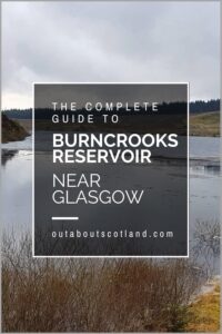
Burncrooks Reservoir
Burncrooks Reservoir is a lesser-known gem nestled within the captivating landscape of Stirlingshire, where it offers a serene escape from the hustle and bustle of nearby Glasgow. The reservoir is a part of the Scottish Water-managed drinking water network in the Kilpatrick Hills, which are northwest of Glasgow.
The picturesque countryside that surrounds the reservoir offers breathtaking views and a sense of peace that is normally difficult to find so close to a major city. With its scenic setting and the rolling hills in the backdrop, Burncrooks Reservoir is a haven for outdoor enthusiasts and nature lovers alike.
🠇 Head to the bottom of the page for essential details on each attraction featured here, including addresses, opening hours, and entry prices 🠇
Burncrooks Reservoir
Most long-distance hikers choose to complete the John Muir Way in sections, split into ten distinct walks, each of which has been chosen to show off the best areas of Central Scotland. One of these sections, route 2, starts in Balloch at the southern foot of Loch Lomond and finishes in Strathblane, giving walkers fantastic views over the Kilpatrick Hills along the way.
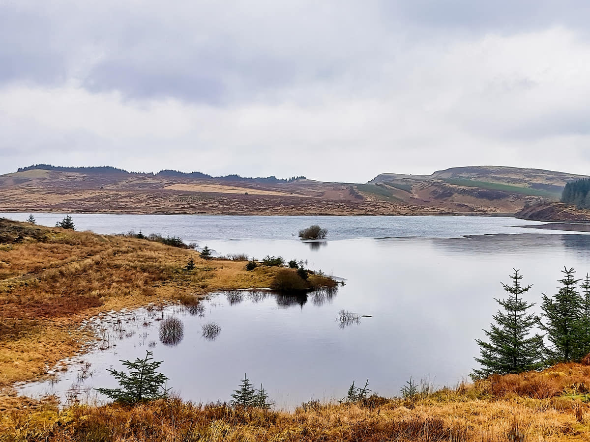
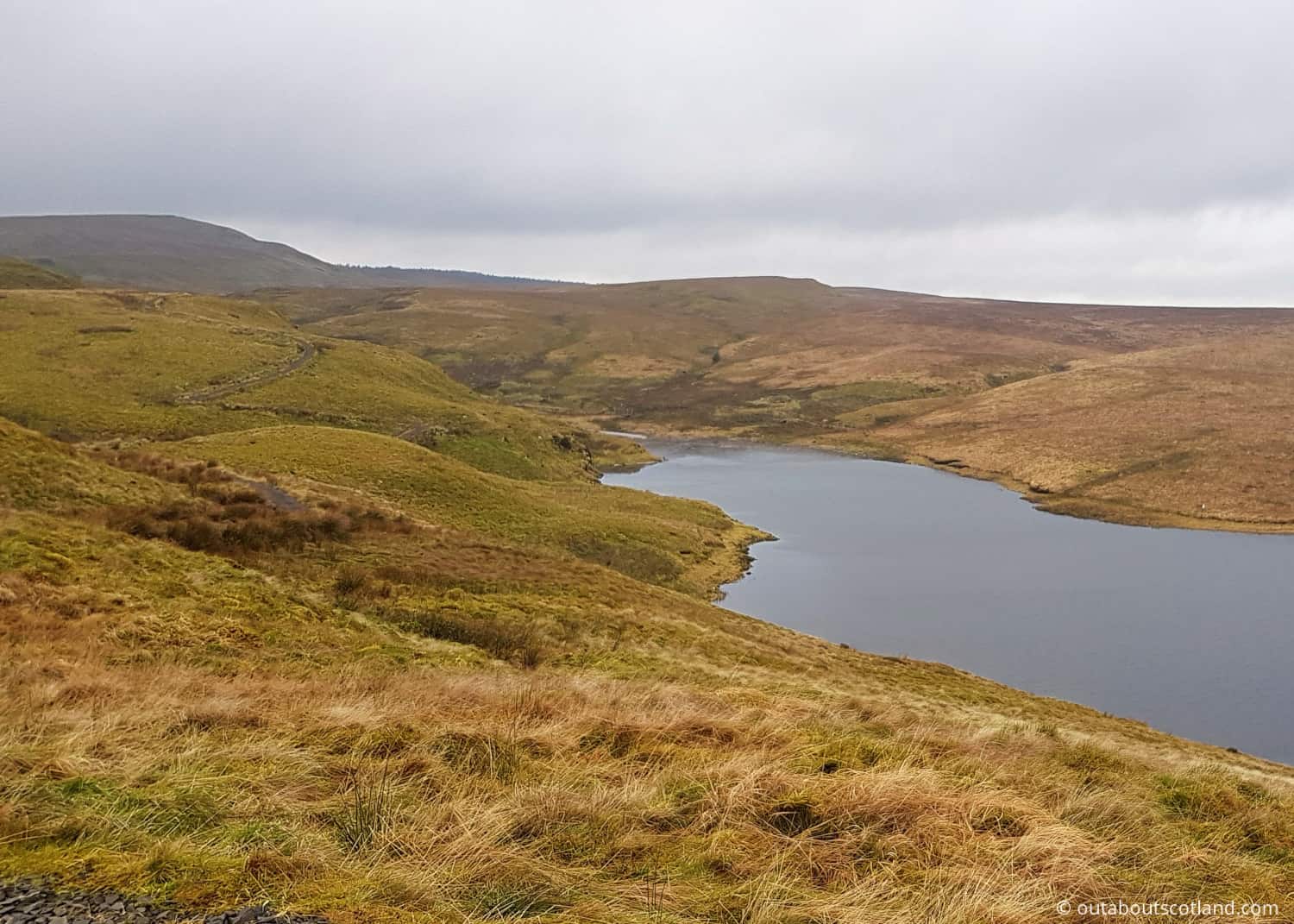
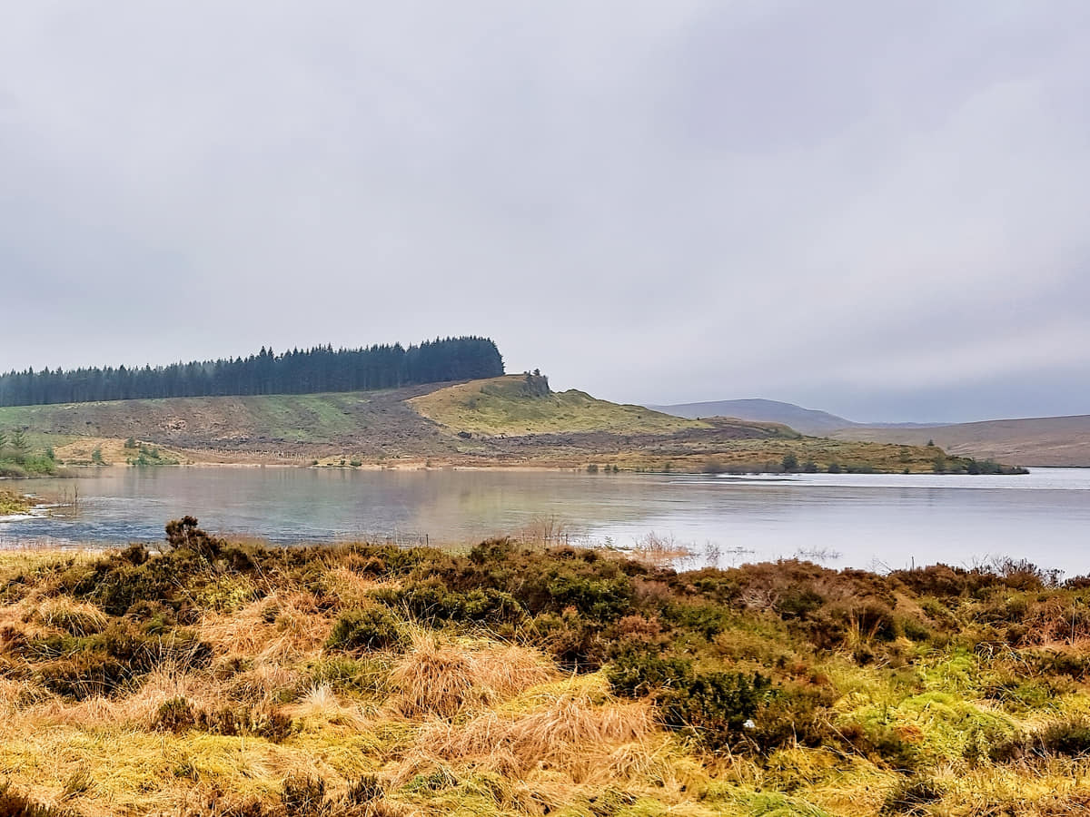
Midway between these two points is a large body of water that’s worth taking a detour to explore – Burncrooks Reservoir. This reservoir partially supplies the city of Glasgow, which lies 5 miles away, with fresh water, and it’s one of the highlights of an area that’s renowned for its hills, forests, bodies of water, and mile after mile of fantastic walking trails.
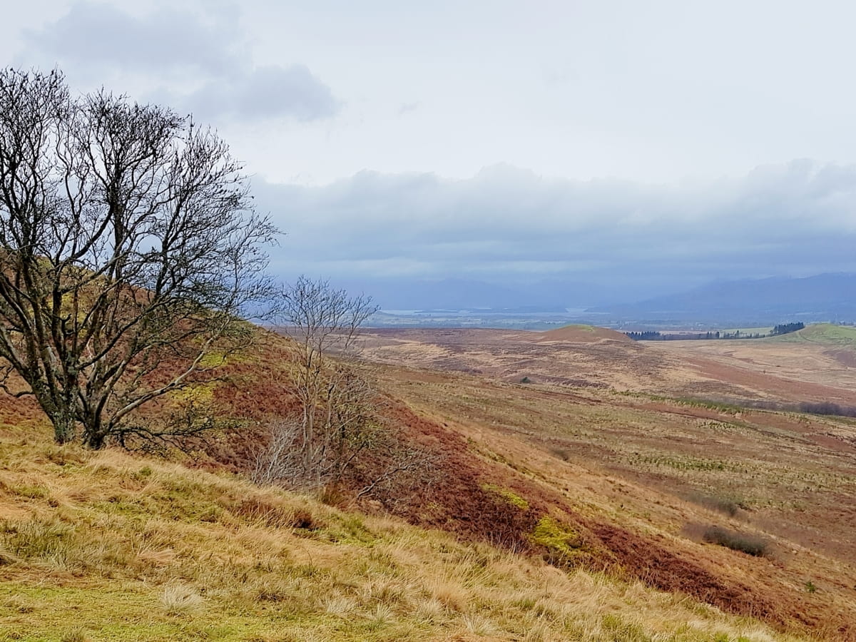
Due to the fact that it’s so elevated, visitors to Burncrooks Reservoir will be rewarded with amazing views across the hills to Glasgow, and it’s even possible to see the Campsies and Arrochar Alps from some sections of the footpath. This footpath runs in a giant loop on a well-maintained gravel surface (installed as part of a half-million-pound development) that’s mostly level, though there are a few twisting/steep areas, so I wouldn’t suggest wheelchair users attempt it.
The area around the reservoir is laced with trails that cater to casual walkers and more serious hikers alike, offering a variety of routes that can take you around the reservoir, through woodland areas, and up into the hills.
Getting to Burncrooks Reservoir itself is relatively straightforward, with access possible from nearby villages such as Carbeth or Auchengillan, or alternatively, it can be included in a walking route that includes The Whangie, a scenic viewpoint set amongst stunning natural rock formations.
The Highlights
1: Photography enthusiasts will find plenty of opportunities to capture the changing light on the water, the undulating landscapes, and the rich flora and fauna. Whether blanketed in snow during the winter months or basking in the gentle warmth of a summer’s day, the reservoir’s setting is always picturesque.
2: Burncrooks Reservoir may not have the fame of Loch Lomond (6.5 miles northwest), but its understated charm makes it a perfect day trip for those looking to enjoy the outdoors and experience the peace and quiet side of the Scottish countryside.
Visiting Tips
1: Take your walk a bit further and follow the path along the John Muir Way to Balloch and Loch Lomond. There are many resources that describe the route, but the best is the official John Muir Way website.
2: The nearby Edenmill Farm Shop café is very reasonably priced, and the steak pies from the butchers are delicious. If you haven’t eaten, a visit is well worth it. The address of the farm shop is: Stockiemuir Road, Blanefield, Glasgow, G63 9AX.
3: It’s worth noting that, as with many such natural sites, amenities are minimal, so visitors should come prepared with enough food, water, and appropriate clothing for the changeable Scottish weather.
Tourist Information
There’s no car park at Burncrooks Reservoir so the best place to start this walk is from the Edenmill Farm shop located west off the A809 near Carbeth. The farm shop is signposted but I suggest you get your sat-nav out as the roads are narrow and fairly non-descript in this part of the country.
Once you get to Edenmill, you’ll find a large car park next to the farm shop which is a nice place to visit as they’ve gone to great lengths to provide activities for children, so if the weather turns grotty you could always wait for the clouds to lift while sipping a coffee. Inside, you’ll find a soft play area, a small go-kart track, and a mini-playground, as well as a café and a quality butcher.
The route around the reservoir and back again is about six miles in total, so it shouldn’t take much more than three hours to complete, and thankfully it’s well signposted from the car park so it’s pretty much impossible to get lost.
You’ll pass through the Auchineden Forest along the way, which is a popular destination for both dog walkers and mountain bikers. With regards to bikes, I personally wouldn’t ride around the reservoir as the path isn’t quite wide enough for walkers and cyclists at the same time, but there are enough tracks in the area that this shouldn’t be too much of a problem for anyone wanting to get out on two wheels.
Walkers, meanwhile, are well catered for, and the John Muir Way, which joins Burncrooks Reservoir, is absolutely stunning in this part of Scotland. If you’re not intending to hike this particular route you’ll find lots more trails on an Ordnance Survey map.
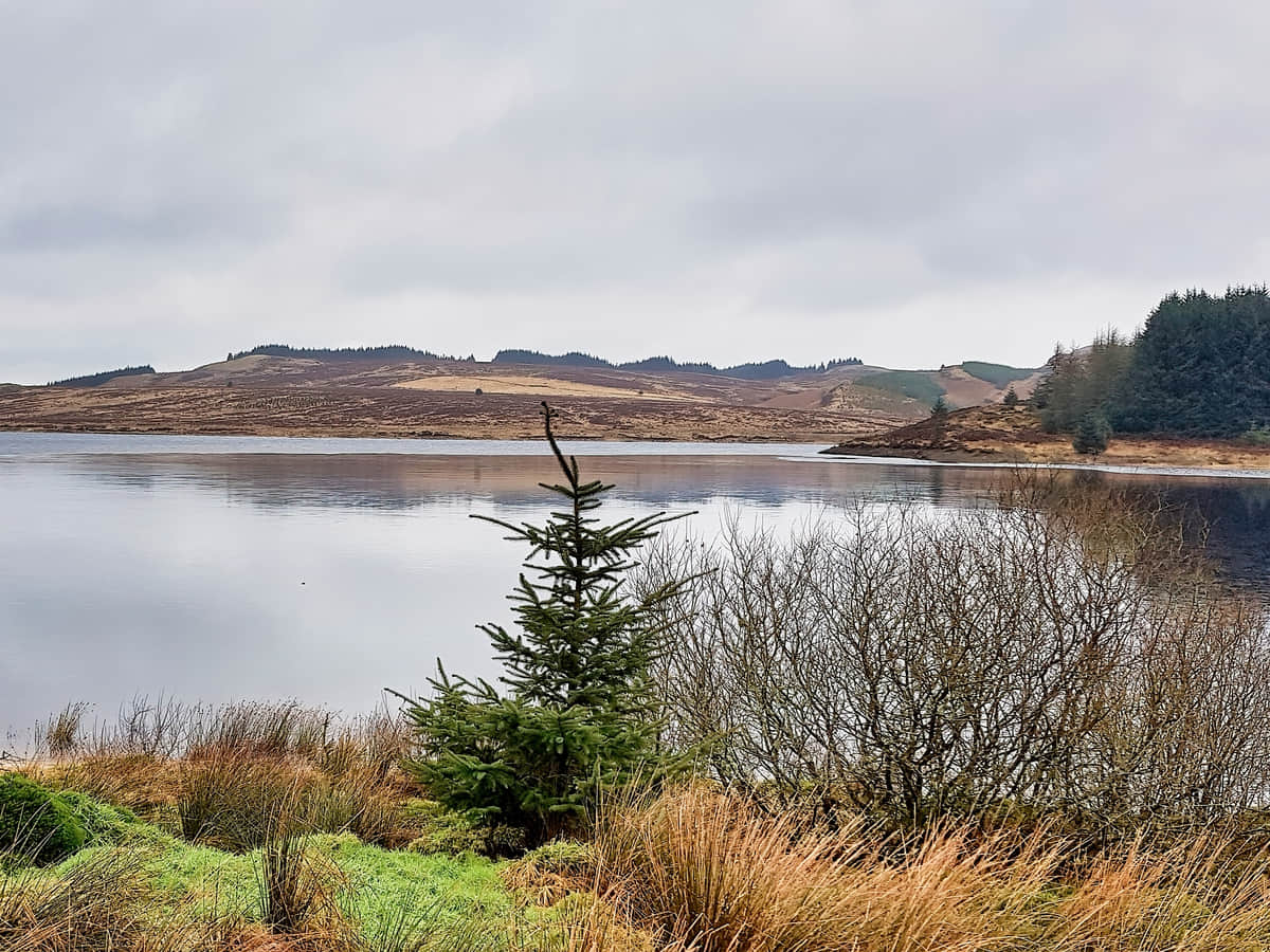
Once past the forest, you’ll find that Burncrooks Reservoir comes into view shortly after. It’s a surprisingly large body of water and it’s a lovely place on a bright summer’s day, but it’s not quite so nice on a cold and damp morning in February, as you can probably see from the photos on this page.
Still, as a way to escape the city or as part of a walk on the John Muir Way, it’s definitely worth a visit, and combined with a trek to The Whangie, you’ll have a very enjoyable jaunt in the Scottish countryside.
The Whangie, if you’re not aware of it, is a rock formation in the Kilpatrick Hills that has stunning views of Loch Lomond. You’ll find the car park next to it on the A809, a few miles north of the turning to the Edenmill Farm shop.
Walking Directions
Distance: 6 miles. Time: 3 hours
From the car park, go through the gates and follow a tarmac road alongside a hedge, then turn left at an angled T-junction onto a private road. Follow this road up a gentle incline in a westerly direction to a gate that leads into open countryside. A short way ahead, you’ll find a track that leads into the Auchineden Forest, which splits into two directions. Take either one because this track forms part of the Burncrooks Reservoir loop, so whichever you take, you’ll end up back at the same place.
Once through the forest, you’ll find the reservoir opening up in front of you with the newly laid path ringing the reservoir’s shoreline. This is a great spot to look for birds of prey before heading up the incline ahead where you’ll have an amazing view over the surrounding hills.
At the far end of the reservoir is a signpost that points towards the Balloch section of the John Muir Way, but if you don’t fancy that excursion you can just follow the grassy track around the perimeter of the reservoir.
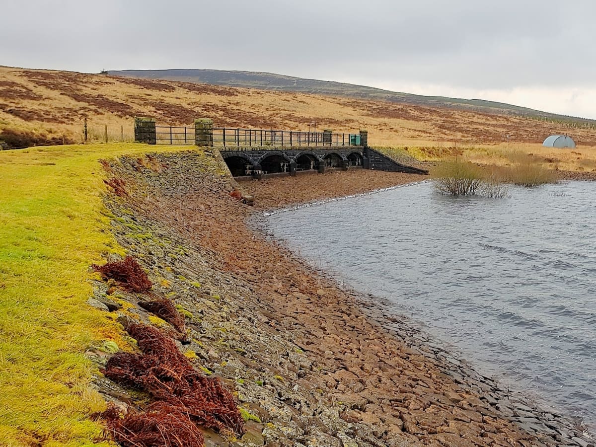
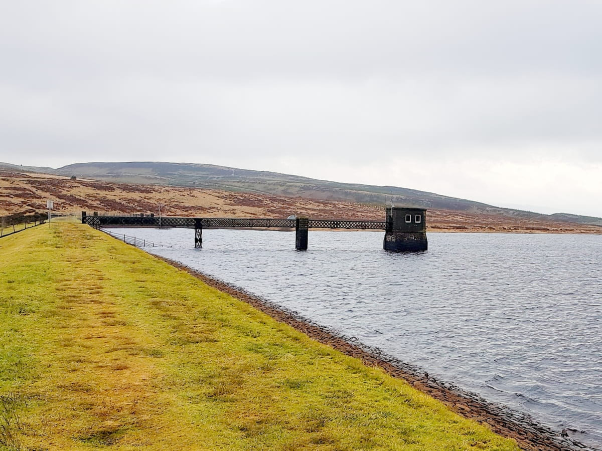
There’s a water-board building off a small jetty at the far end that’s strictly off-limits, so skirt around it and you’ll shortly pass the Queen Elizabeth Angling Club hut. From this point, it’s a short and easy walk back through the forest, after which you’ll follow the exact same route you initially took from the farm shop car park.
Things to Do
Bird Watching: Burncrooks Reservoir is a paradise for bird enthusiasts thanks to its populations of waterfowl, songbirds, and birds of prey. You can spend hours watching and photographing these birds in their natural habitat, but don’t forget your binoculars (link to binocular reviews) for the best views.
Hiking: Experience the beauty of West Dunbartonshire by embarking on a hiking trip around the reservoir. The trail offers panoramic views of the reservoir and the surrounding Kilpatrick Hills on paths that are suitable for all fitness levels. Be aware that it’s quite a popular destination at the weekend, so you might consider looking elsewhere for walks in solitude.
Picnicking: Pack a picnic and enjoy an outdoor lunch by the serene waters of the reservoir. The area is dotted with spots that are ideal for a leisurely lunch but if you’d rather enjoy a sit-down meal I recommend heading to the Edenmill Farm Shop (address: Stockiemuir Road, Blanefield, Glasgow, G63 9AX).
Fishing: Burncrooks Reservoir is a popular location for fishing enthusiasts. Just remember to check the current rules and obtain any necessary permits before casting your line.
Photography: With its stunning landscapes and diverse wildlife, Burncrooks Reservoir provides abundant opportunities for photography. Capture the play of light on the water, the atmospheric morning mist, or the vibrant hues of sunset. Whether you’re a professional photographer or an amateur with a phone, you’ll find plenty of inspiration to practice your skills at this reservoir.
Things to Do Nearby
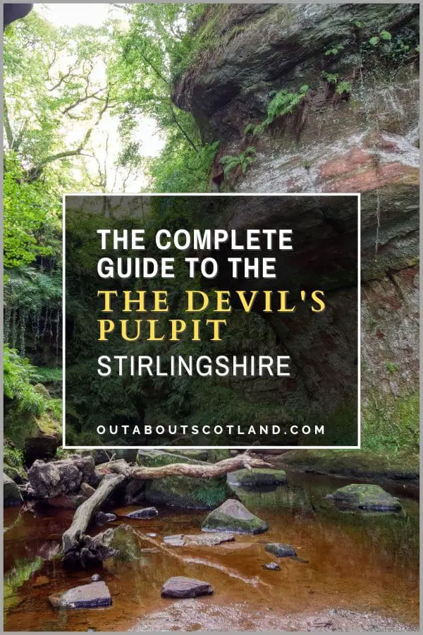
The Devil’s Pulpit. Glasgow, G63 9QJ, 5.7-mile drive.
This is a natural curiosity that is believed to have been the site of magical rituals and sermons by the devil. In the middle of a deep gorge, there is a red sandstone outcrop called The Devil’s Pulpit. Due to the colour of the underlying bedrock, the water that flows through the gorge has a unique blood-red colour.
Balloch Castle and Country Park. Drymen Road, Balloch, G83 8LX, is a 30-minute drive.
Balloch Castle is a 19th-century fortified manor house set in large grounds that face Loch Lomond. The grounds are highly regarded for their ornamental gardens and the nature trails that run through them.
The Whangie and Auchineden Hill. 45-minute walk.
The Whangie is a popular destination for walkers looking for panoramic views of the countryside between Loch Lomond and Glasgow. The hill is best approached from the car park on the B809. The ascent is a fairly gentle incline but the ground gets very boggy after a rainfall.
Mugdock Country Park and Castle. Milngavie, Mugdock, Glasgow G62 8EL. 20-minute drive.
A large country park that is an easy drive from Glasgow. The park features a multitude of paths for walking and cycling as well as areas for sports, children’s play parks and events.
Sea Life Loch Lomond Aquarium. Drumkinnon Tower, Ben Lomond Way, Balloch G83 8QL. 31-minute drive.
One of the busiest tourist attractions in the area due to its location in the Loch Lomond Shores shopping mall. The aquarium allows visitors to get up close to a collection of animals in large tanks that house fish, sharks, turtles and much more.
Loch Lomond. Drumkinnon Tower, Ben Lomond Way, Balloch G83 8QL. 30-minute drive.
One of the most-visited lochs in Scotland after Loch Ness. The loch covers almost 28 square miles and features well-managed walking and cycling paths around its perimeter. Its position in The Trossachs makes it a popular start and endpoint for walkers.
Frequently Asked Questions
How long is Burncrooks Reservoir walk?
The return walking loop around Burncrooks Reservoir from the Edenmill farm shop car park is six miles.
How tall is the Whangie?
The Whangie is a rock outcrop near Burncrooks Reservoir that has an elevation of 984 feet. The path through the Whangie is bordered by sheer sides of rock that are 33 feet high.
Can you fish at Burncrooks Reservoir?
Yes, you can fish at Burncrooks Reservoir. However, you must ensure you have the appropriate fishing permit according to the local regulations.
Can you take dogs to Burncrooks Reservoir?
Dogs are allowed at Burncrooks Reservoir but they must be kept on leads (there are warning signs around the perimeter).