
Ben Hope, Sutherland
Ben Hope is a Munro (a mountain over 3,000 feet) in the Sutherland region of Scotland. It’s the most northerly Munro in mainland Scotland and offers stunning views of the surrounding landscape from its summit. It’s also popular among hill walkers and climbers as it offers a relatively straightforward ascent, though the weather can be unpredictable and challenging at times.
The usual route to climb Ben Hope starts from the small car park at the end of a minor road that leads north from the village of Altnaharra. The trail is well-defined and takes walkers up the southwest ridge, with the ascent taking around 3 to 4 hours to complete.
🠇 Head to the bottom of the page for essential details on each attraction featured here, including addresses, opening hours, and entry prices 🠇
Ben Hope
Ben Hope, located in Sutherland, is celebrated for its panoramic vistas, which offer views as far away as the Orkney Islands on clear days. Despite its remote location, it’s a popular choice among hillwalkers due to its relatively straightforward ascent and the breathtaking scenery of its wild, unspoiled landscape.
Ben Hope is the most northerly Munro in Scotland, rising 967 metres (3,170 feet) southeast of Loch Hope in Sutherland. This is an area known as the Flow Country – a wide, open stretch of peatland – that’s home to the largest expanse of blanket bog in Europe. It’s also the location of the Forsinard Flows National Nature Reserve which covers more than 21,000 hectares and has a diverse range of birds, insects, and reptiles living in it.
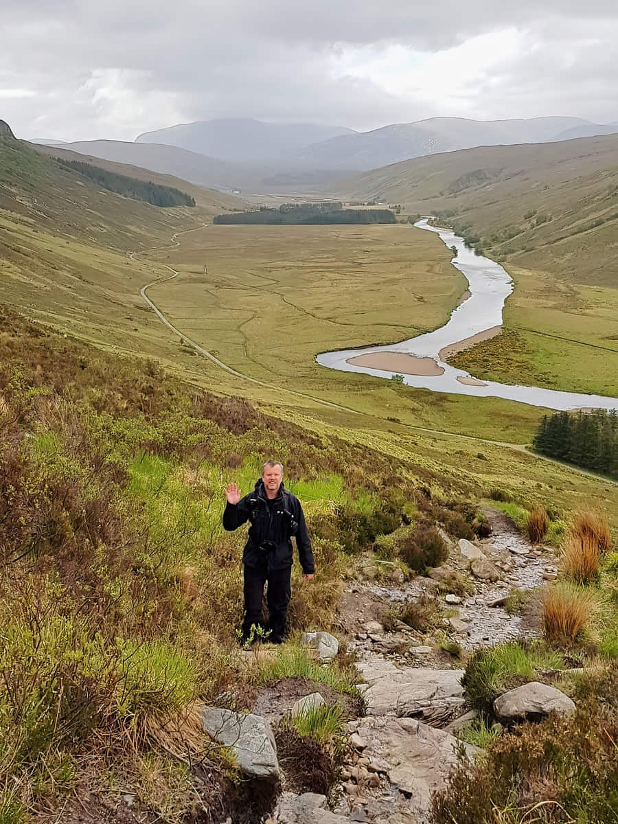
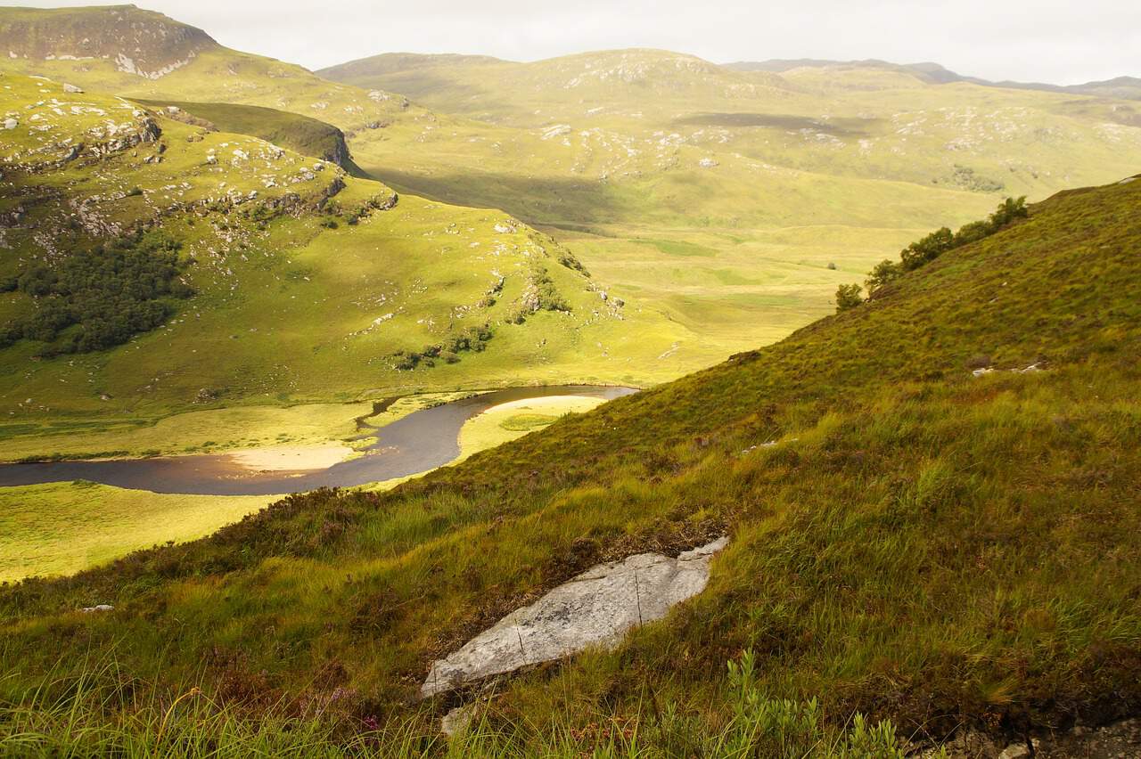
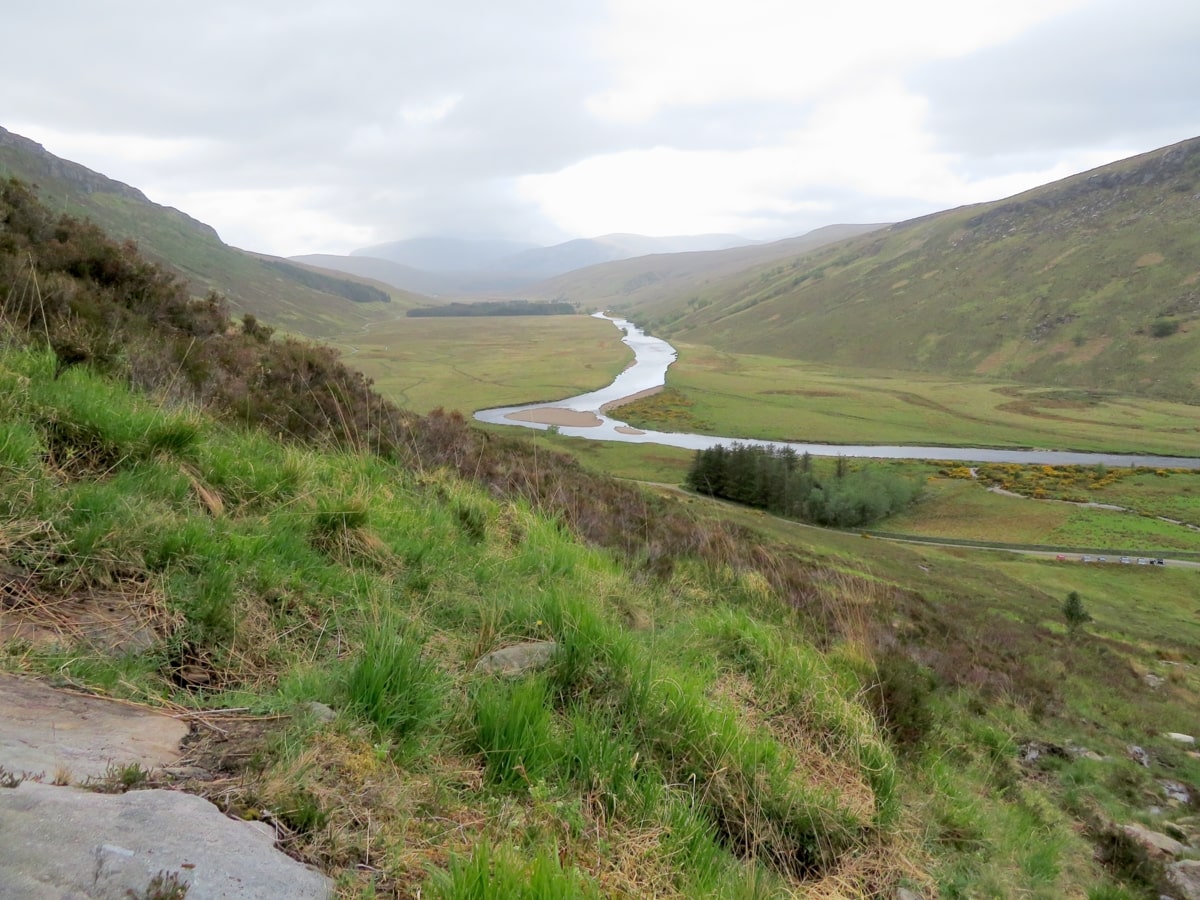
Standing majestically in this seemingly desolate landscape is Ben Hope. To the west of Ben Hope lies the wide valley of Strathmore that runs north-south and has a minor road running alongside it, with the Strathmore River flowing through the valley on its way to Loch Hope and the North Sea beyond.
You can approach the mountain from either the north or south, but before you get there, I recommend taking a look at Broch Dun Dornaigil, which is situated a couple of miles south of the Ben Hope car park. The broch is at least 2,300 years old and is sizeable at an impressive 7 metres in height, but the interior has now collapsed so you can’t go inside it.
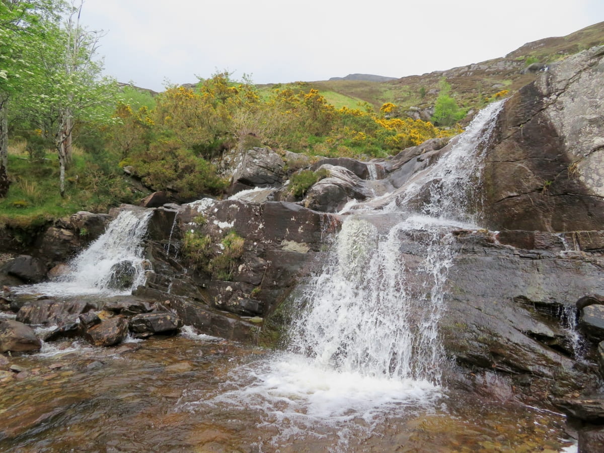
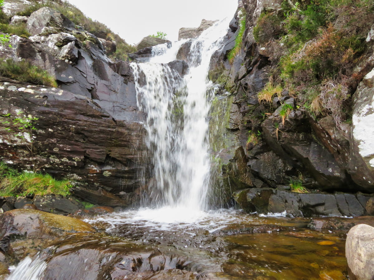
Heading back to the car park of Ben Hope, you’ll get your first glimpse of the mountain that awaits you, with the tumbling waterfalls of the Allt-na-Caillich burn cascading in front of you and alpine flowers spreading out around the base of the glen. You’ll find more information about how to climb Ben Hope in the next section.
The Highlights
1: From the summit of Ben Hope, you have breathtaking panoramic views across the wild landscape of the North Highlands. On a clear day you can even see across the Orkney Islands.
2: The ascent of Ben Hope is considered a challenging but rewarding hike. Although it’s one of the shorter Munro climbs, it’s steep, and the path can be rough in places which offers a good challenge to hillwalkers.
3: It’s an easy enough climb if you’re fit, but if you don’t feel up to it you can instead enjoy a nice walk along the single-track road that runs beneath Ben Hope.
Visiting Tips
1: Due to its location near the coast, the weather can change suddenly. Checking the weather forecast before leaving home is a must-do for this mountain climb.
2: Purchase a decent map before you climb Ben Hope as it will be invaluable if you lose sight of the track. It will also help you explore more of this remote part of Scotland.
3: Visitors to Ben Hope should be prepared for variable weather conditions and ensure they have the right equipment before attempting the climb. Always let someone know your plans before heading out into the wilderness of the Scottish Highlands.
Tourist Information
The first third of the climb is quite steep and unforgiving, and to be honest, I wouldn’t even try to attempt it if you have children under 10 with you. It’s also in a location where changes in the weather can make conditions on the mountain pretty miserable, and if the clouds roll in, you can forget about seeing anything from the trig point at the top.
If the forecast shows clouds rolling in, I suggest saving this mountain for another day as you’ll likely miss out on seeing Sutherland in all its glory. But then again, if you’re one of those sporty, adventurous types, you’ll no doubt enjoy reaching the top no matter what Scotland’s famously changeable weather decides to do.
You should consider planning between four to six hours to complete the return climb, which is only around 5 miles in total. Unfortunately, the path has to almost double back on itself in a couple of places to avoid a few crags in the mountainside; otherwise, you’d be able to reach the summit in half the time.
I’d say half of the walk is on grass (which was a complete muddy quagmire when I visited), and the rest is on loose rocks and scree, so whatever you do, make sure you wear good weatherproof gear, especially when it comes to your boots. I specifically bought a pair of Berghaus boots from Amazon for my trip to Sutherland, and they were fantastic. Lots of grip and ankle support, and totally water-resistant. They were pricey, but you get what you pay for.
Before you set off, bear in mind that there are no facilities for miles around in any direction, so make sure your phone is charged up, you take a backpack full of food, and chuck a couple of bottles of water in there for good measure. Believe me, once you start climbing this steep mountain you’re going to work up a thirst.
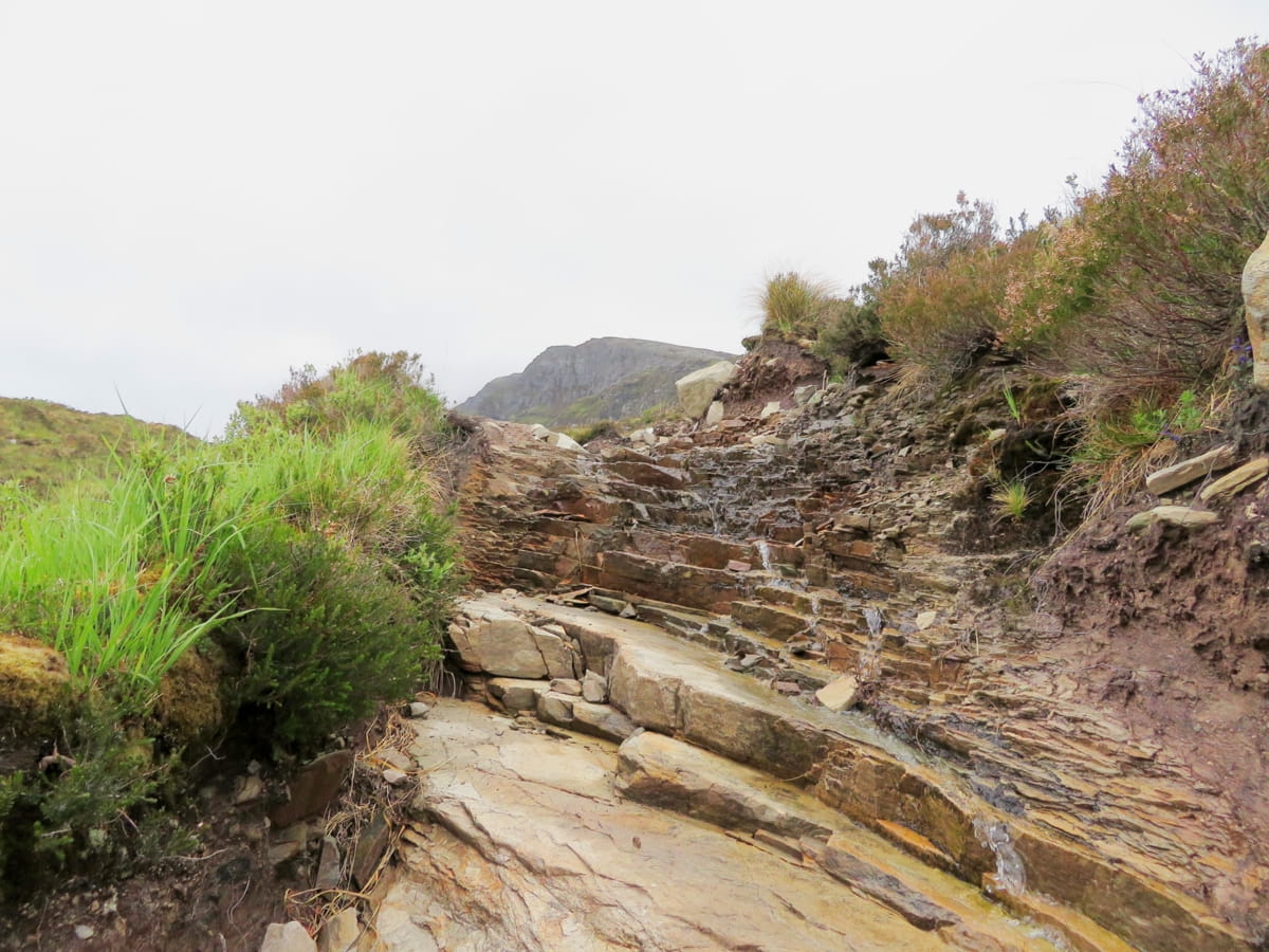
The track to the top of Ben Hope is fairly easy to follow, but it’s quite hard going in places, especially the first section before the southern ridge. Thankfully, there are several marker cairns along the way to keep you on the right track, and as it’s such a popular hike you’ll no doubt find fellow walkers along the way to offer advice if you’re not sure where you’re going.
Walking Route
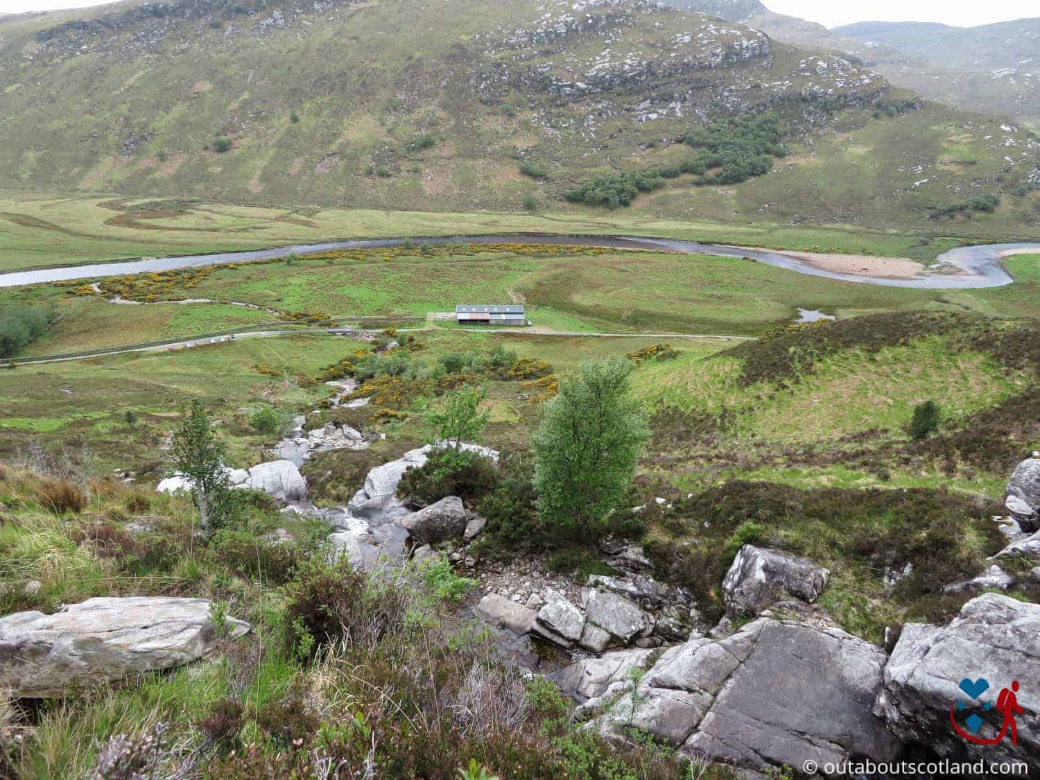
The start of the walk is at the Ben Hope car park in Strathmore, which you’ll find by turning off the A838 at the northern end of Loch Hope.
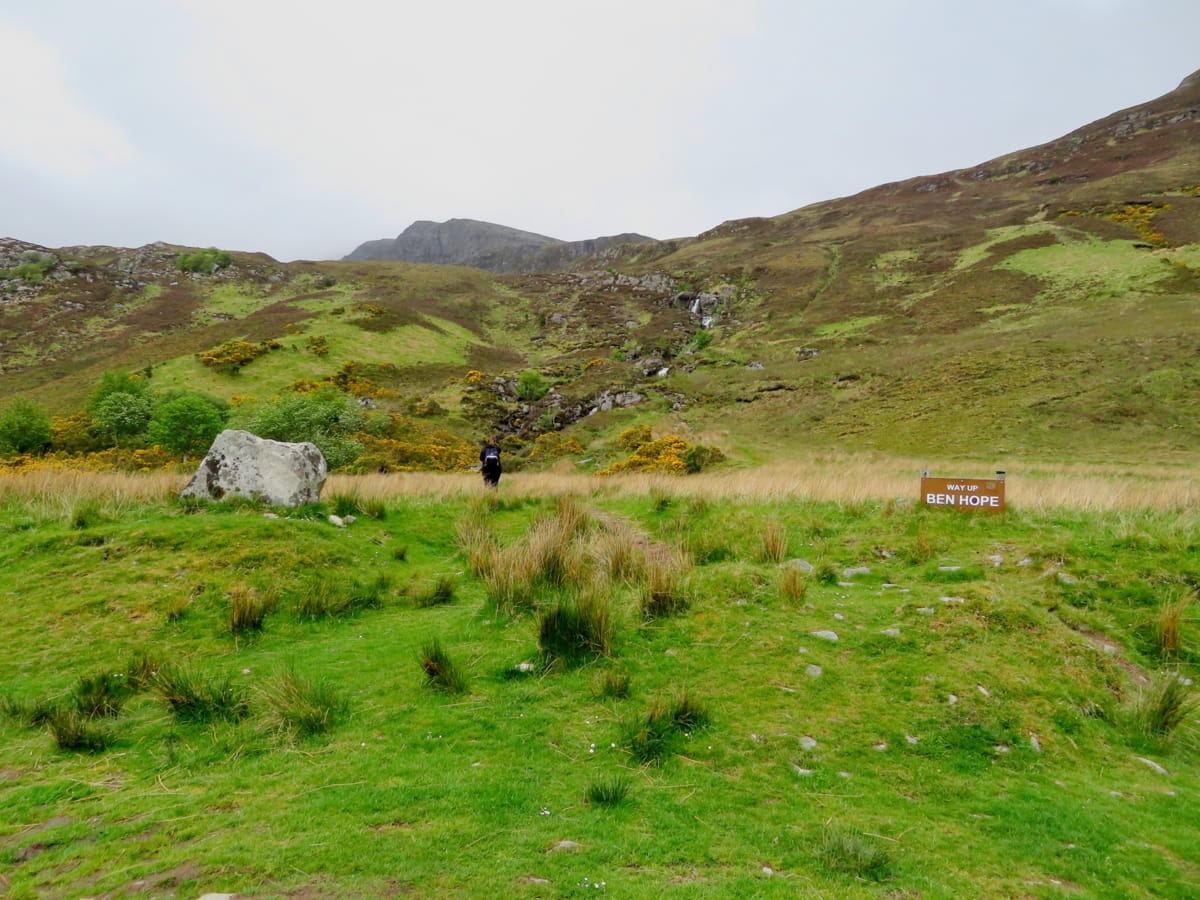
From there, follow the single-lane road till you reach a bay opposite a barn that has space for around 5 cars. A sign greets you, proclaiming ‘Way up, Ben Hope’ with a path heading towards the Munro through a field. Be warned, though, that the difficulty ramps up quickly and the track becomes rather steep as soon as you leave the field.
To your left are the tumbling waters of the Allt a’Mhuiseil burn which the path follows before zig-zagging around a few crags. Once you’ve cleared the first steep section, you’ll emerge onto a wide grassy shelf on the southern ridge of Ben Hope.
As the path continues its zigzag line upwards, you’ll reach the first false summit where you’ll notice the grass giving way to bare rocks. It’s a mild scramble from there on in, as the slope of the western escarpment pitches at another steep angle, but at least there are a few cairns along the route to keep you pointed in the right direction.
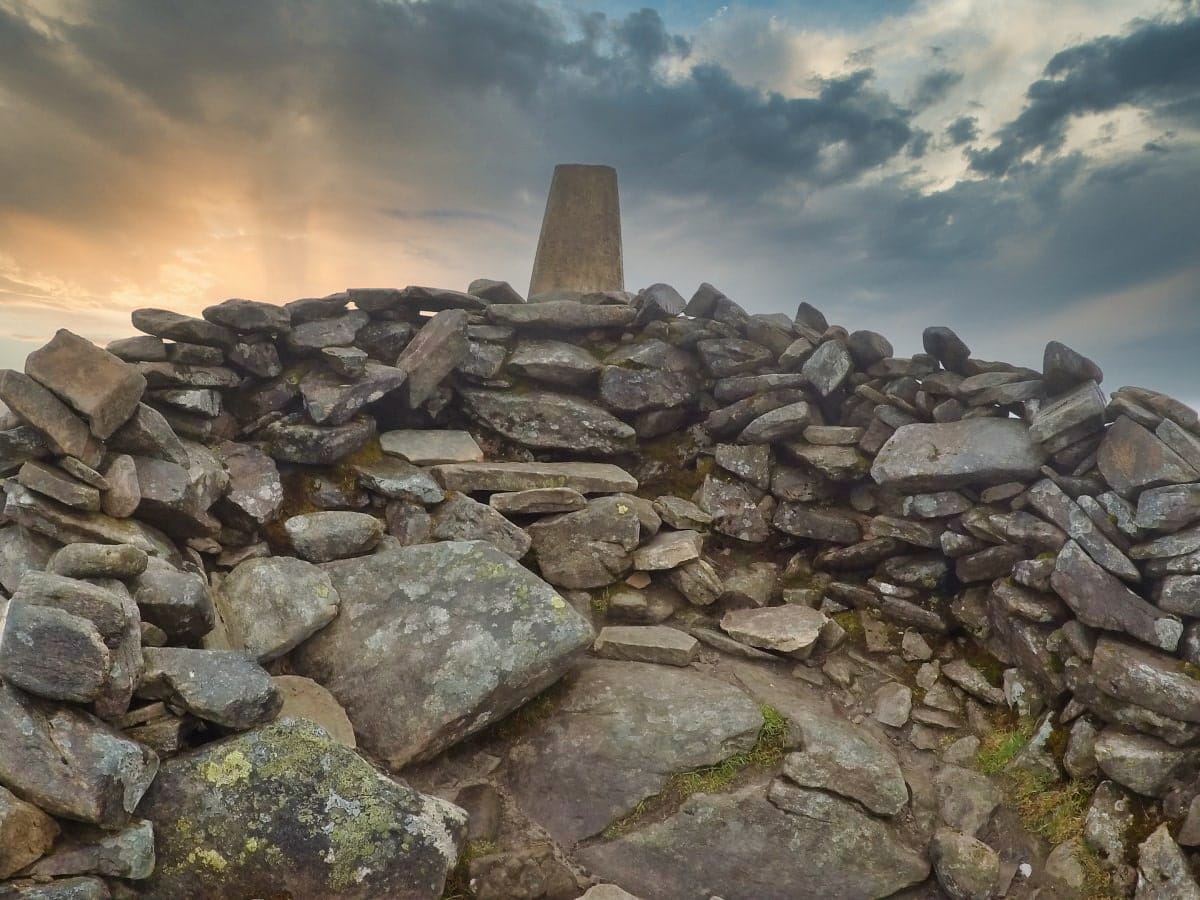
If the wind isn’t too fierce, the low wall of rocks surrounding the trig point on the summit makes a good place to eat a sandwich while admiring the Highland scenery, before making your way back to the car park by following the same route.
Things to Do
Hiking Ben Hope: As the most northerly Munro in Scotland, Ben Hope offers a challenging yet rewarding hiking experience, and the trail to the summit provides breathtaking views of the surrounding landscape. Whether you’re an experienced hiker or a beginner, climbing Ben Hope is a must for outdoor enthusiasts.
Wildlife Spotting: Ben Hope is a haven for wildlife. Keep your eyes peeled for red deer, golden eagles, and other creatures that call this part of Sutherland home. Don’t forget your binoculars (link to binocular reviews), as the opportunity to spot these animals in their natural environment is an experience that shouldn’t be missed.
Photography: With its stunning landscapes, Ben Hope is a photographer’s paradise. From the morning mist rolling over the hills to the setting sun casting golden hues over the lochs, there’s a picture-perfect moment waiting at every corner. Whether you’re a professional photographer or a hobbyist, you’ll find endless inspiration here.
Stargazing: Thanks to its remote location, Ben Hope offers some of the best stargazing opportunities in Scotland. On clear nights, the sky above is a spectacle of twinkling stars, and there’s a good chance you’ll even get to witness the mesmerising Northern Lights.
Exploring Nearby Lochs: Just a short distance from Ben Hope, you’ll find several picturesque lochs, including Loch Hope, Loch an Seilg, and Loch Ghoba-Dhuibh. Spend a day exploring these bodies of water, enjoying a picnic on the shore, or trying your hand at fishing.
Things to Do Nearby
Castle Varrich. Lairg IV27 4XE. 32-minute drive.
A ruined tower house overlooking the Kyle of Tongue. Accessible via a path that runs from Tongue village through woodland. There is no fee to visit the tower. The village has a shop and two pub restaurants.
Loch Hope. A 1-minute drive from Ben Hope car park.
One of Scotland’s best sea lochs for trout fishing has plenty of sea trout and salmon to be caught. The loch sits at the foot of Ben Hope, a short distance from Loch Eriboll.
Broch Dun Dornaigil, Lairg IV27 4UL, is a 9-minute drive from Ben Hope Car Park.
A historic landmark that is a fairly well-preserved broch is one of the ancient fortified roundhouses found in Scotland over 2,000 years ago. The broch’s interior is filled with rubble and is inaccessible.
Kyle of Tongue. 30-minute drive.
An expansive yet shallow sea loch that features a rocky coastline designated as a National Scenic Area. Visitors flock to the area for the views of Ben Hope and Ben Loyal.
Ard Neakie Lime Kilns, Lairg IV27 4UJ, 24-minute drive.
A historic landmark on a spit of land that juts out into Loch Eriboll. Low cliffs surround the mostly shingled shoreline. Superb walks are possible away from the shore.
Frequently Asked Questions
How long does it take to climb Ben Hope?
The time it takes to climb Ben Hope will vary depending on your fitness level and weather conditions. Generally, it takes 3-5 hours to ascend and descend.
Is Ben Hope an easy Munro?
Ben Hope in Sutherland is considered to be a fairly easy Munro to climb. The 3,000-foot ascent to the summit takes approximately 3 hours. The initial climb is steep on loose gravel and muddy terrain, but this levels off to a relatively shallow incline higher up.
What is the most northerly Munro?
Ben Hope is the most northerly Munro in mainland Scotland. The mountain is situated in the heart of the Flow Country (a region known for its ancient peat bog) in the county of Sutherland.
What is the Flow Country in Scotland?
The Flow Country is an area of deep peatland in Scotland, covering about 200,000 hectares in the north of the country. It’s one of the largest and most intact areas of blanket bog in the world, making it a place of significant scientific interest.
This vast, open landscape is home to a variety of wildlife, including many rare and endangered species. It’s also an important carbon storage site, holding almost twice as much carbon as all the forests in the UK combined.