Bracklinn Falls
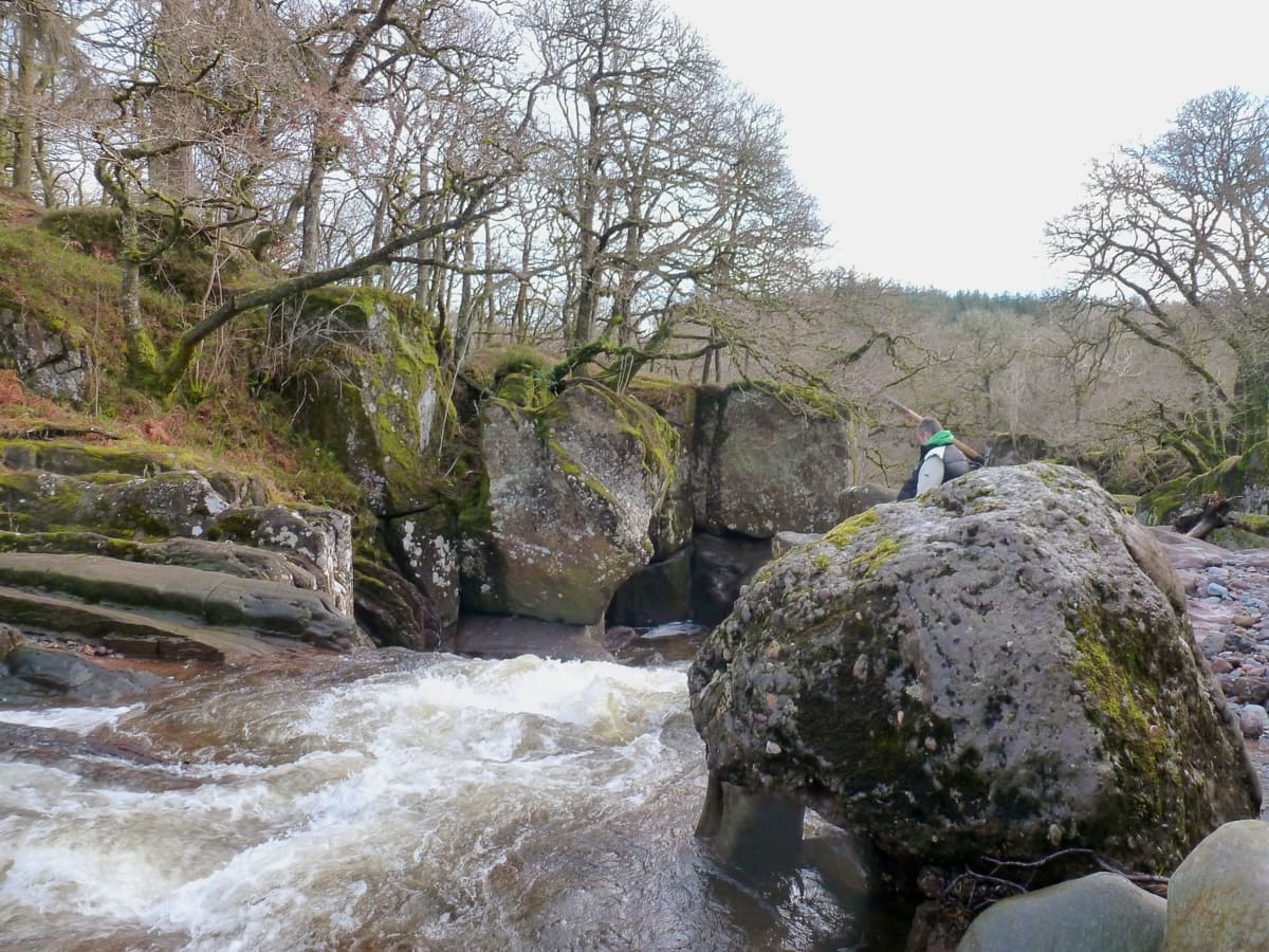
The Bracklinn Falls are a series of waterfalls on the Keltie Water near the town of Callander in Stirlingshire. It’s a popular spot for locals and tourists as the falls are surrounded by a loop walk which offers stunning views of the surrounding countryside.
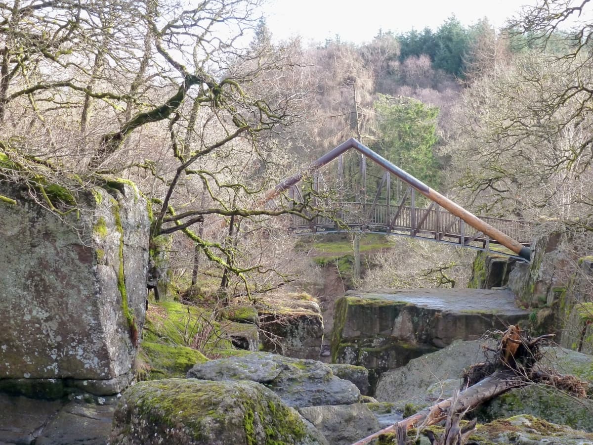
In 2004, the bridge over the falls was washed away by floods but has since been replaced by a new, award-winning wooden bridge that provides a great viewpoint for visitors to fully appreciate the power and beauty of the waterfalls.
🠇 Head to the bottom of the page for essential details on each attraction featured here, including addresses, opening hours, and entry prices 🠇
Bracklinn Falls
While many visitors go to Callander to use it as a base to explore Loch Lomond and the Trossachs National Park, other visitors go there to enjoy the many walking trails that run throughout this incredibly scenic part of Scotland. There are dozens of trails to choose from, but the Callander Crags, Rob Roy Way, and Bracklinn Falls routes are among the most popular.
The reason why the area around Callander is regarded as one of the top hiking destinations in Scotland is that it lies on top of the Highland Boundary Fault, a geological fault line that runs across Scotland from Helensburgh on the west coast to Stonehaven on the east. This fault line separates the two very different terrains of the Highlands and Lowlands, and where the rivers cross the fault line, they fall from one to the other, hence the waterfalls that you can see on the Keltie Water.
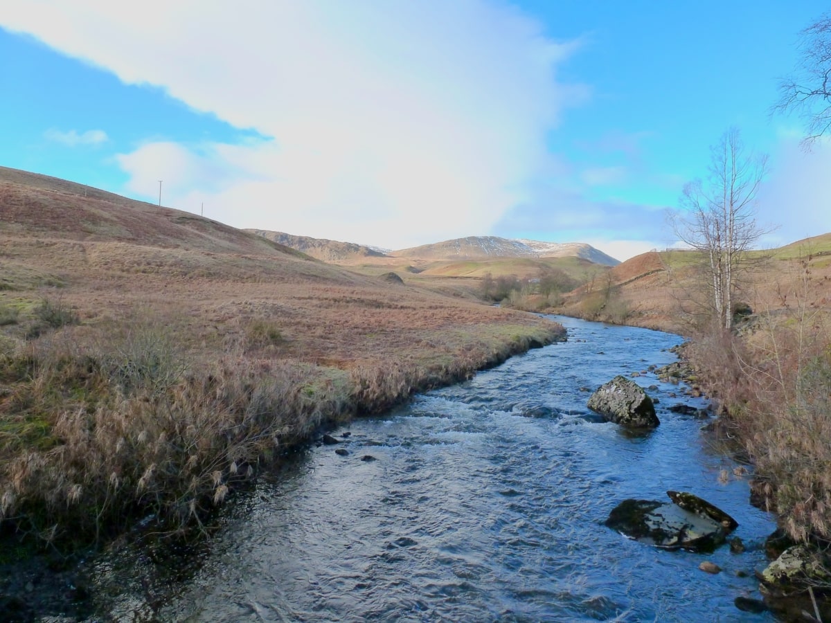
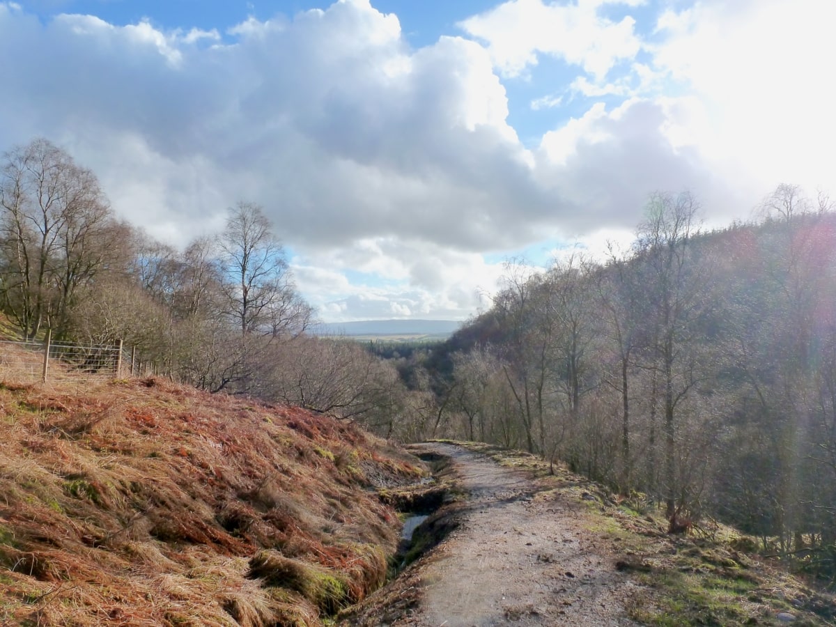
The route around the Bracklinn Falls is quite beautiful and I can guarantee you’ll enjoy this walk even if the weather closes in. As you make your way from Callander towards the river, you’ll pass through pretty country roads, dense woodlands, steep rocks, thick moorland, and the fast-flowing Keltie River, with the Trossachs mountain range providing a stunning backdrop in the distance.
The Highlights
1: One of the main highlights of visiting the Bracklinn Falls is the beautiful walk up to the falls. The trail takes you through a lovely woodland, and you get to enjoy the beautiful landscape on your way to the falls.
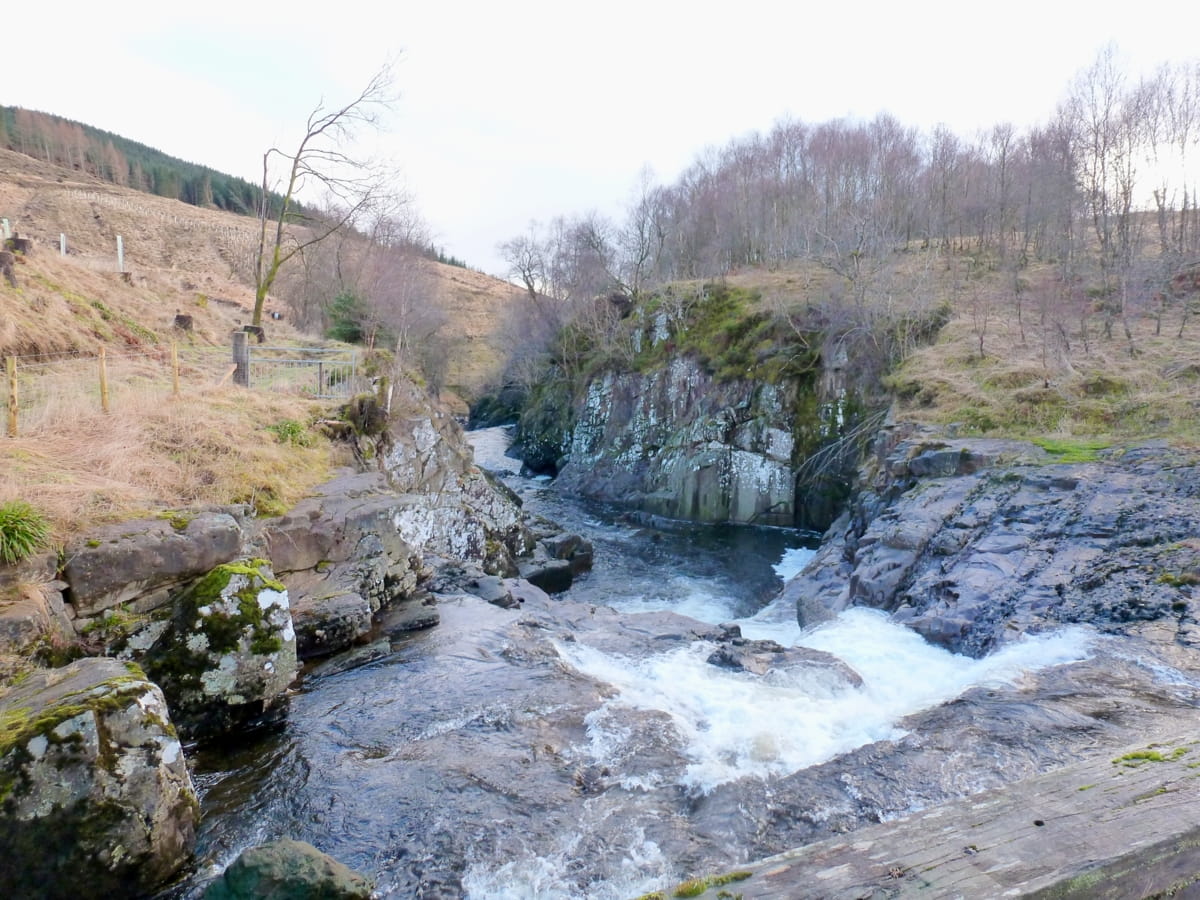
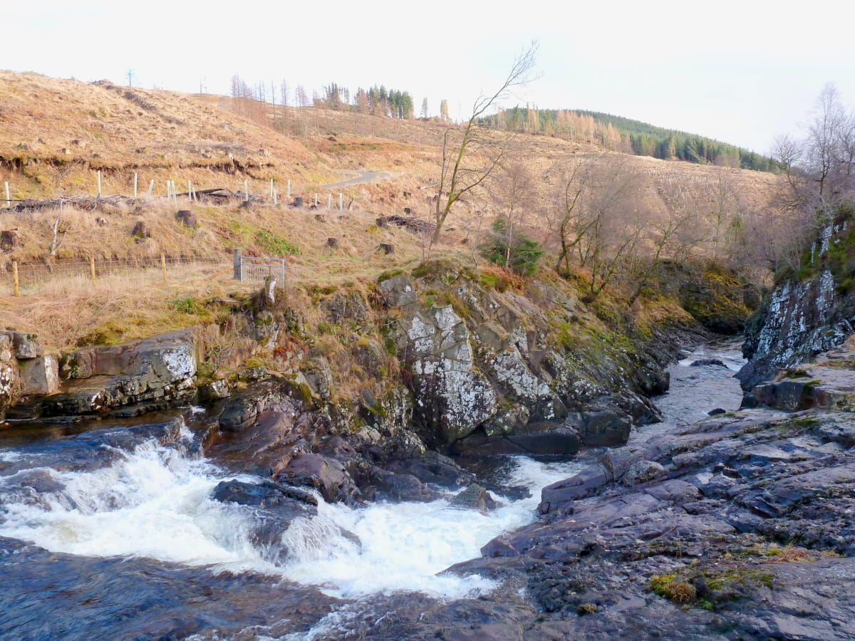
2: Of course, the falls themselves are a stunning sight. The waterfall is most impressive after heavy rain when the water flow is high. The noise and power of the water are truly awe-inspiring.
3: There’s a fantastic viewpoint from a modern bridge that spans the falls, replacing the old one swept away in floods. It offers an excellent vantage point for admiring the cascading waters and taking some great photos.
Visiting Tips
1: The forests around this part of the country are exceptional. Discover the best ones to visit in this article, Forests in Scotland.
2: Parts of the Bracklinn Falls gorge are very steep. Take extra care, especially with children and dogs.
3: While the walk around the Bracklinn Falls is great, you might fancy something a bit different afterwards, in which case I recommend a short drive down the A81 to Inchmahome Priory, which is located in the middle of the Lake of Menteith.
Tourist Information
It’s easy to drive to the Bracklinn Falls as it only takes an hour from Stirling (via the M80 and A84) and an hour and a half from Edinburgh (via the M9 and A84). If you prefer to cycle, you can follow the National Cycle Network route number 7 which passes through Callander and offers a superb ride in the Trossachs, or if you’d rather take the bus, you can catch the number 59 from Stirling.
I have to say I really enjoyed my walk around the Bracklinn Falls circuit, helped no end by the fact the path is nicely compacted and relatively mud-free – even in winter. It doesn’t take long to complete, maybe 2 and a half hours, but it’s a good three and a half miles in length, so bear that in mind if you have young children with you.
Aside from the different landscapes you’ll encounter, there will also, more than likely, be lots of wildlife as you follow the trail. The area around Callander and the Trossachs is home to some of Scotland’s favourite animals, with Highland cows, red squirrels, roe and red deer, osprey, buzzards, and even Scottish wild cats frequently reported by keen-eyed nature lovers. The woodland, in particular, is well-known for woodpeckers that are often heard but rarely seen between the thick trunks of the firs and conifers.
The main section of the waterfalls is immediately obvious as soon as you get near it, as it’s incredibly loud, especially after heavy rainfall. For the best viewpoint, head to the 20-metre wooden footbridge that was hauled into place by hand – all 20 tonnes of it! It’s a stunning location and a must-visit destination for photographers
Walking Route
There are several places where you can start and end a walk around the Bracklinn Falls, but for a good walk I suggest starting at one of the car parks in Callander town centre.
With the Eas Gobhain River behind you, make your way to Callander Main Street and head west, where you’ll eventually come to a junction with Bracklin Road heading north. Cross the junctions with Craigard Road and Ancaster Road and follow the signs for Callander Golf Club, at which point you should also see signs directing you towards Callander Crags and Bracklinn Falls. Both of these sites have their own car parks, so if you want a shorter walk, you can start there and save 30 minutes or so.
Heading north past the turning to Callander Crags, you’ll find yourself on the single-track road that leads to the Falls car park, and it’s at this point where the road and path diverge. The trail runs around either side of the Keltie Water in a big loop so you can take either direction, but the path into the woodland away from the road will take you to the Bracklin Falls bridge. You can’t get lost on the remainder of the walk, as signs are positioned along the way to point you in the right direction.
Once you reach the footbridge, bear left and follow the path that leads into the woodland while curving around a hill. As you crest the hill, you’ll have the amazing sight of Ben Ledi and Ben Lomond in front of you, and before long, the path will start to drop down again, at which point you’ll cross a much less-impressive footbridge that again crosses the Keltie Water.
This point signals the start of the return journey back to the Falls car park, which will be marked by the footpath suddenly turning into a single-track road. Follow this road until you reach the car park, or continue into Callander.
Things to Do
Walking: A variety of walking paths surround the Bracklinn Falls, but the Bracklinn Falls Circular Walk, a picturesque 3.5-mile trail that crosses the falls and the Keltie Water, is the highlight. It’s a moderately challenging walk in winter due to the muddy paths, but in summer it’s suitable for most abilities except wheelchair users.
Photography Session: The entire area is a wonderland for photographers. The falls, the gorge, the woods, and the mighty Bracklinn Bridge offer countless opportunities for landscape and wildlife photography whether you’re a seasoned pro or an amateur.
Picnicking: What could be more enjoyable than a picnic under a canopy of ancient woodland? There are numerous picnic spots where you can relax and enjoy lunch with the sounds of the waterfall and the chirping of birds for company, but sitting on the bridge overlooking Scout’s Pool (at the northernmost point of the trail) is the best option in my opinion.
Wildlife Watching: The area around Bracklinn Falls is teeming with wildlife. Look out for red squirrels, roe deer, and a variety of bird species. Early morning or dusk are the best times for wildlife spotting but be aware it’s also the time when midges are at their worst so you might like to take some midge repellent with you.
Historical Exploration: Just a short walk from the falls, you’ll find the historic town of Callander. Filled with charming local galleries, museums, and traditional shops, it’s a great destination for a lazy afternoon. Don’t miss the opportunity to sample local Scottish cuisine at one of the many cosy pubs or restaurants, or maybe just grab a takeout and sit on the banks of the River Teith.
Things to Do Nearby
Doune Castle. Castle Hill, Doune FK16 6EA. 17-minute drive.
A medieval castle with one of the largest curtain walls in Scotland. Doune Castle is located near the River Teith in the historic village of Doune. It is famous for being the filming site of Monty Python, Outlander and Game of Thrones.
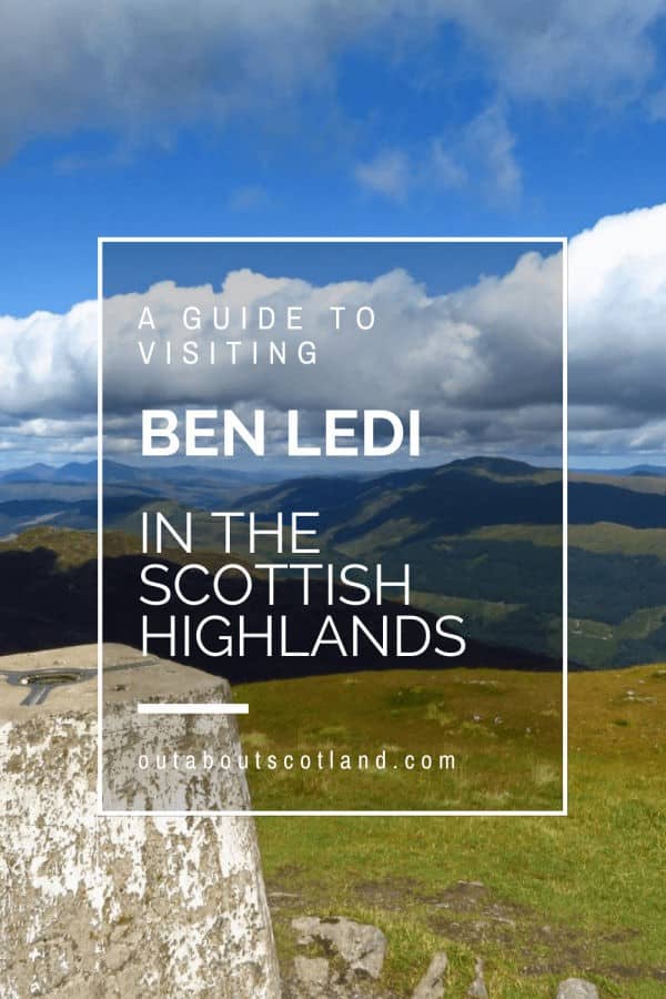
Ben Ledi. 20-minute drive.
Ben Ledi is an 879-metre Corbett located around 4 miles northwest of Callander. The route to the summit is relatively easy-going but if the weather is unsuitable visitors will find an equally-enjoyable walk to Strathyre along the western edge of Loch Lubnaig.
Callander. 4-minute drive.
A popular tourist destination on the edge of The Trossachs National Park. Callander is often used as the starting point for walks into the surrounding forests. A recommended trail follows the Garbh Uisge river which starts at the car park in the town centre. There are a variety of traditional pubs, restaurants and gift shops in the high street.
Falls of Leny. 9-minute drive.
The walk to the Falls of Leny from Callander is one of the highlights of this part of The Trossachs. The falls are a series of natural low-lying waterfalls on the Garbh Uisge river. A shorter route starts at the Ben Ledi car park.
Deanston Distillery. Teith Rd, Deanston, Doune FK16 6AG. 16-minute drive.
Located in a former cotton mill, this distillery on the banks of the River Teith offers guided whisky tours, tasting experiences, a shop and a café.
Frequently Asked Questions
Is the Bracklinn Falls walk pram friendly?
The trail to the falls is not pram or wheelchair-friendly. The path includes steep gradients, uneven surfaces, and a narrow bridge crossing, which can make it challenging for prams, pushchairs, or wheelchairs.
How long is the Bracklinn Falls walk?
The Bracklinn Falls walk is a loop around a waterfall and a glen near Callander, Stirling, that is 3.7 miles (6 km) in length.
How far is Bracklinn Falls from the car park?
The distance from the high level car park (postcode FK17 8EP) to the Bracklinn Falls is 3/4 mile (1.5 miles return walk).
Can you swim at Bracklinn Falls?
It is possible to swim in some of the deeper pools at the Bracklinn Falls, however, the rocks are very slippery and it should be noted that there have been fatalities in the past.