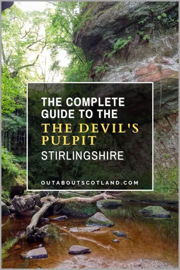
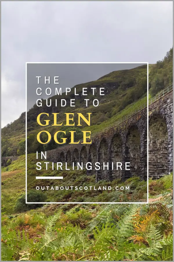
Glen Ogle
Glen Ogle lies in a particularly scenic area of Stirlingshire, 2 miles (3.22 km) northwest of the village of Lochearnhead. The Glen is a popular tourist destination thanks to the Sustrans Route 7, which offers a superb cycle and walking route through the glen, where stunning views are on offer from Loch Earn to the Glen Ogle railway viaduct and beyond.
Discover this bewitching glen and its surrounding landscape in this guide which includes an overview of the route between Loch Earn and the Falls of Dochart, as well as tourist information and handy visiting tips.
🠇 Head to the bottom of the page for essential details on each attraction featured here, including addresses, opening hours, and entry prices 🠇
Glen Ogle
You may not have heard of Glen Ogle, but there’s every possibility you’ve driven through it on your way to the north or south of Scotland. The glen offers access to Oban via the A85 which is one of the most-used roads for the ferry terminal, and it’s also the main route for traffic from Edinburgh and Stirling to the Highlands.
That usually means travellers sit and look at the glen through the car window as they zoom past but few actually stop to explore it, which is a shame as Glen Ogle has a number of features that make it an attractive tourist destination in its own right.
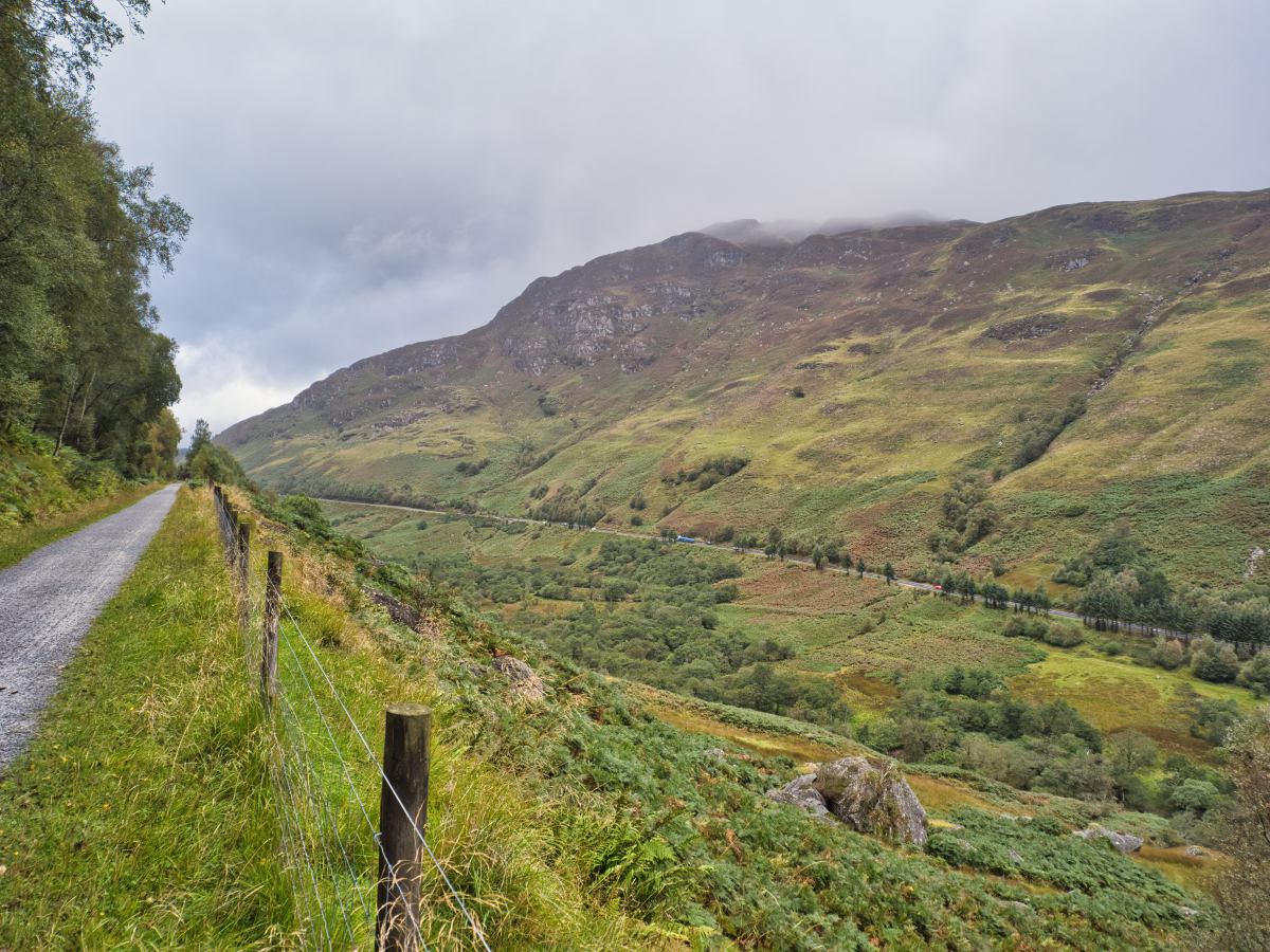
The glen starts at the village of Lochearnhead which lies at the western end of Loch Earn and continues north for seven miles to the blink-and-you’ll-miss-it village of Lix, where it then opens up into the equally pretty Glen Dochart.
The Ogle Burn gently winds its way alongside the A85 while the heather-covered hills of Meall Reamhar and Scorrach Nuadh tower above, making the landscape spectacularly pretty, especially in summer.
Central Scotland is rightly regarded as one of the most scenic parts of the country and the entire area surrounding Glen Ogle doesn’t disappoint when it comes to breathtaking views. In addition, it’s in a perfect location for anyone wanting to explore the countryside, with Glasgow just over an hour away via the M80 and Edinburgh less than two hours via the M9.
This ease of access means visitors can enjoy places like Loch Earn, Loch Tay, Ben More, Ben Vorlich, and Ben Lawers from either of Scotland’s major cities on a day trip, with Glen Ogle positioned more or less in the middle.
The highlight of a visit to the glen has to be the old railway line that cuts through its entire length. This disused line is part of the Sustrans Route 7 national cycle path as well as the Rob Roy Way walking trail, so anyone looking to complete either of those routes will inevitably end up at Glen Ogle.
While there they can marvel at the 44-foot stone viaduct in the middle before continuing onwards to gaze at the foaming Falls of Dochart to the north or the glassy waters of Loch Earn to the south, or they can push on further into the hills on either side.
The Highlights
1: This is a truly beautiful part of Scotland that’s relatively quiet and tourist-free, even though it’s located just 45 minutes from Stirling. The Sustrans Route 7 that runs through the glen offers an easy walking and cycling route on well-maintained surfaces, making Glen Ogle the perfect destination for an escape to the country.
2: The 150-year-old viaduct in the middle of Glen Ogle gives visitors panoramic views across the glen that are unmatched in the region. The 12-arched, 44-foot-high viaduct runs along the Meall Reamhar and Scorrach Nuadh hillsides so it’s a popular destination for hillwalkers looking to explore the area, and it’s also a favourite stopping-off point for cyclists and walkers on their way to Killin or Lochearnhead.
3: Glen Ogle is just one of many outdoor attractions in this part of Central Scotland. Within a 30-minute drive you can reach Loch Earn, Loch Tay, Ben Vorlich, Ben More, Ben Lawers, Loch Voil, Loch Lubnaig and Ben Ledi, amongst others.
Visiting Tips
1: There are many places to begin your walk/cycle to Glen Ogle, but the best options are Killin to the north and Lochearnhead to the south, both of which have car parks and are close to the Sustrans Route 7. An alternative and much quicker route to the viaduct is to follow the A85 to the Glen Ogle viaduct viewpoint and then walk across the heathland where it’s possible to clamber up the embankment on either side of the viaduct.
2: There is a very pretty but partially hidden body of water (Lochan Larig Cheile) to the north of Glen Ogle which is worth stopping at, especially in summer when the surrounding ground dries out. Note that although there’s a large open area on the roadside next to the lochan, it’s reserved for logging lorries and cars are not permitted to park there.
3: As nice as the glen is, you’ll only really get a good view of it from the viaduct as the majority of the cycle path is lined by dense trees. A good itinerary is to spend time at Loch Earn or the Falls of Dochart (depending on your starting point) and then follow the Glen Ogle trail to the viaduct where you can scramble down the slopes to the viewpoint next to the A85.
Tourist Information
The fastest and easiest way to see Glen Ogle is to drive through it on the A85 either heading north from Lochearnhead or south from Mid Lix. It’s a very scenic drive but unfortunately, there’s only one layby which is located roughly midway.
If your intention is to just have a quick look on your way elsewhere in Scotland, I certainly recommend stopping at this viewpoint, but as picturesque as it is, I feel you’ll be missing out on the best reason to visit Glen Ogle, which is to follow the trail between Loch Earn and Killin. There’s no particular advantage to starting from either end, but when I visited, I started at Loch Earn, so that’s the direction I’ll talk about.
Cycle Route
From Loch Earn, head west on the A85 till you get to the junction of the A84. There’s a village shop on the junction which is the last shop you’ll see on this route till you get to Killin, so if you haven’t already packed food and drinks you might consider popping in to stock up.
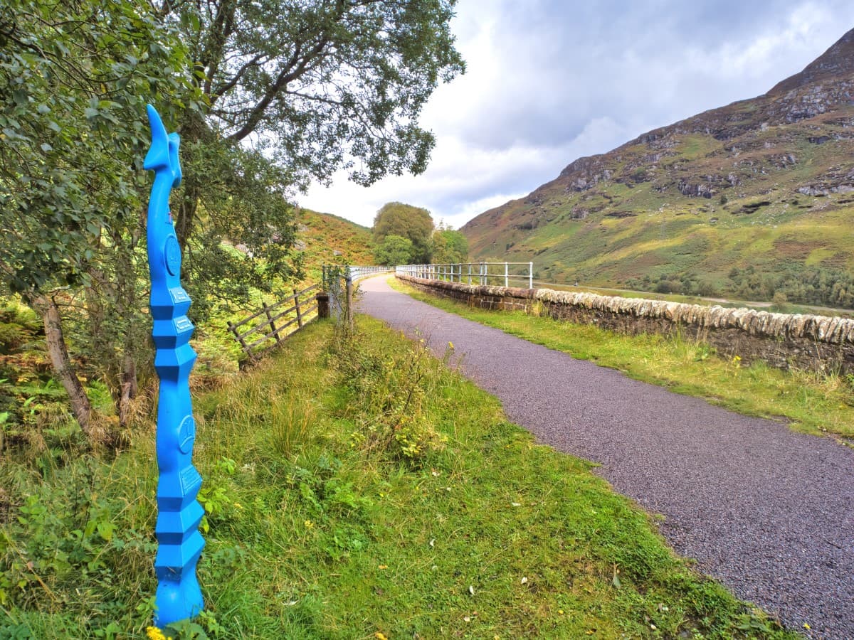
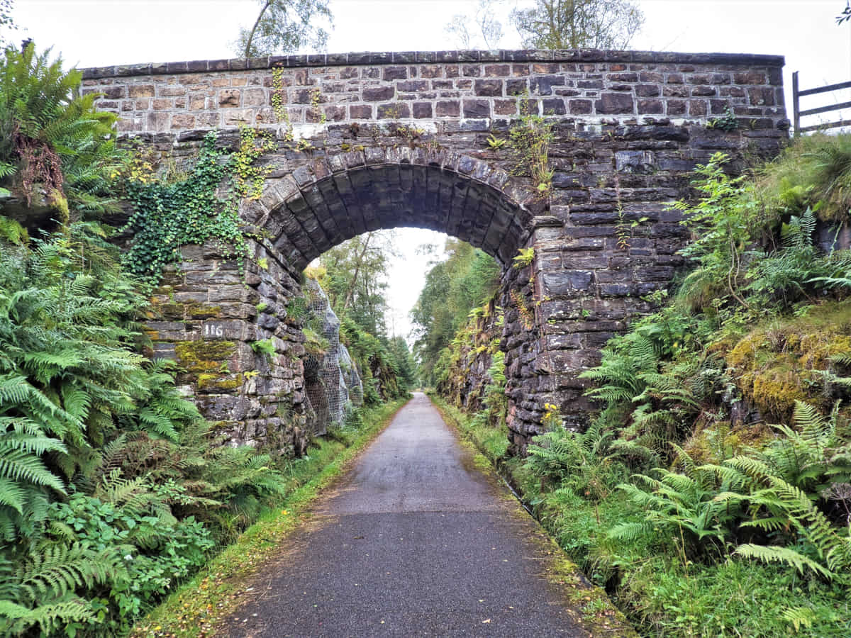
Follow the A84 south for a half-mile and then turn onto a single-track side road that winds its way uphill for another half mile. At this point, you’ll be on the Rob Roy Way/Sustrans Route 7 which heads through the glen.
One point to note about the start of the trail is that it heads upwards quite steeply in a zigzag so it’s hard going, but once you get to the top you’ll find the remainder of the route is level until you get to the commercial forest at the opposite end of the glen.
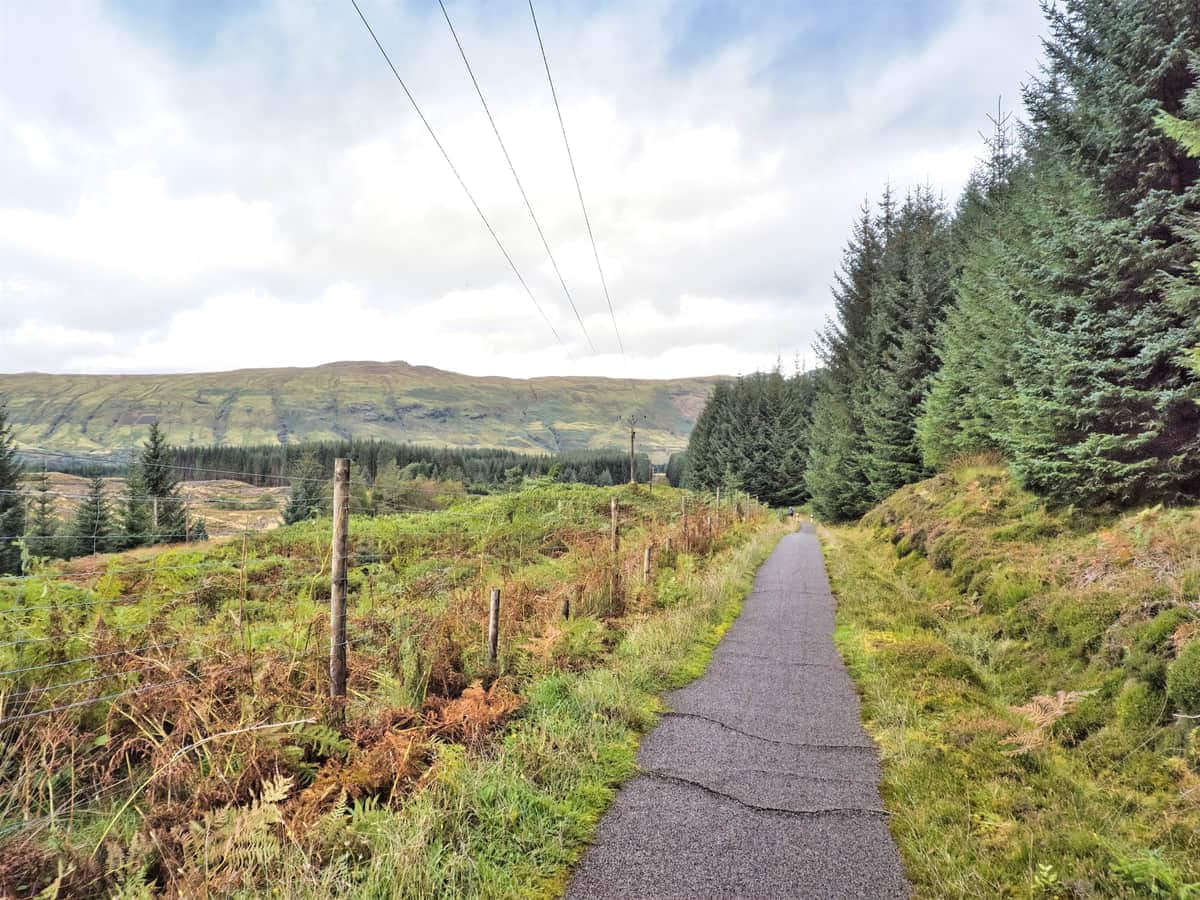
The Glen Ogle walk follows an old railway line that’s predominantly gravel and grass but has several sections of tarmac so it’s ideal for cycling along, hence its inclusion in the Sustrans network. Route 7 is one of the longest off-road cycling routes in Britain with 547 miles (ca. 880 km) of sumptuous scenery between Sunderland and Inverness, and this section at Glen Ogle is one of the highlights.
If you’re not familiar with Sustrans I recommend taking a look at the Sustrans website which has all the information you need to plan a fabulous cycling holiday in Scotland, and also take a look at the OS Maps website which has detailed Sustrans routes that you can print out.
The Glen Ogle trail is also part of the Rob Roy Way which is a long-distance walk that starts in Drymen and finishes in Pitlochry on a 79-mile (ca. 127 km) route that takes in Scotland’s finest lochs, glens, and forests. Many places on the trail have links to the famous Scottish outlaw Rob Roy MacGregor, so if you’d like to experience a little history while seeing some of the best sights Scotland has to offer you might consider walking the Rob Roy Way.
Back to Glen Ogle. From the start of the trail at the top of Dunearn Heights in Lochearnhead you’ll find the surface is well-maintained and wide enough for cyclists to pass each other with ease.
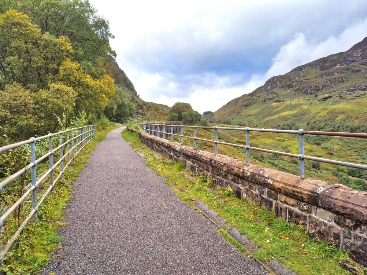
It’s also almost completely straight, which is the biggest clue that it used to be a railway. There’s a bit of a negative to bear in mind though, which is that trees line the route almost completely so much of the view of Glen Ogle is obscured, at least until you reach the viaduct 2 miles (3.22 km) further on.
The viaduct was built in 1869 and was used extensively until the mid-1960s when a major rockfall caused it to be closed permanently. It’s at this point where you’ll be able to take in the stunning views of Glen Ogle and if you take care it’s even possible to get underneath to walk under the 12 giant arches.
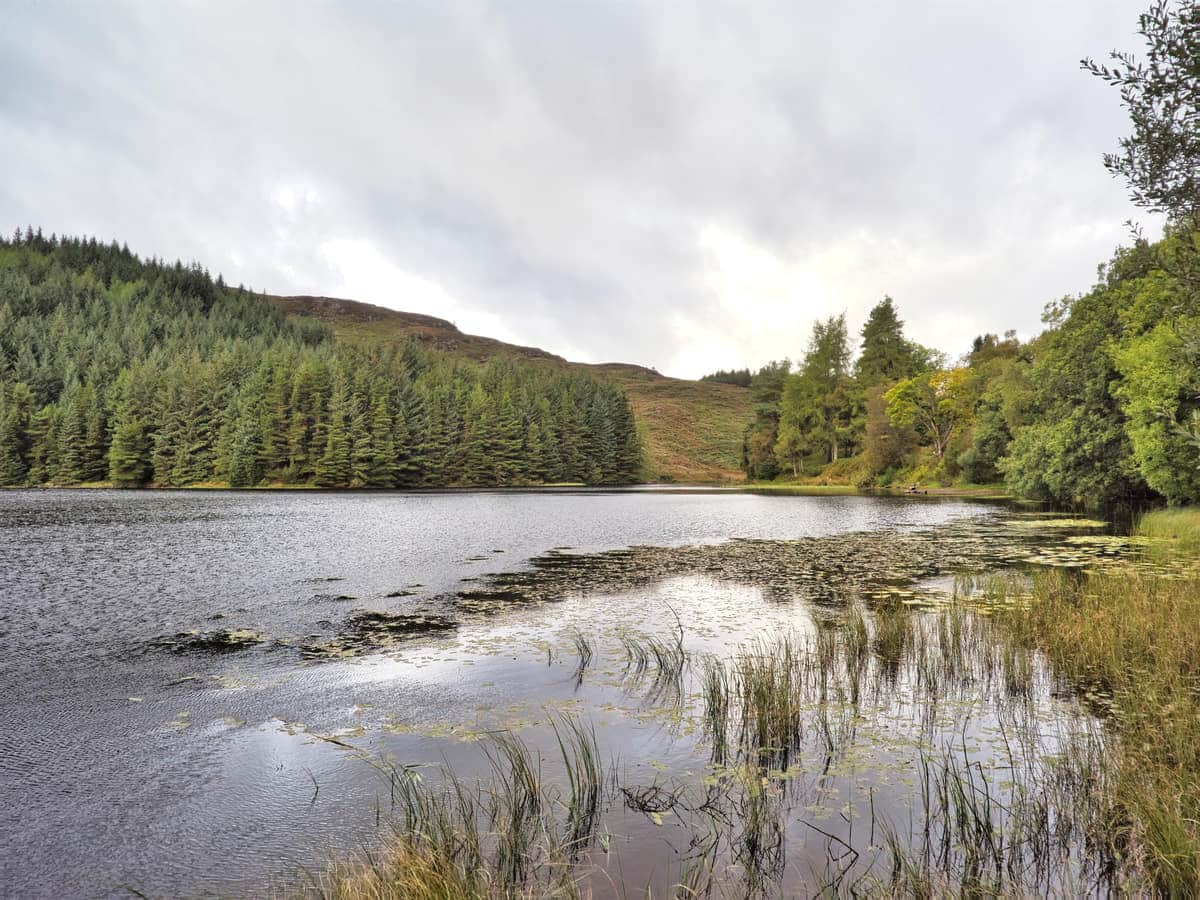
From the viaduct, the trail continues on to the head of Glen Ogle where it passes through managed woodland with Lochan Larig Cheile nestled amongst the trees. The lochan is another very pretty feature of the route but there aren’t many accessible places to get to it apart from the lorry-turning layby next to the A85.
After admiring the body of water you have two options as that’s basically the end of Glen Ogle. You can either return the way you came for a nice two-hour, seven-mile walk, or you can continue towards Killin for a five-hour, 15-mile walk.
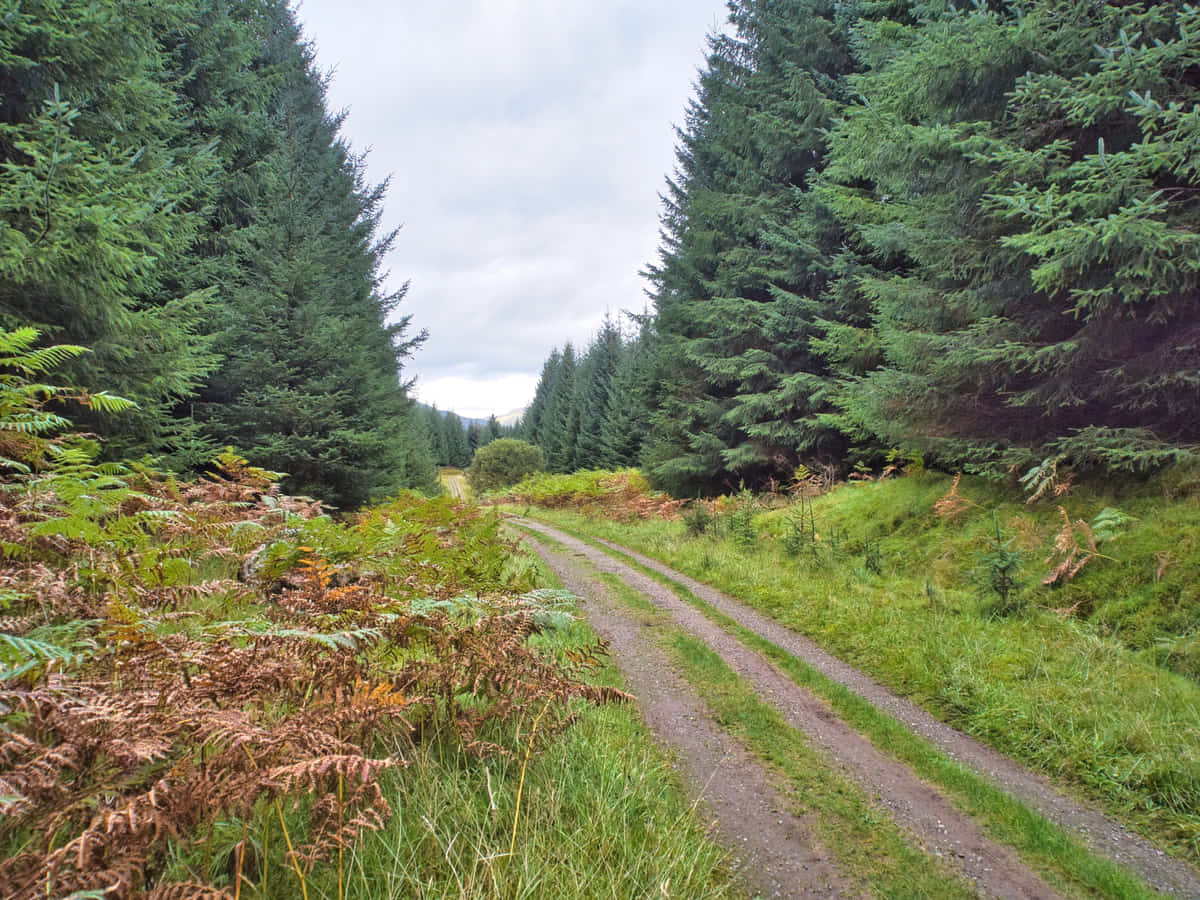
If you have time I recommend pushing on to Killin as the trail winds its way through dense forest before opening up onto spectacular views of Glen Dochart. The downside is that the section that goes through the forest is used by commercial logging lorries so if it has been raining the path quickly turns into a muddy quagmire.
Still, if you can cope with muddy feet, it won’t be long before you find yourself in Killin, which is a quaint wee village situated on the Falls of Dochart. These falls are nothing short of spectacular after a rainfall, as the crashing white waters cascade around the islands of Inchbuie, which are the traditional burial grounds of Clan Macnab.
There are a number of places to get onto the rocks to see the falls up close and I have to say it’s quite exciting when the river is in full flow, but if you’d rather see the River Dochart without having to clamber over rocks there are good views from the nearby Bridge of Dochart.
One final point to note when returning to Glen Ogle is that there’s a very slight downhill incline for the majority of the way so it’s considerably easier and faster to get from Killin to Lochearnhead than vice versa if you’re on a bike.
Things to Do
Hiking the Glen Ogle Rail Trail: This historic disused railway offers breathtaking views of Glen Ogle and features a tarmacked path that’s well-maintained and suitable for all abilities. The majority of the trail is level although there’s a steep incline at the Lochearnhead end.
Mountain Biking: Glen Ogle provides excellent mountain biking trails for adventure-seeking cyclists. The terrain varies from gentle slopes to challenging rocky paths, all surrounded by the spectacular scenery of the Scottish Highlands.
Bird Watching: The area around Glen Ogle is a haven for bird watchers. Numerous species such as golden eagles, red kites, and peregrine falcons call it home, so if you love wildlife then take your binoculars (link to binocular reviews) and enjoy an afternoon watching the skies.
Historical Exploration: See the Glen Ogle Viaduct, a historic 19th-century masonry viaduct that is now part of the Sustrans National Cycle Route #7. The viaduct is a testament to Scotland’s engineering prowess during the Victorian era.
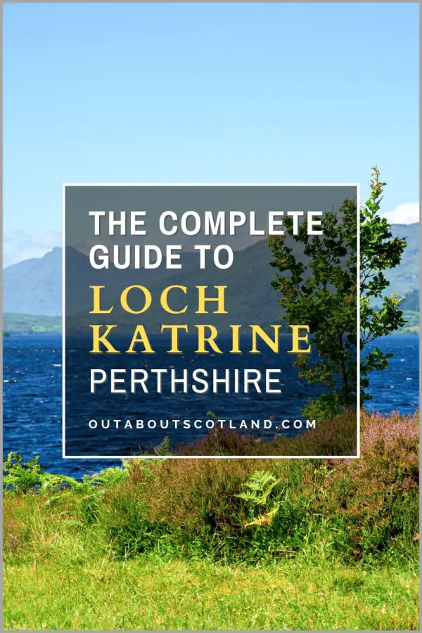
Fishing: Loch Earn is a good location for fishing. The loch is teeming with a variety of fish species like brown trout and char, but a permit must be obtained before venturing onto the water.
Things to Do Nearby
From Glen Ogle viaduct:
Falls of Dochart, A827, Killin, FK21 8XE. 8-minute drive.
The Falls of Dochart are located in the quaint village of Killin, where the River Dochart thunders over rocks that create fast-flowing white water rapids, especially after a rainfall. The surrounding area is rich in history, which visitors can learn about at the nearby Breadalbane Folklore Centre.
Ben Lawers Dam. Aberfeldy, FK21 8TX. 24-minute drive.
Ben Lawers Dam offers hill walkers stunning views of Ben Lawers Mountain and the surrounding landscape. There is a car park 1 mile (1.61 km) to the south, which is accessed via a spur road from the A827.
Loch Earn. Lochearnhead, Perthshire, FK19 8PN. 5-minute drive.
A freshwater loch in Perthshire is situated 10 miles (ca. 16 km) west of Crieff. The hills that surround Loch Earn and the numerous mountains nearby, including Ben Vorlich, Ben More, and Ben Lawers, make it a great place for walkers, climbers, and lovers of water sports.
Colin Burt Wildlife Reserve. A85, Killin, FK21 8RH. 7-minute drive.
A 50-acre nature reserve that comprises various habitats designed to encourage wildlife. The reserve includes woodland, wetland, meadows, and rivers, as well as the remains of a Stone Age roundhouse. Colin Burt Wildlife Reserve is open to the public but is partially sectioned off for wildlife protection. Visit the Colin Burt Reserve website for further information.
Finlarig Castle. Killin, FK21 8TU. 12-minute drive.
An ancient castle set inside a small woodland located within walking distance of the Falls of Dochart. A footpath joins the ruined castle which leads onto the River Lochay and Loch Tay.
Frequently Asked Questions
Where is the Glen Ogle viaduct?
The Glen Ogle viaduct is located 2 miles north of the village of Lochearnhead in Perthshire.
The postcode of the viaduct is: FK21 8SZ. Lat/Long is 56.40743307995052, -4.3161122444975994.
Glen Ogle extends for 7 miles from Lochearnhead to Lix Toll which opens up onto Glen Dochart.
Where is the Rob Roy Way?
The Rob Roy Way is a 79-mile long-distance walking trail in the Southern Highlands. The trail starts in the village of Drymen and finishes in the town of Pitlochry. Part of the Rob Roy Way passes through Glen Ogle.
Can you park at Glen Ogle?
There is a small parking area at the Glen Ogle viewpoint on the A85 (postcode FK20 8QT, Lat/Long 56.41213594703095, -4.317188984289874).
Roadside parking places can be found in Lochearnhead (southern end) and Killin (northern end).
What visitor facilities are there at Glen Ogle?
There are no visitor facilities at Glen Ogle. The nearest facilities are located at Lochearnhead and Killin, both of which have a shop and a pub restaurant.
Can you walk around Loch Earn?
It is theoretically possible to walk around Loch Earn but it is not advisable. The road on the southern side is narrow and very quiet with little traffic so it’s perfectly possible to walk along it. The northern side, meanwhile, borders the A85 which is much busier, has two lanes, and virtually no roadside verges.