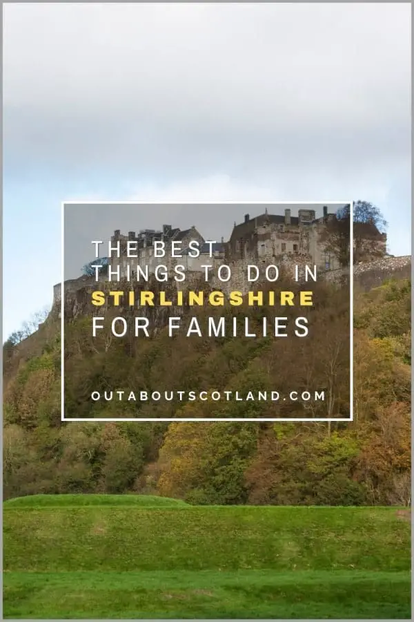
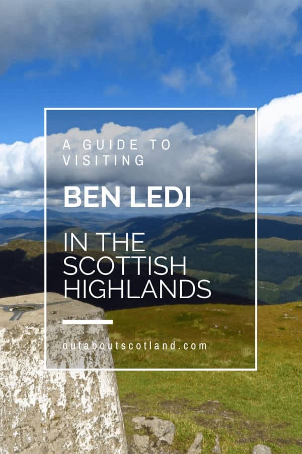
Ben Ledi
Ben Ledi is a 2,884-foot mountain in Stirlingshire that’s part of the Trossachs, a range of hills in the Scottish Highlands. It’s situated in Loch Lomond and the Trossachs National Park, which is renowned for its picturesque landscapes and is a popular destination for outdoor enthusiasts, including hikers, climbers, and nature lovers.
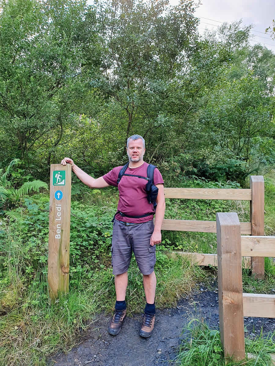
The most common route to the summit starts at the car park near Loch Lubnaig, just north of the small village of Callander. The path is well-trodden, but it can be quite busy during the summer months.
🠇 Head to the bottom of the page for essential details on each attraction featured here, including addresses, opening hours, and entry prices 🠇
Ben Ledi
Ben Ledi is a captivating mountain in the Trossachs region of Scotland. Peaking at 879 metres, it’s classified as a Corbett, and its name originates from Gaelic, meaning ‘Mountain of God’. The ascent is a popular trek among outdoor enthusiasts as it offers panoramic views of Loch Lubnaig and the surrounding landscape.
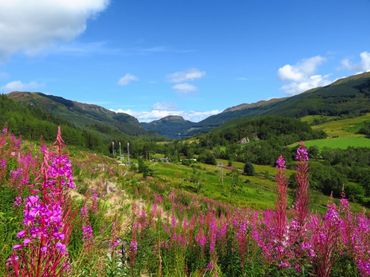
If you’re looking for a nice, easy walk into the spectacular Trossachs National Park on the southern borders of the Highlands, the meandering path that winds its way up Ben Ledi should be your first port of call. There are two main entry points into the national park if you visit from the south, which are the A82 from Glasgow and the A84 from Stirling, but it’s the latter that will take you to the foot of Ben Ledi.
Keep a watchful eye on the road signs once you pass the village of Kilmahog, as it’s just a wee bit further on where you’ll see the signpost for ‘Strathyre Log Cabins’. As soon as you see the sign, you’ll have to take an abrupt turn onto a narrow bridge which leads towards the cabins on the right and a car park to the left. From the car park, you’ll see signs pointing to Ben Ledi along with an occasional glimpse of the summit through the pine forest that surrounds it.
The mountain (2,884 feet to the top) is classified as a Corbett, so it doesn’t have the prestige of climbing a Munro (a mountain over 3,000 feet), but it’s a very popular climb due to the long shoulder used to access the summit from the south. Much of the route is up a rather shallow incline, so don’t be surprised to set out and see mountain bikers, pensioners, and children along the way.
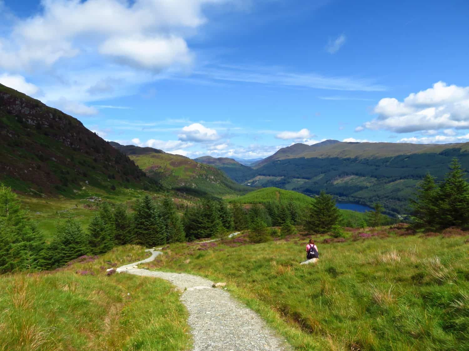
The northern slope of Ben Ledi is notable for a few features like Lochan nan Corp, or ‘the little loch of the dead’ where 200 people died in a tragic accident in the 1900s, but in my opinion, the semi-circular valley near the bottom of the northern side is the star of the show.
It’s at this point where you’ll find a gently babbling burn running off the lower slopes, with swathes of purple heather and yellow gorse covering the landscape in all directions. Coupled with the occasional call of buzzards on the hunt and a lack of tourists, it’s an oasis of nature that pretty much sums up Scotland’s great outdoors.
If you can drag yourself away, you’ll find the well-maintained path will take you back to the starting point at the Ben Ledi car park in around an hour and a half for a complete circuit that should take around five to six hours in total.
The Highlights
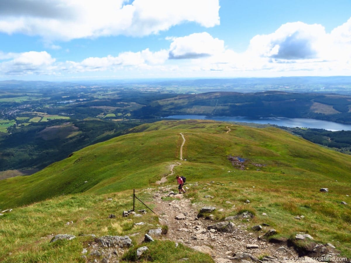
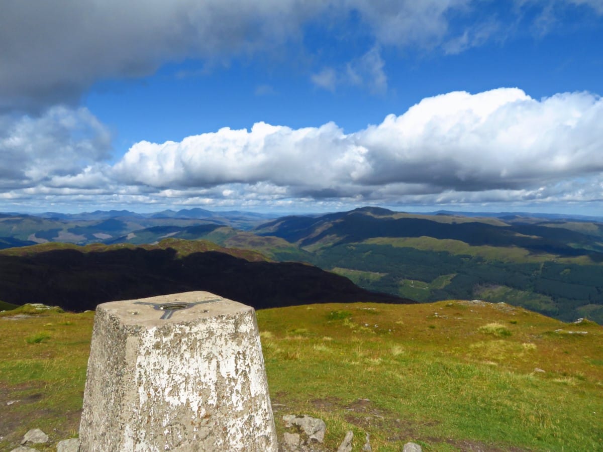
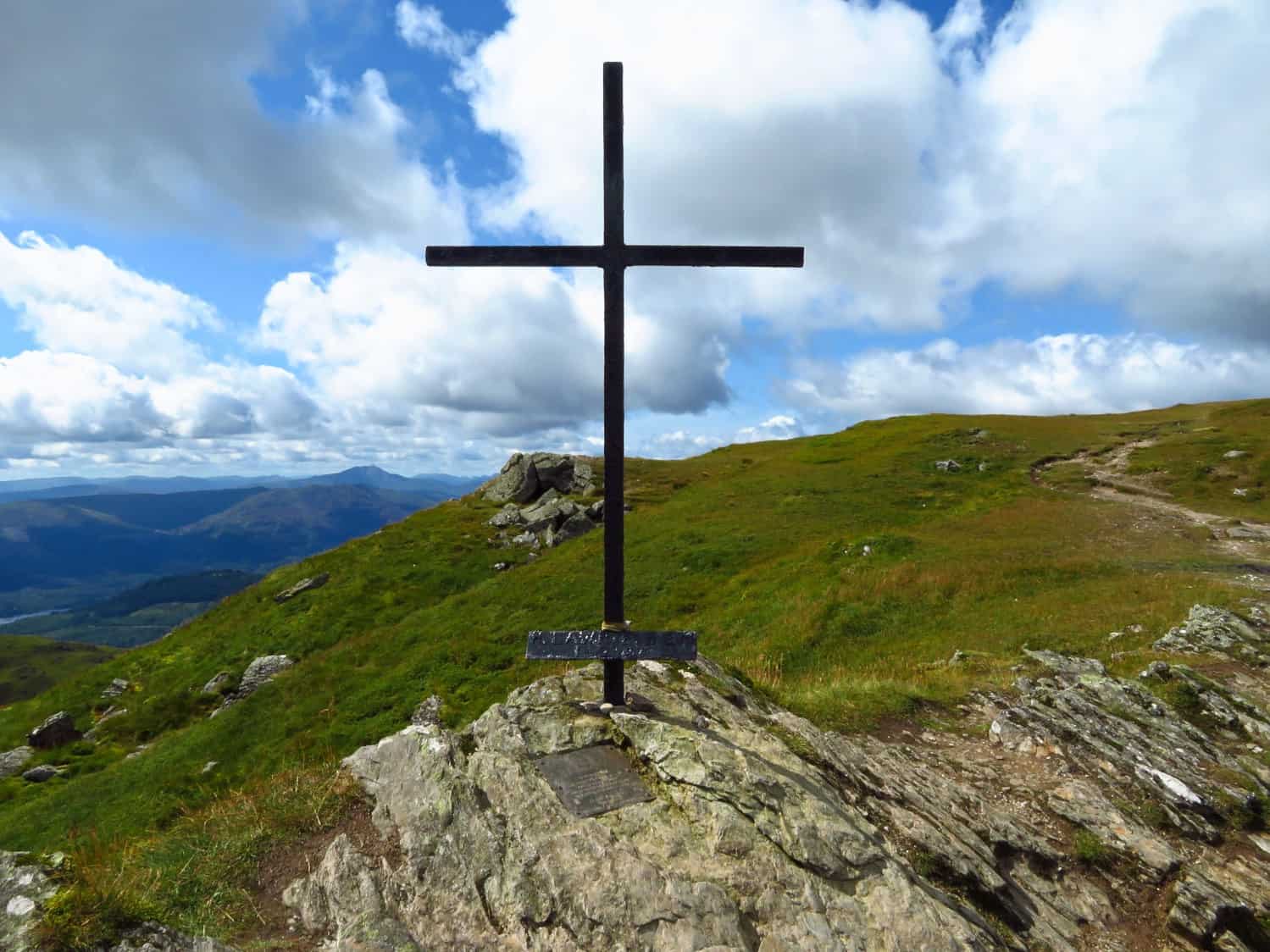
1: From the summit of Ben Ledi, climbers are rewarded with sweeping views of the surrounding area. On a clear day, you can see across to the Arrochar Alps, the mountains of Glen Coe, Ben Lomond to the west, and the length of Loch Lubnaig below.
2: The mountain is part of the Ben Ledi Special Area of Conservation. The lower slopes are covered in broadleaf and conifer woodlands, and as you ascend, you’ll find heath and bog habitats that are home to a variety of wildlife.
3: Ben Ledi offers a rewarding experience for those looking to explore Scotland’s natural beauty and is an excellent challenge for hikers seeking to immerse themselves in the stunning landscapes of the Trossachs.
Visiting Tips
1: Get there early or you’ll never find a space to park the car (in the summer anyway). The road leading into Strathyre cabins is unsuitable to park on, but there are a few parking spaces at the opposite end of the road to the north that you might be able to use. The maximum capacity is about ten cars.
2: Strathyre Cabins has a nice wee café if you’re after a snack and a hot cuppa after your hike, but if you can hold on a bit longer, you’ll find Callander offers a much wider selection of places to eat. The ever-popular Mhor Bread in the high street sells delicious fresh bread and cakes.
3: As with any mountain adventure in Scotland, it’s important to respect the weather conditions and be prepared for them to change rapidly. Even if the day starts sunny and calm, it’s wise to carry waterproof clothing, extra layers, and navigational equipment like a map and compass.
Tourist Information
If you intend on just sticking to the south slope of Ben Ledi, you could probably finish the route up and down in around four hours. Bear in mind, though, that these are summer times, and once winter hits, it will no doubt take longer.
While the path is rocky for the bottom two-thirds, the top gets very muddy and slippery after a rainfall, so it shouldn’t be attempted if you’re inexperienced in mountain hiking. As always, whatever the weather, pack a spare warm jacket, a few snacks, and bottles of water, and make sure your phone has plenty of power before you set off.
There’s not much that can be said about the path up Ben Ledi other than that it offers a great walk with amazing views. As I already mentioned, the path is well-maintained and quite easy from the south side, and as it’s so popular, you’ll almost certainly have someone around to follow.
The entire route up the south side, down the north, and back around to the car park is around six miles in total, and the majority of the path is comprised of a light-coloured stone that clearly stands out amongst the greens and browns of the mountainside.
The first third of the ascent is mostly meadows with a few copses of trees, which get grassier the further you climb, and while there are a couple of false summits, the ascent is mostly straightforward. Once you get around two-thirds of the way up the mountain, you can look south to see the Wallace Monument and Stirling Castle, with the Firth of Forth just about visible in the distance.
From the summit of Ben Ledi, climbers are rewarded with sweeping views of the surrounding area. On a clear day, you can see across to the Arrochar Alps, the mountains of Glen Coe, Ben Lomond to the west, and the length of Loch Lubnaig below.
Things to Do
Mountain Hiking: Ben Ledi, standing at 2,880 feet (879 metres) high, is an inviting peak for any avid hiker. The well-marked paths through open moorland offer breathtaking views of the Trossachs and beyond, and there are lots of places to have a picnic while you take in the beautiful scenery.
Wildlife Spotting: Ben Ledi is home to a diverse range of flora and fauna. Take your binoculars (link to binocular reviews) and keep your eyes open for red deer, golden eagles, and elusive red squirrels. During spring and summer, you’ll be able to breathe in the scent of swathes of wildflowers that pepper the hillside.
Photography: With its stunning landscapes, Ben Ledi is a fantastic place to practice your photography skills. Try to get there during the magical golden hour to capture the best shots.
Cycling: Ben Ledi’s surrounding landscapes provide excellent cycling routes. Whether you prefer on-road or off-road biking, the variety of trails will keep you challenged and entertained for hours on end. A highly recommended route is Sustrans #7, which runs along Loch Lubnaig at the foot of Ben Ledi.
Explore the Area: Close to Ben Ledi is the village of Kilmahog, which is home to the Trossachs Woollen Mill, and nearby you’ll find the Falls of Leny (an impressive waterfall) and the picturesque Leny Woodlands.
Things to Do Nearby
The Bracklinn Falls. Bracklin Rd., FK17, Callander, FK17, 8EQ. 10-minute drive from the Ben Ledi car park.
A lovely woodland walk that extends throughout the area to the north of Callander. This local beauty spot is very popular due to the Bracklinn Falls bridge, which has superb views of the thundering Allt a’ Choire Bhric river.
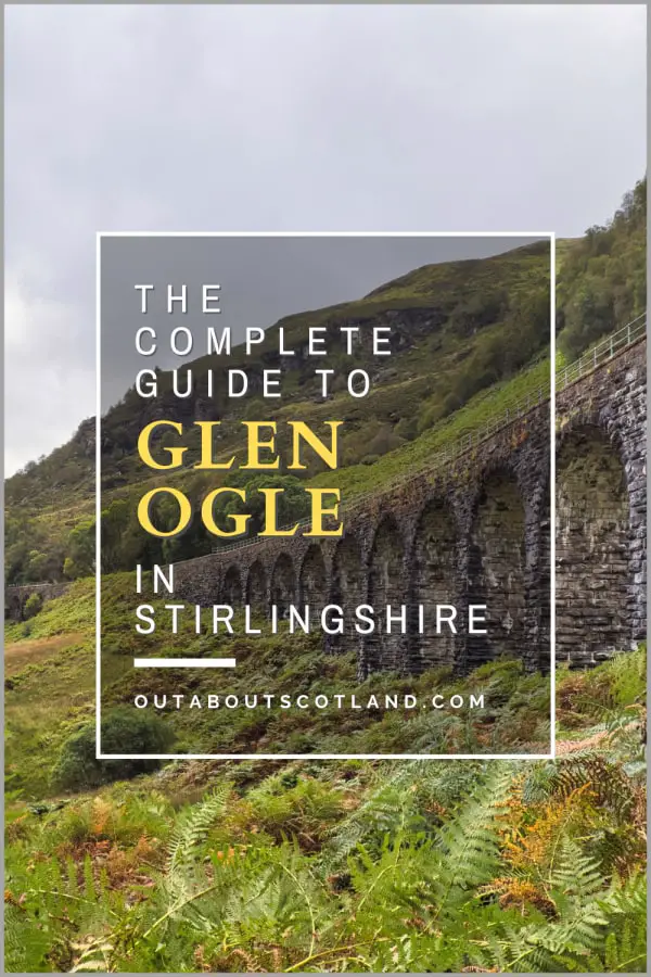
Glen Ogle. Lochearnhead, FK19 8PX, 19-minute drive.
A scenic glen with a walking and cycling trail that cuts through it from Loch Earn to Lochan Larig Cheile. Glen Ogle is famous for its 12-arched stone viaduct that can be seen from the A85, which was part of a well-used railway line from 1870 until the 1960s.
Loch Lubnaig. 12-minute walk from the Ben Ledi car park.
A 574-acre loch that is extremely popular with kayakers and water sports enthusiasts. There are car parks on either side of the loch with small cafés and picnic areas. The western side of the loch has an easy-access path that runs alongside it for its entire length.
Falls of Leny. A84, Callander FK17 8HD. 14-minute walk from the Ben Ledi car park.
A waterfall on Garbh Uisge that’s a favourite stopping-off point with walkers thanks to the footpath that follows the river from Callander to the Ben Ledi car park.
Callander. Stirling FK17 8BA. 7-minute drive from the Ben Ledi car park.
A Highland village that offers a selection of traditional shops and pubs as well as a selection of cafés and restaurants. Several walking trails start and finish at Callander, mostly centred around the River Teith.
Glen Finglas. Brig o’Turk, Callander FK17 8 hours, a 12-minute drive from the Ben Ledi car park.
A woodland that is the largest in the care of Scotland’s Woodland Trust. Glen Finglas is home to mountains, rivers, hills, and glens. There are lots of walking trails, and the woodland is regarded as one of the country’s top wildlife-spotting areas.
Frequently Asked Questions
How long does it take to climb Ben Ledi?
From Strathyre Forest Cabins at the foot of the mountain, the return route to the summit of Ben Ledi takes 4-6 hours. The route is 6 miles in length and has an ascent of 2,490 feet.
How hard is it to climb Ben Ledi?
Ben Ledi is widely regarded as one of the easiest mountains to climb in Scotland. The route up the eastern side is long, which makes the incline relatively shallow. The route down the western side of Ben Ledi is much steeper.
Where do you park to climb Ben Ledi?
There is a car park off the A84 between Kilmahog and the southern end of Loch Lubnaig, near the signposted Strathyre Forest Cabins. Postcode: FK17 8HF.
What visitor facilities are there at Ben Ledi?
There are no visitor facilities on Ben Ledi, though there is a campsite at the foot of the mountain on the eastern side, which has a small shop, toilets, and a café.
Is Ben Ledi a Munro?
Ben Ledi in the Trossachs is not a Munro and is instead classified as a Corbett. Corbetts are Scottish mountains that are between 2,500 and 3,000 feet (762 and 914.4 metres) in height. There are currently 222 peaks on the official Corbett list. Ben Ledi stands at 879m (2884ft) and is situated in Loch Lomond and the Trossachs National Park.