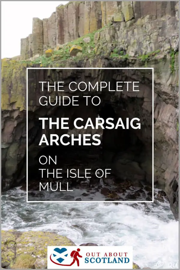
The Carsaig Arches are located on the south side of the Isle of Mull. From Carsaig Pier, it takes around 6 hours to walk the 8-mile return route, which is very difficult due to the boulder-strewn coastline.
Walking to the arches is worth every bit of the effort involved, though, not only for the scenic views of Islay and Jura but also for the wildlife that can be seen in this remote part of the island.
Overview
Carsaig, located on the Isle of Mull, is renowned for its striking geological features, most notably the Carsaig Arches. The arches are sea caves that the ruthless forces of nature carved out, and they offer adventurous walkers a breathtaking sight. A walk there offers a blend of beautiful landscapes, wildlife sightings, and a dramatic slice of Mull’s geology.
The walk from Carsaig Pier to the Carsaig Arches has to be one of the highlights of any trip to the Isle of Mull, and although it’s a very difficult walk, you’ll be rewarded with some of the best views on the island and you’ll see lots of wildlife along the way.
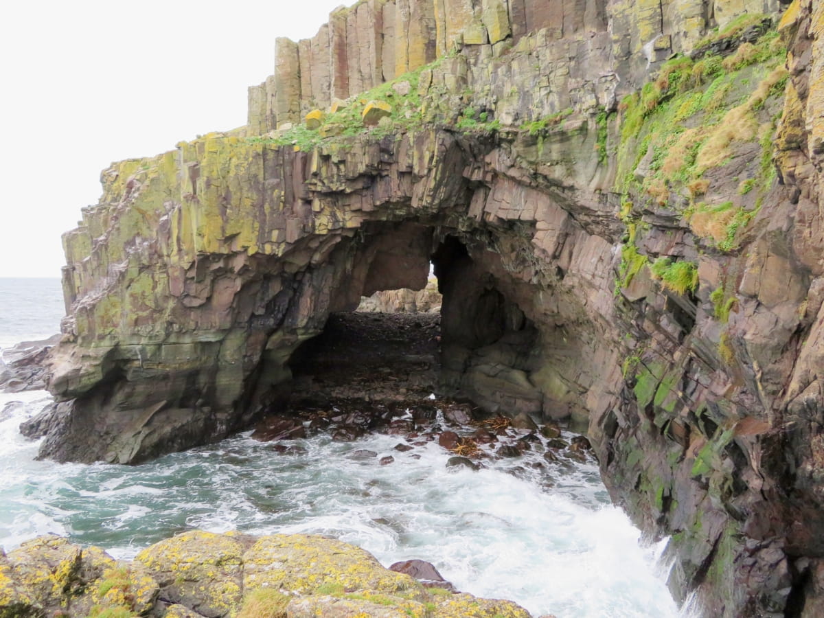
The arches are caves that have been carved into the cliffs by the relentless power of the sea and it’s possible to walk through them onto what has to be the remotest beach on the island, but getting there is quite a difficult scramble.
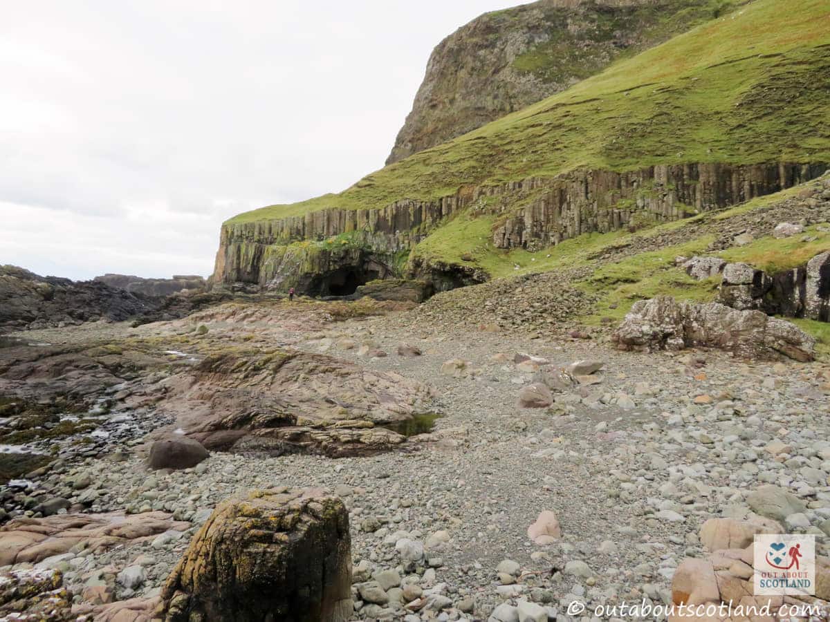
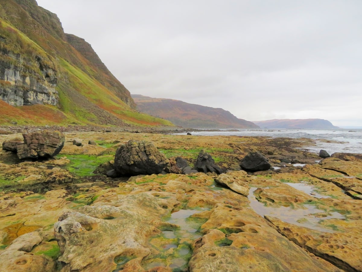
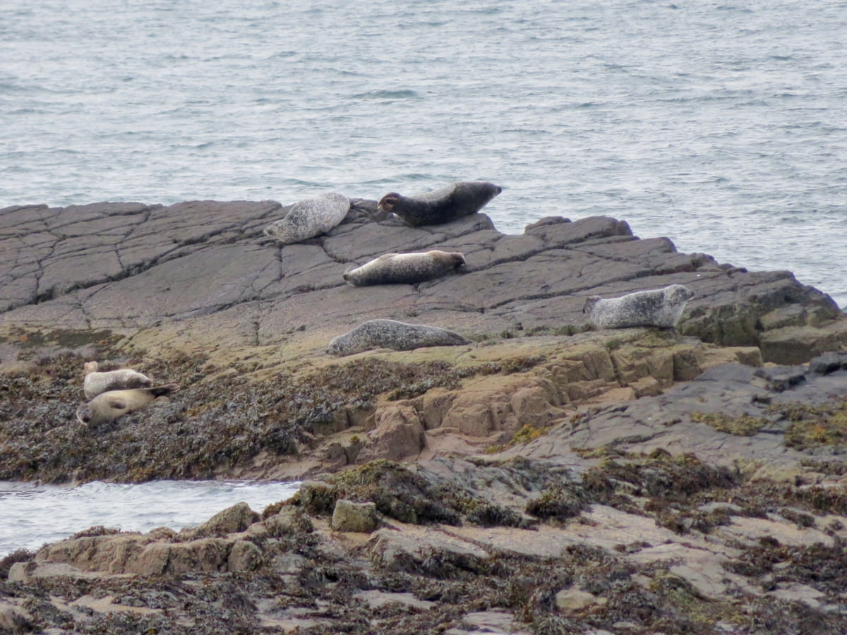
The route starts at Carsaig Pier which is worth visiting in itself because there are often colonies of seals soaking up the sun on the exposed rocks jutting out of Carsaig Bay. After waving goodbye to the seals, you’ll walk along rocky beaches and boggy grassland while following a boulder-strewn goat track, in-between scurrying across waterfalls and traversing narrow clifftop paths.
The views are fantastic though, with the islands of Jura and Islay providing a backdrop to a landscape that has dramatic cliffs towering on one side and the roaring ocean pounding on the other.
It’s a wonder that so much wildlife chooses to live there, but this part of Mull is a haven for animals and there’s no doubt that at some point during your walk you’ll encounter wild goats, red deer, seals, and a variety of sea birds.
There’s no getting around the fact that this walk is tough. And I mean really tough. Not because it’s particularly steep, but because the majority of it involves a clamber over boulders and rocky landslides, so although the return walk is only around 8 miles, you’re going to need to set aside at least 6 hours to complete it.
Book Tours in Scotland
The Highlights
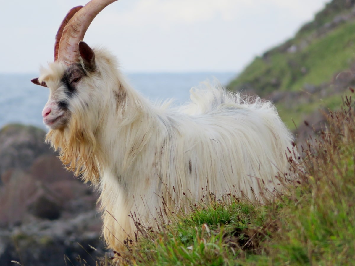
1: There’s so much wildlife to see along this stretch of Mull’s coastline, yet it’s one of the least-visited parts of the island. Who’d have thought there would be wild goats living on the beach?
2: The views are amazing at every point, from Carsaig Bay all the way to the Carsaig Arches.
3: The pier near the car park is a great spot to watch seals basking on the rocks in the bay.
Visiting Tips
1: Be aware the walk to Carsaig Arches is very hard work due to the number of loose boulders on the path. Walkers should wear waterproof hiking boots with good grips and ankle supports. To view a selection of top-rated boots read this article: The Best Waterproof Hiking Boots.
2: The route to the second arch is reached via a dangerous path that follows the top of the cliff face. Personally, I wouldn’t attempt to climb it.
3: If you want to discover more walks on Mull, get yourself an OS map. Buy OS Landranger maps direct from Ordnance Survey.
Protect Your Family From Scotland's Biting Midges
- Powerful, reliable protection for up to 8 hours
- Water- and sweat resistant
- Repels midges, mosquitoes, horse flies, sand flies, fleas and ticks
- Safe for use on adults, children over 30 months and pregnant women
- Non-sticky, moisturising with a pleasant fragrance
- Packaging may vary
Tourist Information
Before you begin the journey, decide if you’re actually fit enough to do it. It’s not easy, and I’d suggest you definitely don’t attempt it if you’re on your own or if you have a fear of heights.
That being said, if you’re committed to reaching the arches, you’ll need to drive towards Pennyghael on the A849 and follow the signs to Carsaig. The road to the pier is single-track and very steep, so take your time, but once at the bottom you’ll find yourself in a small car park where you can leave the car before heading to the pier.
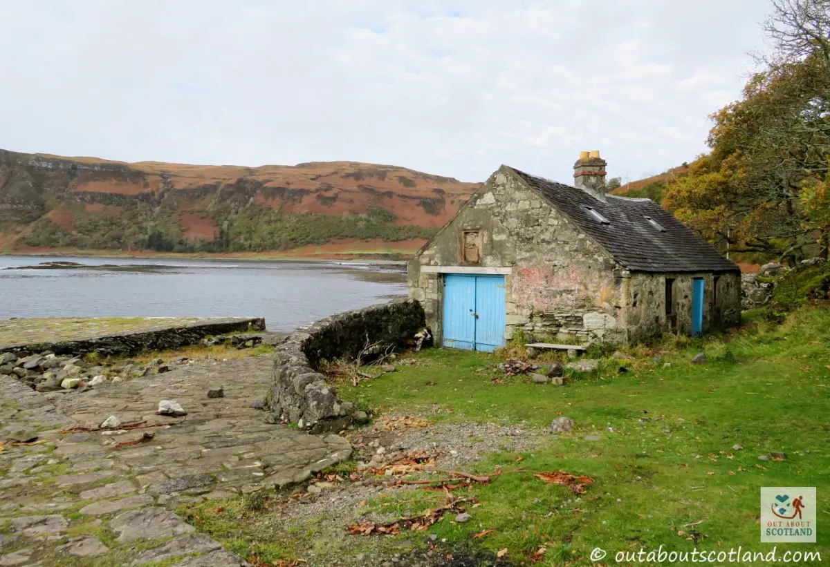
This small stone fisherman’s pier is a wonderful place to enjoy the bay, not just for the views but also for the seal colonies on the nearby rocks. From the pier, take the track that runs along the top of the stony beach heading west, and follow it until you reach an expanse of grass.
Take care once you reach this point because it gets extremely muddy, although thankfully there are a few wooden boards laid out that cross the worst of the bogs, but even so, you’re going to want to wear boots for this walk. Trainers and Crocs are going to get destroyed…
Ahead lies a stone wall and a kissing gate, and after passing through them you’ll simply follow the coastal trail until you reach the Carsaig Arches. There are a couple of points of interest to be aware of along the way, though.
The first is the Nun’s Cave, a partially hidden sandstone cave that nuns used to flee from Iona Abbey during the Reformation. If you want to explore the cave, you can take a short detour off the track to look inside it, where you’ll see religious symbols carved into the walls which are believed to be over 1,400 years old.
The second point of interest is a cascading waterfall about an hour’s walk after the Nun’s Cave. It also happens to be a favourite place for foraging deer, so don’t be surprised if a head suddenly pops up from behind the rocks. The shingle beaches at this point of the walk are also a favourite spot for herds of wild goats, and if you keep an eye on the water’s edge, there’s a good chance you’ll see otters as well.
When you finally get to the first arch you might initially think it’s the end point of the walk, but it is, in fact, possible to climb around the cliffs to see the second arch, which is otherwise hidden away.
To get there, follow the narrow path that runs up the cliff face before the first arch and descend down the other side onto a small beach at the foot of the cliffs. But take extreme care. The rocks are slippery and the cliffs are high and steep, so any fall could cause serious injury.
Whatever you decide to do once you reach the arches, make sure you have enough daylight to make the return journey to the car park, which will take at least 3 hours at a reasonable pace.
Things to Do
Exploring the Carsaig Arches: Located on the Southern coast of the Isle of Mull, the Carsaig Arches are a must-see natural wonder. Trek along the coast and take in the breathtaking views of the sea before reaching the stone arches – but be aware the route is boulder-strewn and can be difficult to navigate.
Wildlife Watching: The Carsaig area is abundant with wildlife. Keep your eyes peeled for sightings of seals basking on the rocks below or eagles soaring in the sky above. The area is also home to a variety of seabirds, making it a birdwatcher’s paradise. If you don’t have binoculars, take a look at these reviews.
Photography: The Carsaig Arches provide a unique backdrop for photographers. The dramatic sea cliffs, the roaring ocean, and the enchanting wildlife are just a few of the subjects you can capture. Whether you’re a professional or an amateur, make sure to take your camera to this truly picturesque location.
Historical Exploration: Visit the nearby Carsaig Pier, a historic site with a small building that once served as a waiting room for the ferry to Jura. It’s a perfect spot to view the scenery of the area and it’s also one of the best spots on the island for watching seals.
Geology Tour: The Isle of Mull is known for its geological wonders. Take a guided tour to learn about the volcanic activity that shaped the island. The Carsaig area, in particular, offers a fascinating look at basalt columns and fossil trees, providing a unique learning experience for visitors of all ages.
Book Tours in Scotland
Things to Do Nearby
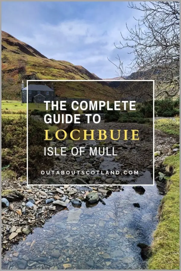
Lochbuie. Isle of Mull, PA62 6AA. 5.7-mile coastal walk.
Lochbuie is a settlement at the head of Loch Buie. There are a number of attractions that can be visited during a walk along the coastline including St. Kilda Chruch, the Lochbuie standing stones, Laggan Sands beach, and the Maclain mausoleum.
Uisken Beach. Uisken, Isle of Mull PA67 6DT. 33-minute drive.
An easily accessible beach on Mull’s south coast. There is a small parking area close to the seafront. The bay is shallow and protected from the sea by small islands to the south.
Ross of Mull Historical Centre. Millbrae Cottage, Bunessan, Isle of Mull PA67 6DG. 26-minute drive.
A privately run museum and archive that serves to keep the Isle of Mull’s heritage alive for future generations. The small museum features displays and information about the people of Mull as well as the island’s geology and wildlife.
Loch Beg Bridge. Crossroads, Pennyghael, Isle of Mull PA70 6HG. 16-minute drive.
A popular location for walks into the wilds surrounding Loch Beg. There is a small car park near the bridge and single-track roads and rough paths extend around the sea loch to the north and south.
Fionnphort. Fionnphort PA66 6BL. 35-minute drive.
A small village on the southwest of Mull that serves as the gateway to the Isle of Iona. Regular ferries allow access to Iona and the abbey but Fionnphort is also worth visiting for the sandy bay to the north and the cliff-top walks to the north and south.
Frequently Asked Questions
How do you get to the Carsaig Arches on Mull?
Address: Carsaig Bay, Isle of Mull, PA70 6HD.
Drive towards Carsaig Bay. The drive from Craignure to Carsaig Bay takes about an hour. You’ll need to head towards Pennyghael on the A849. From Pennyghael, there’s a narrow, single-track road leading to Carsaig Bay where you’ll find a small parking area. You can then follow the coastline west to get to the arches.
What is the Isle of Mull famous for?
The Isle of Mull, located off the west coast of Scotland, is renowned for several reasons.
Wildlife: The Isle of Mull is considered one of the best places in the UK for wildlife spotting. It’s home to a variety of birds, including golden eagles and sea eagles, and its coastline is a prime spot for seeing otters, seals, dolphins, whales, and basking sharks.
Scenic Beauty: The island is famous for its breathtaking landscapes which include rugged mountains, and stunning coastlines. The island’s highest peak, Ben More, offers panoramic views of the surrounding area.
Castles: The Isle of Mull is home to several historic castles, including Duart Castle and Moy Castle.
Colourful Towns: The island’s main town, Tobermory, is known for its brightly coloured waterfront buildings and is often recognized from the children’s television series ‘Balamory’.
Iona Abbey: Located on the neighbouring island of Iona, which is easily accessible from Mull, the abbey is one of Scotland’s most important religious sites and is a popular tourist destination.
How do I get to the Isle of Mull?
The Isle of Mull, off the west coast of Scotland, is a well-loved tourist destination that is typically accessible by ferry from the mainland.
The most common route is from Oban to Craignure, a journey that takes about 50 minutes. CalMac Ferries operates this service multiple times a day. Other ferry routes include Lochaline to Fishnish and Kilchoan to Tobermory, but these are less frequent.
Is the Isle of Mull better than the Isle of Skye?
Determining whether the Isle of Mull is better than the Isle of Skye depends on what you’re looking for in your visit. Both islands offer their own unique attractions and experiences.
The Isle of Skye is the larger and more popular of the two, known for its dramatic landscapes including the Old Man of Storr, the Quiraing, and the Fairy Pools, but it can be quite busy, particularly during the summer months.
The Isle of Mull, on the other hand, is less crowded and offers its own natural beauty with attractions like the colourful town of Tobermory, Duart Castle, and the opportunity to see wildlife such as eagles, otters, and even whales. It’s also the gateway to the smaller, tranquil Isle of Iona.
Protect Your Family From Scotland's Biting Midges
- Powerful, reliable protection for up to 8 hours
- Water- and sweat resistant
- Repels midges, mosquitoes, horse flies, sand flies, fleas and ticks
- Safe for use on adults, children over 30 months and pregnant women
- Non-sticky, moisturising with a pleasant fragrance
- Packaging may vary


