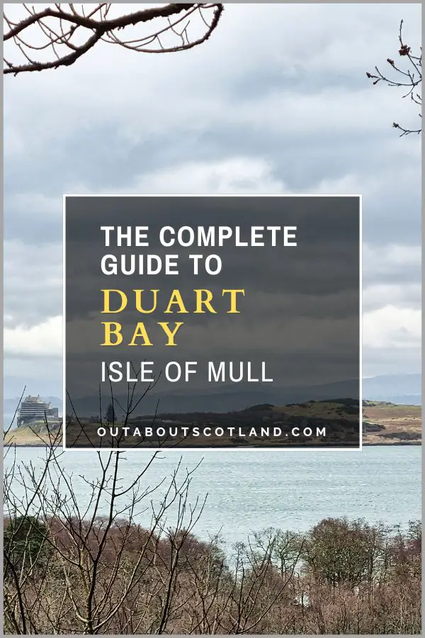
Lochbuie, Mull
The village of Lochbuie, nestled amidst the breathtaking landscape of the Isle of Mull, is a genuine hidden gem that offers visitors a taste of the island’s natural beauty far away from crowds of visiting tourists.
Lochbuie lies at the head of Loch Buie on the southern coast of Mull and is accessed via a single-track road that offers fabulous views of hill ranges to the north and Lochs Spelve and Uisg to the south.
Once at the village, you’ll discover an ancient castle and Neolithic standing stones, windswept beaches, and mile after mile of rugged coastline that’s begging to be explored, whether walking along the shoreline or kayaking around the coast.
🠇 Head to the bottom of the page for essential details on each attraction featured here, including addresses, opening hours, and entry prices 🠇
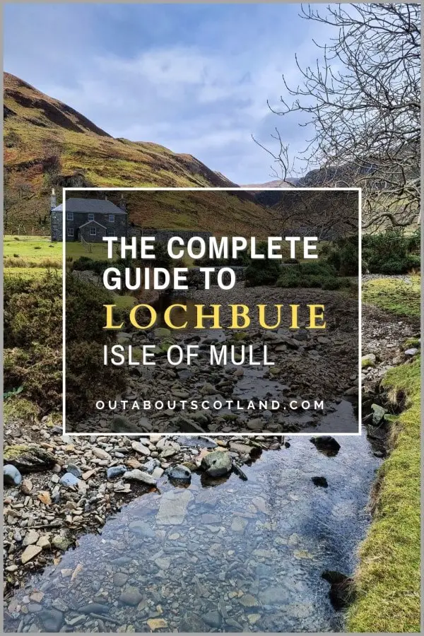
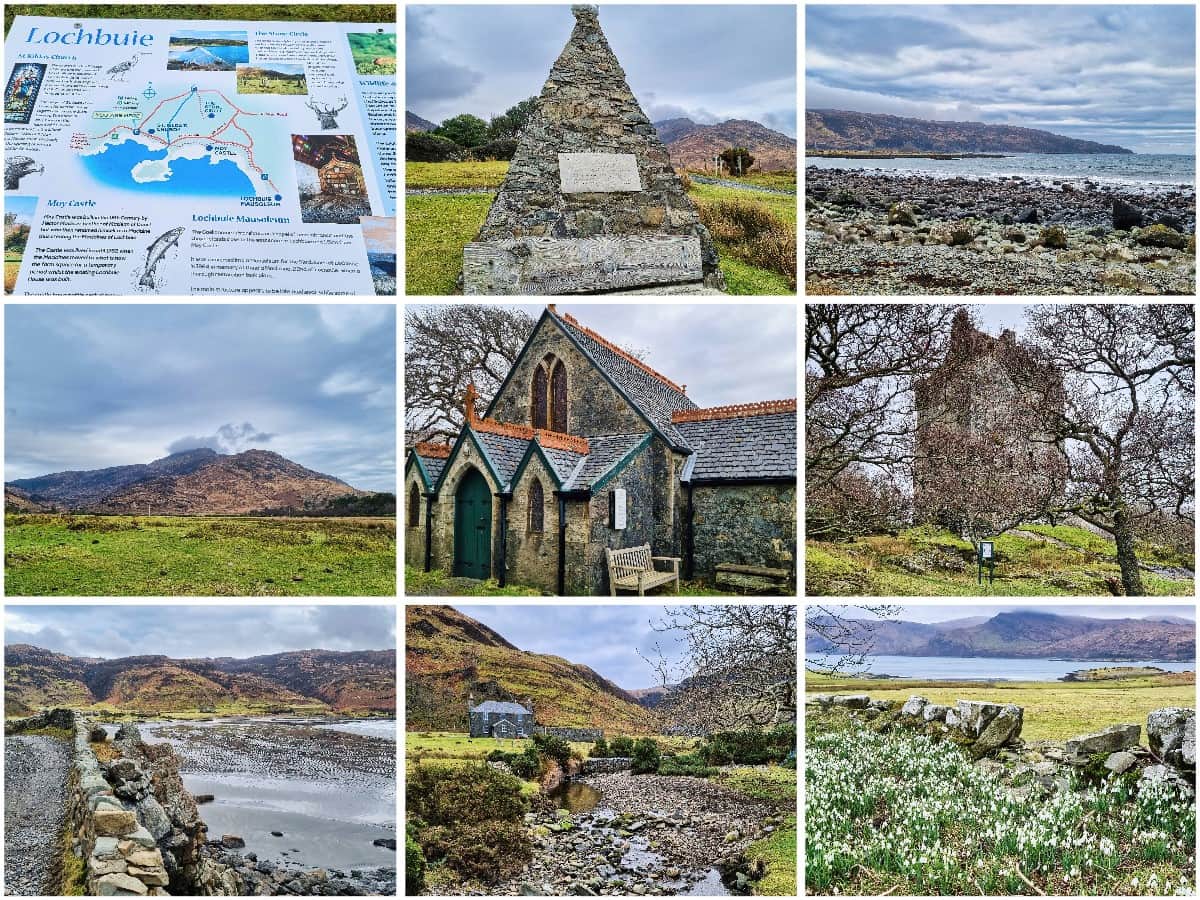
Lochbuie
Lochbuie is a village (more like a collection of spread-out houses) on the southeast corner of Mull around 14 miles from the ferry terminal at Craignure. This is one of those hidden-away corners of the island that most visitors don’t know about, but that means it’s one of the few places where you can escape from the island’s tourist hordes even in the height of summer.
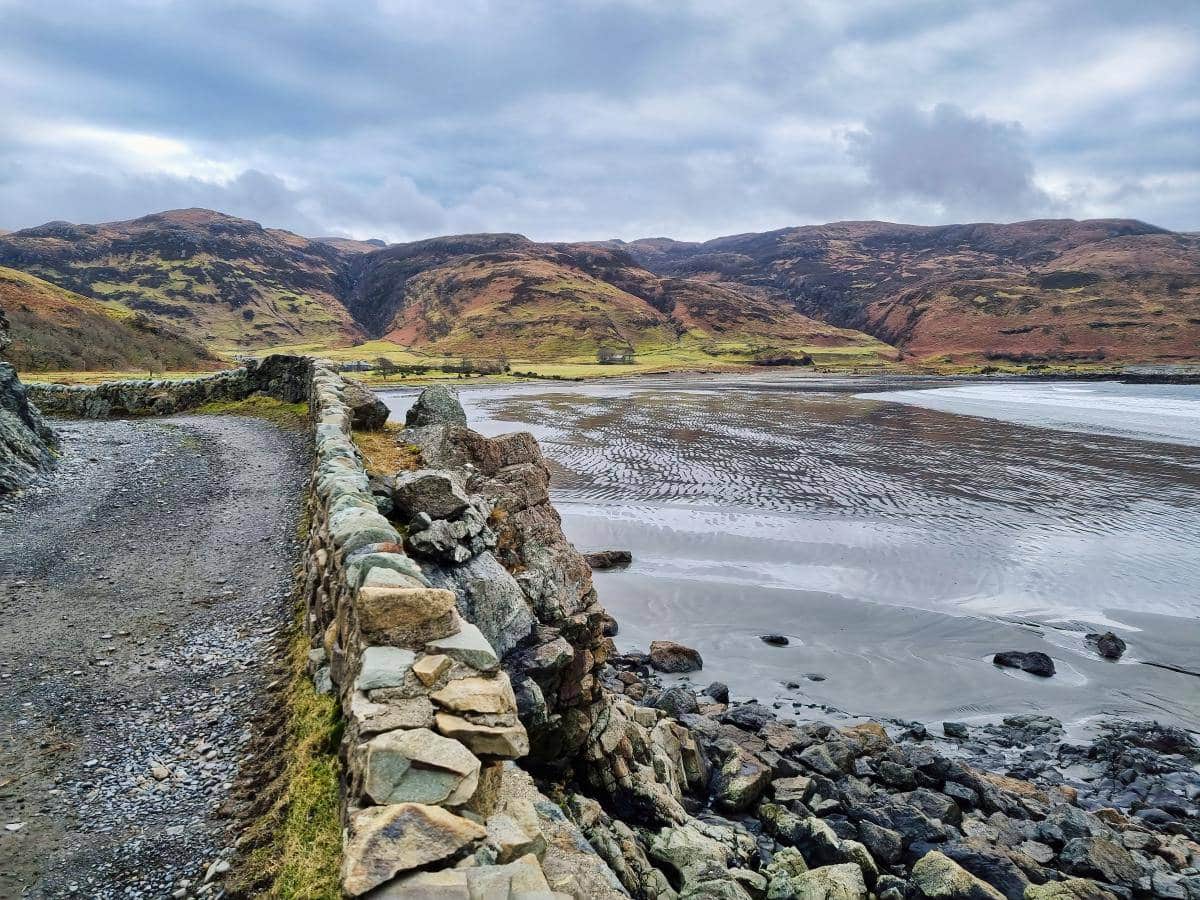
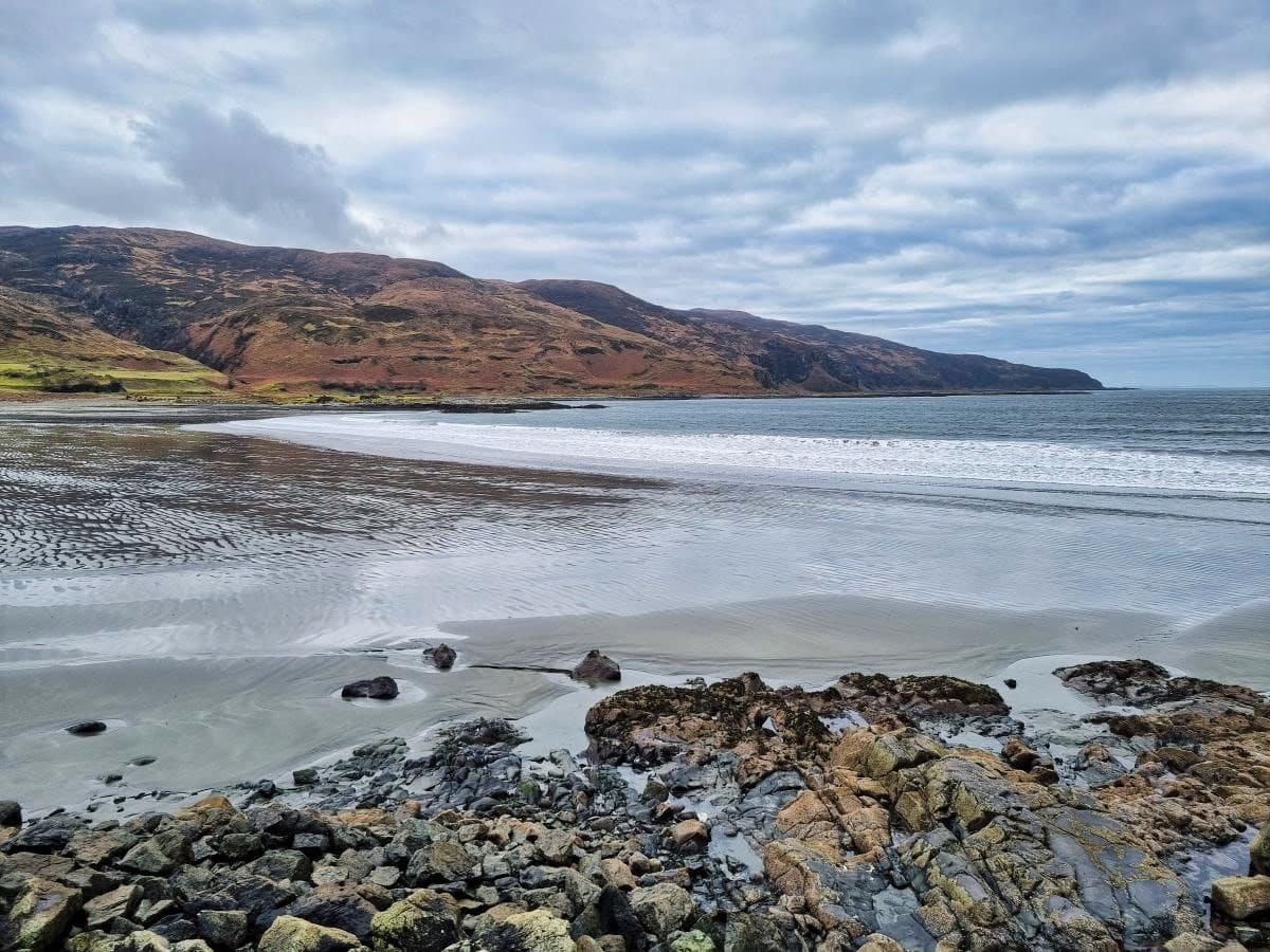
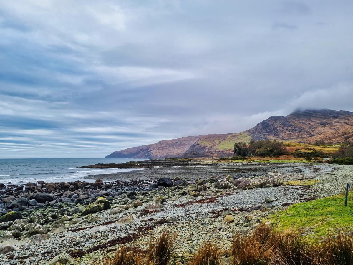
The region surrounding Lochbuie is incredibly scenic, with grey-black sand beaches set against crystal-clear seawater, all surrounded by hills, woodlands, and a breathtaking coastline that is a haven for wildlife. The landscape at Lochbuie is particularly fertile and green throughout the year, in stark contrast to the majority of Mull, which fades to deep browns and reds as soon as summer ends.
As far as highlights go, walking is the order of the day at Lochbuie, and there are two main routes to choose from, the first of which heads east and passes St. Kilda’s Church, Moy Castle, and Laggan Beach, while the second route heads east around a very rocky shoreline towards Carsaig Bay.
Lochbuie is part of the 22,000-acre Lochbuie Estate and is accessed via a single-track road that spurs off the A849 near the head of Loch Spelve. This road continues for 8 miles before finishing at the parking area next to The Old Post Office.
The road is narrow, so it’s not really recommended for campervans, but it’s easily driveable for cars and makes a great cycle route for anyone on two wheels. In fact, having cycled this road myself on a couple of occasions, I have to say it’s just as enjoyable as Lochbuie itself, thanks to the lovely views across Loch Uisg and Loch Spelve.
Once parked outside the Lochbuie cafe you’ll find yourself presented with a gorgeous viewpoint with a rocky beach facing the loch and a number of picnic benches to sit on and enjoy the scenery. This would be a good opportunity to grab a coffee and a cake from the Old Post Office cafe, but sadly, it’s closed during the off-season, so you’ll only be able to use its facilities from early April to the end of October.
There are a couple of benches in the car park and a couple more on the far side of the building as well as a couple indoors for those occasions when the weather turns wet and windy (this is Scotland after all…).
The Highlights
1: Lochbuie is a great place for walks, and you’ll find rough tracks heading in either direction from the car park. The best walk (in my opinion) is heading east past St. Kilda’s Church, along to Moy Castle, up to the standing stones, back down to Laggan Beach, and continuing on to the Maclaine Mausoleum. This route is around 4 miles there and back and will take 2 to 3 hours at a leisurely pace.
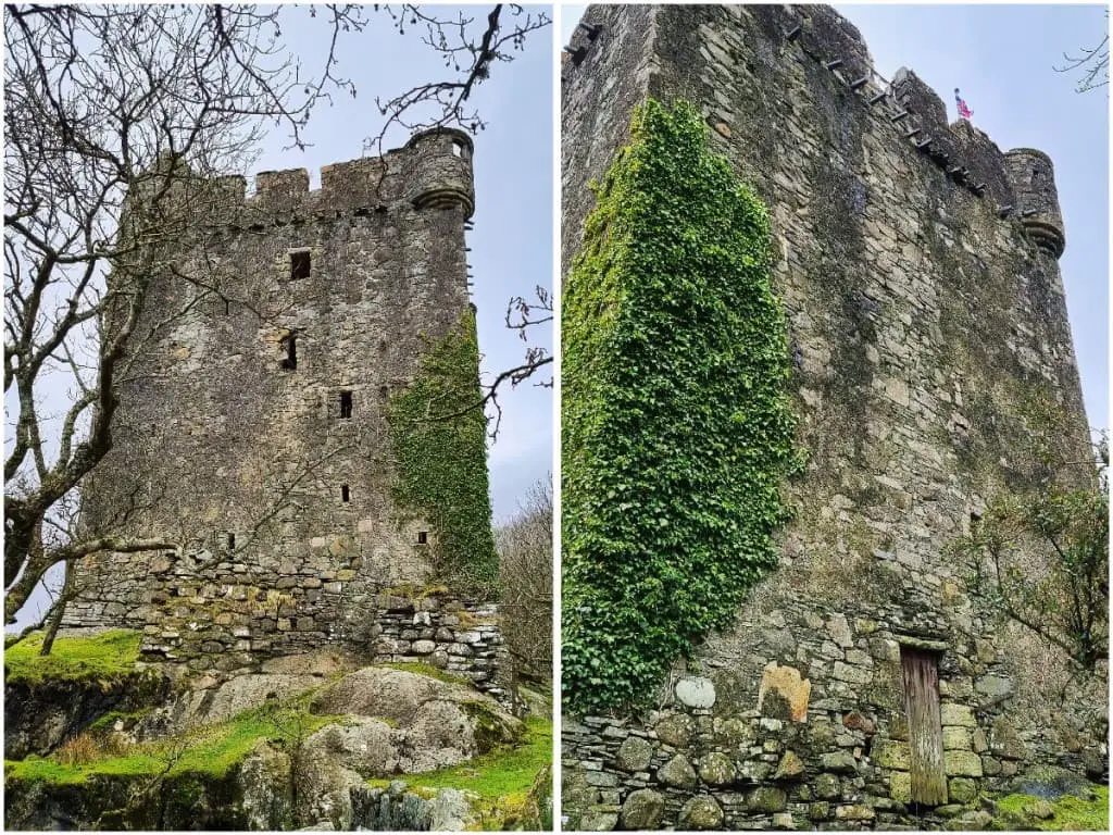
2: The ruined Moy Castle is set in a stunning location with gorgeous views and is well worth taking the time to have a look around. Sadly, visitors cannot go inside the castle due to safety concerns over crumbling masonry.
3: The Old Post Office, located near the car park, is a fantastic place to enjoy a snack with a hot cuppa while basking in the glorious views of Loch Buie and the hills that line it on either side. The servings at the cafe are generous and everything is freshly made from local produce.
Visiting Tips
1: If you can brave the temperatures, Laggan Beach is as good a place as anywhere on Mull for swimming. The water is fairly shallow close to the shore and it’s reasonably sheltered due to it being set at the end of the sea loch.
2: The Old Post Office has a great selection of baked goodies but if you’re staying in the area you might consider treating yourself to an evening meal from the Lochbuie Larder menu. All ready-made meals from the cafe are pre-cooked and just require reheating in an oven – ideal after a long day of sightseeing.
Tourist Information
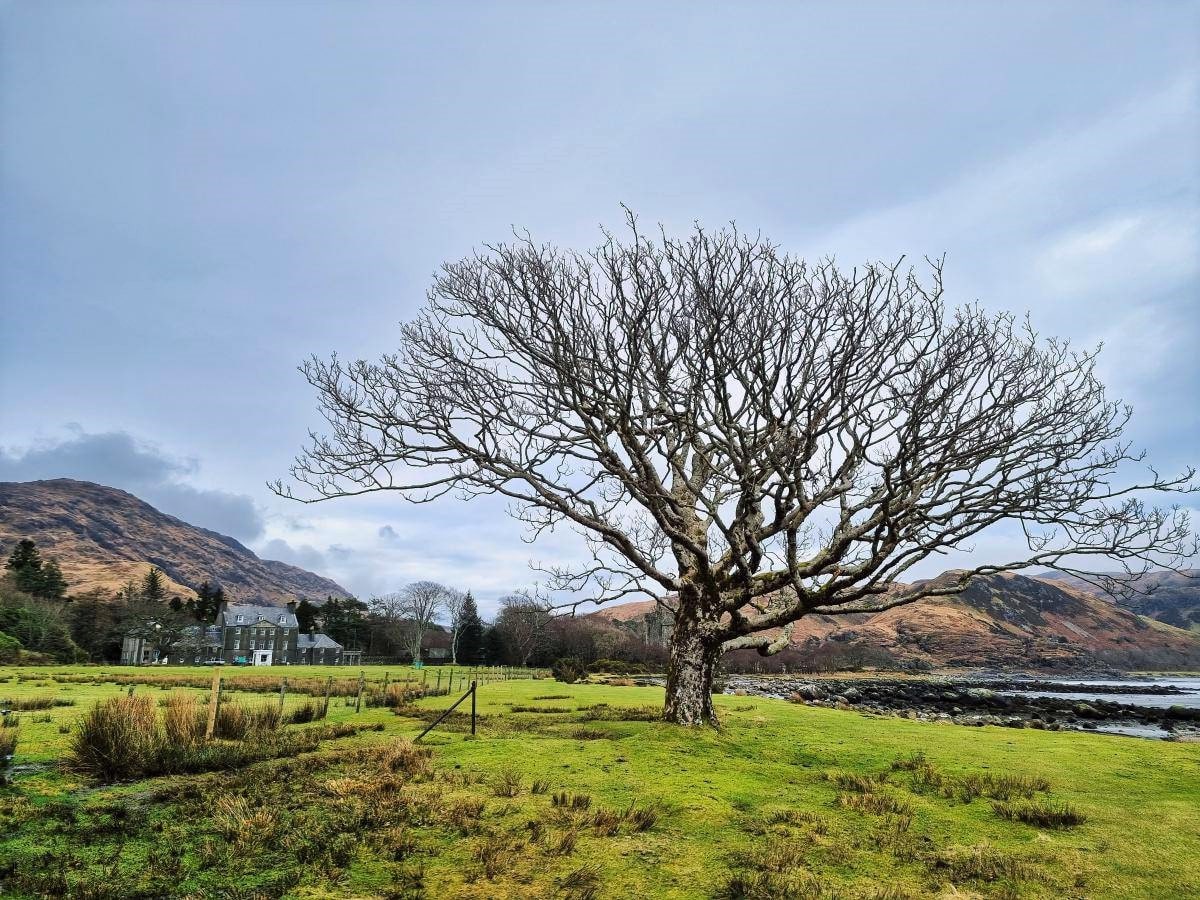
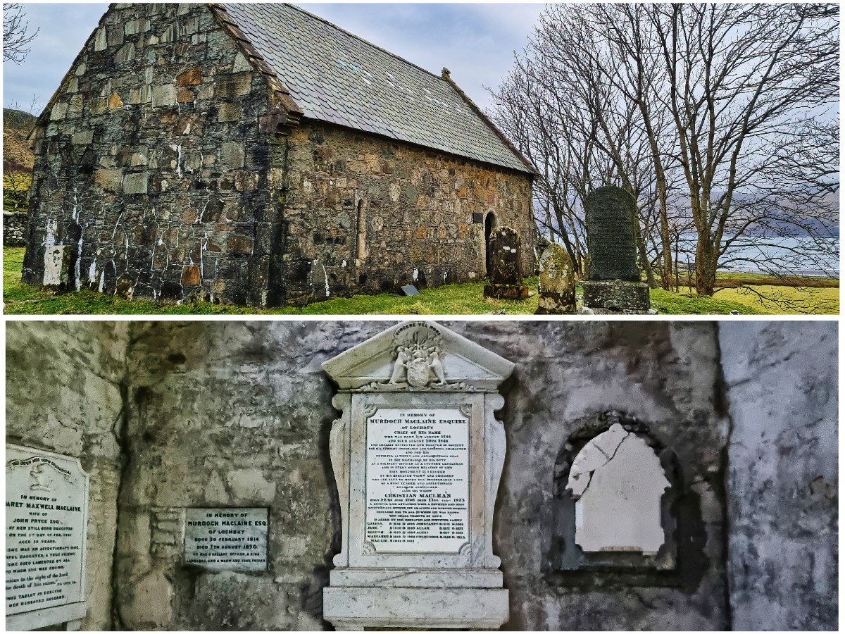
Coffee slurped and cakes munched at the cafe, follow the rough track east to the small church that was built in 1876 and consecrated to St. Kilda. It’s a pretty wee place that’s worth a photo or two, after which you can continue east past Lochbuie House (a private residence and former home of Clan Maclaine) and Moy Castle.
The castle dates from the 15th century and was built as the powerbase for Clan Maclaine of Lochbuie who made it their home before moving into Lochbuie House in the mid-1700s. The tower house is 3 stories high and is roofless, which means there’s a risk of crumbling masonry falling from a height, so it’s now sadly closed to the public until/if renovations are completed on it.
At the rear of Moy Castle, there’s a path leading towards the Lochbuie stone circle,the only stone circle on the entire island. The Lochbuie standing stones comprise nine granite stones that form a 12-metre-diameter ring, with another three stones offset around the ring at varying distances.
The purpose of the stone circle is unknown, but it’s certainly an atmospheric place with the mighty Ben Buie framing the scene to the north. One thing to be aware of when you visit is that the path leading to the stones becomes a quagmire when it’s wet, so if you visit in winter remember to pack a pair of wellies.
On your way back to Moy Castle, you’ll discover that the path continues around Loch Buie’s head to Laggan Sands, a sizable beach with low hills on either side. While the benches outside the post office are good for a bite to eat, I personally recommend packing a picnic for this beach instead, as there are plenty of spots to tuck yourself away against the foot of the hills where you can escape the winds that blow up the loch.
The last point of interest at Lochbuie lies a few hundred feet further east at the end of the track where you’ll find the Maclaine mausoleum. It was built in 1864 on top of a chapel that’s believed to date from around 1500, though not much is known about the building prior to its conversion.
Inside, there are inscriptions dedicated to various Maclaine clan members, while the small graveyard to the rear has a few memorial stones. There’s not much else to see after the mausoleum, so I advise heading back to the car park unless you want to continue along the coastline to the southwest end of the loch.
Take note that if you decide to continue walking south, you’ll need sturdy boots as there is no path and the coastline is very rocky. If you don’t have a decent pair of walking boots, take a look at my recommended boots from Amazon.
Things to Do
Visit Moy Castle: This ancient, partially-ruined castle on the shores of Lochbuie offers a glimpse into Scotland’s past. The walk to this rustic castle is a fantastic experience and the views of the surrounding coastline are simply breathtaking.
Lochbuie Stone Circle: Explore this historic stone circle that’s believed to date back to the Bronze Age. The circle has an air of mystery and it’s a perfect place for history enthusiasts or anyone looking for a unique photo opportunity
Outdoor Adventure: The Lochbuie area is perfect for outdoor activities like hillwalking and bird-watching. The wild terrain combined with stunning views means visitors will have an exhilarating outdoor adventure no matter the time of year.
Photography: The stunning landscape of Lochbuie, with its impressive hill range, serene waters, and abundant wildlife, makes it a haven for photographers. Capture the magic of this picturesque location in the early morning and evening when the light bathes the scene during the ‘golden hour’.
Fishing: The clear, tranquil waters of Lochbuie are great for fishing. Spend a quiet afternoon casting a line and you might catch black bream, seabass, and coalfish, among other species. The nearby Loch Uisg is also worth visiting for its trout fishing.
Things to Do Nearby
Carsaig. Isle of Mull, PA70 6HD. 5 miles by foot around the coast.
Carsaig is a secluded settlement on the edge of Carsaig Bay. The bay is a popular destination for wildlife watchers due to the offshore rocks which are home to colonies of seals. It’s also possible to walk around the coastline to the Carsaig Arches.
Loch Uisg., Isle of Mull, PA62 6AA. 6-minute drive.
A picturesque loch near Lochbuie that’s easily viewed thanks to a single-track lane that runs alongside it. Rare birds like rock pipits and red-breasted geese frequently stop by Loch Uisg.
Mull Forest & River Walk. A849, Isle of Mull PA65 6BD. 23-minute drive.
This footpath follows the River Lussa for 2.5 miles near the A849 on the southern side of Mull. There’s a car park at the start of the footpath on the south end while the northern end has a wider gravel track with a couple of verges that can accommodate cars.
It’s possible to continue the walk by following the A849 where another footpath continues across moorland to the three lochs viewpoint (Ishriff, Isle of Mull, PA65 6BD).
Kinlochspelve. Isle of Mull, PA62 6AA. 12-minute drive.
This is the location of a single-track road that runs along the southern edge of Loch Spelve. The road is level and in good condition so it’s well-suited for cycling and walking. The endpoint at Croggan (3.5 miles) marks the start of another track that continues around the coastline to the opening of the sea loch.
Frequently Asked Questions
How do I get to the Isle of Mull?
To get to the Isle of Mull you have several transportation options depending on your starting point and preferred method of travel. Here are some of the most common ways to reach the Isle of Mull:
By ferry: The Isle of Mull is accessible by ferry from several ports on the Scottish mainland including Oban, Lochaline, and Kilchoan.
The Oban ferry is the most popular option with regular sailings throughout the year. The journey takes around 45 minutes to 1 hour and tickets can be purchased in advance or on the day of travel.
By car: If you’re travelling by car you can drive to one of the ferry ports mentioned above and take your vehicle onto the ferry. The journey time and ticket prices will vary depending on your starting point.
By air: If you’re travelling from further afield you can fly into Glasgow Airport and then take a bus or train to one of the ferry ports. Alternatively, you can fly to Oban Airport, take a taxi to the Oban ferry terminal, and then catch a ferry to Mull.
What is the Isle of Mull known for?
The Isle of Mull is the second-largest island in the Inner Hebrides and is known for its breathtaking mountain scenery as well as its beautiful coastline which is a haven for sea eagles, seals, and dolphins.
Tobermory, located on northeast Mull, is one of Scotland’s most picturesque fishing villages while Ben More in the middle of the island is one of the Hebrides’ tallest peaks.
Can you drive around the Isle of Mull?
It is possible to drive around the majority of Mull’s perimeter except for the far southern edge which has no road. The B8035 cuts through the centre of the island allowing easy access to both the western and eastern sides.
Which is better, the Isle of Mull or the Isle of Skye?
Both islands have their pros and cons. Skye has more dramatic landscapes (especially at the Trotternish Ridge) but it’s much busier than Mull and attracts more tourists. The roads are better on Skye and it’s easier to get to thanks to the Skye bridge.
Mull has fewer visitors than Skye and has an almost-as-pretty landscape, plus it’s closer to the main Highland ferry port of Oban. Mull is also close to the Isle of Iona and the Treshnish Isles.