Causeymire Wind Farm
This pleasant walk will take you across Dale Moss near Thurso in Caithness to the Causeymire Wind Farm where you will see the impressive turbines generating power for the local area. There are lovely views to take in along the way on paths that are gravelled and well-maintained, making this wild part of northeast Scotland ideal for a stroll.

🠇 Head to the bottom of the page for essential details on each attraction featured here, including addresses, opening hours, and entry prices 🠇
Causeymire Wind Farm
The wide-open expanses around the far northeast of Scotland are just begging to be walked. One place that’s particularly good for stretching the legs is the well-maintained trail around Causeymire Wind Farm.
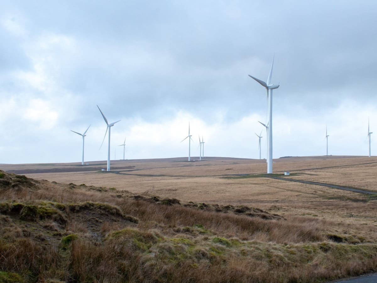
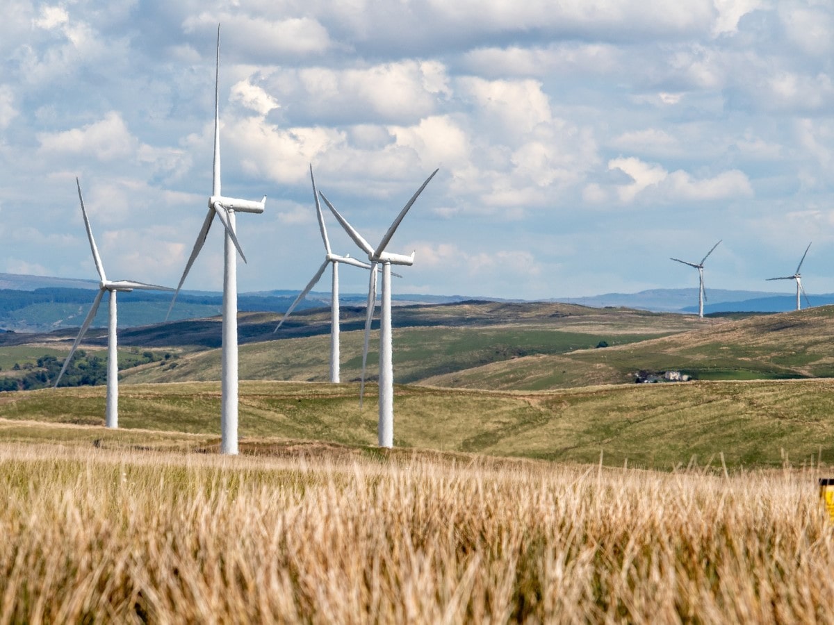
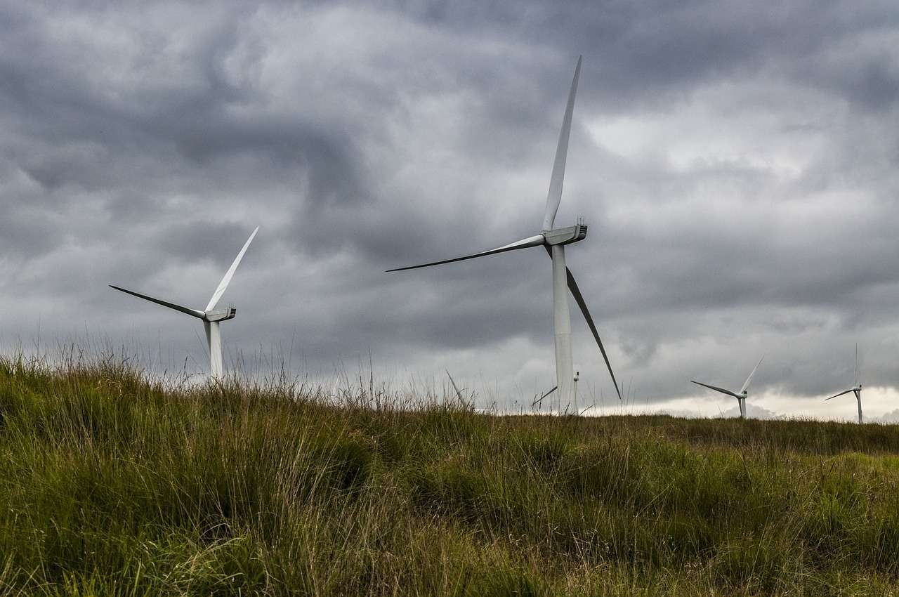
Although you might think a wind farm is an unusual place to take a walk, you’ll see some beautiful views across Dale Moss and out towards Morven as you make your way around the route. It’s also the perfect opportunity to take a good look at the 21 turbines up close, which are an impressive 197 feet (60 metres) in height.
This part of the country has plenty to offer visitors as there are lots of easily accessible attractions nearby, plus it’s easy to get to John O’ Groats or take a ferry to Orkney from Scrabster.
The towns of Thurso and Wick are roughly the same distance apart from this windfarm walk so you can drive to either one if you fancy a cuppa afterwards, but Wick has the added bonus of the excellent Heritage Museum near the harbour.

The Highlights
1: This is an easy walk on well-maintained surfaces so if the weather’s grotty it’s definitely worth considering.
2: The landscape is flat, but it’s quite attractive. This is an ideal walk if you have your dog with you.
3: It’s interesting seeing the enormous wind turbines close up. Be aware though, that the land is owned by the wind farm operator so there may be restrictions in place with regard to getting near the turbines.
Visiting Tips
1: This is a remote walk but it’s worth doing if you’re close to the A9 and it’s not that far from Wick if you want to join the NC500 touring route. You can drive north to Latheron on the A9 then head north on the A99 for a mini NC500 tour of the area.
2: There isn’t much room to park the car but you’ll find a couple of spaces near the entrance gate. The A9 is fairly quiet so you shouldn’t have a problem parking on the verge.
3: If you’d rather go for a coastal walk I recommend driving 20 miles east on the A882 to the coastline around Castle Sinclair Girnigoe.
Tourist Information
As walks in the countryside go, this is one of the more unusual ones, but no less enjoyable for it. It’s an easy walk with fairly well-maintained paths but I wouldn’t recommend it if you have impaired mobility. Even so, if you’re in the area and looking for a quick walk that offers fresh air along with the chance to see some enormous wind turbines, Causeymire Wind Farm is the place to go.
The wind farm is situated on a large area of peatland that’s very flat and makes for a refreshing change from the highland peaks that you’ll find along the western side of the country. It might appear quite bleak at first, but keep your eyes open because there’s a lot of birdlife that calls this wilderness their home and you’ll likely meet a few Highland cows on the way as the land below the turbines is used for grazing cattle.
But obviously, it’s the turbines themselves that dominate the landscape with their 40-metre blades spinning away in Scotland’s winds to provide power for more than 30,000 homes. They’re certainly quite a feat of modern engineering.
The views along this short route are very pretty indeed and you’ll get some great views across Dale Moss, with the hills of Morven and the Maiden Paps clearly visible in the distance.
I have two pieces of advice for you if you fancy exploring this part of Scotland a wee bit further. The first is to invest in an OS Map map of the area as it’s so open and desolate. The second tip is to invest in a can of Smidge anti-midge repellent. Trust me, it’ll save you from untold misery in summer.
Walking Route
Time
This 5-mile trek will take most walkers around 2 hours to complete.
Difficulty
Easy. This is a fairly flat route across open land on good-quality vehicle tracks. There should be no access problems even in winter.
Route
The site is easy to locate as the turbines can be seen for a good distance away on the A9, and access is simple as the start of the walk starts at the main gate. This gated area has a couple of parking spaces as well as a map of the walking route which has been installed by the wind farm operators.
You can’t really get lost on the route as it’s circular and the construction of the paths is clearly marked gravel which contrasts against the surrounding moorland. The lovely River Thurso runs a short distance away to the west, while heading back to the A9 offers plenty of other walking opportunities in the area.
Things to Do Nearby
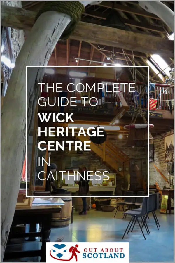
Wick Heritage Museum. 20 Bank Row, Wick KW1 5EY. 22-minute drive.
A community-run museum that celebrates the heritage of Wick and the surrounding area. The museum has a varied collection of displays and exhibits from Wick’s herring fishing glory days and the Caithness Glass industry as well as recreations of school rooms and a collection of restored photographs.
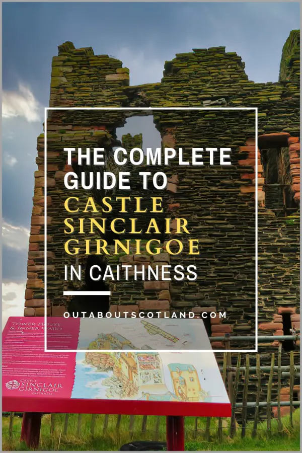
Castle Sinclair Girnigoe. Wick KW1 4QT. 31-minute drive.
A ruined castle located on a very dramatic clifftop overlooking the North Sea a few miles north of Wick. Access is via a short walk from an inland car park through fields of machair (coastal wildflowers) and there are footpaths along the coastline in both directions.
Wick. 21-minute drive.
A small fishing village that was the biggest exporter of herring in the world in the 1800s. Wick is part of the NC500 coastal route and it is a good stopping-off point for refuelling and shopping. There is a large harbour that is still in use as a fishing port.
Thurso. 16-minute drive.
A small town on the remote far north coast of Scotland that is one of the few places in the area to offer a supermarket and refuelling station. The town is located next to the historic Scrabster harbour where ferries provide a regular service for visiting the Shetland Islands.
Loch Watten. Wick KW1 5XL. 10-minute drive.
A small low-lying loch that has pavements around its southern edge and rough paths around its northern edge. Loch Watten is a very popular location for recreational fishing.
Frequently Asked Questions
How do I get to Causeymire Wind Farm?
Address: Unnamed Road, Halkirk, KW12 6UP
Directions map: Google Maps
How much does it cost to visit Causeymire Wind Farm?
There is no fee to visit Causeymire Wind Farm.
What are the Causeymire Wind Farm opening times?
Causeymire Wind Farm is open all day, 365 days a year.
What visitor facilities are there at Causeymire Wind Farm?
There are no visitor facilities at Causeymire Wind Farm.