Ben More, Mull
With a peak of 966 metres (3,169 feet), Ben More is the highest mountain on the Isle of Mull and is a must-do for all visitors to the island. The mountain is located on the shores of Loch na Keal and Loch Beg, where it offers spectacular views from two very different approaches on the north and south sides.
🠇 Head to the bottom of the page for essential details on each attraction featured here, including addresses, opening hours, and entry prices 🠇
Ben More
Ben More, located on the Isle of Mull, is the highest peak in the Inner Hebrides, standing at 966 metres. It’s a popular attraction for hikers and nature enthusiasts, offering panoramic views of the island from its summit. The mountain’s challenging terrain, abundant wildlife, and scenic beauty make it a must-visit for those keen on outdoor adventures.
As the highest mountain on the island (rising to an impressive 3,169 feet), Ben More mountain (it’s actually a Munro) dominates the landscape for miles around and offers amazing views from the summit.
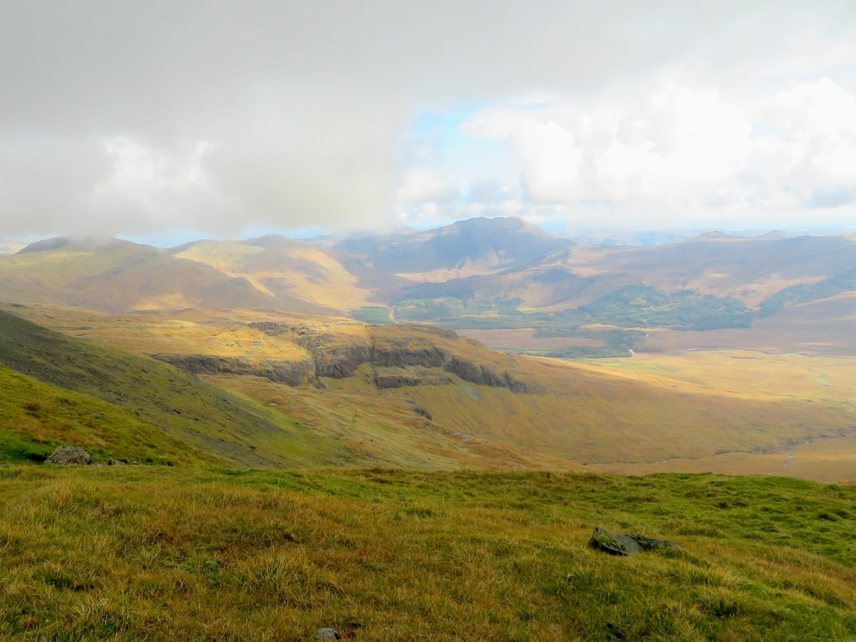
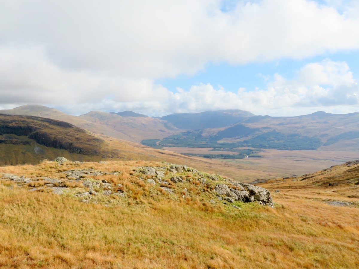
Not only is Ben More the highest peak on the island, but it’s one of the highest in the entire Inner Hebrides, with only the peaks on the Isle of Skye beating it for height. But although Ben More can’t take credit for being the highest peak, I personally think it wins the award for having the best scenery, with the view from the summit encompassing the Sound of Mull, the islands of Staffa and Ulva, the Isle of Skye, and the Highlands over on the mainland.
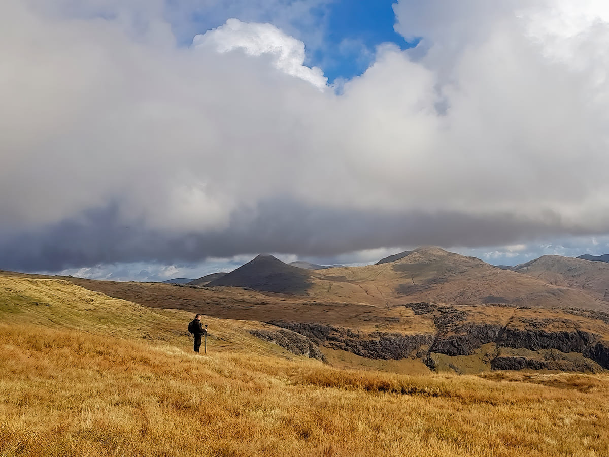
There are two routes to reach the top of Ben More, one from the shore of Loch Na Keal on its northern side and the other from the shore of Loch Beg on its southern side. Both are equally enjoyable, although the second route from Loch Beg is much steeper.
Both routes take approximately 4 hours to reach the summit, though it’s a good idea to have extensive hiking experience before you attempt the climb as the mountain is formed from a magnetic volcanic rock, meaning compasses won’t work in some places.
The Highlights
1: Ben More is the highest mountain on the Isle of Mull, standing at 966 metres (3,169 feet) and offering a challenging yet rewarding hike for outdoor enthusiasts. The ascent to the summit provides stunning panoramic views of the surrounding landscapes, including the neighbouring islands and the vast expanse of the Atlantic Ocean. On a clear day, you can even see as far as the Isle of Skye.
2: Ben More offers a fantastic opportunity for hikers to test their orienteering skills. The mountain provides a variety of hiking routes that range from moderate to difficult and cater to different fitness levels. The rugged terrain, steep slopes, and rocky paths make for an exhilarating and memorable adventure. Just make sure to pack suitable footwear, clothing, and navigation equipment.
3: The lower slopes are covered in heather, grasses, and wildflowers, creating a colourful and picturesque landscape. Keep an eye out for wildlife such as red deer, mountain hares, and various bird species that call the mountain home.
Visiting Tips
1: The route described on this page from Loch Beg is very tough due to the steep and rough terrain. Don’t attempt it unless you’re reasonably fit. The best route is the one from the opposite side of the mountain, starting at the village of Dhiseig.
2: Much of the route is very boggy. Make sure you’re wearing a good pair of waterproof walking boots (link to recommended boots) and take extra waterproof clothing.
3: It would be easy to get lost without some form of navigation, so take an OS map with you, or at least make sure you have plenty of battery power to use Google Maps.
Tourist Information
As the only Munro on Mull, Ben More offers a perfect opportunity to get your boots on if you’re into Munro bagging. Trails leading up the mountain can be hard to follow, but once you get towards the summit, you’ll be rewarded with the best viewpoint on the entire island.
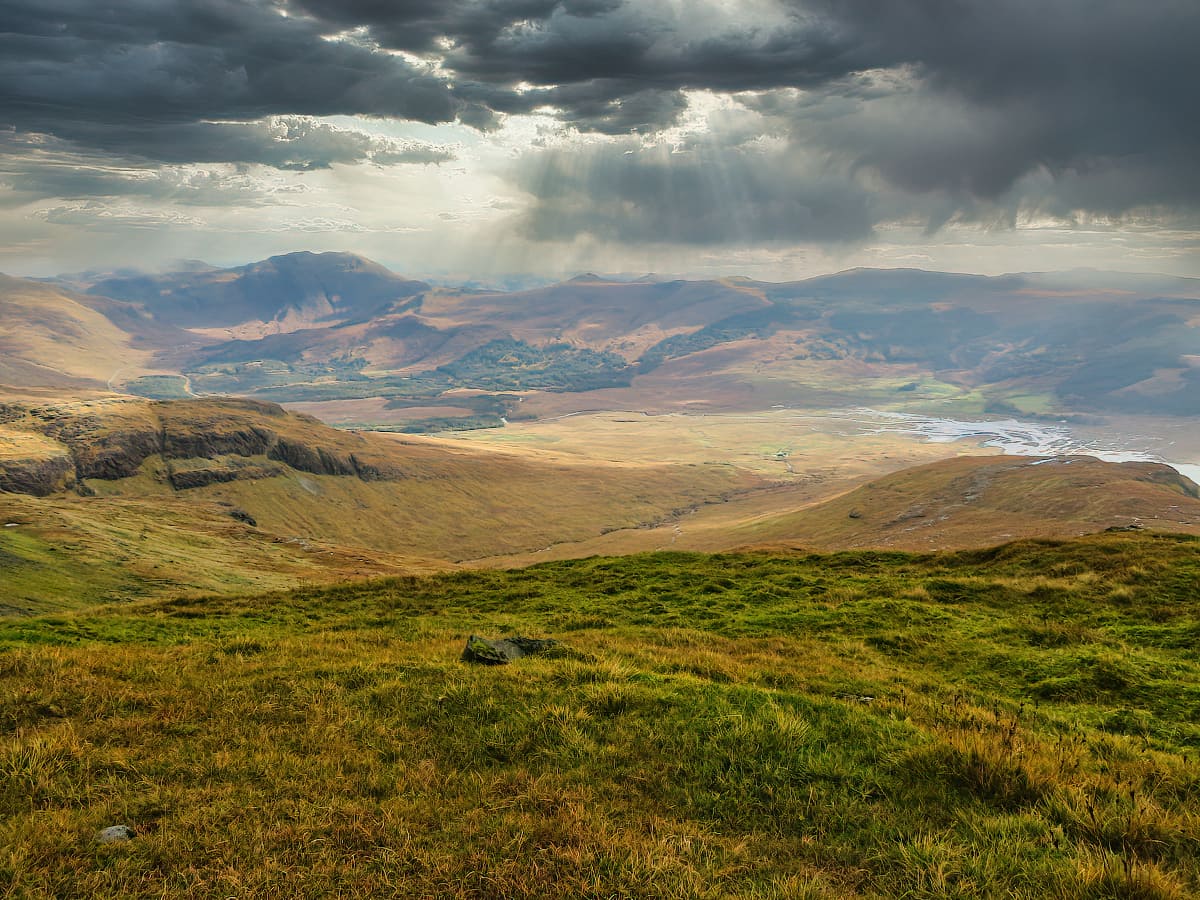
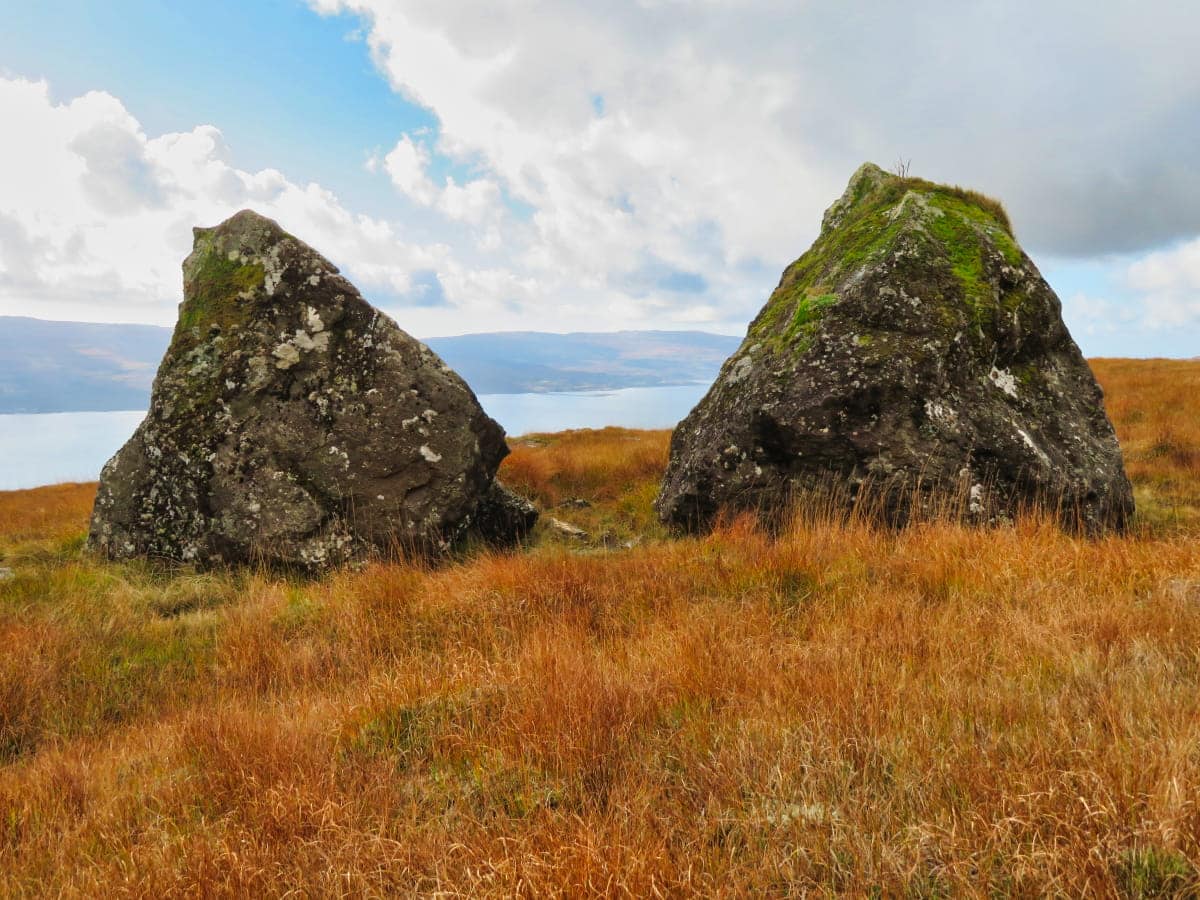
On your way up, you’ll find a mixture of thick grassland, waterfalls, muddy bogs, scree-strewn cliff faces, woodland (at the bottom), rocky tracks, and car-sized boulders. There’s also a fair amount of wildlife to keep an eye open for as you make your way past each section.
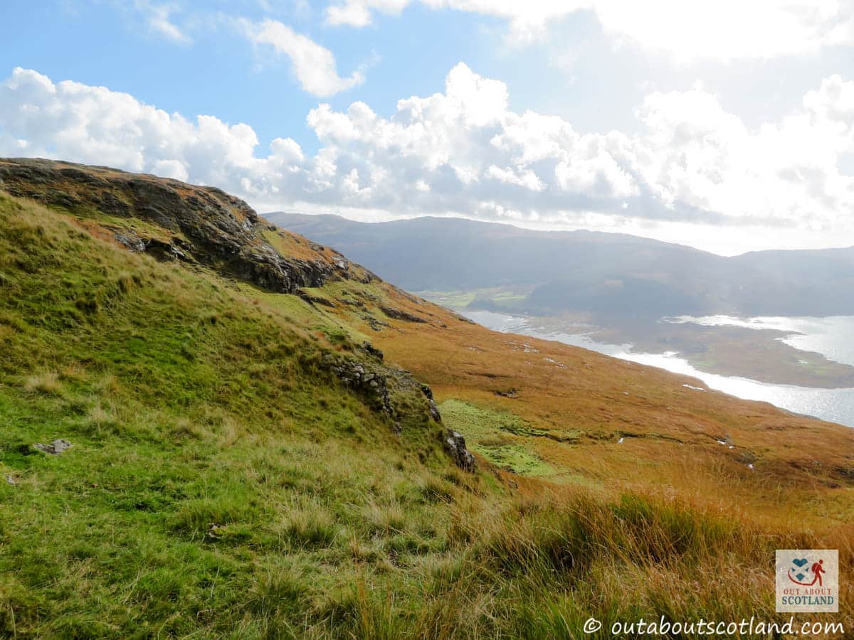
Remember to take your binoculars because there are usually herds of wild red deer roaming around the lower sections of Ben More, while at the summit, you might be lucky enough to catch a glimpse of white-tailed sea eagles on the hunt for their next meal. Although the route to the summit is easiest from the northern side at Loch Na Keal, if you’d like to push yourself harder you can follow the much more challenging route from Loch Beg on the south side.
Beware that this route gets very boggy in places, so unless you’re wearing a good pair of walking boots, you’re going to find this walk nearly impossible, and forget it if you’re wearing trainers. My advice would be to pack for every possible scenario because the weather can dramatically change in an instant once you get near the summit.
On a clear day the views are stunning, and you’ll be able to see as far as the islands of Ulva and Iona, and even the mighty Ben Cruachan mountain on the mainland.
Things to Do
Climb Ben More: As the only island Munro outside of Skye, Ben More offers a challenging but rewarding climb. As you ascend the 3,170-foot (966-metre) route to the summit, you’ll be treated to breathtaking panoramic views of the surrounding islands and Scottish mainland.
Watching wildlife: There are numerous habitats all around Ben More that are home to a wide variety of wildlife. Keep an eye out for golden eagles in the skies above, red deer on the lower slopes, and otters on the shorelines of Loch Scridain and Loch Na Keal.
Stargazing: With low light pollution, Mull offers some of the best stargazing opportunities in Scotland. Set up camp near Ben More and watch as the Milky Way unfurls above you. If you’re lucky, you might even catch a glimpse of the Northern Lights.
Photography Walks: The stunning landscapes of Ben More provide endless photographic opportunities. Capture the raw beauty of the rugged mountain and the serene surrounding lochs. Whether you’re a professional photographer or a casual snapper, you’ll find lots of inspiration at Ben More.
Wild Swimming: If you’re a fan of outdoor swimming, the lochs at the base of Ben More offer a unique experience. While the water can be chilly, the thrill of swimming in such a scenic location is worth the initial shiver. Just remember to wear a wetsuit to lower the risk of muscle cramps.
Things to Do Nearby
Loch Na Keal.
A large sea loch to the north of Ben More. The loch is a popular destination for cyclists thanks to the B8073 and the B8035 that follow the water’s edge to the north and south, respectively.
Dun da Ghaoithe. Isle of Mull PA65 6BB.
A 766-metre-high curving ridge that looks over the ferry terminal at Craignure. Relatively easy-going, although the rough path is unmarked.
Loch Spelve. Inverlussa, Isle of Mull, PA65 6BD.
A sea loch that is almost landlocked apart from a narrow opening to the Firth of Lorn. Easily accessed via the A849. Loch Spelve is a popular destination for kayakers and a good place to use paddleboards to explore Mull’s Southeast because of its protection from the sea.
Aros Castle. Isle of Mull, PA72 6JP.
A ruined 13th-century castle that mostly comprises a few walled sections. Good views across the firth to the mainland. There are lots of paths that follow the coastline to the north and south.
Loch Scridain and Loch Beg.
Sea lochs that cut into the southwest tip of Mull. The larger loch, Scridain, is over nine miles in length and stops at a small peninsula that separates it from Loch Beg. There are a multitude of walks in the area, especially to the south on the Ross of Mull.
Frequently Asked Questions
How steep is Ben More?
Ben More is the highest peak on Mull and one of the most prominent in the UK. Its steepness can vary depending on the route you take, but it’s generally quite steep and challenging, especially its northeastern face, which slopes at an angle of about 30 to 40 degrees. The most popular route, starting from Dhiseig on the shores of Loch na Keal, is a direct ascent to the summit and includes a steep, sustained climb with a gradient of approximately 20–25 degrees in parts. However, this varies across the route, with some sections being steeper than others.
How difficult is Ben More on Mull?
Ben More on the Isle of Mull is either moderate or hard, depending on the side climbed. From Loch Beg, heading north, the summit is a steep and difficult climb with lots of rough, boggy ground to cross.
The climb in the opposite direction from Loch Na Keal heading south is easier thanks to a narrow ridge that is longer but shallower and firmer underfoot.
How long does it take to climb Ben More on Mull?
Expect to take 6 hours for the return climb to the summit of Ben More from Dhiseig.
What height is Ben More?
The height of Ben More is 3,100 feet (945 metres).