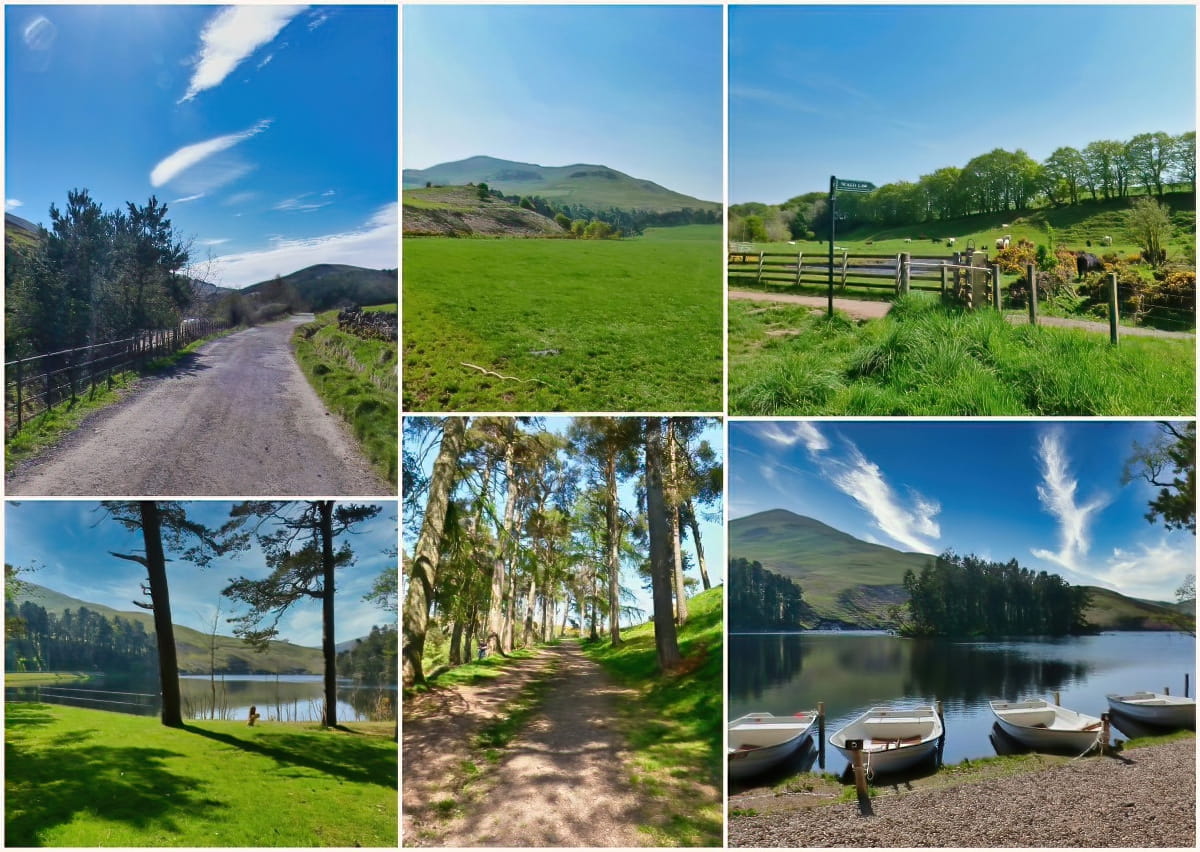
Flotterstone, Pentland Hills
The Pentland Hills in Midlothian are a captivating range of hills that offer stunning views and invigorating outdoor activities. Covering an area of about 40 square miles, they serve as a tranquil oasis for nature lovers, hikers, and adventurers alike.
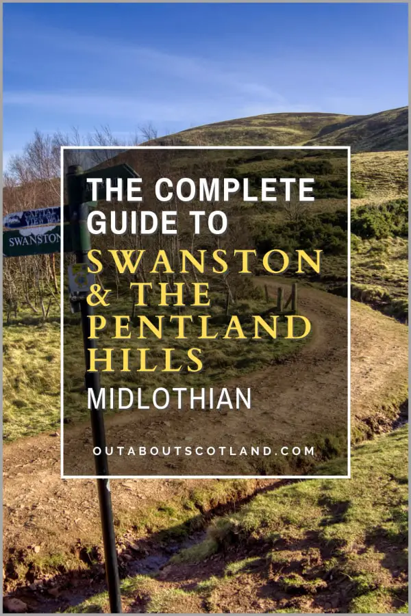
Despite their rural charm, the Pentland Hills are easily accessible, with numerous well-marked trails for walking, cycling, and horseback riding. They offer a range of recreational opportunities from gentle strolls around placid reservoirs to challenging hill walks, and one of the best entry points can be found at Flotterstone.
🠇 Head to the bottom of the page for essential details on each attraction featured here, including addresses, opening hours, and entry prices 🠇
Flotterstone
The Pentland Hills, located south of Edinburgh, are a range of hills offering visitors the chance to escape into breathtaking landscapes. Popular among walkers and nature lovers, the area runs southwest from Edinburgh towards Biggar for 20 miles. The hills encompass several peaks, reservoirs, and paths, making it a diverse terrain for anyone who loves the great outdoors.
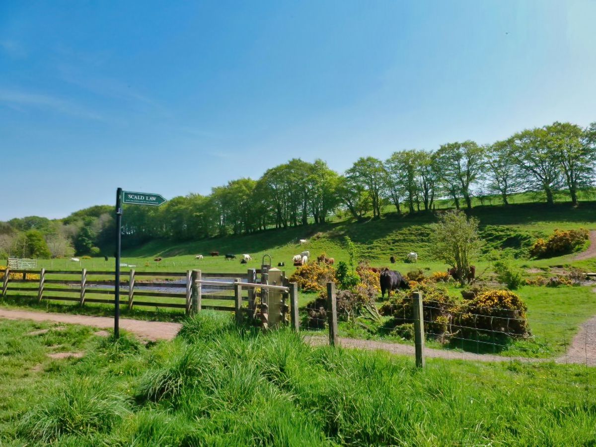
The Pentland Hills are clearly visible from almost anywhere in the city, and they make a great destination for a relaxing walk if you want to get away from the noise of Edinburgh. Although locals frequently use the hills, it seems that few tourists take the time to visit this regional park, which is a shame because it has a lot to offer, with areas of woodland, lochs, and wild, hilly expanses of heather and gorse to explore.
Much of the land is upland pasture, but there are a few forest plantations along with several reservoirs that supply the city of Edinburgh and the surrounding Lothians with fresh water.
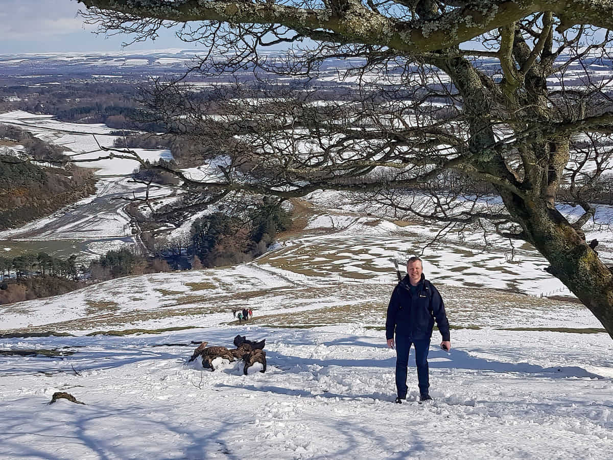
The walk from Flotterstone to Turnhouse Hill is fairly easy apart from a steep scramble at the beginning, but it’s worth doing because it offers spectacular views across the countryside of Midlothian.
The Highlights
1: The views across the Pentlands are fantastic, and the walk from Flotterstone is easy-going (apart from an initial steep climb), so it’s ideal for most fitness levels.
2: There’s a nice café in the Flotterstone car park, but there are no other facilities in the rest of the Pentlands. But who wants a burger van in the middle of a national park anyway?
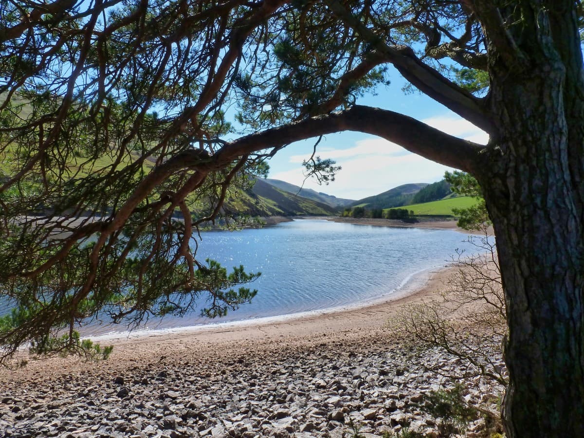
3: There are lots of paths throughout the Pentlands and you have the option of either going up and over the hills or keeping to the lower areas where the reservoirs are. The route to Glencorse Reservoir is highly recommended.
Visiting Tips
1: The footpath turns into an absolute quagmire when it’s wet (i.e., most of the time). Save your feet with a pair of waterproof hiking boots from Amazon.
2: An alternative walk starts from Castlelaw Hill Fort, which can be reached from the A702 heading south from Edinburgh. Another good route is the walk around Caerketton Hill from Swanston.
3: If the weather is too wet for a walk in the Pentland Hills you could always visit the nearby Midlothian Snowsports Centre or Rosslyn Chapel.
Tourist Information
Much of the area that encompasses the Pentland Hills is used for recreational activities, with hill walking, mountain biking, and horseback riding among the most popular. There are also fishing sites at the Glencorse, Harlow, and Threipmuir reservoirs, and there’s an artificial ski slope at the Midlothian Snowsports Centre which is accessible year-round.
If you feel like getting a bit more active you can climb the peaks of the Pentland Hills to find the best views in the Lothians, with many of the peaks reaching around 1,800 feet at the summit, including:
- Scald Law (579 m) (1,900 ft)
- Carnethy Hill (573 m) (1,880 ft)
- East Cairn Hill (567 m) (1,860 ft)
- West Cairn Hill (562 m) (1,844 ft)
- West Kip (551 m) (1,808 ft)
- Byrehope Mount (536 m) (1,759 ft)
- East Kip (534 m) (1,752 ft)
- Turnhouse Hill (506 m) (1,660 ft)
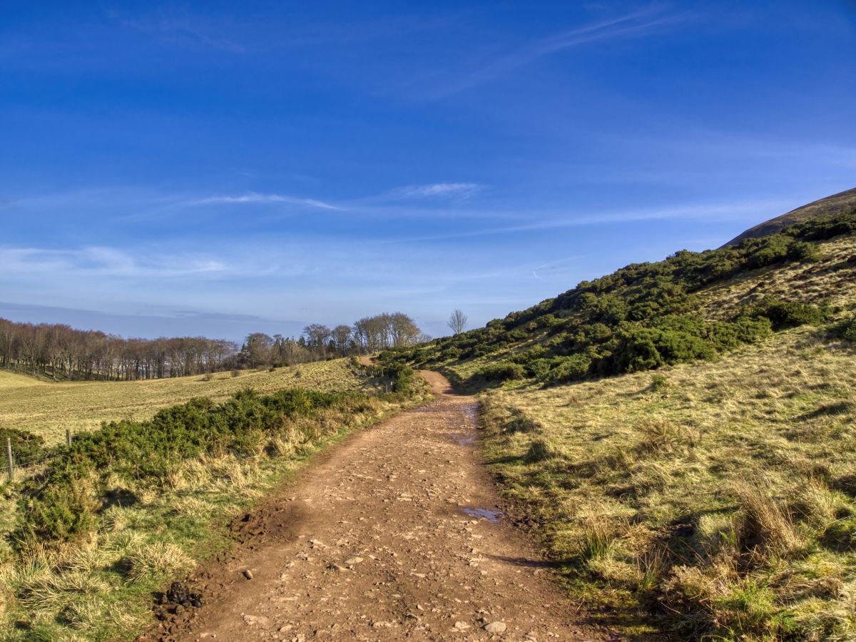
In total, there are over 60 miles of paths through the Pentland Hills that are easily accessible on foot, and most of these paths lead to the summits of the hills mentioned above. While some of these hills are only suitable for walkers with above-average fitness levels, most are easy to climb, the highlight of which has to be Turnhouse Hill.
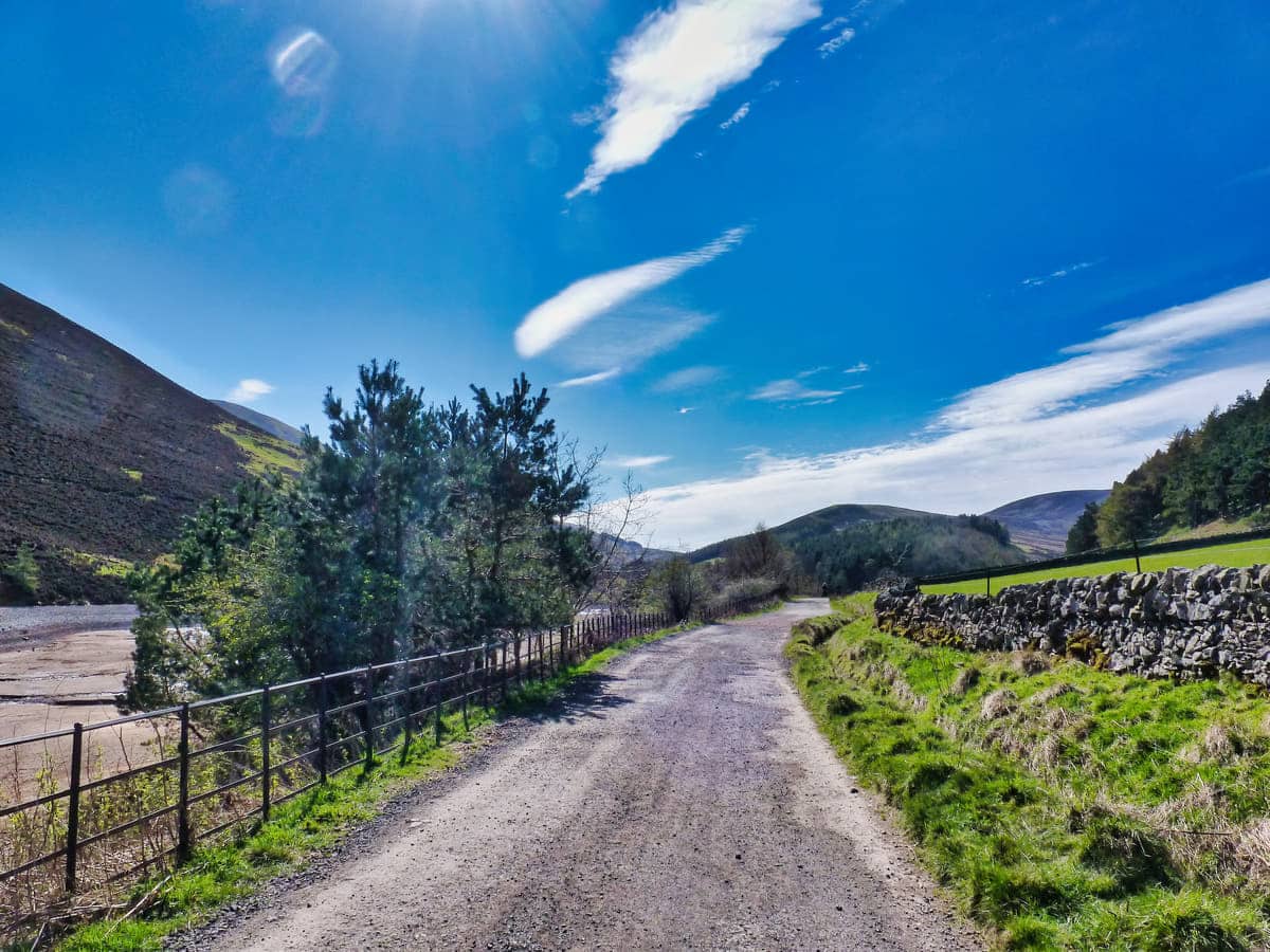
The visitor centre at Flotterstone is the starting point for many walkers as they venture into the hills, with an easily accessible car park on-site which has toilets and a small café. The route to Turnhouse Hill is clearly marked on information panels in the car park if you want to get your bearings before setting off, which I recommend doing as it’s easy to take the wrong route due to the path branching off in different directions at several points.
Leaving the car park takes you on a short section of road before turning onto the trail to Turnhouse Hill on a well-worn footpath that’s easy to follow. The ascent is quite steep at around 1,600 feet, but it does at least offer glorious views across East Lothian, with Fife clearly visible in the opposite direction.
The route to the summit takes around an hour for someone of reasonable fitness and the path continues beyond Turnhouse Hill if you want to explore Carnethy Hill and Scald Law. This walk is easy to follow, so directions aren’t really needed (just point yourself in the right direction and follow the path), but if you want to explore the rest of the range, it would be a good idea to invest in a good map.
Things to Do
Hiking in the Pentland Hills: As one of Scotland’s most scenic hill ranges, the Pentland Hills offers a variety of trails for anyone who loves getting outdoors. From gentle slopes to challenging peaks, there’s a route for every ability level.
Wildlife Watching: The Pentland Hills are home to a wealth of wildlife. With patience and a little luck, there’s a good chance you’ll spot deer, foxes, badgers, and birds of prey. The hills are particularly vibrant in spring when wildflowers bloom and young animals make their first appearances.
Mountain Biking: If you’re an adrenaline junkie, why not give mountain biking a try? The entire regional park has a range of routes that offer a thrilling way to explore the hills for beginners and advanced bikers alike. The terrain can be challenging, but the stunning views are worth every pedal stroke.
Fishing in Harlaw and Threipmuir Reservoirs: Nestled within the hills are the Harlaw and Threipmuir reservoirs, perfect for fishing enthusiasts. These peaceful, scenic spots offer a chance to catch brown trout for anglers that have obtained a fishing permit (the Post Office in Balerno sells them).
Picnicking at Flotterstone: Flotterstone is a popular starting point for hikes, but it’s also a wonderful place to have a picnic. With a cafe in the car park and a pub restaurant nearby, it’s the perfect spot to relax with some locally-made dishes after an adventurous day in the hills.
Things to Do Nearby
Rosslyn Chapel. Chapel Loan, Roslin EH25 9PU. 8-minute drive.
Widely recognized as one of the most beautiful buildings in Scotland. Rosslyn Chapel was founded in 1446 and is covered with intricate stone carvings. The chapel features a visitor centre with a shop, toilets and a café with outdoor seating.
Midlothian Snowsports Centre. Biggar Rd, Edinburgh EH10 7DU. 8-minute drive.
A large dry slope centre on the edge of the Pentland Hills overlooking the city of Edinburgh. In addition to the downhill snowboard and ski runs there are children’s tubing runs and zorb ball runs. The centre has a café and a ski coaching school on-site.
Castlelaw Hill Fort. Penicuik EH26 0PB. 4-minute drive.
A raised earthwork that’s believed to have been used for storage by the tribes that lived around the area 2,000 years ago. There is a car park nearby and a footpath that continues past the fort in the direction of the City of Edinburgh bypass.
Glencorse Reservoir. Penicuik EH26 0PP. 27-minute walk.
Tranquil reservoir set within the Pentland Hills. The reservoir can be reached on foot from Flotterstone car park by a path that continues past it to Loganlea Reservoir. Trout fishing permits are available on request.
Roslin Glen. Roslin EH25 9PX. 8-minute drive.
Riverside walk with rough paths that follow the River North Esk. The country park is a short walk from Rosslyn Chapel and there is a car parking area with nearby seating and picnic benches.
Frequently Asked Questions
What is the tallest hill in the Pentlands?
The tallest hill in the Pentland Hills is Scald Law at 579 metres (1,900 feet).
How many hills are in the Pentland Hills?
There are 5 hills in the Pentland Hills – Turnhouse Hill, Carnethy Hill, Scald Law, East Kip and West Kip
How high are the Pentlands?
Peaks in the Pentland Hills:
Scald Law: 579 m (1,900 ft).
Carnethy Hill: 573 m (1,880 ft).
East Cairn Hill: 567 m (1,860 ft).
South Black Hill: 563 m (1,860 ft).
West Cairn Hill: 562 m (1,844 ft).
West Kip: 551 m (1,808 ft).
Byrehope Mount: 536 m (1,759 ft).
Mount Maw: 535 m (1,759 ft).
East Kip: 534 m (1,752 ft).
Turnhouse Hill: 506 m (1660 ft).
Black Hill: 501 m (1,644 ft).
Allermuir Hill: 493 m (1,617 ft).
Castlelaw Hill: 488 m (1,601 ft).
Caerketton Hill: 478 m (1,568 ft).
Can you camp in the Pentland Hills?
Camping is allowed in the Pentland Hills with some restrictions. It is not permitted to pitch a tent within 1 mile of a public road, within enclosed farmland, or anywhere near buildings, private roads, or historic landmarks.