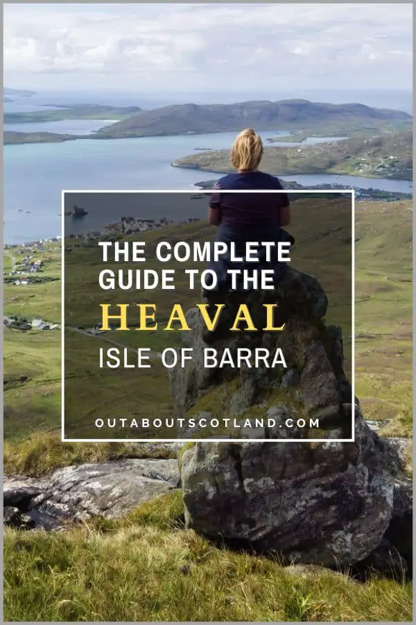
Munros in Scotland – A Guide for Hikers
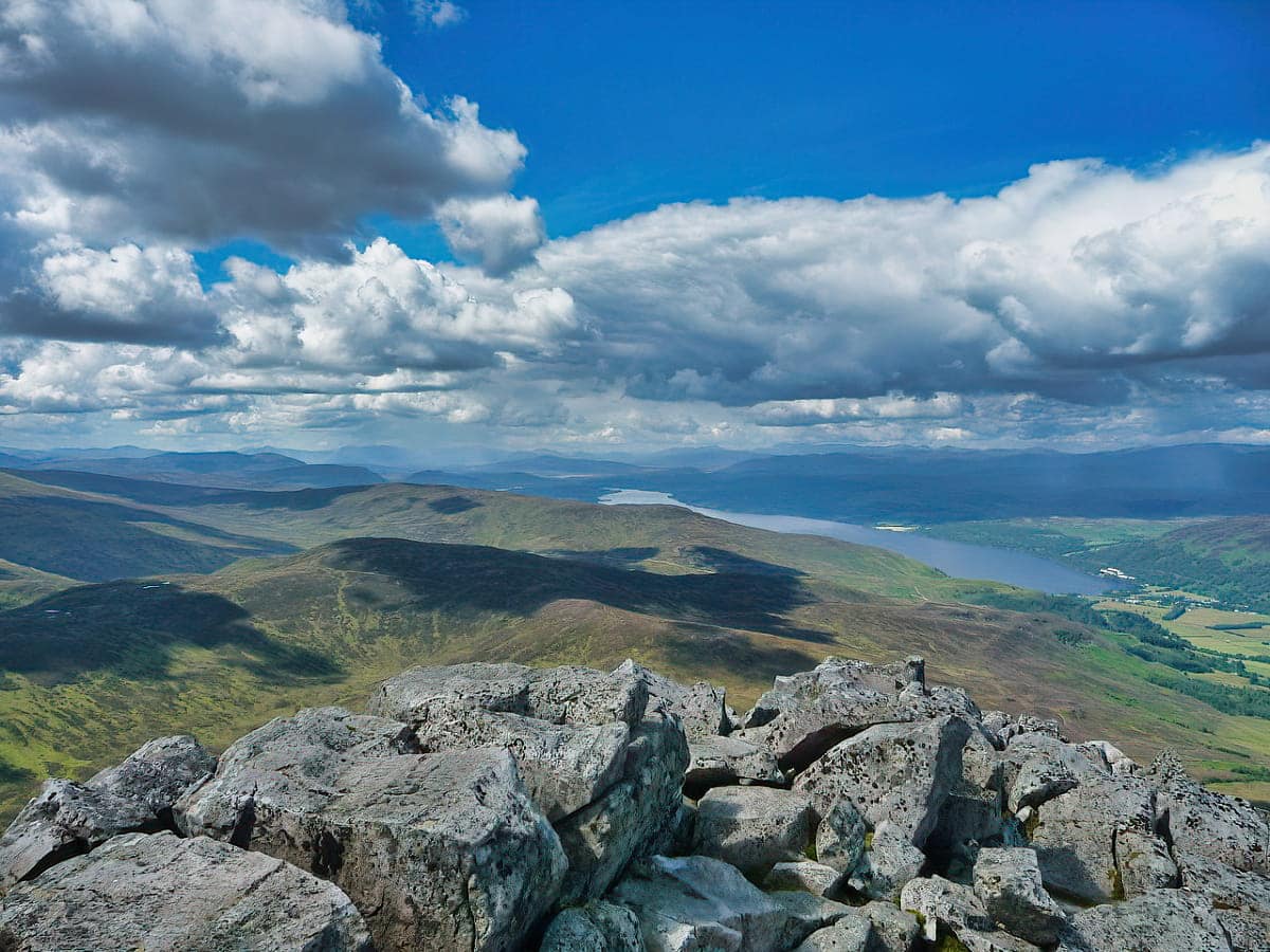
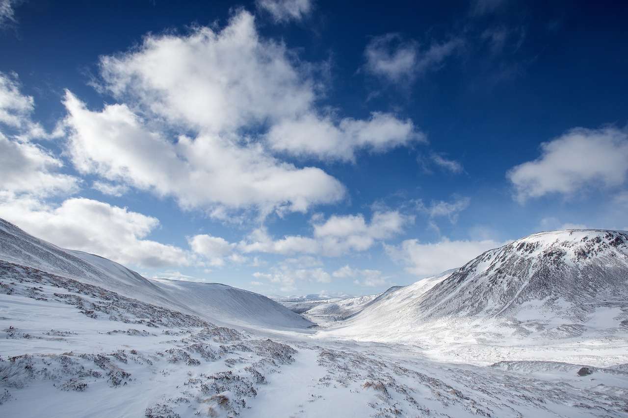
Munros are mountains in Scotland over 3,000 feet (914.4 metres) in height. They can be found in the Scottish Highlands as well as the Western Isles and the central belt, and climbing them (aka Munro bagging) is an ongoing challenge for thousands of hill walkers each year.
Discover the best Munros in Scotland, where they are, and information about Munro bagging in this complete guide, which includes maps and useful resources to make your Scottish mountain adventure an experience you’ll never forget.
How Many Munros Are There in Scotland?
A Munro is defined as a mountain in Scotland that is over 3,000 feet (914.4 metres) in height. There are several categories used to describe Scottish mountains, but it’s the tallest of them that has spawned an entire pastime in Scotland.
Before 1891, there was a lot of uncertainty about the number of Scotland’s tallest peaks, and estimates of how many were over 3,000 feet ranged from 31 to 236. It was obvious that someone would have to accurately survey each one, so the founding member of the Scottish Mountaineering Club, Sir Hugh Munro, took on the monumental task of climbing and classifying them.
Munro published his findings in the Scottish Mountaineering Club journal in 1891 with a set of tables that detailed 538 summits over 3,000 feet. Of these, 282 were classified as separate mountains, and it’s these that we refer to today as ‘Munros’. If you’re wondering what happened to the other 256 summits, they’re actually classified as Munro Tops, which is a peak that has no prominence over others nearby.
There are also gradings for mountains under 3,000 feet, all of which were surveyed and published through the Scottish Mountaineering Club. These are:
- Corbett: Scottish mountains between 2,500 and 3,000 feet with a drop of 500 feet on all sides.
- Graham: Scottish mountains between 2,000 and 2,500 feet with a drop of 150 feet on all sides.
- Donald: Scottish mountain with a height up to 2,000 feet with a drop of 100 feet on all sides.
- Marilyn: Any mountain in Scotland with a drop of at least 150 feet on all sides.
With the advent of more accurate surveying techniques, some of the original Munros were downgraded to Corbetts, while some Corbetts were upgraded to Munros, but the number coincidentally still totals 282, just as it did 130 years ago.
Climbing Scotland’s Munros is an extremely popular leisure activity, and it’s even more popular today than it was when Hugh Munro published his official list. This is in part thanks to the efforts of groups like the John Muir Trust, which have created superb footpaths on many of Scotland’s most-walked mountains.
What Is Munro Bagging?
After the official list of Munros was published a new outdoor activity quickly gained popularity with Scotland’s mountaineers and hillwalkers which took the name ‘Munro bagging’. It’s an activity that’s challenging, to say the least, but it’s an incredibly rewarding experience that’s also very addictive once you get into it.
Munro bagging is basically where an individual climbs each one of Scotland’s 282 Munros to their summit, with each completion called a ’round’ and the individual that made the achievement called a ‘compleationist’.
That’s not a typo by the way, the Scottish Mountaineering Club still uses the spelling from the days of Hugh Munro.
So how long does it take to bag all the Munros in Scotland? Well, to date, there are more than 6,700 completionists, and each year, another 200+ add their names to the official register. Some people spend their whole lives trying to get to that 282nd Munro, while others attempt to finish a round in the fastest time possible (currently a jaw-dropping 32 days).
The average time to complete a round is around 20 years, but that hasn’t stopped some individuals from repeating the climb up all 282 Munros multiple times over.
The achievements of these Munroists (yes, you can officially call yourself a ‘Munroist’ after finishing your first round) are inspiring, to say the least, and they include the youngest, who finished his first round at just 9 years old, and the current record holder, who has an incredible 16 rounds under his belt.
If you’ve decided you want to go it alone, you have two options: go on your own at your own pace or join a mountain climbing group.
If you decide to go it alone, you must research each mountain to determine its difficulty level, but if you start off with the ‘easier’ Munros listed further down this page, you should be able to climb them without much planning at all. When I recently climbed Schiehallion for example, I found myself at the top with a family with two 8-year-olds, a couple of pensioners, and a couple who’d brought their tiny Jack Russell along for the walk.
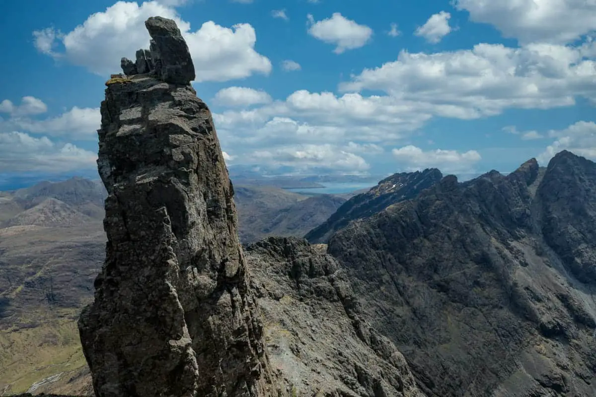
On the other hand, some of the more difficult Munros are extremely challenging and shouldn’t be attempted by anyone inexperienced in hill walking or climbing. A prime example of this is the ‘Inaccessible Pinnacle, otherwise known as the ‘In Pinn, on the Isle of Skye.
This large blade of basalt rock is widely regarded as the most difficult peak in Britain, but if you want to stake your place in history as a completionist, you have no option but to climb it.
Viewed side-on, the pinnacle takes the shape of a shark fin with sheer sides that offer little in the way of access. If getting up there looks difficult, getting down is even worse, as you’ll have to abseil, which is why securing the help of a professional guide is pretty much a necessity.
Of course, you don’t have to climb every single Munro and if you’re anything like me you’ll have an amazing time just reaching the summit when and wherever you can. You’ll get to see places of extraordinary beauty that you would never otherwise see, you’ll have unforgettable encounters with wildlife, and you’ll get immense personal satisfaction from pushing yourself harder than you ever thought you were capable of.
Where Are the Munros in Scotland?
The majority of Scotland’s Munros are located in the Scottish Highlands, a mountainous region that lies west of the Highland Boundary Fault. This fault line extends from the Isle of Arran on the west coast up towards Stonehaven on the east before doubling back towards Inverness, with everything lying to the west known as the Highlands and everything to the south called the Lowlands.
A picture speaks a thousand words, so here’s a little diagram:
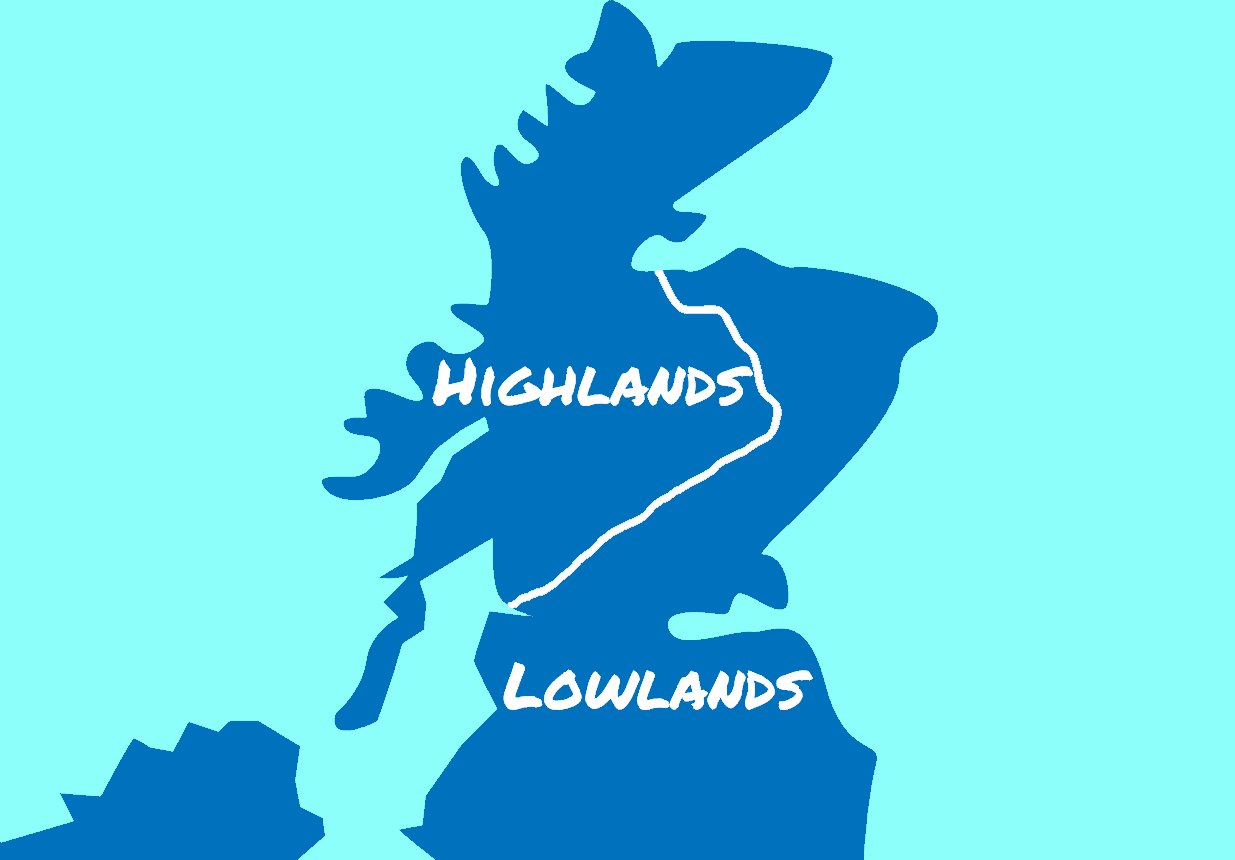
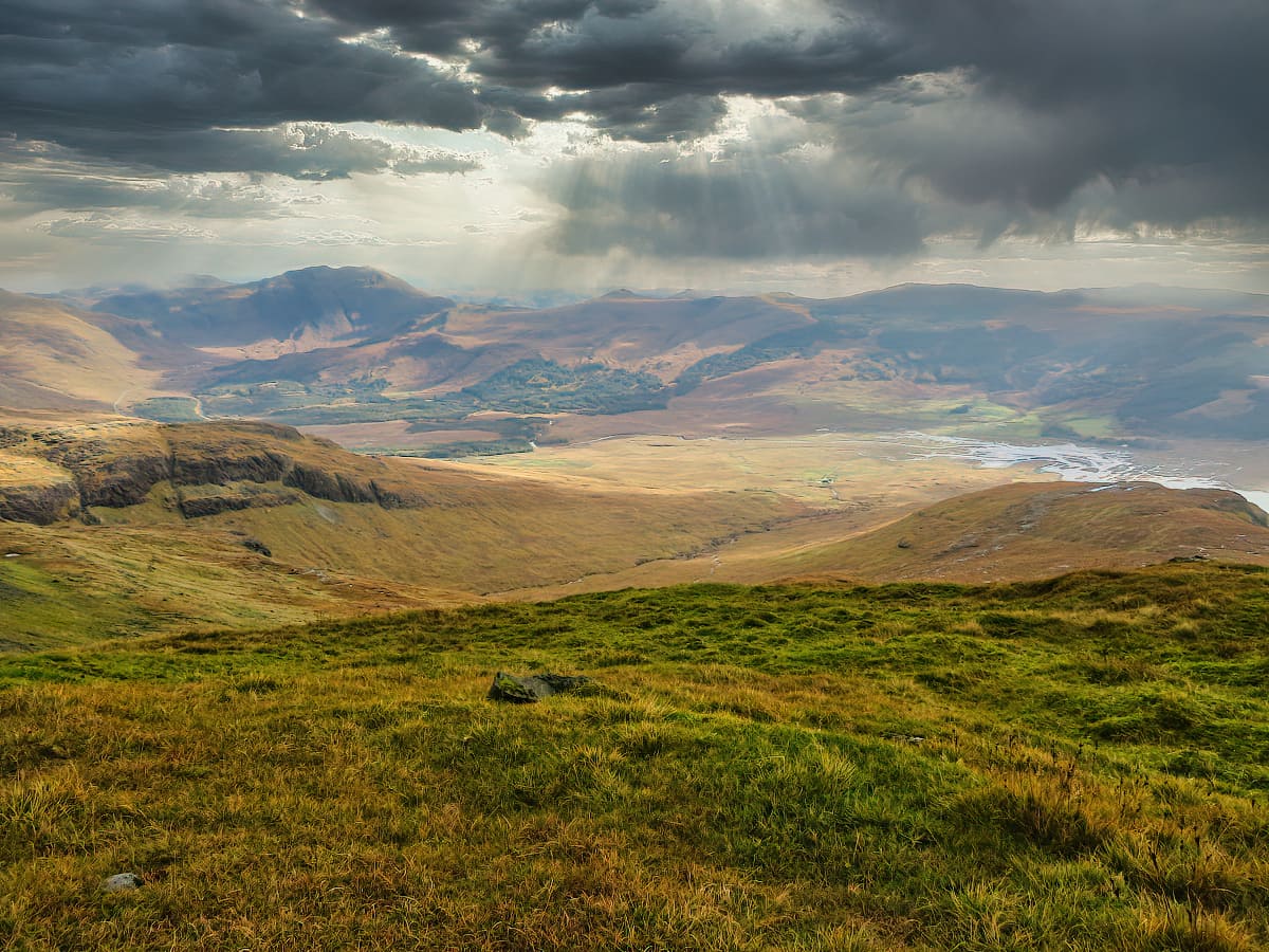
The Highland landscape is one of the most diverse on the planet as a result of the enormous geological activity this fault line has caused and the deep scores that glaciers carved through Scotland during the last ice age.
A truly stunning coastline that rivals Norway’s fjords borders vast freshwater lochs, and thick forests are set amongst monumental mountain ranges that stretch in every direction as far as the eye can see.
This landscape is the location for the majority of Scotland’s mountains, and while there are a few on the west coast islands and the central belt, if you’re trying to decide where to bag your first Munro, the Highlands should be your first port of call.
All Munros in Scotland
CLICK HERE to see a list of all 282 Munros in Scotland, the region they’re located in and their heights.
| Mountain | Region | Altitude |
|---|---|---|
| A’ Bhuidheanach Bheag | Cairngorms | 936m |
| A’ Chailleach | Ullapool | 997m |
| A’ Chailleach (Monadhliath) | Cairngorms | 930m |
| A’ Chralaig | Kintail | 1120m |
| A’ Ghlas-bheinn | Kintail | 918m |
| A’ Mhaighdean | Ullapool | 967m |
| A’ Mharconaich | Cairngorms | 975m |
| Am Basteir | Islands | 934m |
| Am Bodach | Fort William | 1032m |
| Am Faochagach | Ullapool | 954m |
| An Caisteal | Loch Lomond | 995m |
| An Coileachan | Ullapool | 923m |
| An Gearanach | Fort William | 982m |
| An Riabhachan | Loch Ness | 1129m |
| An Sgarsoch | Cairngorms | 1006m |
| An Socach (Affric) | Loch Ness | 921m |
| An Socach (Braemar) | Cairngorms | 944m |
| An Socach (Mullardoch) | Loch Ness | 1069m |
| An Stuc | Perthshire | 1118m |
| Aonach Air Chrith | Kintail | 1021m |
| Aonach Beag (Alder) | Cairngorms | 1116m |
| Aonach Beag (Nevis Range) | Fort William | 1234m |
| Aonach Meadhoin | Kintail | 1001m |
| Aonach Mor | Fort William | 1221m |
| Beinn a’Bhuird | Cairngorms | 1197m |
| Beinn a’Chaorainn (Cairngorms) | Cairngorms | 1082m |
| Beinn a’Chaorainn (Glen Spean) | Fort William | 1050m |
| Beinn a’Chlachair | Fort William | 1087m |
| Beinn a’Chleibh | Argyll | 916m |
| Beinn a’Chochuill | Argyll | 980m |
| Beinn a’Chreachain | Argyll | 1081m |
| Beinn a’Chroin | Loch Lomond | 942m |
| Beinn Achaladair | Argyll | 1038m |
| Beinn an Dothaidh | Argyll | 1004m |
| Beinn Bheoil | Cairngorms | 1019m |
| Beinn Bhreac | Cairngorms | 931m |
| Beinn Bhrotain | Cairngorms | 1157m |
| Beinn Bhuidhe | Argyll | 948m |
| Beinn Chabhair | Loch Lomond | 933m |
| Beinn Dearg (Blair Atholl) | Perthshire | 1008m |
| Beinn Dearg (Ullapool) | Ullapool | 1084m |
| Beinn Dorain | Argyll | 1076m |
| Beinn Dubhchraig | Argyll | 978m |
| Beinn Eibhinn | Cairngorms | 1102m |
| Beinn Eunaich | Argyll | 989m |
| Beinn Fhada | Kintail | 1032m |
| Beinn Fhionnlaidh | Argyll | 959m |
| Beinn Fhionnlaidh (Carn Eige) | Loch Ness | 1005m |
| Beinn Ghlas | Perthshire | 1103m |
| Beinn Heasgarnich | Perthshire | 1078m |
| Beinn Ime | Loch Lomond | 1011m |
| Beinn Iutharn Mhor | Cairngorms | 1045m |
| Beinn Liath Mhor | Torridon | 926m |
| Beinn Liath Mhor Fannaich | Ullapool | 954m |
| Beinn Mhanach | Argyll | 953m |
| Beinn Mheadhoin | Cairngorms | 1182m |
| Beinn na Lap | Fort William | 937m |
| Beinn nan Aighenan | Fort William | 960m |
| Beinn Narnain | Loch Lomond | 926m |
| Beinn Sgritheall | Kintail | 974m |
| Beinn Sgulaird | Argyll | 937m |
| Beinn Tarsuinn | Ullapool | 937m |
| Beinn Teallach | Fort William | 915m |
| Beinn Tulaichean | Loch Lomond | 946m |
| Beinn Udlamain | Cairngorms | 1010m |
| Ben Alder | Cairngorms | 1148m |
| Ben Avon | Cairngorms | 1171m |
| Ben Challum | Argyll | 1025m |
| Ben Chonzie | Perthshire | 931m |
| Ben Cruachan | Argyll | 1126m |
| Ben Hope | Sutherland | 927m |
| Ben Klibreck | Sutherland | 961m |
| Ben Lawers | Perthshire | 1214m |
| Ben Lomond | Loch Lomond | 974m |
| Ben Lui | Argyll | 1130m |
| Ben Macdui | Cairngorms | 1309m |
| Ben More | Loch Lomond | 1174m |
| Ben More (Mull) | Islands | 966m |
| Ben More Assynt | Ullapool | 998m |
| Ben Nevis | Fort William | 1345m |
| Ben Oss | Argyll | 1029m |
| Ben Starav | Fort William | 1078m |
| Ben Vane | Loch Lomond | 915m |
| Ben Vorlich (Loch Earn) | Perthshire | 985m |
| Ben Vorlich (Loch Lomond) | Loch Lomond | 943m |
| Ben Wyvis | Loch Ness | 1046m |
| Bidean nam Bian | Fort William | 1150m |
| Bidein a’Choire Sheasgaich | Torridon | 945m |
| Bidein a’Ghlas Thuill (An Teallach) | Ullapool | 1062m |
| Binnein Beag | Fort William | 943m |
| Binnein Mor | Fort William | 1130m |
| Bla Bheinn | Islands | 928m |
| Braeriach | Cairngorms | 1296m |
| Braigh Coire Chruinn-bhalgain | Perthshire | 1070m |
| Broad Cairn | Cairngorms | 998m |
| Bruach na Frithe | Islands | 958m |
| Bynack More | Cairngorms | 1090m |
| Cairn Bannoch | Cairngorms | 1012m |
| Cairn Gorm | Cairngorms | 1245m |
| Cairn of Claise | Cairngorms | 1064m |
| Cairn Toul | Cairngorms | 1291m |
| Carn a’Chlamain | Perthshire | 963m |
| Carn a’Choire Bhoidheach | Cairngorms | 1118m |
| Carn a’Gheoidh | Cairngorms | 975m |
| Carn a’Mhaim | Cairngorms | 1037m |
| Carn an Fhidhleir (Carn Ealar) | Cairngorms | 994m |
| Carn an Righ | Perthshire | 1029m |
| Carn an t-Sagairt Mor | Cairngorms | 1047m |
| Carn an Tuirc | Cairngorms | 1019m |
| Carn Aosda | Cairngorms | 917m |
| Carn Bhac | Cairngorms | 946m |
| Carn Dearg (Corrour) | Fort William | 941m |
| Carn Dearg (Loch Pattack) | Cairngorms | 1034m |
| Carn Dearg (Monadhliath) | Cairngorms | 945m |
| Carn Eige | Loch Ness | 1183m |
| Carn Ghluasaid | Kintail | 957m |
| Carn Gorm | Perthshire | 1029m |
| Carn Liath (Beinn a’Ghlo) | Perthshire | 975m |
| Carn Liath (Creag Meagaidh) | Fort William | 1006m |
| Carn Mairg | Perthshire | 1042m |
| Carn Mor Dearg | Fort William | 1220m |
| Carn na Caim | Cairngorms | 941m |
| Carn nan Gabhar | Perthshire | 1121m |
| Carn nan Gobhar (Loch Mullardoch) | Loch Ness | 992m |
| Carn nan Gobhar (Strathfarrar) | Loch Ness | 992m |
| Carn Sgulain | Cairngorms | 920m |
| Chno Dearg | Fort William | 1046m |
| Ciste Dhubh | Kintail | 979m |
| Cona’ Mheall | Ullapool | 978m |
| Conival | Ullapool | 987m |
| Creag a’Mhaim | Kintail | 947m |
| Creag Leacach | Cairngorms | 987m |
| Creag Meagaidh | Fort William | 1130m |
| Creag Mhor (Glen Lochay) | Perthshire | 1047m |
| Creag Mhor (Meall na Aighean) | Perthshire | 981m |
| Creag nan Damh | Kintail | 918m |
| Creag Pitridh | Fort William | 924m |
| Creise | Fort William | 1100m |
| Cruach Ardrain | Loch Lomond | 1046m |
| Derry Cairngorm | Cairngorms | 1155m |
| Driesh | Angus | 947m |
| Druim Shionnach | Kintail | 987m |
| Eididh nan Clach Geala | Ullapool | 927m |
| Fionn Bheinn | Torridon | 933m |
| Gairich | Fort William | 919m |
| Garbh Chioch Mhor | Fort William | 1013m |
| Geal Charn | Fort William | 1049m |
| Geal Charn (Monadhliath) | Cairngorms | 926m |
| Geal-charn (Alder) | Cairngorms | 1132m |
| Geal-charn (Drumochter) | Cairngorms | 917m |
| Glas Bheinn Mhor | Fort William | 997m |
| Glas Maol | Cairngorms | 1068m |
| Glas Tulaichean | Perthshire | 1051m |
| Gleouraich | Fort William | 1035m |
| Gulvain | Fort William | 987m |
| Inaccessible Pinnacle | Islands | 986m |
| Ladhar Bheinn | Fort William | 1020m |
| Lochnagar | Cairngorms | 1155m |
| Luinne Bheinn | Fort William | 939m |
| Lurg Mhor | Torridon | 986m |
| Mam Sodhail | Loch Ness | 1181m |
| Maoile Lunndaidh | Torridon | 1007m |
| Maol Chean-dearg | Torridon | 933m |
| Maol chinn-dearg | Kintail | 981m |
| Mayar | Angus | 928m |
| Meall a’Bhuiridh | Fort William | 1108m |
| Meall a’Choire Leith | Perthshire | 926m |
| Meall a’Chrasgaidh | Ullapool | 934m |
| Meall Buidhe (Glen Lyon) | Perthshire | 932m |
| Meall Buidhe (Knoydart) | Fort William | 946m |
| Meall Chuaich | Cairngorms | 951m |
| Meall Corranaich | Perthshire | 1069m |
| Meall Dearg (Aonach Eagach) | Fort William | 953m |
| Meall Garbh (Ben Lawers) | Perthshire | 1118m |
| Meall Garbh (Carn Mairg) | Perthshire | 968m |
| Meall Ghaordaidh | Perthshire | 1039m |
| Meall Glas | Loch Lomond | 959m |
| Meall Gorm | Ullapool | 949m |
| Meall Greigh | Perthshire | 1001m |
| Meall na Teanga | Fort William | 918m |
| Meall nan Ceapraichean | Ullapool | 977m |
| Meall nan Eun | Fort William | 928m |
| Meall nan Tarmachan | Perthshire | 1044m |
| Monadh Mor | Cairngorms | 1113m |
| Moruisg | Torridon | 928m |
| Mount Keen | Angus | 939m |
| Mullach an Rathain (Liathach) | Torridon | 1023m |
| Mullach Clach a’Bhlair | Cairngorms | 1019m |
| Mullach Coire Mhic Fhearchair | Ullapool | 1019m |
| Mullach Fraoch-choire | Kintail | 1102m |
| Mullach nan Coirean | Fort William | 939m |
| Mullach nan Dheiragain | Loch Ness | 982m |
| Na Gruagaichean | Fort William | 1056m |
| Ruadh Stac Mor | Ullapool | 918m |
| Ruadh-stac Mor (Beinn Eighe) | Torridon | 1010m |
| Sail Chaorainn | Kintail | 1002m |
| Saileag | Kintail | 956m |
| Schiehallion | Perthshire | 1083m |
| Seana Bhraigh | Ullapool | 926m |
| Sgairneach Mhor | Cairngorms | 991m |
| Sgiath Chuil | Loch Lomond | 921m |
| Sgor an Lochain Uaine | Cairngorms | 1258m |
| Sgor Gaibhre | Fort William | 955m |
| Sgor Gaoith | Cairngorms | 1118m |
| Sgor na h-Ulaidh | Fort William | 994m |
| Sgorr Dhearg (Beinn a’Bheithir) | Fort William | 1024m |
| Sgorr Dhonuill (Beinn a’Bheithir) | Fort William | 1001m |
| Sgorr nam Fiannaidh (Aonach Eagach) | Fort William | 967m |
| Sgorr Ruadh | Torridon | 962m |
| Sgurr a’Bhealaich Dheirg | Kintail | 1036m |
| Sgurr a’Chaorachain | Torridon | 1053m |
| Sgurr a’Choire Ghlais | Loch Ness | 1083m |
| Sgurr a’Ghreadaidh | Islands | 973m |
| Sgurr a’Mhadaidh | Islands | 918m |
| Sgurr a’Mhaim | Fort William | 1099m |
| Sgurr a’Mhaoraich | Fort William | 1027m |
| Sgurr Alasdair | Islands | 992m |
| Sgurr an Doire Leathain | Kintail | 1010m |
| Sgurr an Lochain | Kintail | 1004m |
| Sgurr Ban | Ullapool | 989m |
| Sgurr Breac | Ullapool | 999m |
| Sgurr Choinnich | Torridon | 999m |
| Sgurr Choinnich Mor | Fort William | 1094m |
| Sgurr Dubh Mor | Islands | 944m |
| Sgurr Eilde Mor | Fort William | 1010m |
| Sgurr Fhuar-thuill | Loch Ness | 1049m |
| Sgurr Fhuaran | Kintail | 1067m |
| Sgurr Fiona (An Teallach) | Ullapool | 1060m |
| Sgurr Mhic Choinnich | Islands | 948m |
| Sgurr Mor | Ullapool | 1110m |
| Sgurr Mor (Beinn Alligin) | Torridon | 986m |
| Sgurr Mor (Loch Quoich) | Fort William | 1003m |
| Sgurr na Banachdich | Islands | 965m |
| Sgurr na Carnach | Kintail | 1002m |
| Sgurr na Ciche | Fort William | 1040m |
| Sgurr na Ciste Duibhe | Kintail | 1027m |
| Sgurr na Lapaich | Loch Ness | 1150m |
| Sgurr na Ruaidhe | Loch Ness | 993m |
| Sgurr na Sgine | Kintail | 945m |
| Sgurr nan Ceathreamhnan | Loch Ness | 1151m |
| Sgurr nan Clach Geala | Ullapool | 1093m |
| Sgurr nan Coireachan (Glen Dessary) | Fort William | 953m |
| Sgurr nan Coireachan (Glenfinnan) | Fort William | 956m |
| Sgurr nan Conbhairean | Kintail | 1109m |
| Sgurr nan Each | Ullapool | 923m |
| Sgurr nan Eag | Islands | 924m |
| Sgurr nan Gillean | Islands | 964m |
| Sgurr Thuilm | Fort William | 963m |
| Slioch | Torridon | 981m |
| Spidean a’Choire Leith (Liathach) | Torridon | 1055m |
| Spidean Coire nan Clach (Beinn Eighe) | Torridon | 993m |
| Spidean Mialach | Fort William | 996m |
| Sron a’Choire Ghairbh | Fort William | 937m |
| Stob a’Choire Mheadhoin | Fort William | 1106m |
| Stob a’Choire Odhair | Argyll | 945m |
| Stob Ban (Grey Corries) | Fort William | 977m |
| Stob Ban (Mamores) | Fort William | 999m |
| Stob Binnein | Loch Lomond | 1165m |
| Stob Choire Claurigh | Fort William | 1177m |
| Stob Coir an Albannaich | Fort William | 1044m |
| Stob Coire a’Chairn | Fort William | 981m |
| Stob Coire an Laoigh | Fort William | 1116m |
| Stob Coire Easain | Fort William | 1115m |
| Stob Coire Raineach (Buachaille Etive Beag) | Fort William | 925m |
| Stob Coire Sgreamhach | Fort William | 1072m |
| Stob Coire Sgriodain | Fort William | 979m |
| Stob Daimh | Argyll | 998m |
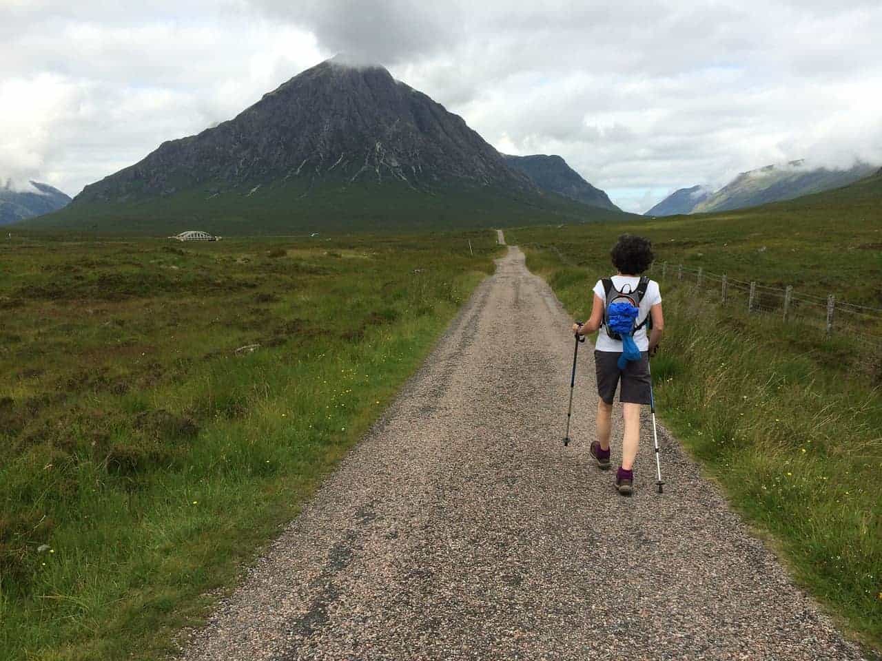
| Stob Dearg (Buachaille Etive Mor) | Fort William | 1021m |
| Stob Dubh (Buachaille Etive Beag) | Fort William | 956m |
| Stob Ghabhar | Argyll | 1090m |
| Stob na Broige (Buachaille Etive Mor) | Fort William | 956m |
| Stob Poite Coire Ardair | Fort William | 1054m |
| Stuc a’Chroin | Perthshire | 975m |
| Stuchd an Lochain | Perthshire | 960m |
| The Cairnwell | Cairngorms | 933m |
| The Devil’s Point | Cairngorms | 1004m |
| The Saddle | Kintail | 1010m |
| Toll Creagach | Loch Ness | 1054m |
| Tolmount | Cairngorms | 958m |
| Tom a’Choinich | Loch Ness | 1112m |
| Tom Buidhe | Cairngorms | 957m |
| Tom na Gruagaich (Beinn Alligin) | Torridon | 922m |
Which Are the Easiest Munros to Bag?
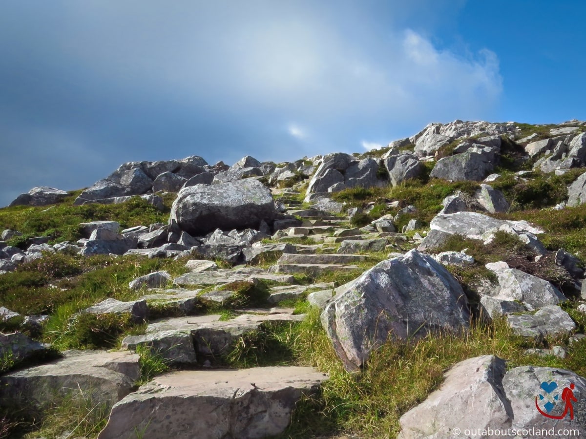
Climbing Scotland’s Munros doesn’t have to be a massive undertaking, and it’s worth bearing in mind that many peaks are quite accessible. That being said, no Munro could ever be described as easy, but it’s certainly true that some are easier than others.
The following list of Munros to bag in Scotland is ideal for anyone starting their first round, or perhaps anyone who just wants to climb a single Munro to say they’ve done it. However, you should have a few basics under your belt before setting off, which include map-reading skills and a moderate level of fitness.
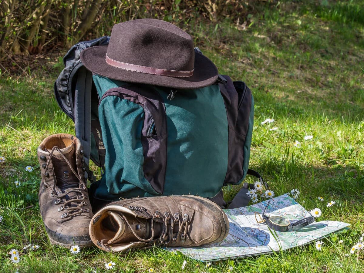
In addition, it’s your responsibility to ensure you’re adequately equipped for the climb, so wear appropriate clothes with additional warm and waterproof layers, even if it’s a warm and sunny day. Take plenty of food and water, wear good-quality waterproof boots (check out my recommended boots, pack a map, and take a GPS device (your phone will suffice in most cases).
Ben Chonzie
- Location: OS Grid Reference NN 77328 30867. Latitude: 56° 27′ 14″ N, Longitude: 3° 59′ 31″ W
- Height: Elevation 3,054 feet (931 metres), Prominence 2,116 feet (645 metres)
This Munro in Perthshire is considered one of the easiest to climb, and it’s often chosen as the first ascent for beginner Munro-baggers. In fact, the hardest part might be finding the start of the walk.
From Loch Earn, follow the A85 to the village of Comrie and take the minor Monument Road for 5 miles till you get to the Ben Chonzie car park. There’s only space for perhaps 5 vehicles, so I suggest getting there early as parking on the narrow verge is difficult.
There’s a narrow track that leads from the car park towards Ben Chonzie, which is waymarked and isn’t at all difficult to navigate, but keep an eye open for a small dam that crosses a burn to know you’re on the right track. From there, it’s a simple walk on a rough path to the summit, where you’ll have stunning views across Glen Lednock.
Ben Lawers
- Location: OS Grid Ref: NN 63553 41423. Latitude: 56° 32′ 41″ N, Longitude: 4° 13′ 15″ W
- Height: Elevation 3,983 feet (1,214 metres), Prominence 3,002 feet (915 metres)
- Out About Scotland complete guide: Ben Lawers
This is the 10th-highest Munro in Scotland at 3,980 feet (1,213.1 metres), but it’s one of the easiest to climb thanks to a car park situated halfway up it, which offers access to a rough footpath to the top. Ben Lawers is one of the few Scottish Munros that isn’t located in the depths of the Highlands miles from anywhere, and instead, you’ll find it’s quite easy to get to by following the A827 along the northern bank of Loch Tay.
There’s a single-track road a mile or so past Morenish that leads to the car park, where you’ll find a well-marked track that continues up the mountain on a route that I’d say is nothing more than a moderate incline. There’s even a wooden walkway in places, so it’s a very accessible way to view Scotland’s mountain scenery.
The wide-open mountainside of Ben Lawers is a favourite hunting ground for eagles, so if you have room in your backpack, I recommend throwing a pair of binoculars in there, as you never know what you’ll see during the ascent.
Ben Lomond
- Location: OS Grid Ref: NN 36707 02861. Latitude: 56° 11′ 25″ N, Longitude: 4° 37′ 58″ W
- Height: Elevation 3,195 feet (974 metres), Prominence 2,687 feet (819 metres)
As the most southerly of all Scotland’s Munros, Ben Lomond is also one of the most visited thanks to a superb (for a Scottish mountain) path that runs in a loop from the eastern shore of Loch Lomond to the summit and back again.
Getting to the Trossachs is a short drive from Glasgow and Edinburgh, so you can easily bag this Munro on a day trip without having to book overnight accommodation. However, with such stunning scenery on your doorstep, I’d advise spending at least a couple of days in the area to explore the pretty villages of Balloch, Queen Elizabeth Forest, Loch Lomond, and, of course, Ben Lomond.
Ben Lomond rivals Ben Nevis as the most-climbed peak in Scotland so don’t expect to have the place to yourself when you visit. If you set off early you’ll find it’s reasonably quiet though, and the views on the 7-mile route are nothing short of spectacular.
As with all of Scotland’s Munros, you’ll find an excellent route guide on the Walk Highlands website as well as a downloadable Google Earth route, but personally, I prefer using an OS Map, which I will cover in detail later in this article.
Schiehallion
- Location: OS Grid Ref: NN 71385 54768. Latitude: 56° 40′ 1″ N, Longitude: 4° 6′ 0″ W
- Height: Elevation 3,553 feet (1,083 metres), Prominence 2,356 feet (718 metres)
- Out About Scotland complete guide: Schiehallion
It has been said that you could drive up Schiehallion, and at times, that’s not too far from the truth. The mountain features a wide and sloping footpath that’s easily accessed, and the only moderately difficult section is the rocky scramble at the very top. Perhaps that’s why more than 20,000 people make the climb each year.
The mountain is located in Perth and Kinross, 10 miles northwest of Aberfeldy, not far from the lochs of Tay, Rannoch, and Tummel.
It might appear daunting when the steep slopes are viewed from the north, but looking at it from the east shows that it’s a slender mountain with a long slope that gradually rises to its peak, and it’s this route that is so appealing to beginner hill walkers.
The best way to tackle Schiehallion is to park at the Braes of Foss car park and follow the path alongside woodland, which abruptly opens onto an open plain of wildflowers and grasses. There’s nowhere else to deviate to, so it’s almost impossible to head off in the wrong direction, and all you really have to do is follow the footpath and keep walking onwards and upwards.
Once at the summit, you’ll have amazing views of Loch Rannoch and Rannoch Moor before returning on the same path back to the car park.
Which Are the Best Munros to Climb?
What makes a mountain great? Is it difficult to climb it? The views from the summit? The wildlife that lives on it? Personally, I wouldn’t say any criteria that make climbing one mountain ‘better’ than climbing any other because what one person thinks is a great Munro can just as easily be at the bottom of the list for someone else.
However, there are a few factors that will help to make the ascent a more enjoyable experience for the majority of people, which include ease of road access and car parking, a not-too-difficult terrain, the chance to see Scotland’s wildlife, and gob-smacking views from the summit.
While there’s a heap of Munros that foot the bill, I have a few favourites that I’d like to share with you, and I reckon they all offer a wonderful experience for any hillwalker, whether they’re an inexperienced newbie or a seasoned pro.
Ben More
- Location: OS Grid Ref: NM 52575 33077. Latitude: 56° 25′ 29″ N, Longitude: 6° 0′ 50″ W
- Height: Elevation 3,169 feet (966 metres), Prominence 3,169 feet (966 metres)
- Out About Scotland complete guide: Ben More
There are actually two Ben More’s in Scotland, but when the name is mentioned, most people immediately think of the peak located between Loch Lomond and Loch Earn. The Munro I’m including in this list, however, is instead the one on the Isle of Mull, which is my favourite west coast island.
Ben More sits on the western side of the island, more or less in the middle, and as it’s the highest mountain in the Inner Hebrides, it dominates the landscape for miles in every direction.
There are two routes to get to the summit, which you can attack from either the north or south faces, but it’s recommended to approach it from the village of Dhiseig on the shore of Loch Na Keal and head south. Only experienced hill walkers should attempt the alternate route in the opposite direction because it is steep and very, very difficult (I know this from experience).
It takes around 4 hours to complete both routes, but whichever you take, you can be assured of amazing views along the way. One tip I have is to take binoculars with you, as there’s every chance you’ll get to see Britain’s biggest bird, the white-tailed sea eagle, soaring overhead.
Ben Nevis
- Location: OS Grid Ref: NN 16675 71282. Latitude: 56° 47′ 48″ N, Longitude: 5° 0′ 12″ W
- Height: Elevation 4,412 feet (1,345 metres), Prominence 4,409 feet (1,344 metres)
- Out About Scotland: A Complete Guide: The Ben Nevis Mountain Gondola
It’s impossible not to have heard of Ben Nevis. As children, we’re taught it’s the highest mountain in Britain, and as adults who love the great outdoors, we aspire to climb it one day. There are a couple of routes to the summit, but it’s the most-used path (otherwise known as ‘the tourist route’) that you’ll probably walk unless you’re a hardened outdoors adventurer.
‘Tourist route’ is a bit of a misnomer, though, as it’s actually quite a long and strenuous trek to the top. It’s a well-maintained path, to be sure, but it’s over ten miles in length and will take most people around eight hours to complete.
Because it’s such a popular trail, there are excellent visitor facilities at the foot of the mountain, which include ample car parking, a visitor centre with a café, an information point, a gift shop, and lots of signposts to keep you pointed in the right direction.
The John Muir Trust is in charge of maintaining the mountain, and just like at Schiehallion, they have done a fantastic job of laying out an accessible path that zigzags its way to the summit, though it becomes rougher and covered in scree near the top. Once there, you’ll be presented with superb views in all directions, but take care as there are steep drops, especially on the north face.
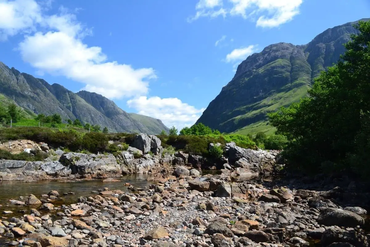
Bidean Nam Bian
- Location: OS Grid Ref: NN 14341 54210. Latitude: 56° 38′ 34″ N, Longitude: 5° 1′ 45″ W
- Height: Elevation 3,772 feet (1,150 metres), Prominence 2,772 feet (845 metres)
- Out About Scotland complete guide: Bidean Nam Bian
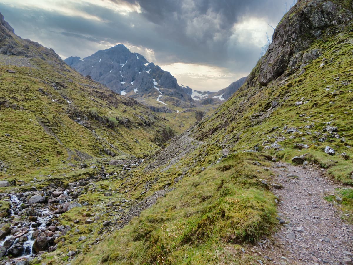
Glencoe is another tourist hotspot in the Highlands, and it’s (at least in my opinion) much prettier than the scenery surrounding Ben Nevis. The route up Bidean Nam Bian starts at Loch Actriochtan and continues up a moderately steep and rocky path to the peak of Stob Coire nan Lochan, where you can venture deep into the ridges of the mountain known as ‘The Three Sisters’.
This route can be tricky when it’s covered with snow and ice, so unless you’re an experienced climber, I suggest reserving a visit until the weather improves, when you’ll be able to appreciate the view across the glen as well as the refreshing pools of water that cascade off the mountainside.
After reaching the top of Coire nan Lochan, you’ll see the path petering out into a box canyon, which requires a scramble up scree slopes, after which you’ll be able to join another path that leads onto Stob Coire nan Lochan.
It looks quite daunting from the bottom, but it’s actually not too bad on close inspection, though it’s quite narrow, so if you haven’t got a head for heights, you might not find it a particularly enjoyable experience. The view from the top of the ridge is nothing short of breathtaking, with superb views out to Loch Etive and even the Isle of Mull on a clear day.
Ben Vorlich and Stuc A’Chroin
- Location: OS Grid Ref: NN 61746 17464. Latitude: 56° 19′ 45″ N, Longitude: 4° 14′ 15″ W
- Height: Elevation 3,199 feet (975 metres), Prominence 827 feet (252 metres)
I would have included Ben Vorlich on its own were it not for the fact that at 2,900 feet, it’s 100 feet shy of being a Munro, but it’s still worth climbing as it’s a lovely walk, and you can tack on nearby Stuc a’Chroin if you really want that magical 3,000-foot accomplishment.
The easiest path starts from the southern shores of Loch Earn, where it passes through woodland before the scenery changes to moorland as the elevation increases. The path is well-worn, so there shouldn’t be any problems making your way to the summit of Ben Vorlich, and at just 5 miles, this first section shouldn’t take more than 3 hours to complete.
If you want to extend the route, there’s a path from Ben Vorlich to Stuc a’Chroin that’s relatively straightforward, apart from the last section, which involves a steep scramble to the summit.
More Recommended Munros in Scotland
Trying to include a review of every single Scottish Munro in one article is pointless, as it would make it so long that you may as well go and read a book on the subject. What I’ll do instead, therefore, is include a few of my personal favourites in the following list as and when I’m able to visit them.
These Munros aren’t classified as ‘best’ in any particular category, but if I enjoy climbing them, I’ll be sure to add them below along with links to my in-depth reviews.
Ben Cruachan
- Location: OS Grid Ref: NN 06962 30471. Latitude: 56° 25′ 36″ N, Longitude: 5° 7′ 54″ W
- Height: Elevation 3,694 feet (1,126 metres), Prominence 2,890 feet (881 metres)
- Out About Scotland: A Complete Guide: Ben Cruachan Dam
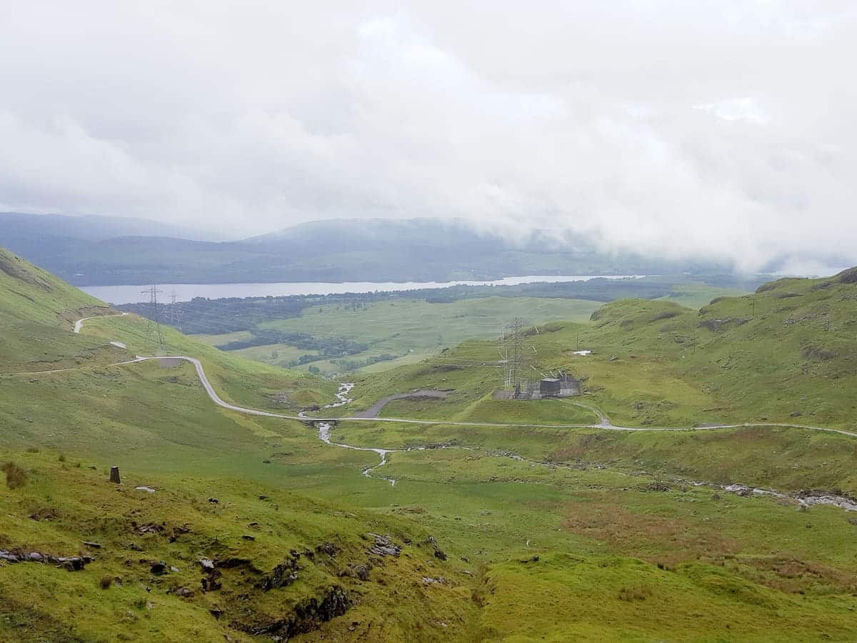
Ben Cruachan is one of the highest Munros in the Southern Highlands, and it’s extremely popular for two reasons.
The first is the fact that the superb ‘Hollow Mountain’ attraction is located nearby, where visitors can take a journey deep inside the mountain to view an enormous underground hydroelectric power station. The station is powered by water stored in the dam, and visitors are encouraged to walk up to it for a look, after which they can continue to the Ben Cruachan summit or return to the visitor centre.
The second reason to visit Ben Cruachan is for the superb views from the summit of Stob Dàimh, where climbers are presented with a sweeping panorama of Argyll that’s nothing short of breathtaking. The route to the summit is exceptionally pretty, and if the road leading to the dam is followed, then a good portion of it is exceptionally easy to walk as well.
Those visitors wanting to take the easy-going road to the dam can park in a lay-by at the side of the A85, not far from the Falls of Cruachan railway station. From there, follow an underpass and take the path heading in the direction of a small electric substation.
The path then joins the road that leads up to the dam, which is a pleasant enough walk in itself, before transitioning into a stony track that leads up to the summit. In total, I’d plan around 8 hours to walk the return route to the summit and half that if you don’t progress further than the dam.
Ben Hope
- Location: OS Grid Ref: NC 47750 50150. Latitude: 58° 24′ 47″ N, Longitude: 4° 36′ 28″ W
- Height: Elevation 3,041 feet (927 metres), Prominence 2,533 feet (772 metres)
- Out About Scotland: A Complete Guide: Ben Hope
This is, without doubt, the remotest Munro I’ve included in this article, as it’s located in the far-northern county of Sutherland and is, in fact, the most northerly mountain on the British mainland. I have to say this is one of my favourite regions of Scotland, with a wild and dramatic coastline, countless picturesque lochs, and a beautiful landscape that’s a haven for wildlife.
Access to Ben Hope is via a single-track road that can be joined from either the A838 to the north or the A836 to the south, with a car park located south of Loch Hope and close to Broch Dun Dornaigil.
The track leading up the mountain is steep and covered with loose rocks, so climbers should take care, especially in the sections that veer towards several burns that cascade down the slopes. As pretty as they are, these flows of water make the ground very slippery underfoot, and after a rainfall, the ascent can be downright treacherous.
Thankfully, despite being so remote, climbers frequently visit Ben Hope, making the trail clear at every turn.
It’s quite a twisty-turny route as it has to bypass quite a few gorges, but the effort involved is more than worth it, and visitors will have umpteen photo opportunities of Strathmore as they forge ahead through the heather-covered lower slopes. Towards the top, it gets steeper and more barren as the plants thin out and the slopes become scree-covered, and it becomes a downright scramble once you get nearer to the summit.
At the top, you’ll find a cairn and a stone wind shelter where you can soak up the gorgeous views across Sutherland before returning to the car park on the same route as used for the ascent.
Cairn Gorm
- Location: OS Grid Ref: NJ 00516 04064. Latitude: 57° 7′ 0″ N, Longitude: 3° 38′ 40″ W
- Height: Elevation 4,084 feet (1,245 metres), Prominence 476 feet (145 metres)
- Out About Scotland: A Complete Guide: Cairngorm Mountain Funicular
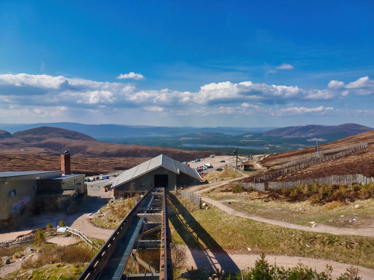
The Cairngorm mountain range is located in the heart of the Highlands, a more-or-less dead centre in the vast Cairngorms National Park.
The Cairngorm range is part of the wider Grampian mountains, which cover a large area of Scotland between the far northern Highlands and the Central Lowlands, and it includes many of the highest mountains in the UK, such as Ben Nevis and Cairn Gorm.
This is one of the highest peaks in Scotland at over 4,000 feet and is, in fact, the seventh-highest mountain in Britain, so anyone thinking of climbing up it will require a degree of fitness and stamina as well as experience in scaling Scotland’s tougher peaks.
There are several routes up the mountain, but by far the most-used is the ‘windy ridge’ path, which is quite steep but also the most direct and is the route that’s almost always described in guidebooks. The internet is full of websites that describe how to make this ascent, but I’ve yet to find one that’s as detailed as the Walk Highlands Cairn Gorm page.
Another route that is almost as popular follows the ski track up the slope of Coire Cas close to the Cairngorm Mountain Funicular, but this trail veers away from the summit in several places and is very busy during the ski season.
My advice is to head to the lower Cairngorm Mountain Experience Centre and take a good look at the information boards and maps to plan your ascent. Speak with the staff while you’re there because they’ll be able to tell you which routes are safe to take and which ones are hazardous—information that’s crucial in the winter when snow covers the tracks along the exposed plateaus.
Even if you decide not to scale the summit on foot, it’s worth visiting the Cairn Gorm base centre, as the mountain funicular allows swift travel up the mountain slopes to a visitor centre near the top where there’s a restaurant and a viewing platform.
For people with mobility issues, this is a great way to “climb” a mountain; however, because of the harm that countless tourists have done over the years to the delicate slopes, visitors are currently not allowed to leave the station.
Munro Walking Advice and Recommended Gear
Climbing mountains is an inherently risky hobby, and while some Munros are easier to bag than others, the fact is that there’s no ‘easy’ Munro.
Before setting off on your adventure, it’s advisable to go online and have a quick run-through of the route you’ll be taking, and maybe look at a few opinions of other hill walkers who have already completed it. One of the best resources for this is the Walk Highlands website, which has detailed route maps and descriptions of thousands of walks in Scotland, plus reviews and photos taken by experienced hill walkers.
When you’ve chosen a Munro that you feel you’re capable of climbing, it’s extremely useful to get an accurate weather forecast. Scotland’s changeable weather can make or break your climb, and if you don’t check the forecast before leaving home, you could find yourself lost in driving rain and unable to see more than a few feet ahead.
My go-to is the Mountain Weather Information Service which has some of the most detailed weather reports you’re ever likely to find, and they specialise in producing forecasts for Britain’s mountain areas. Another website I like to check before heading off into the great outdoors is Mountain Forecast.
This website is best for viewing updated maps that show cloud conditions across the UK, and I personally find the site easier to understand than reading a text report. They also have a handy ‘mountains closest to you’ section, which I’ve used many times to get ideas for peaks to climb whenever I’m visiting a new region of Scotland.
The next stage of your climb is making sure you’ve got the correct kit, and while I’m not going to explicitly state what’s best, I’ve got a few essentials that I use, which I’ll list next. The two most important items are a good water- and wind-proof jacket and comfy, supportive walking boots.
For the jacket, I swear by Berghaus (this and the following links are for Amazon). They’re at the premium end of consumer-level walking jackets, but the quality is excellent, and they’re superb at keeping you dry when it starts raining, which it will at some point.
A great feature of Berghuas jackets is their universal zip, which means you can insert different liners depending on the time of year you’re climbing. In winter, I zip in a thick fleece and in the warmer months, I zip in a lightweight gilet, and then, depending on how hot or cold I get during the climb, I just swap the layers and stuff whatever isn’t needed in my backpack.
For boots, again, I can only recommend what I’ve used myself, and I now only wear Berghaus. I’ve tried other brands, but in my opinion, Berghaus boots offer the best combination of comfort and durability for the money, plus they’re generous with the ankle support and the soles are extra grippy.
I’ve created an article about hiking boots which you can read if you want more information.
OS Maps
Having the right kit means nothing if you can’t get to your destination, and that’s where my final piece of must-have gear comes into play: a map and compass. For the map, you don’t need to look any further than the Ordnance Survey. OS Maps have been going for decades, and they’ve perfected making maps that are easy to read and ultra-detailed, plus you can get waterproof maps that are ideal for Scotland’s wet weather.
There are two types of OS maps, which are either labelled OS Explorer or OS Landranger. Explorer maps have a 1:25,000 scale (where 4 cm on the map equals 1 km in real life), and Landranger maps have a 1:50,000 scale (where 2 cm on the map equals 1 km in real life).
The Explorer range is best for walking as they’re more detailed, but I tend to go for Landranger maps as they double up for long-distance cycle routes.
To be honest, either should suffice for most walks in Scotland, but if you see them in a shop, make sure you only get the new ones that have a blue ‘Mobile download’ logo. This invaluable feature allows you to download your purchased OS map onto your phone, which is worth the price of the map on its own.
The OS Maps app works with your phone’s GPS to overlay your position directly onto the map, so you can see exactly where you are and the direction you’re heading. This feature is worth its weight in gold, and I’ve found it so handy that I only really use the paper map as a backup these days.
That being said, I’d never venture on a hike without a paper map in my bag, as mobile phones have a big downside in that their batteries run out, whereas you’ll always be able to use a paper map. If you like the sound of using OS Maps on your mobile device, you can subscribe to their premium service, which gives you access to every single map of Britain for around £25 a year. Considering the paper maps are around £10 each, it’s a bit of a bargain.
Ordnance Survey also sells an all-in-one GPS mapping device that is ruggedized, has a 30-hour battery life, supports multiple satellites, and includes every OS map of Britain at no extra cost. I’ve seen one and have decided I must have one. As soon as my other half gives me the go-ahead, that is.
Alongside your paper map, it’s recommended to purchase a compass and learn how to use it. There are a million places you can get a compass, and they’re so cheap that you might as well get one to throw in your bag as they weigh virtually nothing and take up a tiny amount of space.
As always, Amazon is your best friend here, so follow this link to buy one. There’s not much else that I’d classify as a necessity unless you’re tackling the more advanced Munros, but if you are, I suggest heading over to the websites in the section below for tips from the pros.
That being said, for most walks in Scotland, it’s always handy to have:
1: A backpack. I’ve created an article about lightweight backpacks for day walks, which you can read here. If you’re scaling advanced peaks, you might like to check out these backpacks on Amazon.
2: A head torch. Handheld torches are a pain to use when holding a map, so a head torch is recommended. There are a bazillion of these things on Amazon, so follow this link and take your pick.
3: A first-aid kit. I wouldn’t carry a big kit as they’re cumbersome, but it’s certainly useful to have plasters for cuts and scrapes and a bandage to support twisted ankles. I have a small pouch kit that weighs very little and sits permanently in a side pocket in my backpack. There are lots of options on Amazon.
4: Food and water. Basically, take lots of it, especially water. Walking uphill for two or three hours is thirsty work, and it’ll be torture if you can’t replace lost fluids because you’ve forgotten to pack a water bottle. I recommend a metal bottle, as they’ll survive being battered about when you drop your backpack to the floor, and most packs have two bottle holders, so you should be able to take 2 litres without problem. Amazon links to metal water bottles.
Recommended Resources and Further Reading
If you want to embark on your own Munro journey but are not sure where to start, Peak Bagging Munros Volume 1, by Nicola Hardy (Munroist number 6,765) – one of the foremost experts on Munro bagging – is the latest guide to climbing the most Munros, via the best routes, in the most efficient way.
Each route includes:
– Detailed directions
– Downloadable GPX files
– 1:40,000 scale maps
– Difficulty gradings
– Timings depending on whether you choose to walk, trek, fastpack or run
– Plus, the 64 routes included are divided into 10 hubs, which have been chosen as each offers a selection of nearby accommodation to suit all budgets, rest day activities for weekend or lengthier stays and public transport options.
Scottish Mountaineering Club: This is one of the most respected clubs for climbing in Scotland. The SMC has been operating for over 100 years, and they have a wealth of information about Munros as well as hosting a number of club meets and events. Members can even book one of their huts, which are strategically positioned close to mountain ranges.
The Munro Society: This is another club for Munro baggers, although The Munro Society aims to serve completionists rather than people that are still working towards finishing their first round. The society aims to act as a social network as well as provide mountain surveys and environmental reports on Scotland’s changing mountain scenery.
Munro Map: This handy website features an interactive map that depicts all the Munros in Scotland, and it also has information about each mountain, including coordinates, elevations, and the distance to surrounding mountains.
Walk Highlands: Walk Highlands is by far the best online resource for walking trails in Scotland. They offer thorough route descriptions, as well as routes that are downloadable onto Google Earth and photos to help you get your bearings on each trail.
If there’s a good walking trail in Scotland, you can be assured that Walk Highlands has it covered on their website.
Steve Fallon Mountain Adventures: Steve Fallon is the current record holder for the most rounds completed, so the guy is a bit of an expert when it comes to Munro bagging. His website is jam-packed with information about Munros, and in addition to detailed guides about them, he also runs guided treks up them. Definitely bookmark this one for your outdoor adventures.
Frequently Asked Questions
Which are the nearest Munros to Edinburgh?
Ben Chonzie: Time from Edinburgh: 1 hour, 53 minutes.
Beinn a’Ghlo: Time from Edinburgh: 1 hour, 51 minutes.
Ben Vorlich and Stuc a Chroin: Time from Edinburgh: 1 hour, 58 minutes.
Beinn Udlamain and Sgairneach Mhor: Time from Edinburgh: 2 hours, 7 minutes.
What are the Munros near Glasgow?
Ben Lomond: Time from Glasgow: 1 hour, 12 minutes.
Beinn Narnain: Time from Glasgow: 1 hour, 20 minutes.
Ben Ime: Time from Glasgow: 1 hour, 11 minutes.
Ben Vane: Time from Glasgow: 1 hour, 17 minutes.
Which are the highest Munros in Scotland?
Ben Nevis (1,345m).
Ben Macdui (1,309m).
Braeriach (1,296m).
Cairn Toul (1,291m).
Sgor an Lochain Uaine (1,258m).
Cairn Gorm (1,245m).
Aonach Beag (Nevis) (1,234m).
Aonach Mor (1,221m).
Carn Mor Dearg (1,220m).
Ben Lawers (1,214m).
Which are the smallest Munros in Scotland?
Ruadh Stac Mor (919m).
A’Ghlas-bheinn (918m).
Sgurr a’Mhadaidh (918m).
Creag nan Damh (917m)
Geal-charn (Drumochter) (917m).
Meall na Teanga (917m).
Beinn a’Chleibh (916m).
Ben Vane (916m).
Carn Aosda (915m).
Beinn Teallach (915m).