Isle of Raasay
The Isle of Raasay is located immediately east of Skye on the west coast of Scotland. This beautiful island in the Inner Hebrides is just 24 square miles in area, yet it’s home to one of the most geologically diverse landscapes in the world.
Visitors to Raasay can explore rolling hills, forests, lochs, golden beaches, and some of the most off-the-grid roads in Scotland. Discover Raasay with this complete visitor guide, which includes an overview and lots of useful tourist information.
🠇 Head to the bottom of the page for essential details on each attraction featured here, including addresses, opening hours, and entry prices 🠇
Isle of Raasay
The Isle of Raasay is one of those places that many tourists have heard of, but few will ever visit. That’s a real shame, as this is a small island that punches well above its weight when it comes to scenery, and it’s the best place to view the dramatic Cuillin mountains on Skye and the rugged Torridon Hills on the mainland.
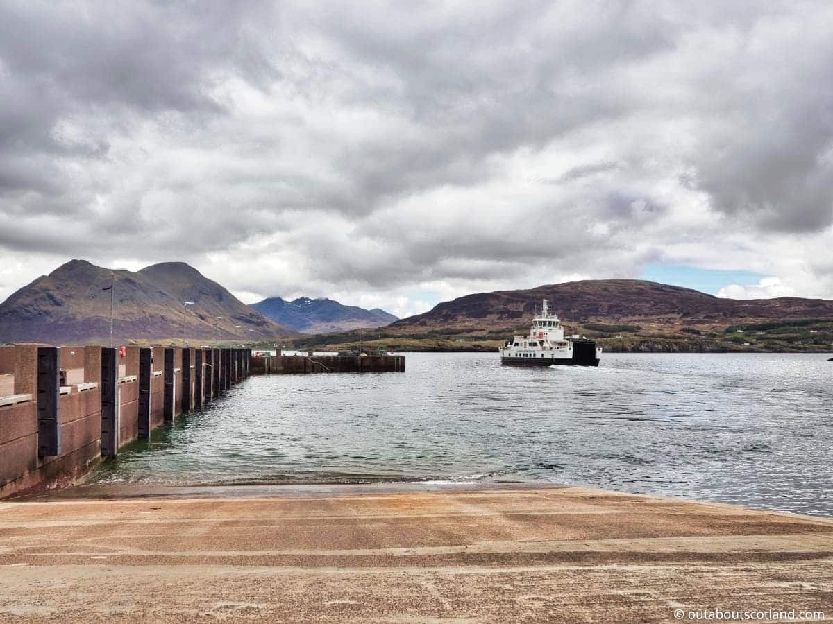
To get to Raasay there’s really only one option (unless you have your own boat) which is to take a 25-minute ferry from the Sconser jetty on Skye’s eastern edge to the opposite jetty at Churchton Bay.
From there, visitors have free roam of the island thanks to a single-track road that winds its way from the beach at the southern end all the way to the northern peninsula where it joins the famous Calum’s Road at the far north (more on that later).
At just 24 square miles, Raasay is nowhere near as big as the Isle of Skye, but it has a much smaller population and far fewer tourists, meaning you can explore it from top to bottom (14 miles) and side to side (5 miles) in almost guaranteed peace and quiet.
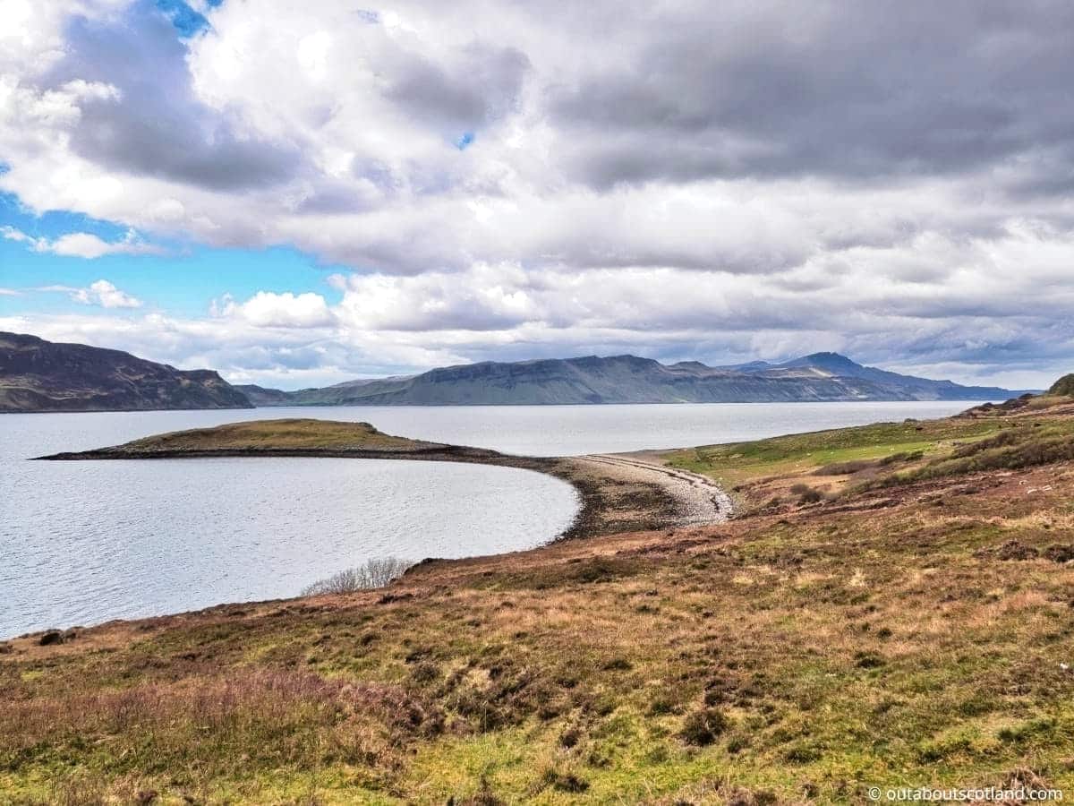
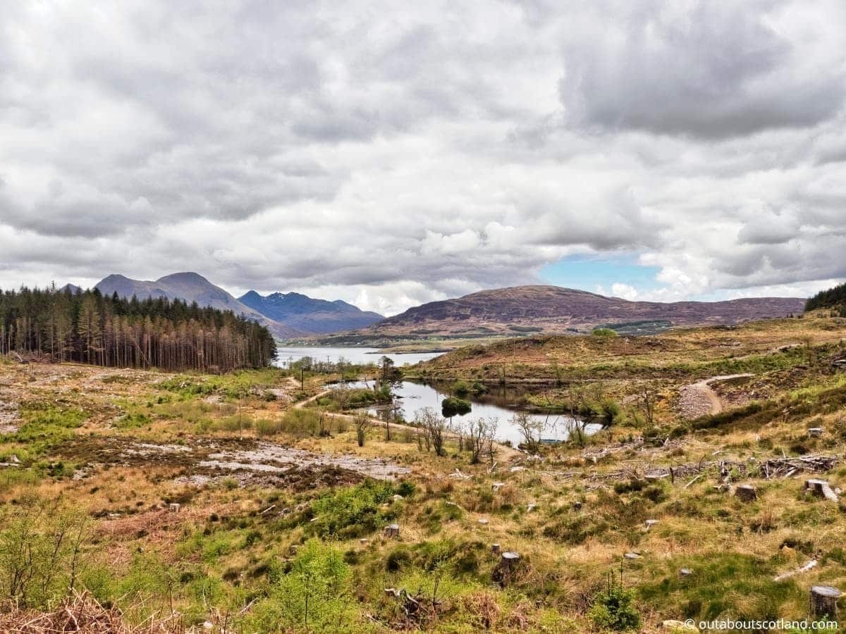
The terrain is surprisingly varied and comprises shingle and sand beaches around its perimeter, low-lying grass plains further inland, and wide stretches of moorland and rocky peaks in the centre, all pockmarked with the occasional woodland and loch. In fact, the landscape is so varied that Raasay has become something of a Mecca for geologists worldwide, and it has been said that the island is one of the most geologically diverse on the planet.
It could be argued that tourist attractions on Raasay are somewhat lacking compared to Skye, but then it could also be argued that this lack of attractions is part of the island’s charm (perhaps it’s why Condé Nast voted it one of the best islands to visit worldwide in 2020).
For day-trippers, there are a handful of destinations to choose from, with the highlights being Raasay House, Raasay Distillery, and Calum’s Road, but in my opinion, the best way to enjoy the island is to just set off on foot—or two wheels—and bathe in the peaceful off-the-grid experience.
In addition to the scenery, Raasay is a paradise for nature lovers – especially around the coastline – where it’s not uncommon to see golden and sea eagles, dolphins, otters, seals, and even the occasional basking shark and minke whale.
Meanwhile, anyone who prefers getting active will have a great time kayaking around the island’s secluded bays or romping across the wild moorland that covers the majority of its centre, and that’s before they’ve hiked to the summit of the 440-metre Dun Caan or taken a boat trip out to nearby Rona.
The Highlights
1: As a place to get away from it all, Raasay is hard to beat. Although it’s close to Skye, it feels a million miles away from that island’s rampant commercialization, and Rassay has a quaint step-back-in-time atmosphere that’s sadly becoming hard to find in Scotland. If you really want to follow Calum’s Road to the far north of the island and then walk along the narrow track that hugs the coastline.
2: Raasay is a good place for cycling, as long as you don’t mind lots of hills. The roads are narrow but in fairly good condition, and there’s hardly any traffic on them, meaning you can set off and lose yourself in the scenery in total peace and quiet. The lower coastal road on the west side of the island is relatively flat and offers stunning views of Skye.
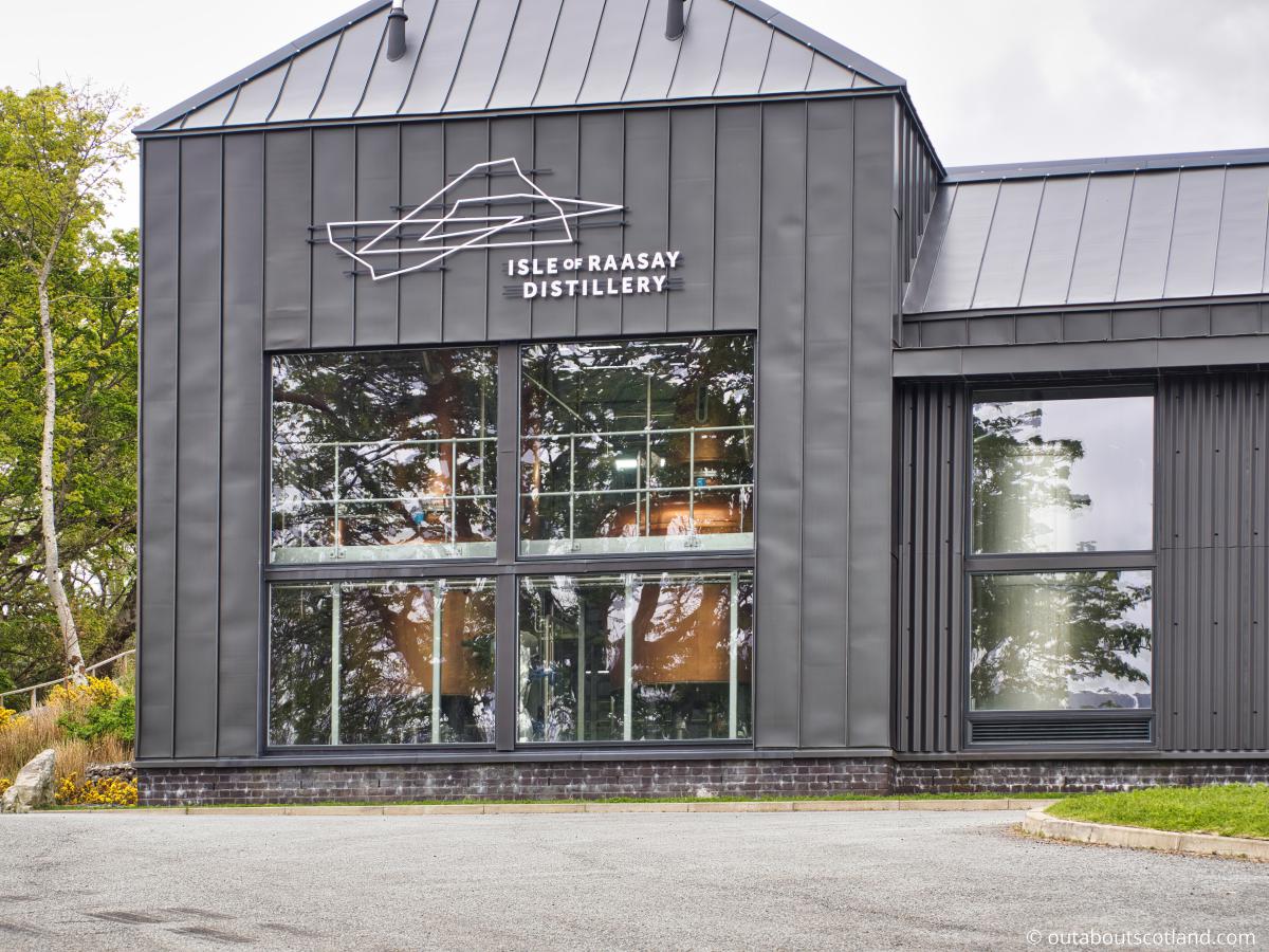
3: There aren’t many facilities on Raasay but the 4-star Raasay House near the ferry terminal more than makes up for it. The hotel features a dining area that serves delicious snacks and hot drinks during the day and fine dining in the evening using locally sourced produce. Combine a visit to Raasay House with a tour of Raasay Distillery, which is just over 1/3 of a mile away—perfect for sampling a few drams without having to drive.
Visiting Tips
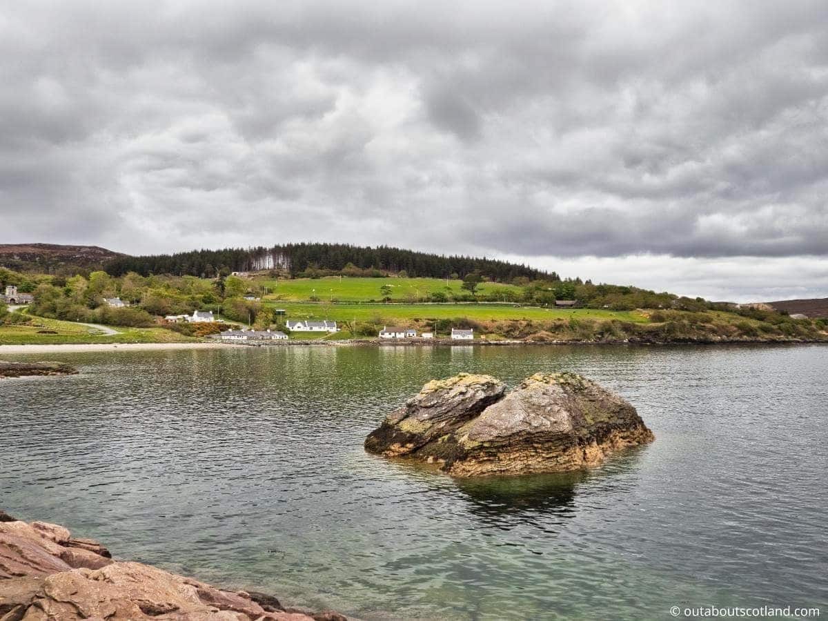
1: The majority of the houses on the island are located around Churchton Bay near the ferry terminal which is also the location of the community store. If you’ve forgotten to pack food and drink, I suggest stocking up at the store before following Mill Road and the sign that points north (it says, bizarrely, ‘The North Pole’!) after which you’ll join the road that ends at Calum’s Road and Brochel Castle.
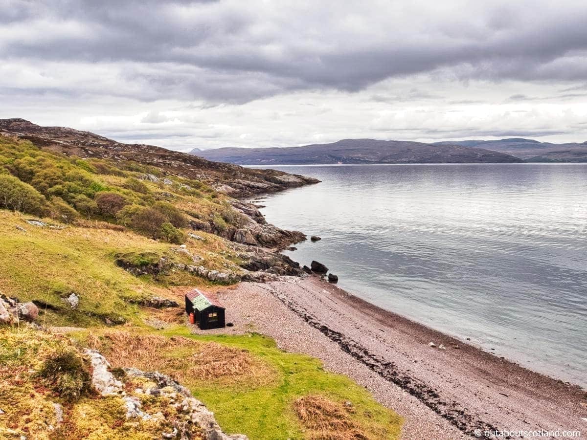
2: There’s a narrow 3-mile beach on the southern edge of Raasay that offers a lovely walk with views of Skye, Scalpay, and the Applecross Peninsula. To get to it, take the road south from the ferry terminal past the distillery and follow it around the coastline for 3 miles (keeping the sea on your right-hand side). The start of the beach has a couple of parking spaces on the grass on either side of the road.
3: If you’re visiting the Isle of Raasay for an afternoon I suggest either of two itineraries. The first is to walk north and climb Dun Caan, and the second is to cycle to Calum’s Road and Brochel Castle. If you’re staying for longer, I recommend continuing past Calum’s Road and walking along the footpath that ends at the far north of Raasay, near the Taigh Thormoid Dhuibh bothy. The views along this route are spectacular.
Tourist Information
It’s a short sail to Raasay at around 25 minutes and the ferry departs every hour midweek during daylight hours, so I booked tickets for a full-day adventure departing Skye at 8.30 am and returning at 6.30 pm, and wheeled my trusty mountain bike into the cargo hold.
While cars are permitted, I think it’s best to take a mountain bike just so you can suddenly veer off down a minor track at a moment’s notice, whereas with a car there’s always the hassle of trying to find a parking space.
From the ferry terminal, it’s a 5-minute cycle ride to Raasay House, which I’d decided would be an ideal place to grab breakfast while examining my OS Map #24 of Raasay (link to the OS Maps shop). Raasay House is a much bigger place than you’d expect to find on such a small island, and it’s surprisingly luxurious, with a very nice dining room, friendly staff, and delicious food.
Breakfast munched, coffee slurped, and route planned, I set off to the next stop, which was the newly opened Raasay Distillery. The distillery runs organised tours as well as tasting sessions, but my main intention was to reserve a bottle of their highly recommended gin and single malt whisky for later collection.
The distillery appears to have gone all-out to cater to tourists, and there’s a very nice bar and shop in the main visitor centre, alongside an outdoor seating area with stunning views over the Sound of Raasay. After the distillery, it was time to head back onto the open road and head north into the heart of Raasay, away from the coastline.
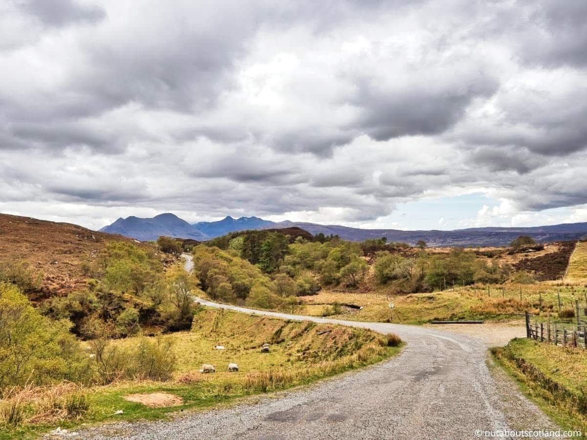
Raasay’s roads are in generally good condition (for a west coast island), but they’re as prone to the weather as anywhere else in Scotland, so expect lots of potholes. They’re also very narrow, with few passing spaces,which is another reason to choose a mountain bike over a car during a visit.
The only negative I have about cycling on Raasay is that it’s a surprisingly hilly island, and unless you’re travelling along the lower coastal road, you’ll find yourself puffing away up steep inclines for the majority of the journey. Still, if you’re of reasonable fitness, I guarantee you’ll enjoy the ride, and the views across the water to Skye are nothing short of breathtaking.
From the village of Clachan (near the distillery), the road winds its way through mixed woodland and up a series of steep hills before finally plateauing at a barren expanse of moorland. There are no other points of interest to comment about this part of Raasay, but 3.5 miles past Clachan, you’ll find a parking area that allows access to the summit of the island’s highest point, Un Caan.
The trail to Dun Caan isn’t long by any means (around 3 miles return) but it’s very, very pretty along the entire route, and the view from the top of the rocky peak is lovely.
To the west there are superb views of Skye with Portree and Trotternish in the distance, while the opposite direction sees the mainland and Applecross in full view (top tip: the most scenic drive in Scotland can be found east of Applecross on the Bealach na Ba mountain pass).
Back to Raasay, it’s another 5 miles to Calum’s Road and Brochel Castle, which are both at the end of the’main road’. One man, his shovel, and his dependable wheelbarrow carved out the narrow single-track section of tarmac that is Calum’s Road. Despite being only 2 miles long, it is incredible that only one person was able to construct it, especially considering how untamed and hilly that region of the island is.
If you make it this far I thoroughly recommend continuing down Calum’s Road to the far end where it stops and transitions into rough footpaths. These paths run through thick woodland before opening up into a wild heather-covered moorland on the far northern tip of Raasay.
The wee isle of Eilean Tigh is immediately to the north and the isle of Rona looks like an easy paddle in a kayak – although by all accounts the currents between the two islands are very strong.
As an alternative option, Raasay House organizes RIB tours out to Rona with expert guides leading the way which might be preferable to kayaking solo.
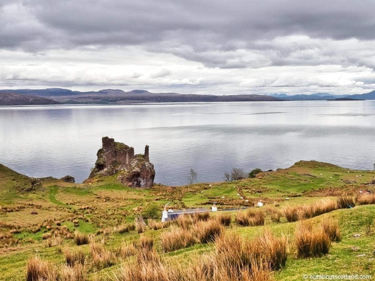
Heading back to the start of Calum’s Road I took a minor diversion across a field to snap a few photos of Brochel Castle. The castle was built in the 1400s and is now entirely in ruin and in fact, were it not for a few square sections, it would barely be recognizable as a man-made structure.
The main reason for taking this detour wasn’t to see the ruin but to whip out my binoculars and look for marine wildlife, as this part of Raasay is renowned as a favourite spot for grey seals. As a top tip, if you walk half a mile down the road away from the castle, you’ll find a footpath that leads to another secluded beach that’s also a well-used resting place for seals.
By this point in my visit to Raasay, time was marching on, so I made an about-turn back to Raasay House for a quick pint before catching the ferry back to Skye.
Things to Do
Raasay Distillery Visit: Explore the Isle of Raasay’s first legal Scotch whisky distillery. Enjoy a guided tour and learn about the distillation process and the history of ‘the water of life’ on Raasay. It’s the perfect destination for whisky enthusiasts.
Hiking on Dun Caan: The highest point on Raasay, Dun Caan, is an extraordinary flat-topped hill that provides breathtaking panoramic views of the Cuillins on Skye and the Applecross Peninsula on mainland Scotland. Climbing Dun Caan is a truly amazing adventure for anyone who loves the great outdoors.
Raasay House Activities: Raasay House, a historic clan mansion, features an outdoor activity centre with activities like kayaking, climbing, and sailing. After a fun-filled day, enjoy a delicious meal in the restaurant or sit back with a relaxing coffee in the cafe. It’s a fantastic place for family fun and adventurous couples.
Exploring Calum’s Road: Visit Calum’s Road, a testament to one man’s determination. Calum Macleod built this 1.5-mile road by hand over the course of a decade. Walk along the road and admire the scenery while appreciating the amount of hard work that went into creating this extraordinary strip of tarmac.
Wildlife spotting: Raasay is a haven for wildlife enthusiasts. Spot red deer, golden eagles, otters, and seals. Binoculars (link to binocular reviews) are an essential part of any Isle of Raasay packing list.
Things to Do Nearby
From the ferry terminal:
Brochel Castle. Arnish, Kyle IV40 8PF. 9 miles (30-minute drive).
Just before the start of Calum’s Road lies Brochel Castle, a ruined fort that was built in the late 15th century. Sadly, due to its dilapidated condition it’s not possible to climb onto the ruins, but visitors can instead view the picturesque bay which is home to a number of grey seals.
Raasay House. Raasay IV40 8PB. 0.3 miles (2-minute drive).
This grand hotel was built in the 1740s as the home of the MacLeod Chief of Raasay, but it’s now privately run as the island’s biggest attraction.
In addition to its sumptuous accommodation, Raasay House has a superb café and restaurant, extensive grounds, and activity packages that include sailing, fishing, rock climbing, wildlife watching, and hiking.
Raasay Distillery. Kyle IV40 8PB. 0.5 miles (2-minute drive).
This is one of Raasay’s newest attractions, having only opened its doors in 2017. The Isle of Raasay Distillery offers guided tours around its whisky production area as well as running expert-led whisky, gin, and chocolate tasting sessions. The distillery houses a bar, a gift shop, a café, and even has luxury overnight accommodation on-site.
Dun Caan. Kyle IV40 8PE. 4 miles (14-minute drive).
Dun Caan is the highest point on the island which reaches 440 metres at its summit. The walk from the ferry terminal to the top of the hill is approximately 10 miles and will take around 5 hours for most people. Alternatively, there’s a car park 4 miles from the ferry terminal which joins a much quicker 1.5-mile trail leading to the summit.
Calum’s Road. Arnish, Kyle IV40 8PF. 9 miles (30-minute drive).
In the 1960s, one man named Calum MacLeod constructed the single-track tarmac stretch known as Calum’s Road. He famously built the road single-handedly as a way to drive from his farm to neighbouring Brochel, and it has now firmly planted itself in modern Scottish folklore. Visitors to Calum’s Road can drive to the end, where they will find a number of footpaths heading into the drop-dead-gorgeous northern tip of Raasay.
Frequently Asked Questions
Does anyone live on Raasay?
The current number of permanent residents living on Raasay is around 160. The main settlements are: Arnish, Brochel, Clachan, East Suisnish, Eyre, Inverarish, Oskaig, Suisnish and Torran.
Who owns the island of Raasay?
The Scottish government owns the Isle of Raasay as well as the island’s fishing and hunting rights. Raasay was traditionally the home of Clan MacSween and Clan MacLeod before the island’s title passed to private landlords and then into public ownership.
Are there deer on Raasay?
There is a large population of red deer living on Raasay, predominantly in the northern half of the island. The name stems from the Norse word ‘Raasay’ meaning ‘Isle of the Roe Deer’.
What visitor facilities are there on the Isle of Raasay?
Facilities for visitors to the Isle of Raasay are limited to the community around Churchton Bay. Raasay House and Raasay Distillery both have a café/restaurant, a gift shop, toilets, and hotel rooms. There is a small shop on Inverarish Terrace. Visit the official Raasay website for updated information on available facilities.
Do you need a car on Raasay?
The Isle of Raasay is a relatively small island that is accessible by bike as well as on foot, so you do not need a car to get around. However, day-trippers might consider taking a car if they are slow at walking and want to see as much of the island as possible before the ferry returns.
Note that the main road running through Raasay is 17 miles in length, which will take around 1 hour to drive or 6 hours to walk.