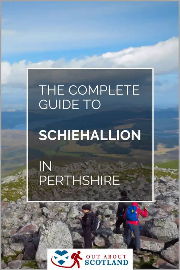
Schiehallion Mountain
Schiehallion is a mountain in Perth & Kinross that is one of the easiest to climb in Scotland. The wide footpath offers visitors superb views of the surrounding countryside on a hike to the summit, which should take 3–4 hours in total.
Schiehallion is known for its distinctive, conical shape when viewed from the west, making it one of Scotland’s most recognisable and photographed mountains. It has an elevation of 1,083 metres (3,553 feet) and is classified as a Munro, a Scottish mountain over 3,000 feet in height.
🠇 Head to the bottom of the page for essential details on each attraction featured here, including addresses, opening hours, and entry prices 🠇
Schiehallion
Schiehallion, one of Scotland’s most famous mountains, embodies both natural beauty and scientific significance. Its historical relevance stems from the 18th-century ‘Schiehallion experiment’ which helped estimate the Earth’s mass. This iconic mountain attracts tens of thousands of hill walkers each year thanks to a well-managed and easy-going path.
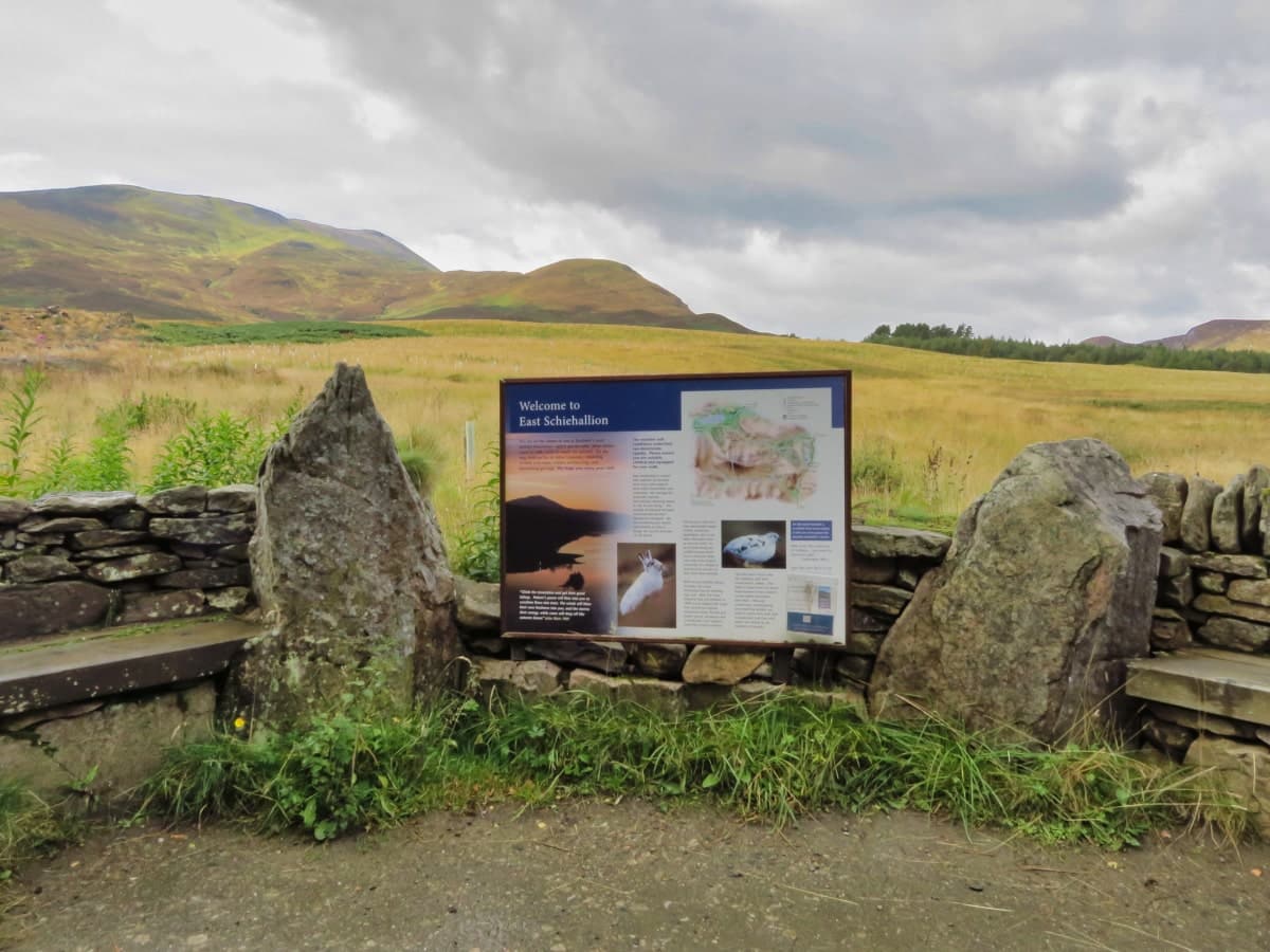
Schiehallion mountain lies between Loch’s Tay, Rannoch, and Tummel, roughly 10 miles northwest of Aberfeldy in Perthshire, and it’s renowned amongst Scotland’s hillwalkers as one of the easiest Munro’s to ‘bag’ in the country. If you’ve never heard of Munro-bagging, it’s an activity where hill-walkers climb as many of Scotland’s mountains as possible, but only those with a height of at least 3,000 feet.
Most Munros are difficult to climb, but Schiehallion is a gentle stroll in comparison, thanks to the path that winds its way from the base to the summit of the east ridge. This comparatively easy ascent is the reason why so many people visit the mountain, and an average of 20,000 visitors make their way from the Braes of Foss car park at the mountain’s base to the 3,553-foot summit each year.
The number of people is the reason why the John Muir Trust took over the management of Schiehallion in 1999, as the amount of footfall was starting to erode the mountainside, which in turn led them to create a new track that almost reaches the summit.
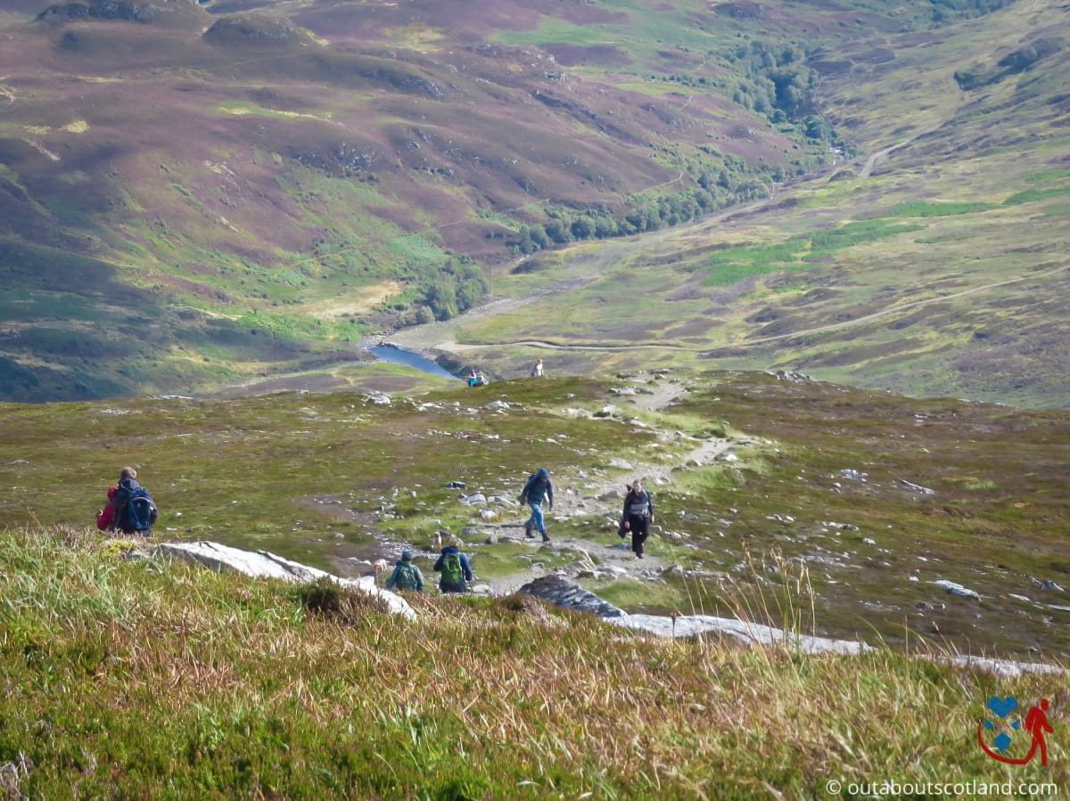
Viewed from across Loch Rannoch, Schiehallion has an almost perfectly conical shape that you’d think is impossible to climb, but by approaching from the opposite direction you’ll see that the ‘cone’ actually has a long and gentle slope on its eastern side. It’s not a particularly long walk either, at around 3 miles in length, and coupled with the gorgeous views along the way, it has to be one of the best short hikes in Scotland.
The east ridge is ablaze with colour in summer thanks to the swathes of heathers and mosses that cover the slopes, while the upper areas past the summit are almost completely covered in flora and fauna right up to the point where the summit comes into view.
The Highlights
1: There’s a decent car park with toilets at the base of the mountain, which is handy because the trail on the way up is wide open. There are no bushes to hide behind if you get caught short on this walk, I’m afraid.
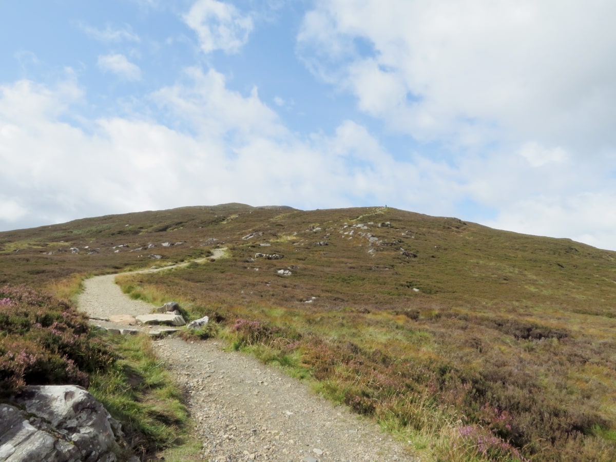
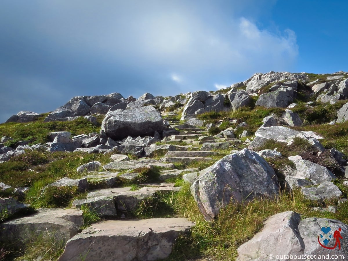
2: The John Muir Trust footpath is in excellent condition and makes the hike fairly easygoing. The only rough section is towards the summit where you’ll have to scramble over boulders.
3: The mountain’s lower slopes are covered with heather moorland, while the higher altitudes host alpine plants adapted to the harsher conditions. Wildlife enthusiasts will spot a variety of birds and mammals during the ascent.
Visiting Tips
1: Take plenty of water. The path is a mild incline from the base of the mountain but it’s quite hard work towards the summit.
2: Be aware that even on a mild day, it can be very windy and cold at the top, so pack a hat and a windproof jacket. If you don’t have a backpack, I recommend Berghaus.
3: This mountain is an extremely popular tourist destination, especially at the weekend. Get to the car park before 9 am to guarantee a parking space.
Tourist Information
The car park at Schiehallion’s base is unusual in that not only is it a decent size and tarmacked, but it also has toilet facilities. The John Muir Trust has installed a gravel-covered track from the car park, which visitors are asked to stick to to prevent damage to the mountainside.
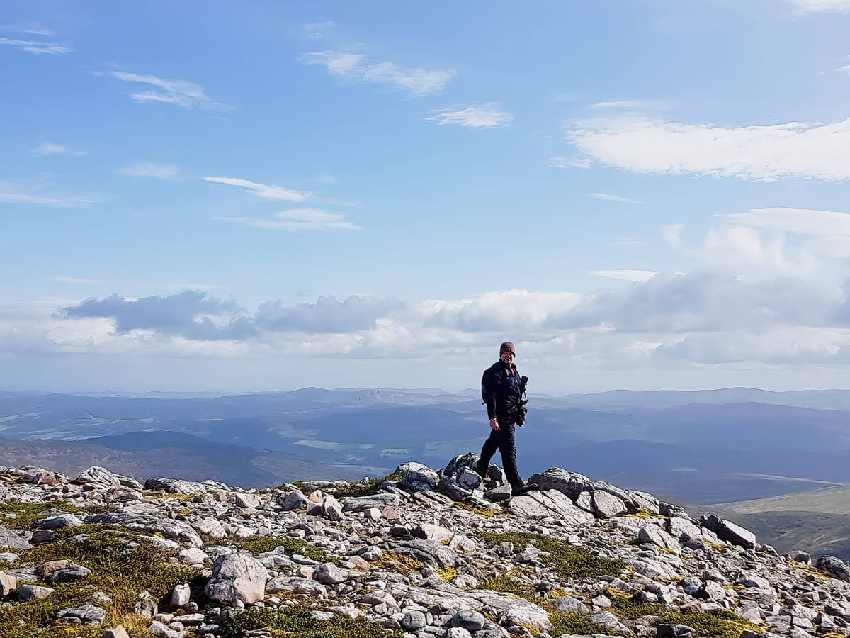
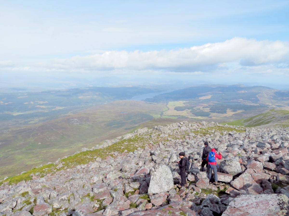
The summit of the mountain can be reached by simply following this track to around 2/3 of its height, after which the route becomes a mild scramble across boulders till you reach the cairn at the top.
The entire walk shouldn’t take more than 3–4 hours on a return loop, and there’s no chance of getting lost as all you need to do is follow the footpath to the top. That being said, I recommend taking an Ordnance Survey map of the area because there are so many stunning walks to enjoy after Schiehallion. Look for OS maps 41, 51, and 52.
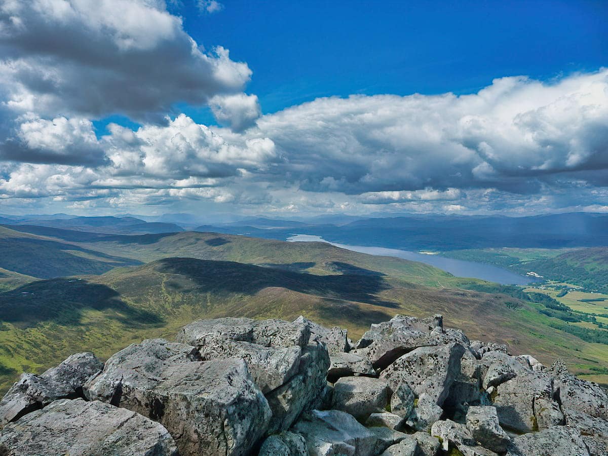
The landscape on the way is stunning and comprises heather-covered slopes, forests, lochs, and open pastures of wildflowers. The views finish nicely at the top with a breathtaking panorama that extends across Loch Rannoch and Perthshire’s forests, and you’ll even see Ben Nevis in the distance to the north.
Walking Route
As always when exploring Scotland’s wilderness areas, make sure you take a bag with you containing warm weather gear no matter the current conditions, and pack a couple of bottles of drinking water in there too. As far as clothing is concerned, I suggest you take windproof and waterproof outer layers, as it’s a good couple of hours of descent if you get caught mid-shower at the summit, and there’s nothing more miserable than trying to get back to the car when you’re cold and wet.
As far as shoes go, wear walking boots as the path is easy going at the bottom but it stops suddenly at the boulder fields at the top of the east ridge. Even so, it’s a relatively straightforward walk and as it’s such a popular hike you’re more than likely to have other people to follow, so you’re unlikely to get lost.
Follow the path at the far end of the car park along a rough shingle track that passes through a couple of gates before looping around past the remains of old stone sheep enclosures. Continue along the path up the east ridge, where you’ll find a couple of viewing platforms that offer stunning views across Loch Tummel towards Beinn a’Ghlo.
The path continues up the ridge to a large cairn, and from that point onwards it becomes a bit of an awkward scramble over rocks and boulders. Several cairns act as route markers, so follow those as there’s no visible path towards the summit past the top of the east ridge. There are a few blind summits, but you can simply keep heading in the same direction to reach the true summit.
Unlike the gentle ascent, the opposite side of the mountain is very steep and pretty much impassable for the average walker, so to get back to ground level, you’ll have to follow the same route. Plan 4-6 hours in total for this walk.
Things to Do
Hike the Schiehallion Trail: Schiehallion, known as the ‘Fairy Hill of the Caledonians’, offers a moderately challenging hike, but it’s a must-do for all visitors to the region. The path is well-marked and leads to panoramic views of Loch Rannoch and the surrounding countryside. Remember to bring a camera to capture the breathtaking scenery from the summit.
Wildlife Spotting: Schiehallion is a haven for wildlife enthusiasts. You can spot red deer, mountain hares, and a plethora of bird species. If you’re lucky, you might even see a golden eagle soaring overhead. Binoculars (link to binocular reviews) are a must for this hike.
Stargazing: With its remote location, Schiehallion provides exceptional opportunities for stargazing. On a clear night, you can gaze at a sky full of stars, the Milky Way, and even the Northern Lights. If you’re planning to camp overnight, check out these tent reviews.
Picnicking: Enjoy a serene picnic amidst the beauty of Schiehallion. There are numerous spots along the trail where you can relax and enjoy a well-deserved break. Pack a lunch and savour the tranquillity of the Scottish Highlands.
Photography: Schiehallion’s diverse landscapes present fantastic photography opportunities. Capture the mountain’s changing moods from misty mornings to spectacular sunsets and everything in between.
Things to Do Nearby
The Birks of Aberfeldy. Moness Burn, Aberfeldy. 25-minute drive.
A picturesque woodland that inspired the poet Robert Burns to write one of his most famous poems. The ‘birks’ are the birch trees that this woodland is famous for. Well-maintained pathways run throughout the site and a wooden bridge overlooks a tremendous waterfall.
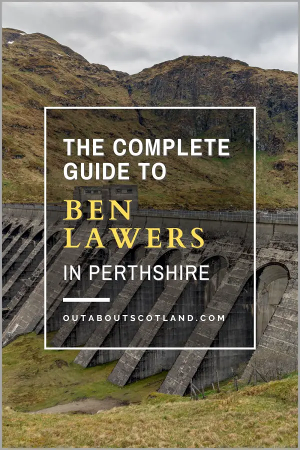
Ben Lawers Dam. Aberfeldy FK21 8TU. 47-minute drive.
A scenic body of water in the Ben Lawers nature reserve that is easily walked to from the Ben Lawers car park. The 334-metre hydroelectric dam offers stunning views over the Loch Tay valley.
Tay Forest Park. Dunkeld, PH8 0JR. 29-minute drive.
Tay Forest is a large forest region of mostly coniferous trees. The forest is popular with walkers and mountain bikers and there are many miles of paths for both activities A popular starting point is to the west of Loch Tummel at Tummel Bridge village.
The Scottish Crannog Centre. 25-minute drive. Kenmore PH15 2HY. 25-minute drive.
An open-air museum that takes visitors on a journey into Scotland’s pre-history. On display are original artefacts, demonstrations of ancient cooking and crafts and guided log boat rides to a replica roundhouse.
Kinloch Rannoch. The Square, Kinloch Rannoch, Pitlochry, PH16 5PW. 16-minute drive.
A tourist-favourite small village located at the eastern end of Loch Rannoch. Visitors frequently use the area surrounding the village as a base to explore the loch and Tay Forest Park.
Frequently Asked Questions
Can a beginner climb Schiehallion?
Yes, a beginner can climb Schiehallion. It’s known as a popular hill walk and it’s not technically challenging. However, it’s still a substantial climb and the weather can change rapidly, so it’s necessary to be well-prepared with appropriate gear and a good understanding of the route.
How long does it take to walk up Schiehallion?
The walk up the 6.25-mile path to the summit of Schiehallion is one of the easiest of Scotland’s Munro’s and takes 4 to 6 hours to complete the return journey.
Why is Schiehallion famous?
Schiehallion was chosen as the site of an experiment in 1774 to calculate the weight of the earth. Due to the mountain’s almost symmetrical shape, it was an ideal location for the experiment which involved measuring the deflections of a plumb line relative to the fixed background of stars.
What does Schiehallion mean in Gaelic?
The name Schiehallion derives from the Gaelic ‘Sith Chailleann’ which means ‘Fairy Hill of the Caledonians’.