Cramond Island
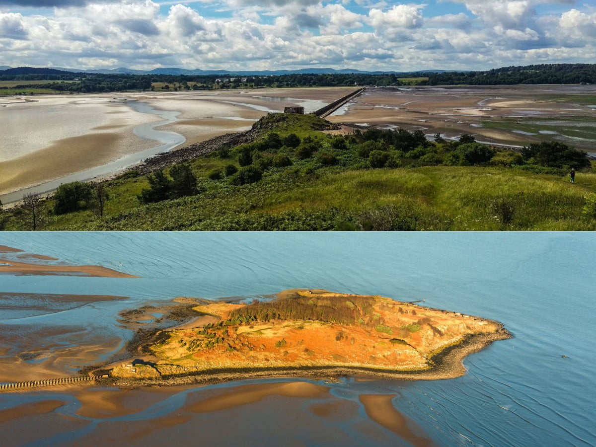
Cramond Island is a tidal island in the Firth of Forth near Edinburgh which is accessed via a long walkway that is the remains of a WWII anti-tank barricade. The island is mostly covered in grassland, although there are a couple of small beach areas on the side facing Cramond village. Discover why Cramond Island is a must-visit destination in this guide which includes an overview and useful visiting advice.
🠇 Head to the bottom of the page for essential details on each attraction featured here, including addresses, opening hours, and entry prices 🠇
Cramond Island
Cramond Island, located near Edinburgh, is a captivating tidal island in the Firth of Forth. Known for its WWII defensive structures, the island offers visitors the chance to explore beautiful scenery as well as the island’s fascinating history. Accessible at low tide via a causeway, it provides fantastic views, lots of birdwatching opportunities, and a tranquil escape from city life. It’s truly a must-visit destination for history enthusiasts and nature lovers alike.
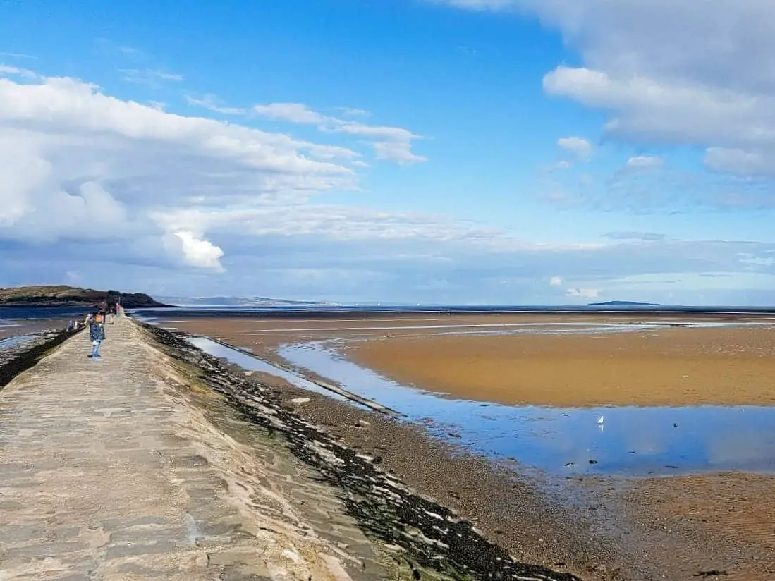
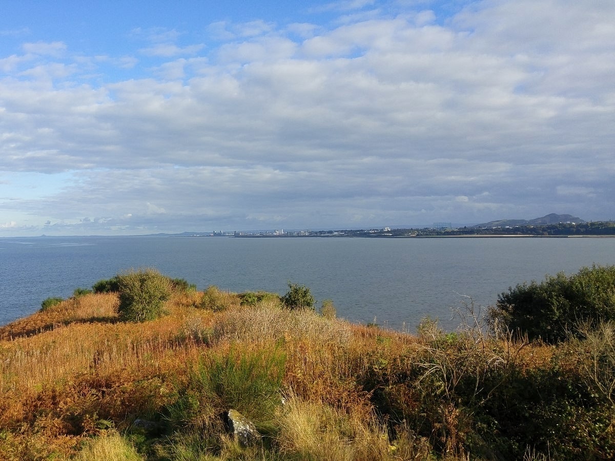
Cramond Island is located near the village of Cramond in Edinburgh, around 3/4 of a mile inside the Firth of Forth. Access to the island is via a causeway that leads from the village along a WWII anti-tank barricade that offers glorious views of the Firth of Forth, with the Fife coastline in front and the Forth Bridges and the City of Edinburgh on either side.
This is a tourist attraction that’s less ‘tourist’ and more ‘local’, mainly because it only seems to be known about by locals, but if you’re planning a trip to Edinburgh I reckon you should do yourself a favour and add Cramond Island to your sightseeing itinerary.
This area of the Firth of Forth is often missed by Scotland’s visitors, which is a shame as it has so much to offer. Visiting Cramond is easily combined with a tour of Edinburgh as the city centre is just 7 miles away and there are frequent buses cycling between the two destinations throughout the day (look for Lothian Buses routes 41, 32 and 36).
The island offers a short walk but it’s one that’s very popular with families when the tide is out, especially when combined with a stroll along nearby Silverknowes Beach. It’s this ability to easily escape from the city that makes Cramond Island so popular with locals – and also why it gets incredibly busy at the weekend in summer.
But if you go there mid-week I guarantee you’ll have an enjoyable time. Just make sure you check the tide times at the causeway entrance before you depart because when the tide returns the causeway is completely submerged.
The Highlights
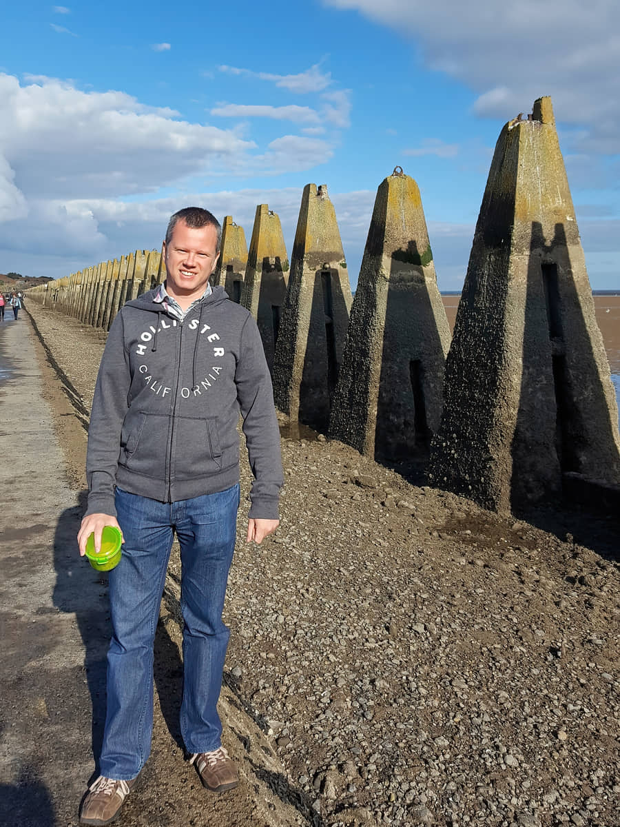
1: One of the main highlights of Cramond Island is the remnants from World War II. The island was part of the Firth of Forth sea defences in the 1940s and still contains defensive structures known as ‘The Dragon’s Teeth’, a line of concrete pyramidal structures designed to prevent enemy landing craft from reaching the mainland.
2: The island is a haven for birdwatchers and nature lovers, with its wide range of coastal birds and seals often sighted in the surrounding waters. The island’s flora and fauna, coupled with its tranquil surroundings, make it an idyllic spot for nature enthusiasts.
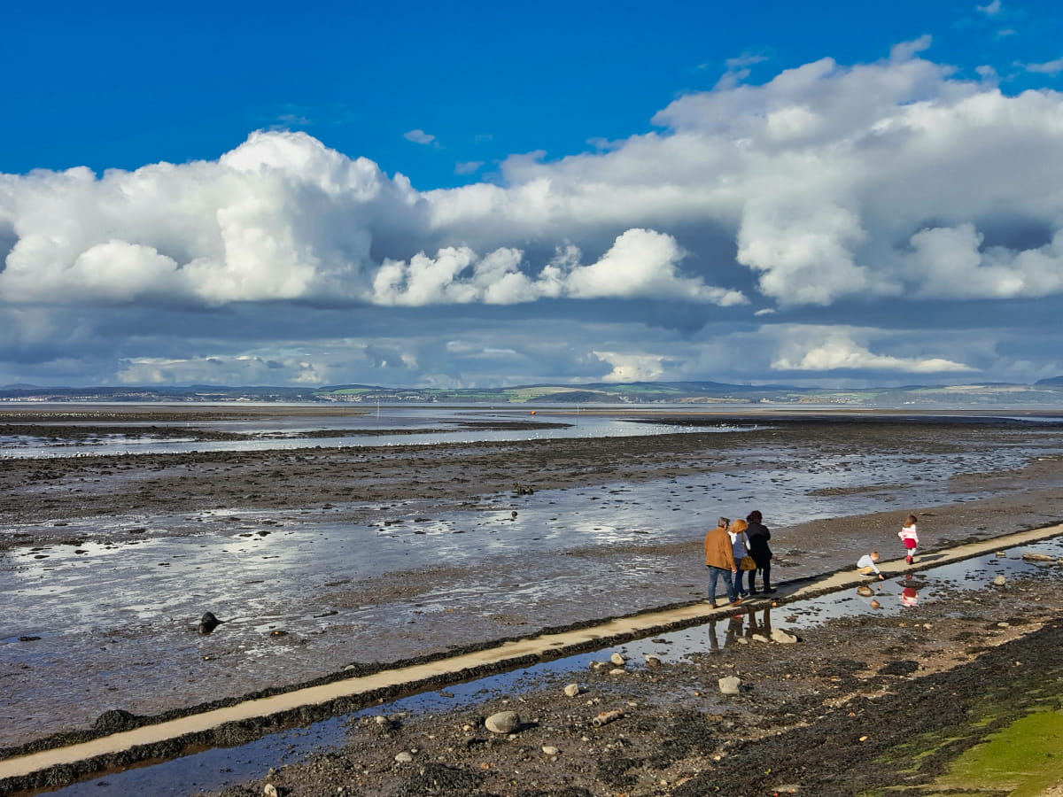
3: All ages can enjoy Cramond Island but young children, especially, will love exploring the rock pools on the causeway.
Visiting Tips
1: Some of the old WWII bunkers are full of broken glass so it’s advisable to keep children and dogs out of them.
2: Keep an eye on the tide times so you don’t get stranded and have to call the rescue services. There’s an information board with tide times at the start of the causeway in Cramond.
3: Another island in the Firth of Forth that’s worth visiting is Inchcolm Island, although you’ll have to book a ferry from South Queensferry to get there.
Tourist Information
If you choose to drive your own car instead of taking the bus you’ll find that parking in Cramond village can be a bit hit-or-miss depending on the weather, so if it’s a sunny day be prepared to park a fair distance away and walk to the coastline. The facilities in Cramond are decent as it has a café and a pub and you’ll usually find a van selling ice cream. There’s also a public toilet near the causeway entrance and a small car park around the corner.
There are lots of walks leading out of Cramond along the River Almond so if you’re unable to get onto the island due to the tides I highly recommend you follow the riverside path instead. It’s a lovely alternative but can be a bit meandering, so to prevent yourself from getting lost you should consider getting an OS map.
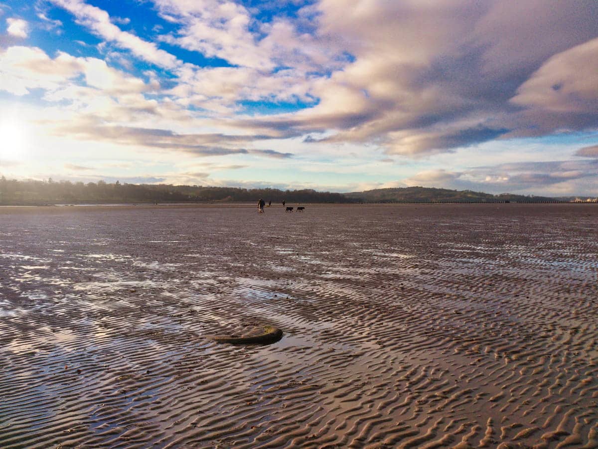
Cramond Island is only a third of a mile across but the walk across it is lovely on a sunny day as you’ll be able to see for miles along each side of the Firth of Forth. The crossing to Cramond Island allows you to view lots of rock pools left behind by the departing tide and children will love going on the hunt for the crabs and small fish that get caught in them.
The causeway only takes around ten minutes to walk over at which point you’ll find yourself on a shingle beach with a small hill that was once home to a WWII lookout post. Climbing up there provides stunning views across the Forth and it’s a good photo opportunity before heading out to explore the rest of the island. A word of caution though – people get caught short on the island and decide to use the bunkers as toilets, so they smell BAD when it’s warm. If you go inside, stick a peg on your nose and watch what you step on…
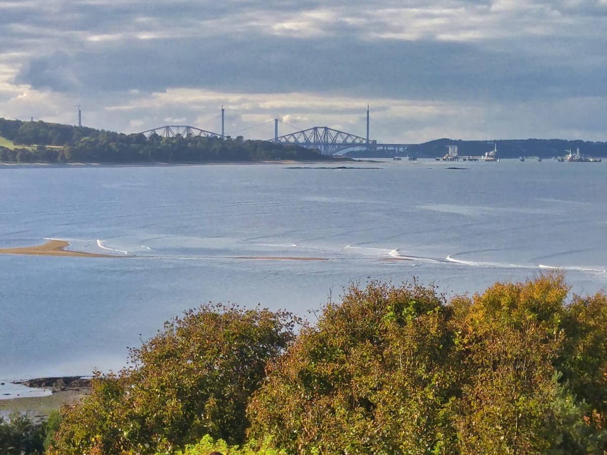
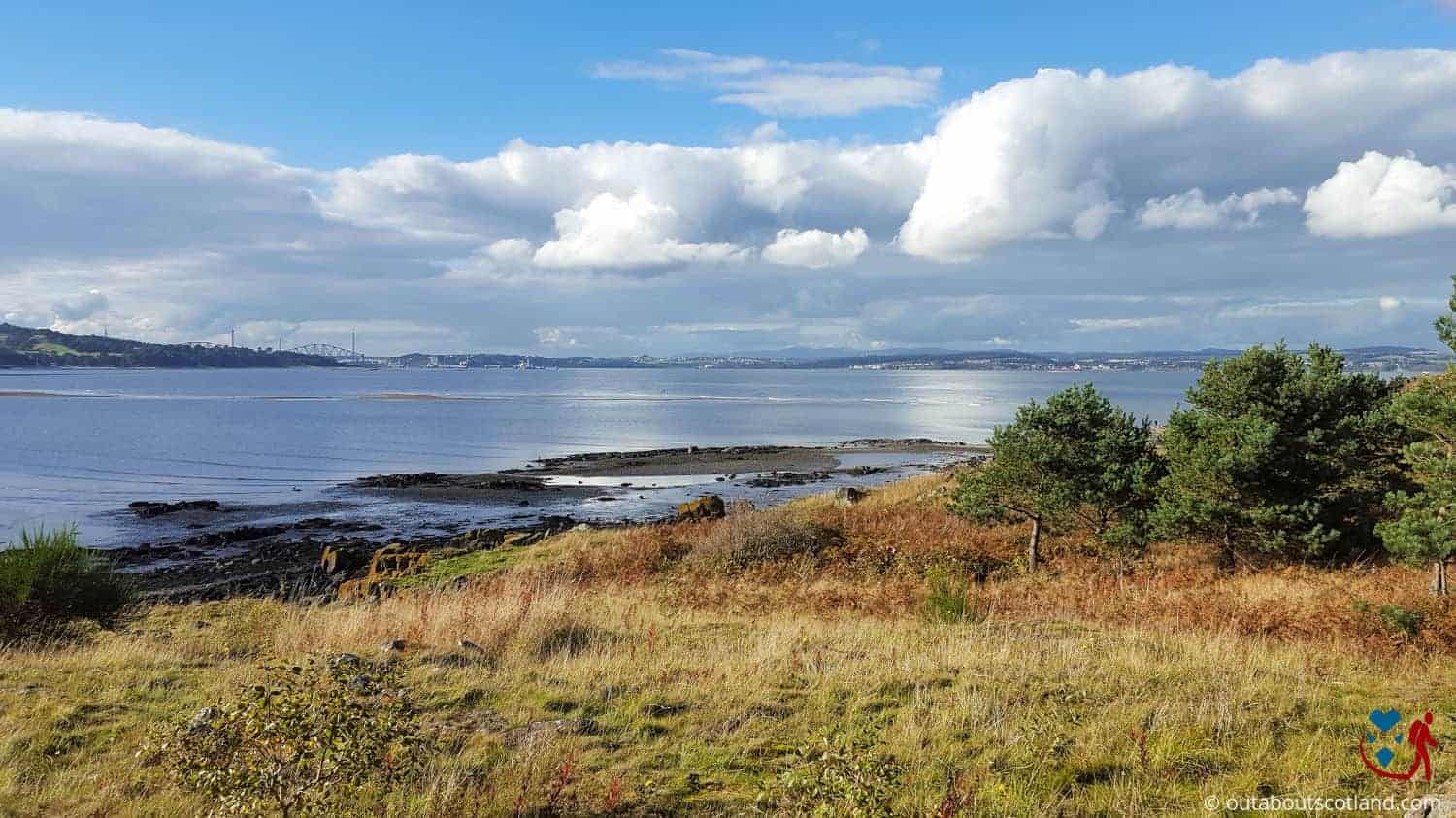
The highest point of Cramond Island lies 68 feet above sea level which is a good vantage point to look over to nearby Granton and Leith, with North Queensferry and the famous Forth Road Bridge visible to the west. To the north, you can see the coastline of Fife as well as the other small islands that are dotted around the estuary.
The island is uninhabited except for several species of seabirds that live on the Forth (sometimes gannets, always seagulls) and the small areas of woodland and wild grasses are home to many insect species.
Although there aren’t any designated picnic areas on the island, the north side is especially quiet and is perfect for an afternoon break away from the hustle and bustle of Edinburgh. Please note that there are no rubbish bins on the island so you’ll have to take the remains of your picnic home with you, and be aware that the concrete bunkers on the north side of the island are littered with broken bottles so I recommend keeping dogs and children out of them.
Silverknowes Beach
I can’t talk about Cramond Island without mentioning the nearby beach as it’s one of the nicest outdoor spaces in Edinburgh. The beach is just 5 miles from the city centre on the estuary of the River Almond, and while it doesn’t look like much when the tide is in, when it goes out you’ll realise just how big it is.
There’s a large car park just above the promenade at the Cramond end which has toilets along with a nice pub, and there’s usually an ice cream van nearby if you want a choc-ice or two.
Note that while the promenade offers good views across the Firth of Forth it often gets quite busy with cyclists, so it’s advisable to keep dogs on a lead. Another point to note is that because the beach gets completely submerged the sand is wet most of the time so there’s every possibility your dog is going to come back caked in it.
History
Cramond Island was mainly used for farming throughout its history and it’s suspected that the Romans made extensive use of the site for cattle grazing as their remains have been found all around the area near Cramond village.
At the northwest corner of the island you’ll find a medieval jetty made from locally sourced stone, while the centre hides a small stone-built farmstead which is believed to have been built in the 18th century. The island was fortified for use as a lookout post and a gun emplacement during the Second World War and the remains of these military buildings are still standing today.
During the war, a garrison of soldiers was stationed on Cramond Island to protect Central Scotland from invaders crossing up the Firth of Forth, and the remains of barrack buildings can still be seen in the undergrowth. Likewise, the causeway to the island was built during WWII as an anti-tank blockade.
Things to Do
Explore the War Remnants: Cramond Island has a rich history and is dotted with remnants from WWII, including submarine defences and lookout bunkers. Spend an hour or two exploring the site, but take care walking inside the bunkers and abandoned storerooms as there’s a lot of broken glass and refuse inside them.
Picnic with a View: Enjoy a relaxing picnic on the island and soak up the lovely views of the Firth of Forth. You can take a leisurely stroll along the nearby Cramond Beach or find a quiet spot on the island and enjoy a light lunch while listening to the splashing waves and calling seabirds.
Wildlife Watching: The Firth of Forth is home to a variety of bird species and marine wildlife. Take your binoculars and keep an eye open for oyster catchers, puffins, and if you’re lucky, otters playing on the shoreline. If you don’t own binoculars, check out these reviews.
Cramond: The quaint village of Cramond is worth a visit whether you’re looking for a relaxing walk along the promenade or the nearby River Almond. Cramond features pubs and cafes and has handy facilities including two car parks and public toilets.
Photography: With its stark WWII concrete bunkers and stunning views of the Firth of Forth, Cramond Island is a great place to brush up your photography skills. For the best scenes, wait till the tide is high during the magical golden hour.
Things to Do Nearby
Lauriston Castle. 2 Cramond Rd S, Edinburgh EH4 6AD. 6-minute drive.
A 16th-century castle in the style of a Georgian manor house. The castle overlooks the Firth of Forth and features expansive grounds with a woodland walk and a Japanese garden.
Dalmeny House. South Queensferry EH30 9TQ. 14-minute drive.
A Gothic country mansion built in 1817 that’s home to the Earls of Rosebery. The house is open to the public for guided tours in the summer only.
Silverknowes Beach. Edinburgh EH4 5ER. 1-minute walk.
A large shingle and sand beach that is famed for its views across the Firth of Forth and Cramond Island. There is a large car park and a wide causeway next to the Gipsy Brae recreation ground.
River Almond Walkway. Caddell’s Row, Cramond, Edinburgh EH4 6HY. 11-minute walk.
This picturesque footpath follows the River Almond from Cramond to the outskirts of Edinburgh Airport. The walkway is suitable for cyclists and walkers.
Forth Bridges Viewpoint. 9XY, South Queensferry. 10-minute drive.
The Forth Rail Bridge is a UNESCO World Heritage Site that is best seen from this viewpoint at the Forth Bridge operations centre. From the car park, it is possible to walk onto the footpath that runs along the Forth Road Bridge.
Frequently Asked Questions
How do I get to Cramond Island?
Cramond Island is located five miles northwest of Princes Street. Cramond village is accessible on the 41 bus from Edinburgh city centre (George Street or Queensferry Road).
Address: Cramond, Edinburgh, EH4 6HY.
How long does it take to walk over to Cramond Island?
The causeway from Cramond village to Cramond Island is 0.7 miles (1.1 km) which takes approximately 10-15 minutes to walk.
Can you camp on Cramond Island?
It is possible to camp on Cramond Island, though it is advised against as once the tide is in the island is completely cut off from the mainland. There are also no facilities on the island.
Is there anything on Cramond Island?
Cramond Island is uninhabited and has no modern facilities, though it was once the site of a farm, a WWII station, and long before that a Roman outpost.
The island has remnants of WWII bunkers and outhouses as well as the remains of an ancient pier. There are small shingle beaches surrounding Cramond Island, and a low hill in the centre offers superb views across the Firth of Forth.