Isle of Vatersay
The Isle of Vatersay is the most southerly inhabited island in the Outer Hebrides, with a population of around 90 permanent residents. Vatersay is best known for its two half-mile white-sand beaches—Traigh Shiar and Traigh a Bhaigh—that are set within shallow bays in the middle of the island. The island is easily reached from the Isle of Barra by a causeway near Barra’s largest settlement, Castlebay.
🠇 Head to the bottom of the page for essential details on each attraction featured here, including addresses, opening hours, and entry prices 🠇
Isle of Vatersay
The Isle of Vatersay is situated south of the Isle of Barra, which in turn lies south of the island of South Uist. Though there are another three islands to the south (Sandary, Pabbay, and Mingualy), they are uninhabited, making Vatersay the most southerly inhabited island of the Outer Hebrides and the most westerly inhabited island of Scotland.
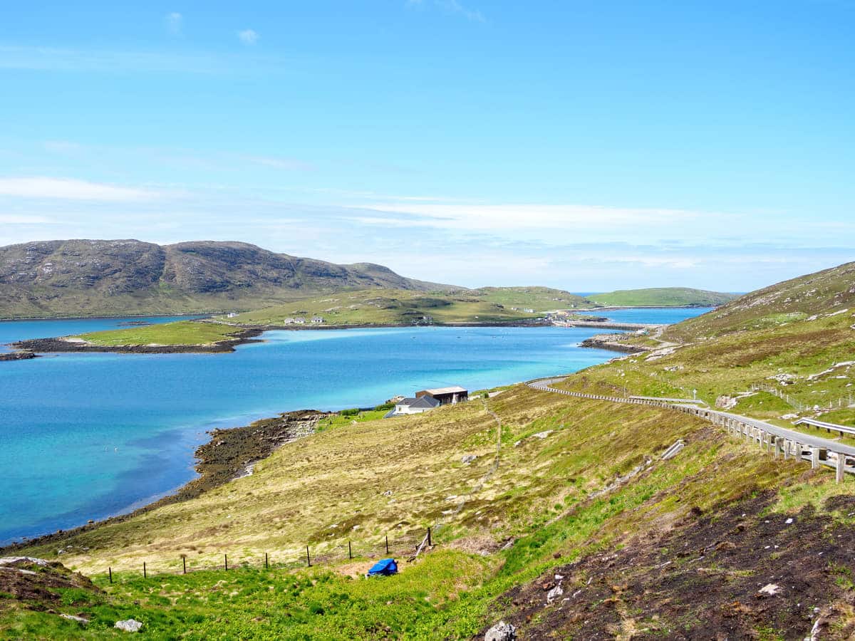
Much like Eriskay to the north, Vatersay is joined to its much larger northern neighbour by a causeway, meaning holidaymakers to one island can easily include trips to the other in a sightseeing tour. But why visit Vatersay in the first place?
Having spent two weeks on Barra in 2023, I have to admit the small, friendly, and exceptionally scenic island is my favourite of the entire Outer Hebrides, and Vatersay is a beautiful extension of it. The 600-foot Vatersay Causeway allows easy access from the southwest tip of Barra, and as it’s so close to Castlebay (approximately 2 miles), holidaymakers can cycle there in less than 30 minutes.
The island’s position south of Barra also means it’s a must-visit for anyone cycling the 185-mile Hebridean Way, as the starting point of the route is located next to the Vatersay Hall Cafe. However, visiting Vatersay for a quick half-hour cycle means missing its main highlights and there are more sights on this wee island than you’ll find on many other isles in the Western Isles.
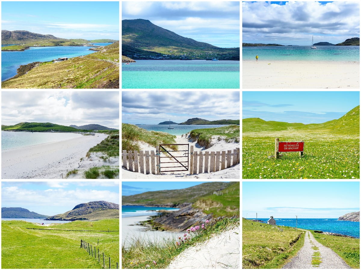
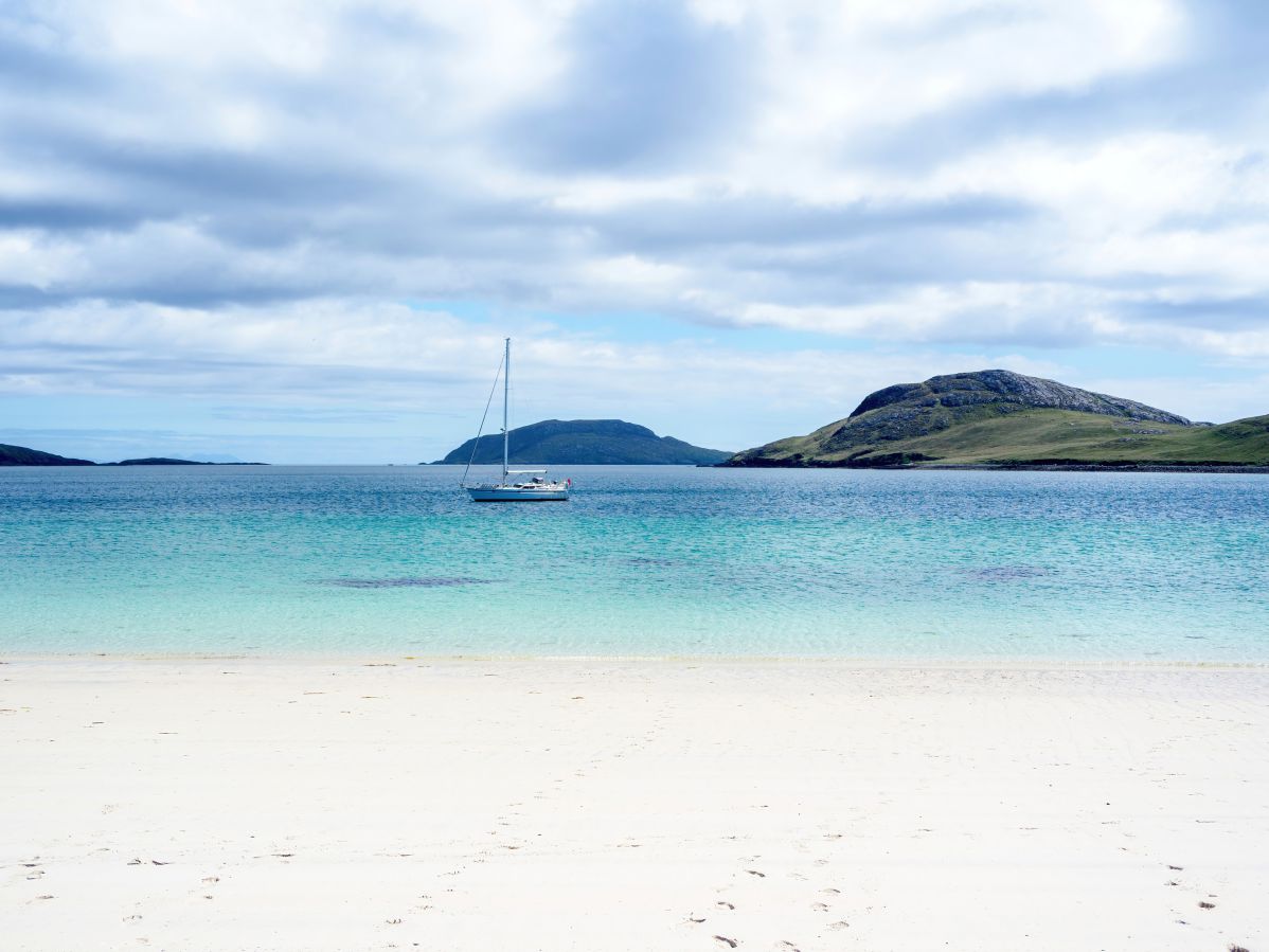
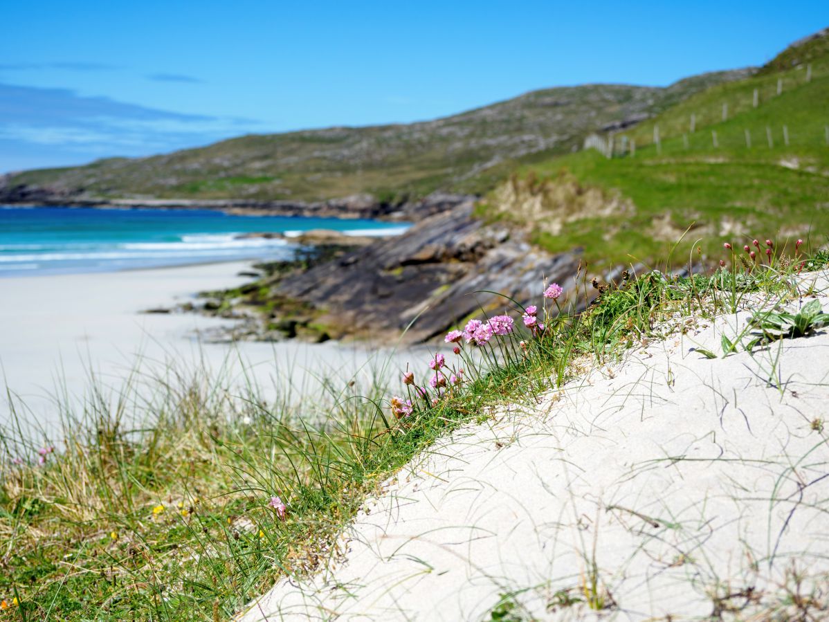
First and foremost are the two pristine white sand beaches in the heart of the island at Traigh Shiar and Traigh a Bhaigh. These wide bays are surrounded by land on three sides, making them great places to take children for a family beach day.
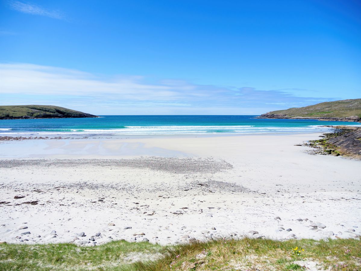
Due to the white sand and shallow, clear water, both bays take on a stunning turquoise colour when the sun’s out (yes, we do get sunny days in Scotland… occasionally) and as they face east and west it’s easy to swap between beaches to avoid waves and strong breezes.
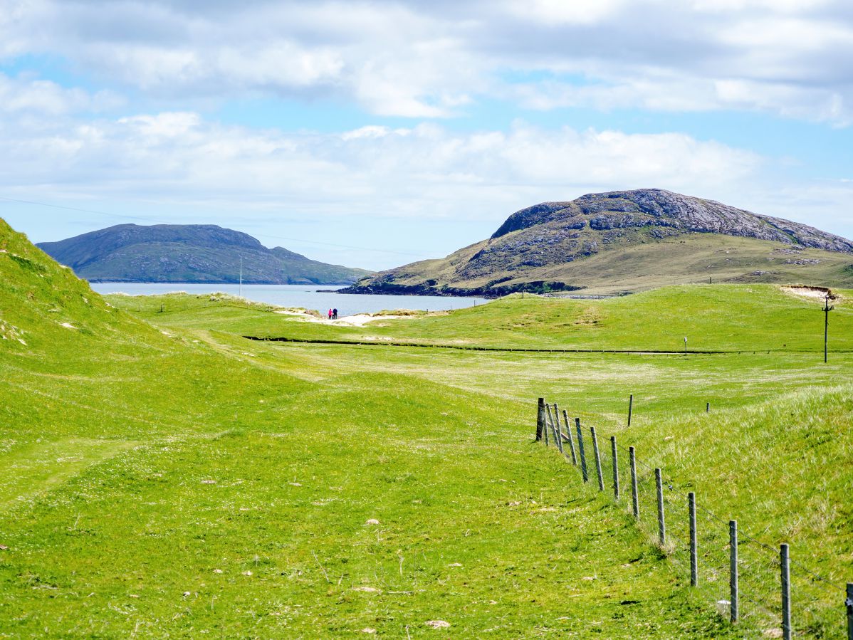
Between the bays is a stretch of flowering grassland (machair) that’s ablaze with colour in the summer months, while to the north and south are small hill ranges that offer walks with stunning views of the surrounding islands once you climb to the top.
As far as facilities go on Vatersay, well, there aren’t many, but that doesn’t really matter as the short drive into Castlebay and its large Co-op takes just 5 minutes from the causeway.
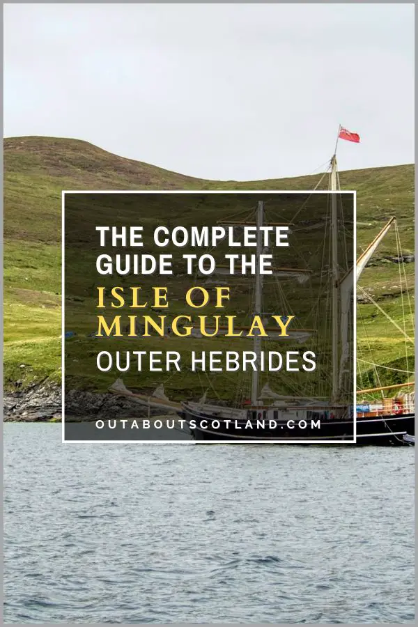
Castlebay has everything you need for a summer holiday, including the aforementioned supermarket, several gift shops, cafes, bars, and restaurants, as well as attractions that include a distillery, a toffee factory, and the famous Kisimul Castle. In addition, Castlebay is the departure point for boat trips that head south beyond Vatersay to the small islands of Sandray, Pabbay, and Mingulay, which are a haven for wildlife.
Visiting these islands opens up opportunities to see seabirds such as puffins, razorbills and terns while the surrounding waters are home to seals, basking sharks and the occasional minke whale.
Finally, visiting Vatersay with a motorhome is possible thanks to designated parking spaces near the community hall. This location offers easy access to both bays and there are 24-hour toilet and shower facilities included in the modest pitch fee.
The Highlights
1: Vatersay is a real gem of an island. Though small at just 3.75 square miles it features two stunning white-sand beaches, lots of walking trails, and excellent wildlife-watching opportunities.
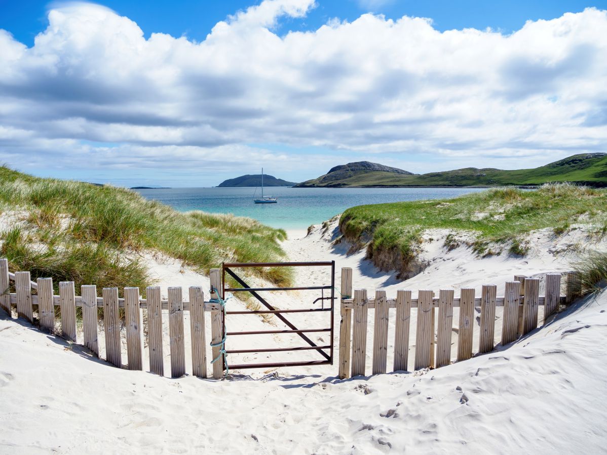
2: The white-sand beaches of Traigh Shiar and Traigh a Bhaigh are among the finest in the Outer Hebrides. A 380-foot strip of machair (wildflowers and grasses) runs north-south between the two bays so visitors can easily move beaches if the wind changes direction. Both beaches are set deep within bays and therefore have protection to the north and south, making them great locations for kayaking and swimming.
3: The Vatersay Heritage Trail is a good way to see the highlights of the island which include Bronze Age sites, beaches, wide-open plains of flowering machair, and marine animals including Eurasian otters, seals, and Atlantic puffins.
Visiting Tips
1: The focus for the majority of tourists on Vatersay is the Hebridean Way start point at the Vatersay Hall Cafe. The cafe serves delicious homemade cakes, but due to the popular cycling trail it gets very busy in the peak summer season. Be prepared to struggle to find a place to park the car if you arrive at midday. Alternative parking spaces can be found on the side of the road, 1/3 mile from the cafe, between the two beaches.
2: As nice as Traigh Shiar and Traigh a Bhaigh are, you might prefer to sit on a more secluded beach. Thankfully Vatersay has you covered with a number of wee inlets and beaches on the northeast tip of the island. To get there, take the first turn near the Vatersay church and continue down the single-track road for 3/4 mile. There are off-road parking spaces near the bus turning area.
3: Though Vatersay is the southernmost inhabited island there are three more islands to the south that offer a fantastic day out if you join an organised boat tour. Sandray, Pabbay and Mingulay lie to the south of Vatersay and are renowned for their bird colonies.
Boat tours operate from both Barra and Vatersay which allow visitors to see seabirds including razorbills, puffins, guillemots, terns and fulmar, as well as marine animals that include dolphins, otters, and basking sharks.
Tourist Information
While it’s certainly possible to visit Vatersay in a car, taking a bike is by far the best option as it’s a small island with just a few designated parking spaces which are quickly filled by camper vans in the peak season.
This has become a problem for the infrastructure of Vatersay as the single-track roads simply aren’t designed to cope with the influx of summer visitors, which has led to erosion of the verges and pollution of grazing land, which puts livestock at risk.
Aside from the cyclists that arrive in their droves to complete the Hebridean Way, taking a bike is (in my opinion) the best way to complete a sightseeing tour of the island, so I’ll cover a recommended itinerary in the remainder of this section.
From Castlebay, head west on the A888 and take the first junction signposted to Nasg Bhatarsaigh (Vatersay). The roads are in pretty good condition on both islands and while there are a few inclines they are easily cycled by anyone with average fitness levels.
The Castlebay junction to the causeway is around 1.5 miles and the causeway to the end of the road on the southern edge of Vatersay is another 3.5 miles, making the route a good option for families with young children.
Once on Vatersay you’ll immediately pass the first settlement of Caolas, after which the single-track road winds its way along the northern edge of the island before veering south towards Vatersay Bay Beach. There are a couple of laybys on the elevated section of road where it turns south, so I recommend stopping to take a few photos as the views are nothing short of stunning.
Heading back to the car, follow the road south till you arrive at the Vatersay Hall Cafe, where you will find a designated car park along with a few more spaces 300 feet down the road. The fence outside the cafe makes a good place to chain the bike, and you can then set off on foot to enjoy 4 miles of the island on the Vatersay Heritage Trail.
The trail is circular so there’s no right or wrong direction to start, but I’ll describe the route I took below.
Walking Route
- From the cafe, head down the road to the small car park opposite a gate signposted ‘Annie Jane Monument’. This monument is a memorial to 350 people who died in a shipwreck off Vatersay in 1853. Walk across the machair to the monument and admire the view across West Bay (Traigh Shiar) before turning south and walking along the beach to its end.
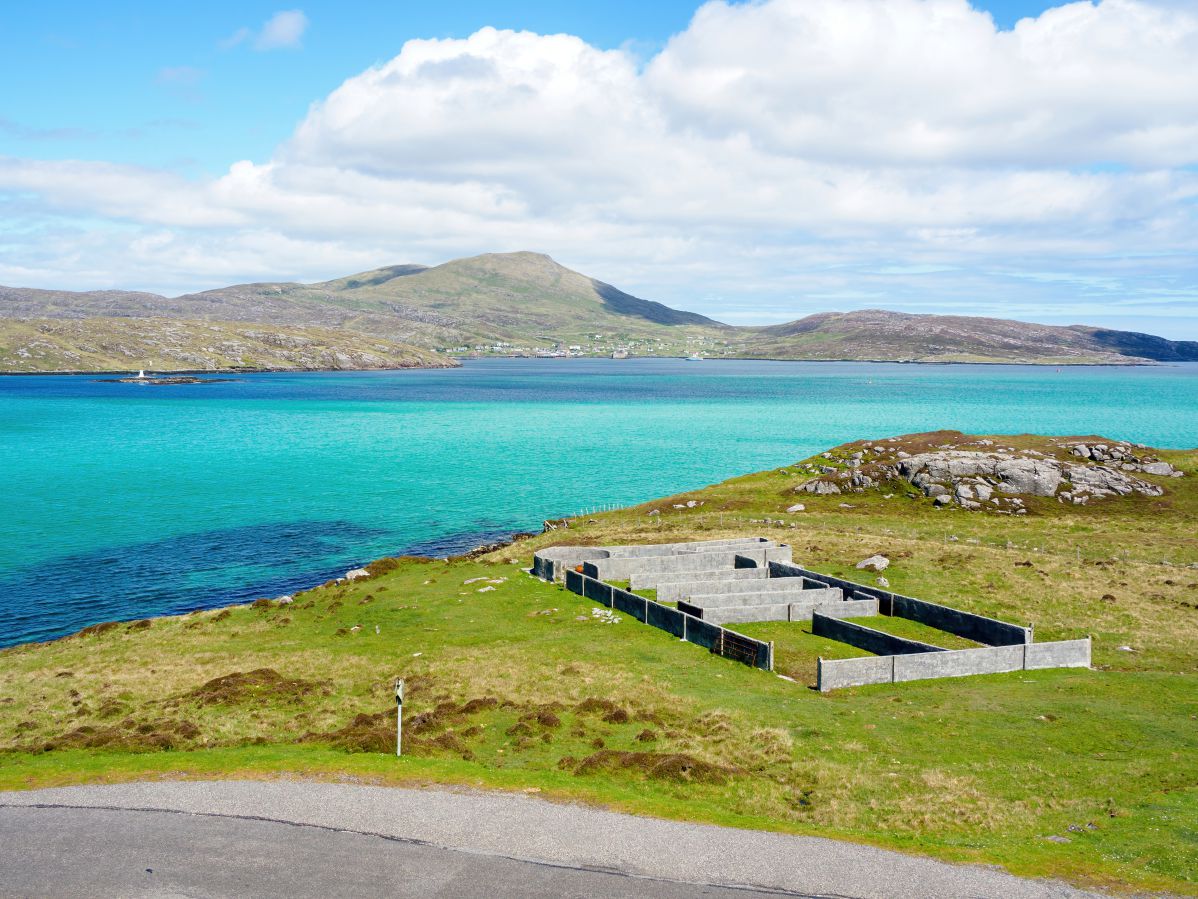
- Ahead lies the hill of Dun Vatersay which has marker posts on an indistinct trail that leads to the summit. Note that this area has a few Bronze Age remains including the just-about-visible remnants of a fort and an ancient burial site.
- Continue over the hill heading south to the ruins of Vatersay House, then follow more marker posts to a burial cairn and a standing stone.
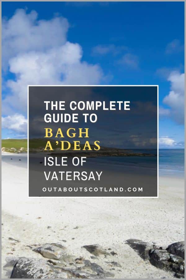
- Head in the direction of Bagh A’Deas (South Beach), admire the view of Sandray Island, cross the grazing land, and proceed up the hill to the east.
- There is another indistinct walking trail at the top of this hill which turns north before turning west close to the shore.
- Follow the trail to Vatersay Beach (Traigh a Bhaig) and walk along it to the far end, leaving the beach at the gate near the road. Head back to the community hall and the cafe where you can enjoy a well-deserved coffee.
Things to Do
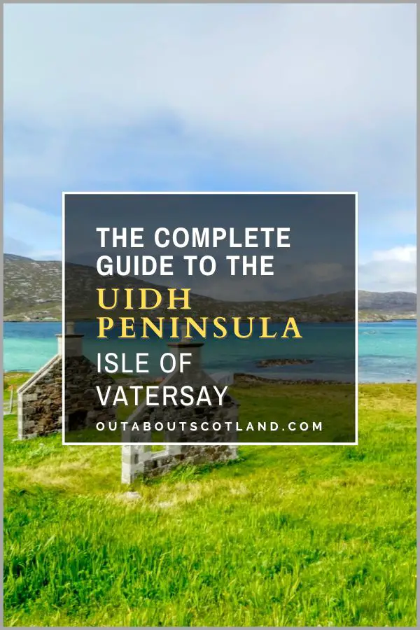
Exploring Vatersay’s Beaches: Vatersay is home to two stunning white sand beaches, Traigh Shiar and Traigh a Bhaigh, which are both set within deep bays. You can spend an afternoon exploring these beaches, collecting seashells, or simply enjoying the tranquillity that these secluded spots offer. There are more beaches on the less-visited northeast region of the island on the Uidh Peninsula, which is accessed from the minor east-facing road before the Catalina Memorial.
Wildlife Spotting: The Isle of Vatersay is a haven for wildlife enthusiasts. With species like seals, otters, and various sea birds, it’s a great place to immerse yourself in nature, especially in the swathes of machair (a rare type of grass) that runs between the two main beaches. Don’t forget your binoculars (link to binocular reviews) as you might even spot a rare corncrake.
Hiking on Vatersay: Hiking is a popular activity on Vatersay and its varied terrain offers trails for all abilities. The Barra Head Trail, for example, is a challenging but rewarding walk that will take you to the southernmost point of the Outer Hebrides.
Start the Hebridean Way: As the southernmost inhabited island in the Outer Hebrides, Vatersay is the traditional starting point of the Hebridean Way. Begin the 185-mile journey from Bagh A Deas Beach or the more well-known starting point outside the Vatersay Hall cafe.
Camping Under the Stars: For a truly immersive experience, consider camping on Vatersay. With minimal light pollution, the island offers an incredible opportunity for stargazing. Listening to the sound of the waves while watching the stars is an experience you won’t forget.
Things to Do Nearby
Bagh A’Deas beach. Address: Vatersay, HS9 5YU. Distance: 4 miles from the causeway.
A small beach on the southern edge of Vatersay that faces the island of Sandray. The beach is notable for being located at the true start of the Hebridean Way, at the end of the most southerly road on the island.
Traigh Shiar and Traigh a Bhaigh beaches. Address: Vatersay, HS9 5YW. Distance: 3 miles from the causeway.
These white-sand beaches in the middle of Vatersay are celebrated for their stunning views and turquoise waters. Both beaches are set within deep bays that offer protection from the sea, making them ideal locations for swimming and kayaking.
Vatersay Heritage Trail. Distance: starts 3 miles from the causeway.
A circular walking route that starts and ends at the Vatersay Hall cafe near Traigh Shiar and Traigh a Bhaigh. The 4-mile route runs along both beaches as well as the southern beach at Bagh A’Deas.
Barra Distillery. Address: Castlebay, Isle of Barra, HS9 5XF. Distance: 2 miles from the causeway.
Barra Distillery is the only distillery on the Isle of Barra and is the most westerly distillery in Scotland. The independent whisky, gin, and rum producer has a small shop in Castlebay.
Kisimul Castle. Address: Castlebay, Isle of Barra, HS9 5UZ. Distance: 2.5 miles from the causeway.
Kisimul Castle is located on a small island within the bay of Castlebay village. Historic Environment Scotland is in charge of managing the castle and offers boat tours from the village jetty.
Frequently Asked Questions
Is Vatersay inhabited?
Vatersay is the most southerly inhabited island in the Outer Hebrides and the most westerly inhabited island in Scotland.
There is a permanent population of around 90 residents. These people live in the main settlement in the middle of the island (also called Vatersay), as well as a number of houses towards the north in a settlement called Caolas.
Are there shops on Vatersay?
There are no shops on Vatersay besides a cafe in the community hall. The nearest shops are located in Castlebay on Barra, approximately 2 miles from the Vatersay causeway.
Can you wild camp on Vatersay?
Wild camping is permitted on Vatersay, as it is in Scotland generally, as long as campers follow the Scottish Outdoor Access Code.
There are designated camping areas near the community hall on Vatersay, which allowcampers to use toilet and shower facilities.
How do I get to Vatersay?
Vatersay is accessed via a causeway on the northern end of the island where it joins Barra.
The causeway is approx 2 miles from the village of Castlebay which has a ferry terminal with links to the Isles of Tiree and South Uist, as well as Oban on the mainland.
See the Calmac website for details of ferry sailing times.