
The Water of Leith
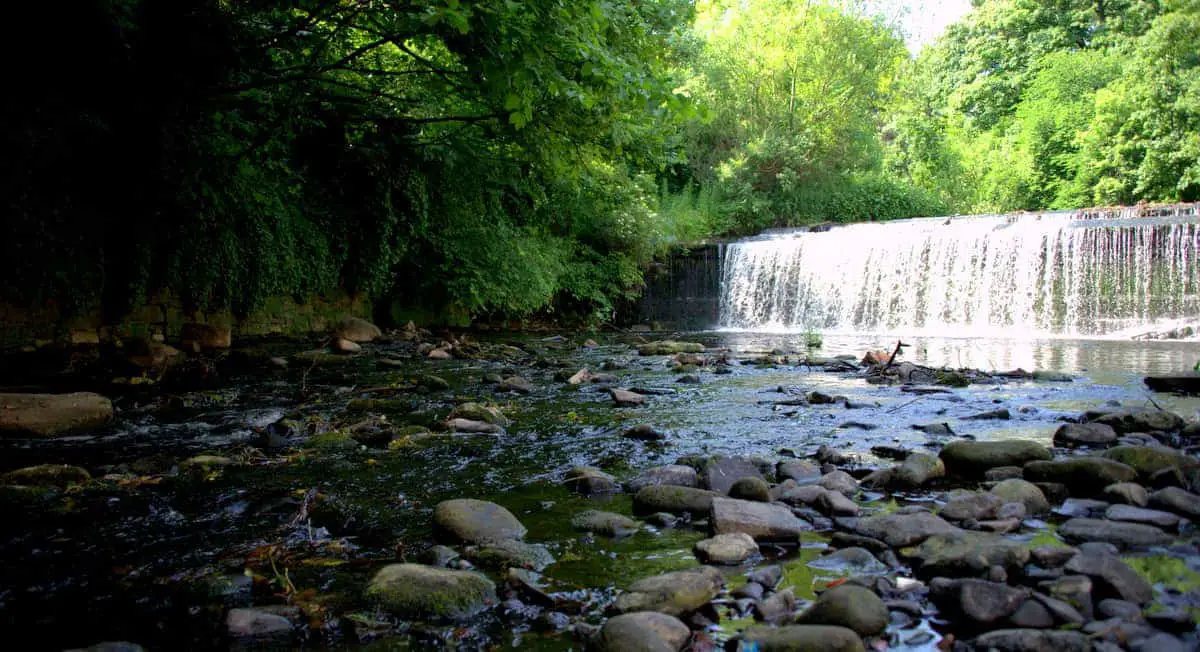
Tucked away amidst the hustle and bustle of Edinburgh, there’s a tranquil oasis that often gets overlooked – the Water of Leith. Meandering through the heart of the city, this winding river offers scenic walks on footpaths that are suitable for all abilities and ages.
In this article, we’ll take an in-depth look at the Water of Leith from its origins in the Pentland Hills to its ultimate rendezvous with the Firth of Forth, as well as take a look at the wildlife that thrives on its banks and the historical landmarks that line its course.
🠇 Head to the bottom of the page for essential details on each attraction featured here, including addresses, opening hours, and entry prices 🠇
The Water of Leith
The Water of Leith winds over 22 miles from the Colzium Springs in the Pentland Hills to the district of Leith. Visitors to Edinburgh might not be aware of the river, but if you have a few days to explore the capital you’ll be well-rewarded by a walk on the many miles of serene pathways that run alongside it.
One of the most popular entry points is at Stockbridge – well known amongst Edinburgh’s locals for its artisan shops and bistros – but there are a number of signposted paths that lead onto the riverside from other districts in the city including Wester Hailes, Slateford, Colinton, Saughton, and Murrayfield, to name just a few.
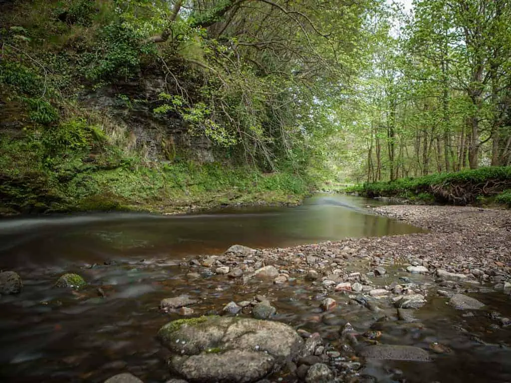
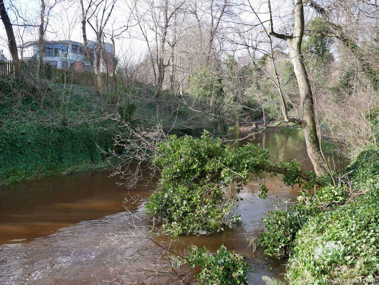
The entire Water of Leith walkway is 12 miles in length so if you want to follow the entire route you might consider using a bicycle, but walking on foot in stages is the best way to experience it in my opinion. The paths are many and varied, passing through thick woodland, old railway tracks, and disused tunnels and bridges, and the variety of wildlife will lead you to completely forget you’re in the middle of Scotland’s capital city.
The Highlights
1: You won’t believe there are so many riverside walks right in the heart of Edinburgh. They’re peaceful too, and the only other people you’re likely to see are locals stretching their legs and city workers taking a shortcut.
2: The Water of Leith is a great place to take a break from the city. There are lots of entrance points so you can enter/exit the walkway at several different places.
3: The Water of Leith makes a pleasant alternative to the busy streets of Edinburgh as it’s very scenic. You can even download audio tracks onto your phone to learn about the river as you follow it: Water of Leith Audio Trail.
Visiting Tips
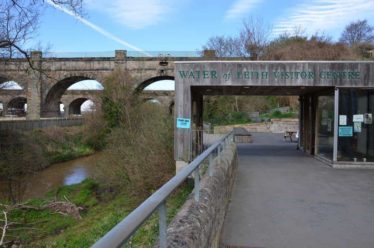
1: Head to the Water of Leith Visitor Centre for further information about the routes you can take on this iconic Edinburgh walkway.
2: Take a packed lunch with you. Munching a sandwich while sitting on the riverside is much nicer than heading back into the city for an overpriced greasy burger. There are benches all along the walkway where you can take a break.
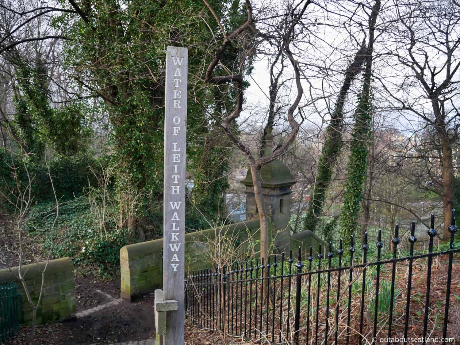
3: The Water of Leith Walkway is a beautiful pedestrian and cycle path that follows the river from Balerno to Leith, and it’s a great way to explore the city. However, depending on the season, the path can be very muddy in places, so it’s a good idea to wear sturdy footwear if you visit in winter.
Tourist Information
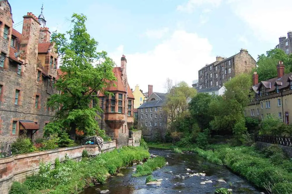
One of the benefits of having a walkway that runs through the heart of Edinburgh is that you can enter and exit it at dozens of locations up and down the river. Good entry points are Dean Village where you can see the remains of watermills that once powered long-forgotten mills, and Bonnington, another interesting site to explore Edinburgh’s industrial heritage.
But perhaps the best way to plan your journey is to pick up a Water of Leith route map from any of Edinburgh’s tourist information centres and then take a taxi or bus ride to your desired starting point.
While each section of the walkway is equally enjoyable they vary in length quite significantly, with the first section between Balerno and Slateford taking around two hours to complete and the last section between Stockbridge and Leith taking around half that time. So decide on a suitable section to visit according to the amount of time you have before you set off.
A recommended section runs from the visitor centre on Lanark Road to Colinton, which is a particularly scenic route that features easily accessible paths. You can find out more information about this walk in my guide to The Water of Leith Visitor Centre.
The visitor centre is open to the public near the Slateford Aqueduct in southwest Edinburgh and it’s a great place to start because you can stock up on snacks before you head off and enjoy hot drinks when you return. The visitor centre is also a good place to acquaint yourself with the wildlife that lives near the water so you know what to look for.
In the woodland that borders the river, you can sometimes see roe deer, badgers and otters, while the river itself is home to fish including trout, eels, salmon, and (near Leith) flounder. Bird species range from kingfishers, woodpeckers, dippers and wagtails, and if you’re lucky you might even spot a heron or two.
History
The river has been an integral part of the city since the earliest days of the Industrial Revolution when waterwheels were dotted along its length to power mills that produced many of the goods that Edinburgh became famous for.
In fact, it could be argued that without the Water of Leith, Edinburgh would not be the size it is today as much of the wealth created by the paper, flour, and linen factories was dependent on the power the river provided. Taking this even further, it’s unlikely that Leith would have become the shipping powerhouse that it eventually became had the mouth of the river not provided a perfect natural harbour for ships to dock and unload their goods.
If you ever manage to walk the entire length of the walkway take note of the number of millstones, weirs, and ruined mill buildings that are dotted along its length as they give an indication of the amount of industry that centred around the Water of Leith for hundreds of years.
Things to Do
Nature Walks & Wildlife Spotting: The Water of Leith is a tranquil haven that’s teeming with wildlife. Walk along the 12-mile Water of Leith Walkway, winding through Edinburgh’s heart, and immerse yourself in the enchanting woodland and riverside habitats where you might spot herons, kingfishers, otters, and deer.
Water of Leith Visitor Centre: The centre provides an educational experience about the river’s history and its local wildlife. Engage with interactive exhibits, learn about conservation efforts to protect the ancient waterway, and even participate in workshops. The centre also has a cafe selling hot drinks and snacks and a gift shop selling books and souvenirs.
Modern Art Galleries: The Water of Leith Walkway takes you right to the Scottish National Galleries of Modern Art. Surrounded by beautiful parkland, these twin galleries (Modern One and Modern Two) house an exceptional collection of modern and contemporary art from renowned artists like Picasso, Matisse, Warhol, and Scottish artists like Eduardo Paolozzi and Ian Hamilton Finlay.
Dean Village: The picturesque former milling village’s preserved 19th-century buildings (including the iconic Well Court) make it a must-visit destination on the Water of Leith Walkway. Learn about Dean Village’s milling history and don’t miss the lovely views from Dean Bridge.
Leith: Follow the walkway to its end and you’ll reach the vibrant area of Leith. Known for its excellent seafood restaurants, cosy pubs, and the Royal Yacht Britannia, it’s a great place to relax after a day of exploring. Dine on fresh seafood while overlooking the harbour, enjoy some locally-made beer, or indulge in a traditional afternoon tea aboard the royal’s former floating palace.
Facts
Length: The Water of Leith spans a length of around 24 miles, rising in the Pentland Hills and flowing into the Firth of Forth at Leith.
Water of Leith Walkway: The Water of Leith Walkway is a 12.25-mile path that accompanies the river from Balerno to Leith. A stroll along the walkway offers a tranquil escape from the city hustle, offering scenic views of the river, woodlands, and historic sites.
Industrial Heritage: The river was historically home to 70 mills, harnessing the water’s power for grinding grain, making paper, and producing cloth. It’s often referred to as the ‘Silver Thread’ due to the rich industrial heritage it represents.
Leith Docks: The river’s mouth at Leith Docks was once one of the busiest ports in Britain. Today, the docks have been transformed into a trendy waterfront area with shops, restaurants, and apartments.
Ecology and Wildlife: The Water of Leith is an important ecological corridor, home to an array of wildlife such as otters, kingfishers, herons, and over 80 species of birds.
The Union Canal Connection: In the 19th century, the river was connected to the Union Canal via the Slateford Aqueduct, enabling coal transportation from the Lothians to the heart of the city.
Frequently Asked Questions
Is the Water of Leith a canal?
The Water of Leith is a freshwater river that starts in the Pentland Hills and finishes at Leith in Edinburgh. The Water of Leith crosses under the Union Canal at the Slateford Aqueduct.
How many miles is the Water of Leith?
The Water of Leith is 22 miles (35 km) long. It starts at the Colzium Springs in the Pentland Hills and runs through Edinburgh to its exit point at Leith.
Can you walk the Water of Leith?
It is possible to walk for 12 miles along the Water of Leith on a designated pathway that begins in Balerno in the west of Edinburgh to Leith in the northeast.
How long does it take to walk the Water of Leith?
The following is a guide to walking the most popular sections of the Water of Leith:
Balerno to Slateford: 5 miles – 2 hours.
Slateford to Leith: 7.5 miles – 3 hours.
Roseburn to Stockbridge: approx 2 miles – 45 mins.
Stockbridge to Leith: approx 3.5 miles – 1 hour 20 mins.