Isle of Benbecula
The Isle of Benbecula is located between the islands of North and South Uist in the Outer Hebrides. The island is approximately 7 miles north to south and the same again east to west, and it has a thriving population of around 1,200 people.
Due to its location, Benbecula is an ideal base to explore the Uists, but it also has a number of attractions of its own, including Reuval, the solitary hill in the middle of the island, and several large beaches on its western side.
🠇 Head to the bottom of the page for essential details on each attraction featured here, including addresses, opening hours, and entry prices 🠇
Isle of Benbecula
Benbecula (Beinn na Faoghla in Gaelic which means Mountain of the Ford) is an island in the Outer Hebrides that most tourists tend to whizz past in pursuit of other, more famous attractions, and to be honest, I can kind of see why. The 185-mile Hebridean Way is one of the main draws for visitors to these islands, starting on Vatersay and finishing on Lewis, with Benbecula sitting more or less in the middle.
By the time cyclists and hikers arrive on Benbecula they’re already used to the stunning landscapes of the Western Isles and therefore don’t pay too much attention beyond the road, which is a shame as this wee island is a real stunner once you veer away from the tourist trails.
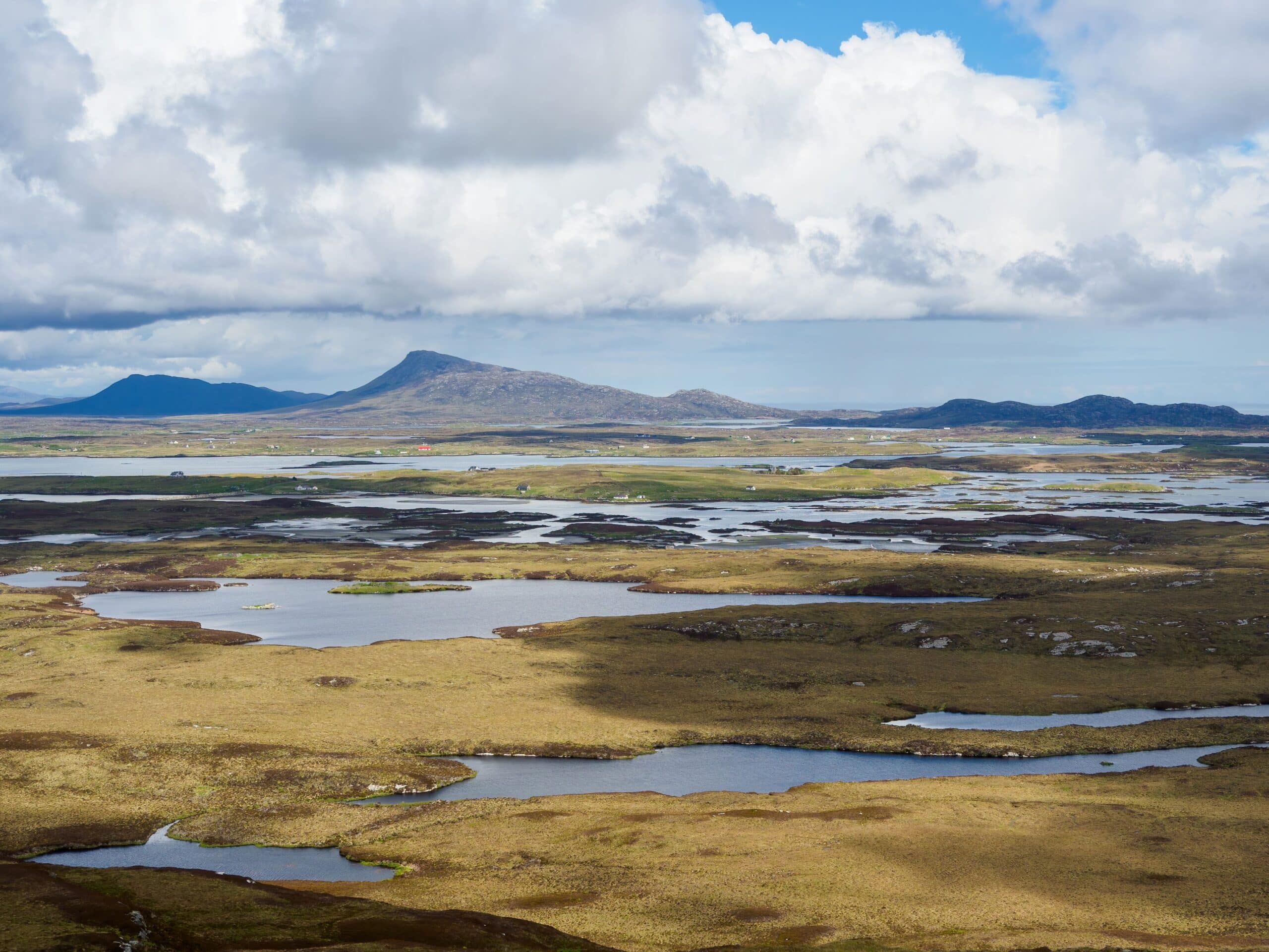
Benbecula is around 7 miles north to south and the same again east to west, with the majority of the landscape comprising flat moorland and grazing land which is peppered with hundreds of lochs, lochans and sea inlets.
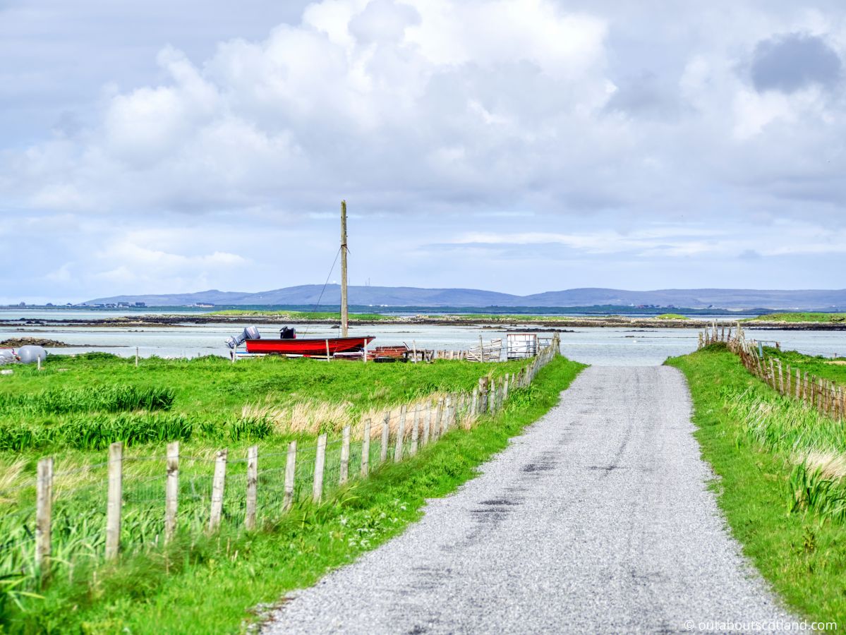
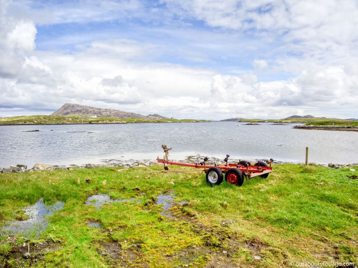
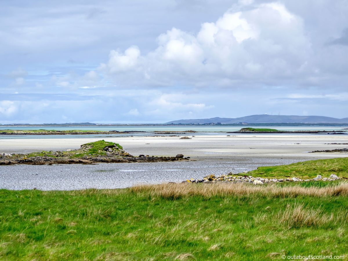
There are large estuaries with enormous sandbanks to the north and south while the western side of the island is home to a number of white sand beaches that are easily accessible thanks to the B892 which follows the coastline. The east side of the island, meanwhile, has few roads but is arguably even more scenic.
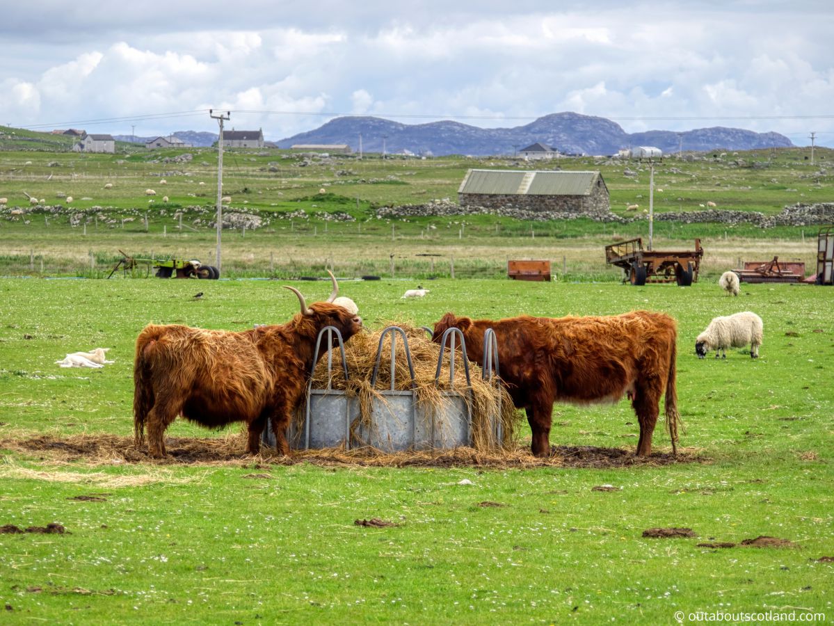
As you might expect for the Outer Hebrides, this island is sparsely populated and has just 1,300 permanent residents, most of whom speak Gaelic as well as English. Though the majority of islanders work in the fishing and farming industries, many have opened their homes to tourists.
That means you’ll find a large number of holiday rentals across Benbecula, though be aware they tend to book early in the year, so it’s advisable to start looking at least 6 months prior to the date of travel.
Climate-wise, don’t expect a heatwave when you visit as historically the average temperatures only rise above 10°C from May to October and the temperature generally stays under 17°C even on the warmest days. It is not exactly freezing, but the island is very flat and is therefore entirely exposed to the chill winds that blow in from the Atlantic Ocean.
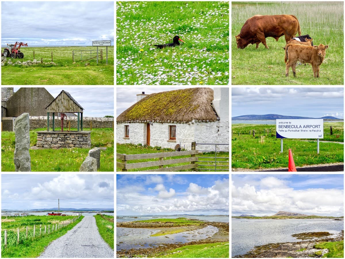
As far as facilities for holidaymakers go, well, they’re pretty good. The main village of Balivanich is situated in the northeast, where it served a nearby military base for several decades, and although the number of personnel has now been reduced to a few dozen, the infrastructure remains in place from the airfield’s heyday.
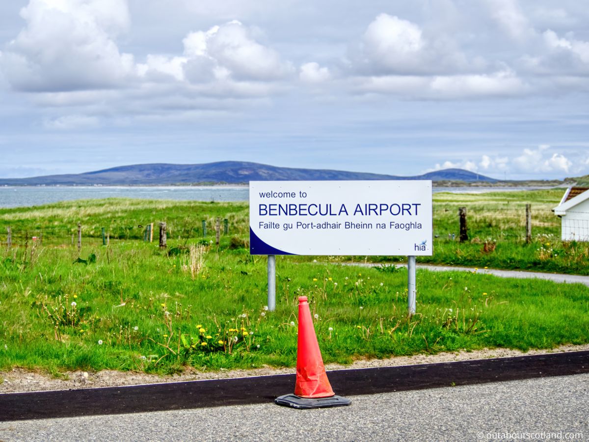
Benbecula Airfield itself is now used by civilian aircraft and it’s possible to fly direct from Glasgow thanks to carriers such as Loganair. Meanwhile, a causeway a couple of miles north provides road access to North Uist and the Isle of Berneray, which has a ferry terminal with regular sailings to the Isle of Harris.
Balivanich has the majority of facilities required for a short stay (supermarket, bank, cafe, bakery, and takeaway, to name just a few), which complement the island’s other settlements of Linaclate and Creagorry. Both of these villages are situated on the southern side of Benbecula, close to the south causeway.
Creagorry is a small settlement, but it has a very handy co-op as well as the superb Isle of Benbecula House Hotel, while Linaclete is much larger and has a sports centre with a gym and a swimming pool, a petrol station, and a large hotel (the Dark Island Hotel) that has a restaurant and a family lounge.
The Highlights
1: Thanks to its location, this is a superb island to base yourself on for a tour of the Uists. From Berneray at the north of the island chain to Eriskay at the south, visitors can cycle or drive to them with ease from Benbecula.
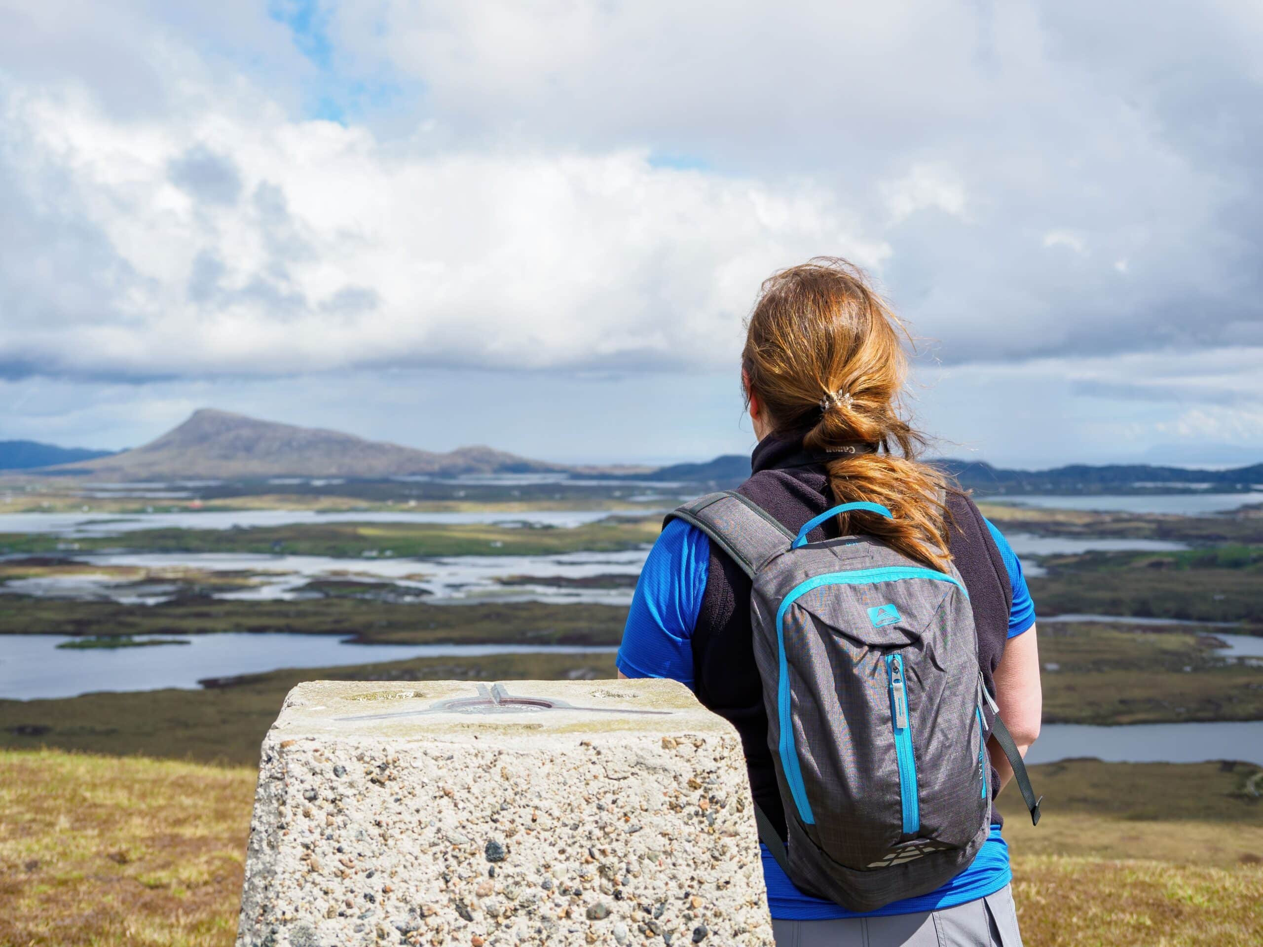
2: There are lots of cycling and walking routes on Benbecula but the highlight has to be Reuval Hill. Though only 407 feet high, the surrounding landscape is flat, pockmarked with dozens of lochs, and framed by mountains and a spectacular coastline.
3: Benbecula has two very distinct landscapes – both of which are extraordinarily scenic. The western half of the island is flat and has some lovely beaches as well as quiet roads that are great for an afternoon cycle, while the eastern half has a rugged coastline that’s great for off-grid walks.
Visiting Tips
1: If you’re visiting Benbecula for the first time be aware that the road signs are few and far between and there are minor roads that spur off in all directions. I’m making this point as on my first visit I drove an hour around Benbecula trying to find my B&B, only to end up back at the exact same place I started…
2: Unlike many of the smaller islands in the Outer Hebrides, Benbecula has two decent (though expensive) supermarkets. The first is located to the north in Balivanich (address: 2, Balivanich, Isle of Benbecula, HS7 5LA). The second is located to the south in Creagorry (address: Creagorry, Isle of Benbecula, HS7 5PG).
3: The beaches on Benbecula are great (I especially liked the one near Borve on the southwest of the island), but there’s an even bigger 6-mile-long beach just a few miles south on South Uist. You can find a good parking space by travelling to Aird a’ Mhachair (postal code: HS8 5RF) and stopping at the end of the road, where there are spaces next to a cemetery. Benbecula’s southern causeway to this location is around 5 miles (10 minutes by car).
Tourist Information
As far as tourist attractions are concerned, Benbecula really comes into its own with the great outdoors and wildlife. Though the highlight is Reuval (see my Visitor Guide to Reuval for a detailed look at the hill), there are many more sights that are best enjoyed either on foot or on a bike.
I was able to spend an entire week on Benbecula recently as I managed to secure accommodation at a great price in Linacleit (the Holiday Home Rentals website is a great resource for places to stay on the island), which meant I could drive north and south between the Uists at my leisure.
However, as I had my trusty mountain bike with me I was also able to explore a good chunk of Benbecula. In the rest of this section, I’ll offer suggestions for a wee cycling itinerary that will help you make the most of your time on the island.
Note: If you have a bike you’ll be pleased to know the roads on Benbecula are almost entirely single-track but have lots of passing spaces and they’re in surprisingly good condition for such a remote island. In fact, I’d say they’re among the best roads in the entire Outer Hebrides.
Cycling Route
Starting in Linacleit, head west on the B892 through fields and grazing land till you pass the Borve Guest House on the right-hand side (postcode: HS7 5PP). There’s a farm track almost opposite that cuts through fields and leads directly onto a beach that’s 1.5 miles in length and is pretty much guaranteed to be free of tourists.
I pushed my bike along the dunes to the far end which has a concrete jetty which leads back onto the B892, but not before sitting on the jetty and watching dozens of seabirds resting on the rocks that lie just offshore. To be honest, this beach is nice enough to spend the whole day on it, so if you’re looking for somewhere to go for a beach day, I highly recommend heading there.
Continuing north you’ll pass the North Uist Distillery which is a new addition to the island and is therefore still in the process of setting up its visitor attractions. That being said, at the time I visited (mid-2022), they had an excellent shop and a tasting room and were renovating the old Nunton Steading where the distillery is housed.
The distillery offers free samples, so you might like to try a sip (or two) of their Downpour gin, as it’s exceptionally tasty. There’s another beach behind the distillery, but this one is a little trickier to access. The best option is to head up the road for 1/3 mile and take the farm track just before Mallan Croft Farm.
Otherwise, continue pedalling – or walking – north till you reach Balivanich.
This village is a good place to stop and take a breather as there are a couple of places to grab food and drink as well as take a look at the airfield. The runways are situated on a large sandbank which looks inviting, but there is very limited access.
Past Benbecula airfield you’ll pass a golf course, after which you can turn north towards the North Ford Causeway. The scenery here is drop-dead gorgeous, with turquoise waters stretching into the distance towards the tiny island of Grimsay and the larger landmass of North Uist sweeping away to the east and west.
I personally cycled across the causeway onto Grimsay purely to add another island to my list, and I’m more than glad I did so.
Grimsay has very quiet roads that follow a wild coastline, and its western edge offers stunning views of the isle of Ronay and dozens of islets in the waters that separate it from North Uist. It’s a genuinely beautiful place, and as the circular road is just 6 miles in length with nothing more than a few mild inclines, it’s a worthy addition to a tour of Benbecula.
After cycling around Grimsay, turn left back across the causeway to Benbecula and take the A865. This single-track road cuts right through the middle of the island, where you’ll be able to visit the final attraction on the route, which is Reuval.
The start of the walk up the hill is situated down a turning to a recycling plant (postcode: HS7 5LA) which admittedly doesn’t sound that exciting – but I can confirm once past the waste station the landscape is breathtaking. This is also the best part of the island for birdwatching, so if you have binoculars with you (link to my recommended optics on Amazon) there’s a good chance you’ll see lots of wildlife.
Hill climb over, it’s now time to return to Linacleit which is situated 3 miles past the recycling centre.
Note: You’ll pass a petrol station along the way, so if you’re completing this route in a car, you might consider filling up as there aren’t many other garages in the Uists.
Once in Linacleit, I recommend heading into the Dark Island Hotel for a coffee and a bite to eat, or perhaps try a tipple or two from their well-stocked bar. In total, this route around the island is 17 miles in length and will take 1.5 to 2 hours at a leisurely cycle speed, in addition to the multiple stops mentioned above.
Things to Do
Explore Sunamul Island: North of Balivanich, the island’s main village, is Sunamul Island. Along with the Benbecula Airport, this promontory is home to a sizable stretch of white sand beach and shallow turquoise waters. Walking along the beach presents one of the best views in the Uists and is a must-do for all visitors to Benbecula.
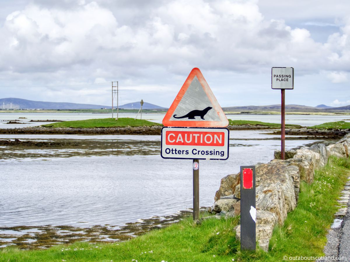
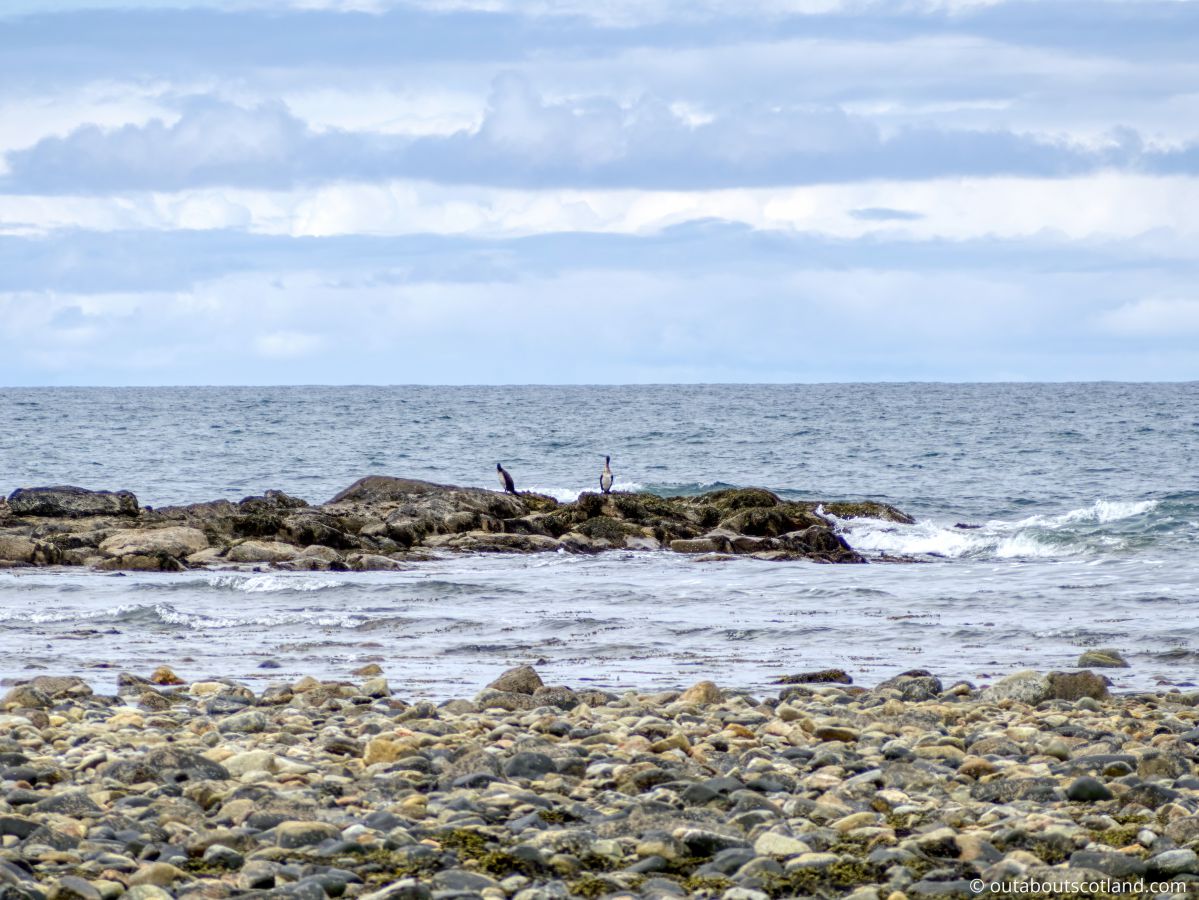
Bird Watching: Benbecula is heaven for bird watchers. With its sandy beaches, dunes, and freshwater lochs, it’s a favoured habitat for various species like corncrakes, skylarks, and lapwings. Bring your binoculars (link to binocular reviews), a picnic, and watch the island’s wildlife for hours on end.
Beachcombing at Cula Bay: The stunning Cula Bay, with its long strip of white sand, is perfect for beachcombing. You can find seashells, driftwood, and other treasures washed ashore, and the tranquil setting is also ideal for photographers. For a wee treat after a visit to the beach, pop into the nearby North Uist Distillery and pick up a bottle of their superb Downpour Gin.
Climb Reuval Hill: Reuval is the highest point on Benbecula and climbing it is a great way to experience the stunning landscape which is pockmarked with hundreds of lochans in all directions. A rough track heads to the summit which is muddy but is well-used and therefore easy to follow.
Hike on the Hebridean Way: Stretching over 185 miles, the Hebridean Way is a long-distance walking route traversing the Outer Hebrides, and the section crossing Benbecula offers stunning views of the island’s magnificent coastal scenery. Pack a picnic and enjoy a day’s trek, or if you have a bike, continue over the causeways to explore the islands of North and South Uist.
Things to Do Nearby
Reuval. Address: Benbecula, HS7 5LA. Distance: 1.2 miles from Market Stance waste station on the A865.
Reuval is the highest point on Benbecula and therefore offers the best viewpoint on the entire island. From the summit, visitors can see as far west as the St. Kilda archipelago and east to the Isle of Skye.
North Ford Causeway. Address: A865, Isle of North Uist.
A scenic viewpoint on the road between North Uist and Benbecula. The causeway is part of the stunning Hebridean Way touring route.
Liniclate Beach. Address: Liniclate, Isle Of Benbecula, Outer Hebrides, HS7 5PJ.
Liniclate Beach is a long strip of golden sand on the southern edge of Benbecula. The beach is a haven for wildlife and especially birds which include plover, redshank, oystercatcher, lapwing, and the elusive corncrake.
Culla Bay Beach. Address: Nunton, Isle Of Benbecula, Outer Hebrides, HS7 5LU.
Culla Bay is a popular beach on Benbecula as it is set slightly inland and is therefore somewhat protected from the sea. The bay is another highly-rated birdwatching location though it’s rather difficult to find. The best option is to head to the village of Aird which is accessed from the B892 1/2 mile south of Balivanich.
Lionacleit Sports Centre. Address: Liniclate, Isle of Benbecula, Outer Hebrides, HS7 5PJ.
This is one of the few sports facilities in the Outer Hebrides. Lionacleit Sports Centre has a fully-equipped fitness suite, a 25-metre swimming pool, a games hall, and a cafe.
Frequently Asked Questions
Why is Benbecula called the Dark Island?
The name ‘Dark Island’ originates from Gaelic poetry in which Benbecula is called An t-Eilean Dorcha. After accordionist and Benbecula resident Iain MacLachlan wrote a well-known traditional song by the same name, “Dark Island” became ingrained in Scottish culture.
Where is the island of Benbecula?
Benbecula is located on the west coast of Scotland, approximately 50 miles from the mainland. It is positioned between the islands of South and North Uist in the Outer Hebrides.
What is Benbecula known for?
Benbecula is perhaps best known for its military association which saw the island used as a base for the British Army before transitioning to an airfield for the RAF and its current use as a civilian airfield.
Due to its location, Benbecula is also home to the majority of facilities in the Uists and it is a good base for a sightseeing tour as it allows easy access to the north and south islands.
Is Benbecula inhabited?
Benbecula is currently inhabited by around 1,300 permanent residents, plus holidaymakers during the May-September tourist season. Benbecula’s population increased by 7% between the 2001 and 2011 census, which is over double the 3% increase seen on other Scottish islands.